
Amailloux Sud

tracegps
Gebruiker

Lengte
12,1 km

Max. hoogte
197 m

Positief hoogteverschil
110 m

Km-Effort
13,5 km

Min. hoogte
165 m

Negatief hoogteverschil
110 m
Boucle
Ja
Datum van aanmaak :
2014-12-10 00:00:00.0
Laatste wijziging :
2014-12-10 00:00:00.0
2h30
Moeilijkheid : Gemakkelijk

Gratisgps-wandelapplicatie
Over ons
Tocht Stappen van 12,1 km beschikbaar op Nieuw-Aquitanië, Deux-Sèvres, Amailloux. Deze tocht wordt voorgesteld door tracegps.
Beschrijving
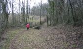
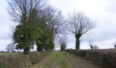
Circuit très agréable sur chemins et petites routes peu fréquentées, belles vues et beaux arbres, arrière pays, la campagne comme on l'aime. Propre même après la pluie. Peu être pratiqué en groupe ( photo "chemin" ) Tracé sur la carte IGN au 1/25000. Seul difficulté, en voiture trouver le point de départ.
Plaatsbepaling
Land:
France
Regio :
Nieuw-Aquitanië
Departement/Provincie :
Deux-Sèvres
Gemeente :
Amailloux
Locatie:
Unknown
Vertrek:(Dec)
Vertrek:(UTM)
703343 ; 5179165 (30T) N.
Opmerkingen
Wandeltochten in de omgeving

Amailloux Sud


Stappen
Gemakkelijk
Amailloux,
Nieuw-Aquitanië,
Deux-Sèvres,
France

12,1 km | 13,5 km-effort
2h 59min
Ja

Amailloux


Stappen
Gemakkelijk
Amailloux,
Nieuw-Aquitanië,
Deux-Sèvres,
France

25 km | 28 km-effort
9h 19min
Neen


 SityTrail


