![](/images/other/stat-length.png)
![Tocht Stappen Moliets-et-Maâ - Moliets - Tour du lac de Soustons - Photo](https://media.geolcdn.com/t/1900/400/ext.pjpeg?maxdim=2&url=https%3A%2F%2Fservices.sitytrail.com%2FGeolivesWS%2FDownloadMedia.ashx%3FTrailID%3D101498%26Media%3D1603_2.jpg)
Moliets - Tour du lac de Soustons
tracegps
Gebruiker
![Lengte](/images/other/stat-length.png)
![Max. hoogte](https://static1.geolcdn.com/siteimages/upload/files/1508320355ic_sort_altitude_max_24dp.png)
![Positief hoogteverschil](https://static1.geolcdn.com/siteimages/upload/files/1508320355ic_sort_den_pos_24dp.png)
![Km-Effort](/images/other/stat-length.png)
![Min. hoogte](https://static1.geolcdn.com/siteimages/upload/files/1508320355ic_sort_altitude_min_24dp.png)
![Negatief hoogteverschil](https://static1.geolcdn.com/siteimages/upload/files/1508320355ic_sort_den_neg_24dp.png)
![Boucle](https://static1.geolcdn.com/siteimages/upload/files/16400158638029165_repeat_loop_refresh_sync_direction_icon.png)
![Stappen](https://static1.geolcdn.com/sitytour/trail-icons/101.png)
6h00
Moeilijkheid : Gemakkelijk
![Scan deze QR-code om de tocht te openen in de SityTrail-applicatie](https://capi.geolives.com/qq0zvz2zws4bq2lad0pu/sitytour/trails/101498/qr.png?size=200)
Gratisgps-wandelapplicatie
Over ons
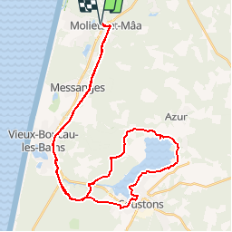
Tocht Stappen van 47 km beschikbaar op Nieuw-Aquitanië, Landes, Moliets-et-Maâ. Deze tocht wordt voorgesteld door tracegps.
Beschrijving
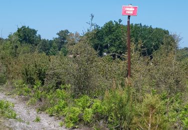
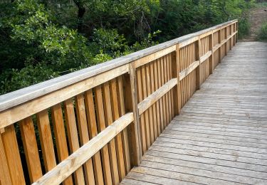
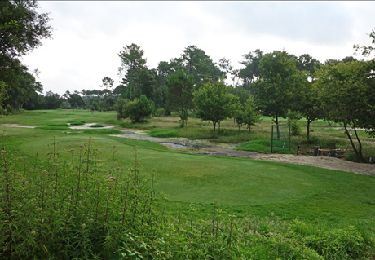
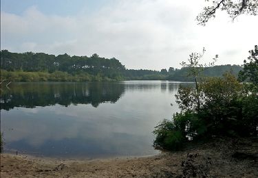
Circuit facile, parfois en chemin sableux. Au départ de Moliets centre, prendre la piste cyclable et suivre la piste jusqu'a Soustons. A Soustons, se diriger vers le centre Nautique puis au abords du lac, suivre la signalisation verte (GR8 jusqu'au lieu dit Mayou). Attention lors de la traversée de la D652 au Pont de Labarthe, il y a beaucoup de circulation. Retour sur la piste cyclable en suivant la signalisation blanc/vert à travers la forêt puis retour sur Moliets.
Plaatsbepaling
Opmerkingen
Wandeltochten in de omgeving
![Tocht Stappen Moliets-et-Maâ - balade dans les pins avec vue sur dune - Photo](https://media.geolcdn.com/t/375/260/0218ac8f-b6c0-46e5-b6fe-b779c8db0705.jpg&format=jpg&maxdim=2)
![Stappen Stappen](https://static1.geolcdn.com/sitytour/trail-icons/101.png)
Stappen
![](/images/other/stat-length.png)
![](https://static1.geolcdn.com/siteimages/upload/files/16400158638029165_repeat_loop_refresh_sync_direction_icon.png)
![Tocht Stappen Moliets-et-Maâ - MOLIETS le courant d huchet 290 7700 - Photo](https://media.geolcdn.com/t/375/260/11eb8d60-2334-433e-941c-ab21d54ad840.jpg&format=jpg&maxdim=2)
![Stappen Stappen](https://static1.geolcdn.com/sitytour/trail-icons/101.png)
Stappen
![](/images/other/stat-length.png)
![](https://static1.geolcdn.com/siteimages/upload/files/16400158638029165_repeat_loop_refresh_sync_direction_icon.png)
![Tocht Stappen Léon - Etang VSP 10km - Photo](https://media.geolcdn.com/t/375/260/0f991cfe-6bda-4037-a335-2a4be6192310.jpg&format=jpg&maxdim=2)
![Stappen Stappen](https://static1.geolcdn.com/sitytour/trail-icons/101.png)
Stappen
![](/images/other/stat-length.png)
![](https://static1.geolcdn.com/siteimages/upload/files/16400158638029165_repeat_loop_refresh_sync_direction_icon.png)
![Tocht Stappen Léon - Courant du Huchet - Photo](https://media.geolcdn.com/t/375/260/32dab752-80e3-43c9-adcf-46932eefb47e.jpg&format=jpg&maxdim=2)
![Stappen Stappen](https://static1.geolcdn.com/sitytour/trail-icons/101.png)
Stappen
![](/images/other/stat-length.png)
![](https://static1.geolcdn.com/siteimages/upload/files/16400158638029165_repeat_loop_refresh_sync_direction_icon.png)
![Tocht Stappen Moliets-et-Maâ - circuit des Cigales camping au courant d'Uchet et retour - Photo](https://media.geolcdn.com/t/375/260/cb479472-290b-4db1-bc86-532d9c3e1638.jpg&format=jpg&maxdim=2)
![Stappen Stappen](https://static1.geolcdn.com/sitytour/trail-icons/101.png)
Stappen
![](/images/other/stat-length.png)
![](https://static1.geolcdn.com/siteimages/upload/files/16400158638029165_repeat_loop_refresh_sync_direction_icon.png)
![Tocht Stappen Moliets-et-Maâ - Le Courant d' Huchet _ 5,3 km_Trace GPS - Photo](https://media.geolcdn.com/t/375/260/ext.jpg?maxdim=2&url=https%3A%2F%2Fservices.sitytrail.com%2FGeolivesWS%2FDownloadMedia.ashx%3FTrailID%3D221866%26Media%3D358f56fb-4383-43a9-84d6-d433489d3737.jpg)
![Stappen Stappen](https://static1.geolcdn.com/sitytour/trail-icons/101.png)
Stappen
![](/images/other/stat-length.png)
![](https://static1.geolcdn.com/siteimages/upload/files/16400158638029165_repeat_loop_refresh_sync_direction_icon.png)
![Tocht Stappen Moliets-et-Maâ - La Chapelle Saint Laurent de Maa _ 8,5 km_Trace GPS - Photo](https://media.geolcdn.com/t/375/260/ext.jpg?maxdim=2&url=https%3A%2F%2Fservices.sitytrail.com%2FGeolivesWS%2FDownloadMedia.ashx%3FTrailID%3D206853%26Media%3D3409a967-a099-4afb-939e-ee94bb6de565.jpg)
![Stappen Stappen](https://static1.geolcdn.com/sitytour/trail-icons/101.png)
Stappen
![](/images/other/stat-length.png)
![](https://static1.geolcdn.com/siteimages/upload/files/16400158638029165_repeat_loop_refresh_sync_direction_icon.png)
![Tocht Stappen Moliets-et-Maâ - Courant Huchet complet - Photo](https://media.geolcdn.com/t/375/260/ext.jpg?maxdim=2&url=https%3A%2F%2Fstatic1.geolcdn.com%2Fsiteimages%2Fupload%2Ffiles%2F1553511878bg_sport_marche.png)
![Stappen Stappen](https://static1.geolcdn.com/sitytour/trail-icons/101.png)
Stappen
![](/images/other/stat-length.png)
![](https://static1.geolcdn.com/siteimages/upload/files/16400158638029165_repeat_loop_refresh_sync_direction_icon.png)
![Tocht Stappen Vielle-Saint-Girons - Ballade Courant Huchet - Photo](https://media.geolcdn.com/t/375/260/ext.jpg?maxdim=2&url=https%3A%2F%2Fstatic1.geolcdn.com%2Fsiteimages%2Fupload%2Ffiles%2F1553511878bg_sport_marche.png)
![Stappen Stappen](https://static1.geolcdn.com/sitytour/trail-icons/101.png)
Stappen
![](/images/other/stat-length.png)
![](https://static1.geolcdn.com/siteimages/upload/files/16400158638029165_repeat_loop_refresh_sync_direction_icon.png)