![](/images/other/stat-length.png)
![Tocht Stappen Castelnaud-la-Chapelle - Les Milandes - St-Cybranet - Photo](https://media.geolcdn.com/t/1900/400/ext.pjpeg?maxdim=2&url=https%3A%2F%2Fservices.sitytrail.com%2FGeolivesWS%2FDownloadMedia.ashx%3FTrailID%3D101307%26Media%3D802_1.jpg)
Les Milandes - St-Cybranet
tracegps
Gebruiker
![Lengte](/images/other/stat-length.png)
Lengte
14,2 km
![Max. hoogte](https://static1.geolcdn.com/siteimages/upload/files/1508320355ic_sort_altitude_max_24dp.png)
Max. hoogte
260 m
![Positief hoogteverschil](https://static1.geolcdn.com/siteimages/upload/files/1508320355ic_sort_den_pos_24dp.png)
Positief hoogteverschil
298 m
![Km-Effort](/images/other/stat-length.png)
Km-Effort
18,3 km
![Min. hoogte](https://static1.geolcdn.com/siteimages/upload/files/1508320355ic_sort_altitude_min_24dp.png)
Min. hoogte
76 m
![Negatief hoogteverschil](https://static1.geolcdn.com/siteimages/upload/files/1508320355ic_sort_den_neg_24dp.png)
Negatief hoogteverschil
334 m
![Boucle](https://static1.geolcdn.com/siteimages/upload/files/16400158638029165_repeat_loop_refresh_sync_direction_icon.png)
Boucle
Neen
Datum van aanmaak :
2014-12-10 00:00:00.0
Laatste wijziging :
2014-12-10 00:00:00.0
![Stappen](https://static1.geolcdn.com/sitytour/trail-icons/101.png)
3h00
Moeilijkheid : Medium
![Scan deze QR-code om de tocht te openen in de SityTrail-applicatie](https://capi.geolives.com/qq0zvz2zws4bq2lad0pu/sitytour/trails/101307/qr.png?size=200)
Gratisgps-wandelapplicatie
Over ons
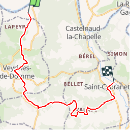
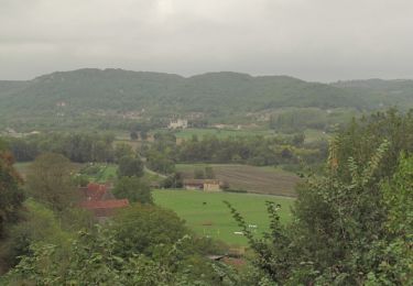
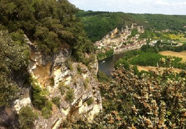
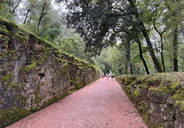
Tocht Stappen van 14,2 km beschikbaar op Nieuw-Aquitanië, Dordogne, Castelnaud-la-Chapelle. Deze tocht wordt voorgesteld door tracegps.
Beschrijving
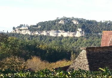
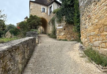
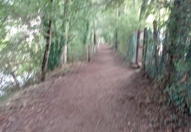
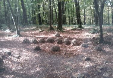
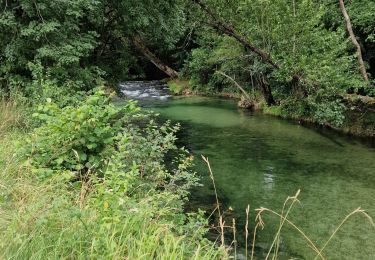
Petite balade linéaire (prévoir le retour) sur les côteaux de la vallée de la Dordogne et du Céou. D’autres infos sur le site Rando.eu Voir le site du Chateau des Milandes
Plaatsbepaling
Land:
France
Regio :
Nieuw-Aquitanië
Departement/Provincie :
Dordogne
Gemeente :
Castelnaud-la-Chapelle
Locatie:
Unknown
Vertrek:(Dec)
Vertrek:(UTM)
350860 ; 4965021 (31T) N.
Opmerkingen
Wandeltochten in de omgeving
![Tocht Stappen Castelnaud-la-Chapelle - Castelnaud 14,5km - Photo](https://media.geolcdn.com/t/375/260/ext.jpg?maxdim=2&url=https%3A%2F%2Fservices.sitytrail.com%2FGeolivesWS%2FDownloadMedia.ashx%3FTrailID%3D1066189%26Media%3Dfix__20181103150326.jpg)
![Stappen Stappen](https://static1.geolcdn.com/sitytour/trail-icons/101.png)
Castelnaud 14,5km
Stappen
Medium
(1)
Castelnaud-la-Chapelle,
Nieuw-Aquitanië,
Dordogne,
France
![](/images/other/stat-length.png)
14,3 km | 18,3 km-effort
3h 41min
![](https://static1.geolcdn.com/siteimages/upload/files/16400158638029165_repeat_loop_refresh_sync_direction_icon.png)
Ja
![Tocht Stappen Castelnaud-la-Chapelle - Périgord j2 Castelnaud - Photo](https://media.geolcdn.com/t/375/260/24da01e3-51b4-4959-999d-053c9737dbd0.jpg&format=jpg&maxdim=2)
![Stappen Stappen](https://static1.geolcdn.com/sitytour/trail-icons/101.png)
Périgord j2 Castelnaud
Stappen
Gemakkelijk
Castelnaud-la-Chapelle,
Nieuw-Aquitanië,
Dordogne,
France
![](/images/other/stat-length.png)
17,1 km | 24 km-effort
4h 38min
![](https://static1.geolcdn.com/siteimages/upload/files/16400158638029165_repeat_loop_refresh_sync_direction_icon.png)
Neen
![Tocht Stappen Vézac - Boucle Beynac- La Roque Gageac - Photo](https://media.geolcdn.com/t/375/260/c8a62bb6-456c-4421-8ac7-a6b4d58db5d2.jpg&format=jpg&maxdim=2)
![Stappen Stappen](https://static1.geolcdn.com/sitytour/trail-icons/101.png)
Boucle Beynac- La Roque Gageac
Stappen
Medium
Vézac,
Nieuw-Aquitanië,
Dordogne,
France
![](/images/other/stat-length.png)
16,3 km | 22 km-effort
4h 20min
![](https://static1.geolcdn.com/siteimages/upload/files/16400158638029165_repeat_loop_refresh_sync_direction_icon.png)
Ja
![Tocht Stappen Beynac-et-Cazenac - Perigor Beynac - Photo](https://media.geolcdn.com/t/375/260/a861afd5-735a-473e-a5f1-3f79378bc8ab.jpg&format=jpg&maxdim=2)
![Stappen Stappen](https://static1.geolcdn.com/sitytour/trail-icons/101.png)
Perigor Beynac
Stappen
Medium
Beynac-et-Cazenac,
Nieuw-Aquitanië,
Dordogne,
France
![](/images/other/stat-length.png)
16,3 km | 22 km-effort
4h 5min
![](https://static1.geolcdn.com/siteimages/upload/files/16400158638029165_repeat_loop_refresh_sync_direction_icon.png)
Ja
![Tocht Motor Vézac - Jardin du château de Marquesac - Photo](https://media.geolcdn.com/t/375/260/ext.jpg?maxdim=2&url=https%3A%2F%2Fservices.sitytrail.com%2FGeolivesWS%2FDownloadMedia.ashx%3FTrailID%3D347730%26Media%3Dfix__20140923141715.jpg)
![Motor Motor](https://static1.geolcdn.com/sitytour/trail-icons/400.png)
Jardin du château de Marquesac
Motor
Zeer moeilijk
Vézac,
Nieuw-Aquitanië,
Dordogne,
France
![](/images/other/stat-length.png)
5,3 km | 6,8 km-effort
4h 19min
![](https://static1.geolcdn.com/siteimages/upload/files/16400158638029165_repeat_loop_refresh_sync_direction_icon.png)
Ja
![Tocht Stappen Castelnaud-la-Chapelle - Balade autour de Castelnaud la Chapelle - Photo](https://media.geolcdn.com/t/375/260/ext.jpg?maxdim=2&url=https%3A%2F%2Fservices.sitytrail.com%2FGeolivesWS%2FDownloadMedia.ashx%3FTrailID%3D172935%26Media%3D14412_3.jpg)
![Stappen Stappen](https://static1.geolcdn.com/sitytour/trail-icons/101.png)
Balade autour de Castelnaud la Chapelle
Stappen
Medium
Castelnaud-la-Chapelle,
Nieuw-Aquitanië,
Dordogne,
France
![](/images/other/stat-length.png)
13,5 km | 19 km-effort
3h 30min
![](https://static1.geolcdn.com/siteimages/upload/files/16400158638029165_repeat_loop_refresh_sync_direction_icon.png)
Ja
![Tocht Stappen Vézac - 2011-06-03 - 17h56m53 - Photo](https://media.geolcdn.com/t/375/260/ext.jpg?maxdim=2&url=https%3A%2F%2Fservices.sitytrail.com%2FGeolivesWS%2FDownloadMedia.ashx%3FTrailID%3D67099%26Media%3D20110603154850.jpg)
![Stappen Stappen](https://static1.geolcdn.com/sitytour/trail-icons/101.png)
2011-06-03 - 17h56m53
Stappen
Heel gemakkelijk
(1)
Vézac,
Nieuw-Aquitanië,
Dordogne,
France
![](/images/other/stat-length.png)
1,2 km | 1,8 km-effort
Onbekend
![](https://static1.geolcdn.com/siteimages/upload/files/16400158638029165_repeat_loop_refresh_sync_direction_icon.png)
Ja
![Tocht Stappen Vézac - Château de Marqueyssac - Photo](https://media.geolcdn.com/t/375/260/b9e15253-79a4-442d-a1c8-a27b8cf42b2d.jpg&format=jpg&maxdim=2)
![Stappen Stappen](https://static1.geolcdn.com/sitytour/trail-icons/101.png)
Château de Marqueyssac
Stappen
Vézac,
Nieuw-Aquitanië,
Dordogne,
France
![](/images/other/stat-length.png)
3,1 km | 4,1 km-effort
53min
![](https://static1.geolcdn.com/siteimages/upload/files/16400158638029165_repeat_loop_refresh_sync_direction_icon.png)
Neen
![Tocht Hybride fiets Castelnaud-la-Chapelle - Castelnaud à l'abbaye Nouvelle et retour (Dordogne) - Photo](https://media.geolcdn.com/t/375/260/9e35bcb8-43a7-463b-b578-7314281c2612.jpg&format=jpg&maxdim=2)
![Hybride fiets Hybride fiets](https://static1.geolcdn.com/sitytour/trail-icons/203.png)
Castelnaud à l'abbaye Nouvelle et retour (Dordogne)
Hybride fiets
Zeer moeilijk
Castelnaud-la-Chapelle,
Nieuw-Aquitanië,
Dordogne,
France
![](/images/other/stat-length.png)
53 km | 62 km-effort
6h 19min
![](https://static1.geolcdn.com/siteimages/upload/files/16400158638029165_repeat_loop_refresh_sync_direction_icon.png)
Ja