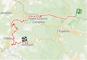
![](/images/other/stat-length.png)
![Tocht Mountainbike Bassurels - GTMC de Claire - 9 - Photo](https://media.geolcdn.com/t/1900/400/ext.pjpeg?maxdim=2&url=https%3A%2F%2Fservices.sitytrail.com%2FGeolivesWS%2FDownloadMedia.ashx%3FTrailID%3D101275%26Media%3D762_1.jpg)
GTMC de Claire - 9
tracegps
Gebruiker
![Lengte](/images/other/stat-length.png)
![Max. hoogte](https://static1.geolcdn.com/siteimages/upload/files/1508320355ic_sort_altitude_max_24dp.png)
![Positief hoogteverschil](https://static1.geolcdn.com/siteimages/upload/files/1508320355ic_sort_den_pos_24dp.png)
![Km-Effort](/images/other/stat-length.png)
![Min. hoogte](https://static1.geolcdn.com/siteimages/upload/files/1508320355ic_sort_altitude_min_24dp.png)
![Negatief hoogteverschil](https://static1.geolcdn.com/siteimages/upload/files/1508320355ic_sort_den_neg_24dp.png)
![Boucle](https://static1.geolcdn.com/siteimages/upload/files/16400158638029165_repeat_loop_refresh_sync_direction_icon.png)
![Mountainbike](https://static1.geolcdn.com/sitytour/trail-icons/202.png)
3h00
Moeilijkheid : Zeer moeilijk
![Scan deze QR-code om de tocht te openen in de SityTrail-applicatie](https://capi.geolives.com/qq0zvz2zws4bq2lad0pu/sitytour/trails/101275/qr.png?size=200)
Gratisgps-wandelapplicatie
Over ons
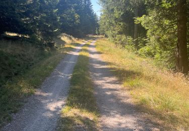
Tocht Mountainbike van 39 km beschikbaar op Occitanië, Lozère, Bassurels. Deze tocht wordt voorgesteld door tracegps.
Beschrijving
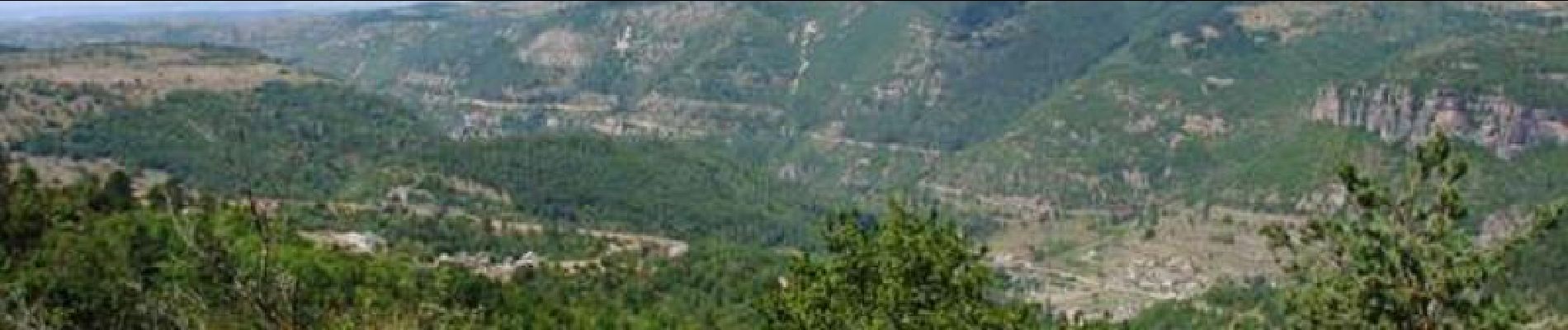
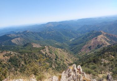
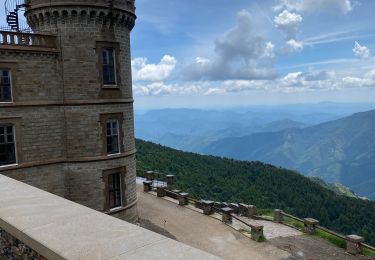
La Grande Traversée du Massif Central par Claire et ses amis. En douze étapes, revivez cette aventure sur son site. Neuvième étape: jeudi 10 Août 2006. Retrouvez le résumé de la journée, les conseils et les photos ICI Erreurs de parcours par rapport à la trace GPS sur la GTMC : à l'entrée des Cévennes après le bled d'Auriac (juste après Bagnols les bains), nous avons légèrement coupé (en fait on a suivi le GR) plutôt que de se diriger à la carte et de se perdre. Ca ne change pas grand chose et c'est moins prise de tête.
Plaatsbepaling
Opmerkingen
Wandeltochten in de omgeving
![Tocht Stappen Bassurels - Aigoual versant Lozérien - Photo](https://media.geolcdn.com/t/375/260/108dc4cb-28af-44a0-ac1e-3b9b5507498b.jpg&format=jpg&maxdim=2)
![Stappen Stappen](https://static1.geolcdn.com/sitytour/trail-icons/101.png)
Stappen
![](/images/other/stat-length.png)
![](https://static1.geolcdn.com/siteimages/upload/files/16400158638029165_repeat_loop_refresh_sync_direction_icon.png)
![Tocht Stappen Rousses - versant nord Aigoual - Photo](https://media.geolcdn.com/t/375/260/1aa2e2c6-c5c4-4f5f-89d2-7fc807e0a5f8.jpg&format=jpg&maxdim=2)
![Stappen Stappen](https://static1.geolcdn.com/sitytour/trail-icons/101.png)
Stappen
![](/images/other/stat-length.png)
![](https://static1.geolcdn.com/siteimages/upload/files/16400158638029165_repeat_loop_refresh_sync_direction_icon.png)
![Tocht Stappen Bassurels - Aire de Côte - Mas Corbières - Photo](https://media.geolcdn.com/t/375/260/ext.jpg?maxdim=2&url=https%3A%2F%2Fstatic1.geolcdn.com%2Fsiteimages%2Fupload%2Ffiles%2F1553511878bg_sport_marche.png)
![Stappen Stappen](https://static1.geolcdn.com/sitytour/trail-icons/101.png)
Stappen
![](/images/other/stat-length.png)
![](https://static1.geolcdn.com/siteimages/upload/files/16400158638029165_repeat_loop_refresh_sync_direction_icon.png)
![Tocht Stappen Meyrueis - Bois de la Dauphine - Photo](https://media.geolcdn.com/t/375/260/a7cc8742-6cf3-4cba-a6a2-d1c0486babc2.jpg&format=jpg&maxdim=2)
![Stappen Stappen](https://static1.geolcdn.com/sitytour/trail-icons/101.png)
Stappen
![](/images/other/stat-length.png)
![](https://static1.geolcdn.com/siteimages/upload/files/16400158638029165_repeat_loop_refresh_sync_direction_icon.png)
![Tocht Stappen Val-d'Aigoual - les cascades de l'aigoual par seyrerede - Photo](https://media.geolcdn.com/t/375/260/f9837145-dbac-42c7-abcf-7cbb3f01b62c.jpg&format=jpg&maxdim=2)
![Stappen Stappen](https://static1.geolcdn.com/sitytour/trail-icons/101.png)
Stappen
![](/images/other/stat-length.png)
![](https://static1.geolcdn.com/siteimages/upload/files/16400158638029165_repeat_loop_refresh_sync_direction_icon.png)
![Tocht Stappen Val-d'Aigoual - serreyrede à l aigoual par arboretum - Photo](https://media.geolcdn.com/t/375/260/2be9adc5-67d2-49de-acda-0293aa7a92e9.jpg&format=jpg&maxdim=2)
![Stappen Stappen](https://static1.geolcdn.com/sitytour/trail-icons/101.png)
Stappen
![](/images/other/stat-length.png)
![](https://static1.geolcdn.com/siteimages/upload/files/16400158638029165_repeat_loop_refresh_sync_direction_icon.png)
![Tocht Stappen Val-d'Aigoual - Serreyrede-caumette-Pra peyrot - Photo](https://media.geolcdn.com/t/375/260/4bd7c368-ffdb-4e2f-8b71-be78c10adff8.jpg&format=jpg&maxdim=2)
![Stappen Stappen](https://static1.geolcdn.com/sitytour/trail-icons/101.png)
Stappen
![](/images/other/stat-length.png)
![](https://static1.geolcdn.com/siteimages/upload/files/16400158638029165_repeat_loop_refresh_sync_direction_icon.png)
![Tocht Stappen Bassurels - Mont Aigoual Meyrues - Photo](https://media.geolcdn.com/t/375/260/6ddc0c7f-3198-46c8-9615-a233dbac5c7f.jpg&format=jpg&maxdim=2)
![Stappen Stappen](https://static1.geolcdn.com/sitytour/trail-icons/101.png)
Stappen
![](/images/other/stat-length.png)
![](https://static1.geolcdn.com/siteimages/upload/files/16400158638029165_repeat_loop_refresh_sync_direction_icon.png)
![Tocht Stappen Bassurels - Observatoire Mont Aigoual / Meyrueis - Photo](https://media.geolcdn.com/t/375/260/12e8418a-66c5-46a2-8d87-f4dcc8a1a26c.jpg&format=jpg&maxdim=2)
![Stappen Stappen](https://static1.geolcdn.com/sitytour/trail-icons/101.png)
Stappen
![](/images/other/stat-length.png)
![](https://static1.geolcdn.com/siteimages/upload/files/16400158638029165_repeat_loop_refresh_sync_direction_icon.png)