

St-Sozy

tracegps
Gebruiker

Lengte
8 km

Max. hoogte
240 m

Positief hoogteverschil
301 m

Km-Effort
12 km

Min. hoogte
98 m

Negatief hoogteverschil
305 m
Boucle
Ja
Datum van aanmaak :
2014-12-10 00:00:00.0
Laatste wijziging :
2014-12-10 00:00:00.0
2h00
Moeilijkheid : Medium

Gratisgps-wandelapplicatie
Over ons
Tocht Stappen van 8 km beschikbaar op Occitanië, Lot, Saint-Sozy. Deze tocht wordt voorgesteld door tracegps.
Beschrijving
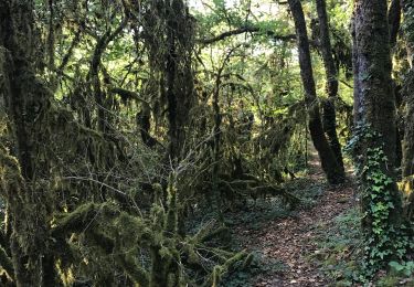
Petite boucle considéré comme "sportive", la montée sur les falaises est la portion la plus difficile mais la beauté du paysage sur la vallée de la Dordogne nous fait vite oublier les efforts fournis. D'autres infos et conseils sur Rando.eu
Plaatsbepaling
Land:
France
Regio :
Occitanië
Departement/Provincie :
Lot
Gemeente :
Saint-Sozy
Locatie:
Unknown
Vertrek:(Dec)
Vertrek:(UTM)
386664 ; 4970683 (31T) N.
Opmerkingen
Wandeltochten in de omgeving
Gluges Rocamadour


Elektrische fiets
Gemakkelijk
Martel,
Occitanië,
Lot,
France

53 km | 64 km-effort
4h 22min
Ja
Gouffre et résurgence du Limon - Grottes de Lacave


Te voet
Gemakkelijk
Lacave,
Occitanië,
Lot,
France

14,4 km | 19,6 km-effort
4h 26min
Ja
Saint Sozy -


Stappen
Zeer moeilijk
Saint-Sozy,
Occitanië,
Lot,
France

13,8 km | 20 km-effort
4h 15min
Ja
Causse toujours


Stappen
Moeilijk
Montvalent,
Occitanië,
Lot,
France

17,2 km | 23 km-effort
4h 30min
Ja
Pont de l'Ouysse Cougnaguet


Stappen
Heel gemakkelijk
Lacave,
Occitanië,
Lot,
France

13,9 km | 16,5 km-effort
3h 32min
Ja
Montvalent


Stappen
Gemakkelijk
Montvalent,
Occitanië,
Lot,
France

13,5 km | 18,9 km-effort
4h 0min
Ja
Gluges- Gluges par St Sozy, Pinsac, Lacave, Meyronne, Creysse.


Mountainbike
Zeer moeilijk
(1)
Martel,
Occitanië,
Lot,
France

35 km | 45 km-effort
3h 23min
Ja


 SityTrail


Belle rando mais nous avons perdu le chemin à 2 reprises dans la 1ère montée.
attention au départ prendre la déviation 2011 conseillée sinon galère
très belles vues