![](/images/other/stat-length.png)
![Tocht Mountainbike Bruniquel - Autour de Bruniquel - Photo](https://media.geolcdn.com/t/1900/400/ext.pjpeg?maxdim=2&url=https%3A%2F%2Fservices.sitytrail.com%2FGeolivesWS%2FDownloadMedia.ashx%3FTrailID%3D100928%26Media%3D427_1.jpg)
Autour de Bruniquel
tracegps
Gebruiker
![Lengte](/images/other/stat-length.png)
Lengte
45 km
![Max. hoogte](https://static1.geolcdn.com/siteimages/upload/files/1508320355ic_sort_altitude_max_24dp.png)
Max. hoogte
447 m
![Positief hoogteverschil](https://static1.geolcdn.com/siteimages/upload/files/1508320355ic_sort_den_pos_24dp.png)
Positief hoogteverschil
1265 m
![Km-Effort](/images/other/stat-length.png)
Km-Effort
62 km
![Min. hoogte](https://static1.geolcdn.com/siteimages/upload/files/1508320355ic_sort_altitude_min_24dp.png)
Min. hoogte
100 m
![Negatief hoogteverschil](https://static1.geolcdn.com/siteimages/upload/files/1508320355ic_sort_den_neg_24dp.png)
Negatief hoogteverschil
1265 m
![Boucle](https://static1.geolcdn.com/siteimages/upload/files/16400158638029165_repeat_loop_refresh_sync_direction_icon.png)
Boucle
Ja
Datum van aanmaak :
2014-12-10 00:00:00.0
Laatste wijziging :
2014-12-10 00:00:00.0
![Mountainbike](https://static1.geolcdn.com/sitytour/trail-icons/202.png)
4h00
Moeilijkheid : Zeer moeilijk
![Scan deze QR-code om de tocht te openen in de SityTrail-applicatie](https://capi.geolives.com/qq0zvz2zws4bq2lad0pu/sitytour/trails/100928/qr.png?size=200)
Gratisgps-wandelapplicatie
Over ons
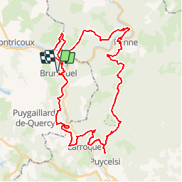
Tocht Mountainbike van 45 km beschikbaar op Occitanië, Tarn-et-Garonne, Bruniquel. Deze tocht wordt voorgesteld door tracegps.
Beschrijving
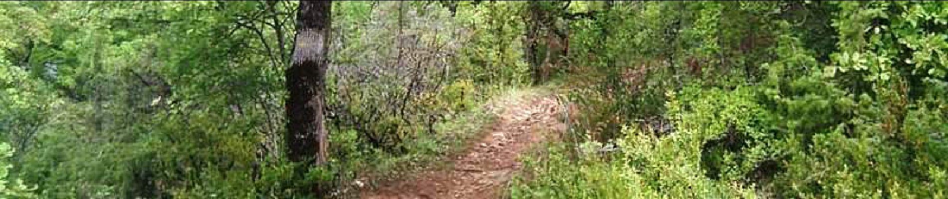
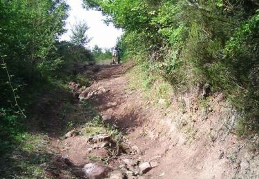
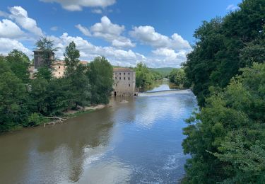
2 Sept 2006 Une bien jolie rando (encore une !) autour de Bruniquel. Dans l'ordre : descente le long de la Vère par St-Pierre, puis les Nouals. Montée/descente puis single joueur pour rejoindre et longer la Vère.... La suite est ICI
Plaatsbepaling
Land:
France
Regio :
Occitanië
Departement/Provincie :
Tarn-et-Garonne
Gemeente :
Bruniquel
Locatie:
Unknown
Vertrek:(Dec)
Vertrek:(UTM)
392989 ; 4878842 (31T) N.
Opmerkingen
Wandeltochten in de omgeving
![Tocht Mountainbike Bruniquel - Bruniquel, Grésigne, Penne - Photo](https://media.geolcdn.com/t/375/260/ext.jpg?maxdim=2&url=https%3A%2F%2Fservices.sitytrail.com%2FGeolivesWS%2FDownloadMedia.ashx%3FTrailID%3D100894%26Media%3D395_2.jpg)
![Mountainbike Mountainbike](https://static1.geolcdn.com/sitytour/trail-icons/202.png)
Bruniquel, Grésigne, Penne
Mountainbike
Zeer moeilijk
(1)
Bruniquel,
Occitanië,
Tarn-et-Garonne,
France
![](/images/other/stat-length.png)
42 km | 56 km-effort
5h 30min
![](https://static1.geolcdn.com/siteimages/upload/files/16400158638029165_repeat_loop_refresh_sync_direction_icon.png)
Ja
![Tocht Stappen Bruniquel - Bruni quel - Photo](https://media.geolcdn.com/t/375/260/6fb8d380-d7d9-467c-88ab-637a210db92b.jpg&format=jpg&maxdim=2)
![Stappen Stappen](https://static1.geolcdn.com/sitytour/trail-icons/101.png)
Bruni quel
Stappen
Medium
Bruniquel,
Occitanië,
Tarn-et-Garonne,
France
![](/images/other/stat-length.png)
16,8 km | 22 km-effort
5h 41min
![](https://static1.geolcdn.com/siteimages/upload/files/16400158638029165_repeat_loop_refresh_sync_direction_icon.png)
Ja
![Tocht Stappen Montricoux - Montricoux - Photo](https://media.geolcdn.com/t/375/260/2655e387-e67f-4901-a5a8-004800180e9a.jpg&format=jpg&maxdim=2)
![Stappen Stappen](https://static1.geolcdn.com/sitytour/trail-icons/101.png)
Montricoux
Stappen
Medium
Montricoux,
Occitanië,
Tarn-et-Garonne,
France
![](/images/other/stat-length.png)
16,7 km | 21 km-effort
5h 12min
![](https://static1.geolcdn.com/siteimages/upload/files/16400158638029165_repeat_loop_refresh_sync_direction_icon.png)
Ja
![Tocht Mountainbike Bruniquel - Rando VTT Boucle Bruniquel - Foret de Bretou - Photo](https://media.geolcdn.com/t/375/260/ext.jpg?maxdim=2&url=https%3A%2F%2Fstatic1.geolcdn.com%2Fsiteimages%2Fupload%2Ffiles%2F1524743154velo.jpg)
![Mountainbike Mountainbike](https://static1.geolcdn.com/sitytour/trail-icons/202.png)
Rando VTT Boucle Bruniquel - Foret de Bretou
Mountainbike
Moeilijk
(1)
Bruniquel,
Occitanië,
Tarn-et-Garonne,
France
![](/images/other/stat-length.png)
26 km | 32 km-effort
2h 5min
![](https://static1.geolcdn.com/siteimages/upload/files/16400158638029165_repeat_loop_refresh_sync_direction_icon.png)
Ja
![Tocht Andere activiteiten Bruniquel - bruniquel - Photo](https://media.geolcdn.com/t/375/260/ext.jpg?maxdim=2&url=https%3A%2F%2Fservices.sitytrail.com%2FGeolivesWS%2FDownloadMedia.ashx%3FTrailID%3D351615%26Media%3Dfix__20141003155114.jpg)
![Andere activiteiten Andere activiteiten](https://static1.geolcdn.com/sitytour/trail-icons/900.png)
bruniquel
Andere activiteiten
Heel gemakkelijk
(1)
Bruniquel,
Occitanië,
Tarn-et-Garonne,
France
![](/images/other/stat-length.png)
8,2 km | 13 km-effort
2h 14min
![](https://static1.geolcdn.com/siteimages/upload/files/16400158638029165_repeat_loop_refresh_sync_direction_icon.png)
Ja
![Tocht Mountainbike Bruniquel - VTT à Bruniquel - Photo](https://media.geolcdn.com/t/375/260/ext.jpg?maxdim=2&url=https%3A%2F%2Fstatic1.geolcdn.com%2Fsiteimages%2Fupload%2Ffiles%2F1524743154velo.jpg)
![Mountainbike Mountainbike](https://static1.geolcdn.com/sitytour/trail-icons/202.png)
VTT à Bruniquel
Mountainbike
Moeilijk
(1)
Bruniquel,
Occitanië,
Tarn-et-Garonne,
France
![](/images/other/stat-length.png)
28 km | 36 km-effort
2h 30min
![](https://static1.geolcdn.com/siteimages/upload/files/16400158638029165_repeat_loop_refresh_sync_direction_icon.png)
Ja
![Tocht Auto Montricoux - Les Bastides Albigeoises-Puycelsi-Castelnau-St Antonin - Photo](https://media.geolcdn.com/t/375/260/12225483-6426-45c4-9727-e792b76a9d9a.jpg&format=jpg&maxdim=2)
![Auto Auto](https://static1.geolcdn.com/sitytour/trail-icons/401.png)
Les Bastides Albigeoises-Puycelsi-Castelnau-St Antonin
Auto
Gemakkelijk
Montricoux,
Occitanië,
Tarn-et-Garonne,
France
![](/images/other/stat-length.png)
97 km | 120 km-effort
2h 30min
![](https://static1.geolcdn.com/siteimages/upload/files/16400158638029165_repeat_loop_refresh_sync_direction_icon.png)
Neen
![Tocht Te voet Montricoux - Montricoux - Photo](https://media.geolcdn.com/t/375/260/ext.jpg?maxdim=2&url=https%3A%2F%2Fstatic1.geolcdn.com%2Fsiteimages%2Fupload%2Ffiles%2F1545311037marcheuse_200dpi.jpg)
![Te voet Te voet](https://static1.geolcdn.com/sitytour/trail-icons/100.png)
Montricoux
Te voet
Medium
(1)
Montricoux,
Occitanië,
Tarn-et-Garonne,
France
![](/images/other/stat-length.png)
16,9 km | 22 km-effort
4h 59min
![](https://static1.geolcdn.com/siteimages/upload/files/16400158638029165_repeat_loop_refresh_sync_direction_icon.png)
Ja
![Tocht Stappen Bruniquel - bruniquel PR9 les rênes - Photo](https://media.geolcdn.com/t/375/260/583f8d15-0fba-48ac-97ed-43ca7eec6f0a.jpg&format=jpg&maxdim=2)
![Stappen Stappen](https://static1.geolcdn.com/sitytour/trail-icons/101.png)
bruniquel PR9 les rênes
Stappen
Gemakkelijk
Bruniquel,
Occitanië,
Tarn-et-Garonne,
France
![](/images/other/stat-length.png)
5 km | 7,5 km-effort
1h 15min
![](https://static1.geolcdn.com/siteimages/upload/files/16400158638029165_repeat_loop_refresh_sync_direction_icon.png)
Ja