Tocht Stappen Thuès-Entre-Valls - La_carancaRefuge_A-R_T - Photo
 force
force

Gebruiker

© OpenStreetMap contributors
Lengte
Lengte
19,9 km
Max. hoogte
Max. hoogte
1837 m
Positief hoogteverschil
1416 m
Km-Effort
Km-Effort  
39 km
Min. hoogte
Min. hoogte
836 m
Negatief hoogteverschil
1422 m
Boucle
Boucle
Ja
Datum van aanmaak :
2018-08-12 10:18:10.548
Laatste wijziging :
2018-08-12 10:18:10.671

(0 Bericht)

Stappen
Stappen
7h55
Moeilijkheid : Onbekend

Scan deze QR-code om de tocht te openen in de SityTrail-applicatie

Gratisgps-wandelapplicatie

Logo SityTrail SityTrail

IGN / Geografische instituten

SityTrail uit de App Store downloaden SityTrail uit Google Play downloaden

Logo SityTrail SityTrail World

De wereld gaat voor u open

SityTrail uit de App Store downloaden SityTrail uit Google Play downloaden SityTrail op Huawei AppGallery downloaden

Over ons

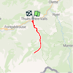
Tocht Stappen van 19,9 km beschikbaar op Occitanië, Pyrénées-Orientales, Thuès-Entre-Valls. Deze tocht wordt voorgesteld door force.

Beschrijving

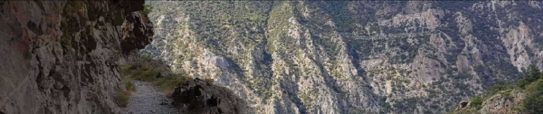
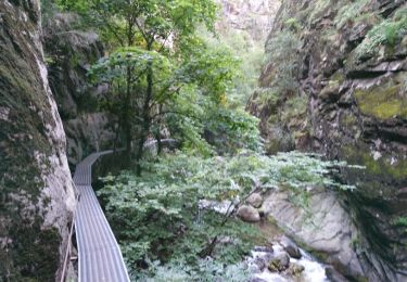
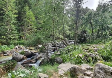
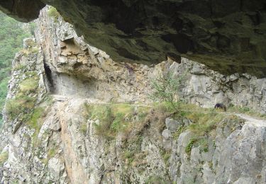
A-R dans les gorges jusqu'au refuge du Ras.
Rando de longueur variable selon disponibilités car l'A-R se fait par les gorges.

Hoogteprofiel

Foto's

33 fotos in totaal. Klik op een foto om ze allemaal in de galerij weer te geven.

Plaatsbepaling

Land:
France
Regio :
Occitanië
Departement/Provincie :
Pyrénées-Orientales
Gemeente :
Thuès-Entre-Valls
Locatie:
Unknown
Vertrek:(Dec)
Vertrek:(UTM)
436055 ; 4708141 (31T) N.

Wandeltochten in de omgeving

Tocht Stappen Thuès-Entre-Valls - boucle des gorges de Caranca - Photo
Stappen
PVERTICAL

Stappen

Medium
(2)
Thuès-Entre-Valls, Occitanië, Pyrénées-Orientales, France
7,2 km | 15,3 km-effort
3h 1min
Ja
Tocht Stappen Thuès-Entre-Valls - Gorges de la garanca - Photo
Stappen
attelageplaisir

Stappen

Heel gemakkelijk
(1)
Thuès-Entre-Valls, Occitanië, Pyrénées-Orientales, France
6,7 km | 13,1 km-effort
3h 39min
Neen
Tocht Stappen Fontpédrouse - Tour du Cucurucull - Photo
Stappen
Pek56

Stappen

Medium
(1)
Fontpédrouse, Occitanië, Pyrénées-Orientales, France
9,3 km | 18,5 km-effort
3h 24min
Ja
Tocht Stappen Fontpédrouse - fontpérouse sentier des canaux et sources chaudes naturelles_T - Photo
Stappen
force

Stappen

Medium
(1)
Fontpédrouse, Occitanië, Pyrénées-Orientales, France
13,7 km | 25 km-effort
5h 9min
Ja
Tocht Stappen Thuès-Entre-Valls - Thuès-Entre-Valls - Gorges de la Cartança - 13.1km D 4h30mn (30mn) - 2018 09 11 - Photo
Stappen
GUIDE
Orcal37

Stappen

Moeilijk
Thuès-Entre-Valls, Occitanië, Pyrénées-Orientales, France
12,3 km | 23 km-effort
4h 30min
Ja
Tocht Stappen Thuès-Entre-Valls - Gorges de Carança - Photo
Stappen
ochamley

Stappen

Medium
(2)
Thuès-Entre-Valls, Occitanië, Pyrénées-Orientales, France
13,6 km | 30 km-effort
3h 43min
Ja
Tocht Stappen Canaveilles - 20221120 Canaveilles - Llar  - Photo
Stappen
ThonyM

Stappen

Medium
Canaveilles, Occitanië, Pyrénées-Orientales, France
11 km | 20 km-effort
3h 15min
Ja
Tocht Stappen Thuès-Entre-Valls - Gorges de  la Carança vers refuge - Photo
Stappen
chrisgps

Stappen

Medium
Thuès-Entre-Valls, Occitanië, Pyrénées-Orientales, France
9,8 km | 22 km-effort
5h 33min
Neen
Tocht Te voet Thuès-Entre-Valls - Les Balcons de la Têt - Photo
Te voet
GUIDE+

Te voet

Medium
Thuès-Entre-Valls, Occitanië, Pyrénées-Orientales, France
10,9 km | 21 km-effort
4h 51min
Neen


Sluiten
Mijn abonnementen