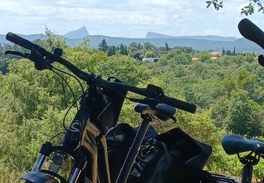
Tocht Mountainbike Sommières - Les Terres de Sommières 2 - Photo

Les Terres de Sommières 2

 tracegps
tracegps

Gebruiker

© OpenStreetMap contributors
Lengte
Lengte
19,1 km
Max. hoogte
Max. hoogte
91 m
Positief hoogteverschil
250 m
Km-Effort
Km-Effort  
22 km
Min. hoogte
Min. hoogte
24 m
Negatief hoogteverschil
239 m
Boucle
Boucle
Neen
Datum van aanmaak :
2014-12-10 00:00:00.0
Laatste wijziging :
2014-12-10 00:00:00.0

(0 Bericht)

Mountainbike
Mountainbike
2h00
Moeilijkheid : Moeilijk

Scan deze QR-code om de tocht te openen in de SityTrail-applicatie

Gratisgps-wandelapplicatie

Logo SityTrail SityTrail

IGN / Geografische instituten

SityTrail uit de App Store downloaden SityTrail uit Google Play downloaden

Logo SityTrail SityTrail World

De wereld gaat voor u open

SityTrail uit de App Store downloaden SityTrail uit Google Play downloaden SityTrail op Huawei AppGallery downloaden

Over ons

Tocht Mountainbike van 19,1 km beschikbaar op Occitanië, Gard, Sommières. Deze tocht wordt voorgesteld door tracegps.

Beschrijving

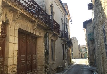
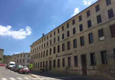
A la croisée des chemins entre Nîmes et Montpellier, la camargue et les Cévennes, le Pays Terres de Sommières est une base de loisirs idéale. Nos villages cachent les vestiges hérités du moyen-âge. Les producteurs vous font partager leur amour du travail bien fait. De nombreux chemins sillonent garrigue, pinède et vignoble et offrent libre cours aux activités. Les rives du Vidourle se prêtent à la pêche, au canoë ou à la baignade... sans oublier que vous vous laisserez entrainer dans de folles fêtes (jazz, classique, taureaux, fêtes médiévales...). (Source gites-de-france-gard.asso.fr)

Hoogteprofiel

Foto's

Plaatsbepaling

Land:
France
Regio :
Occitanië
Departement/Provincie :
Gard
Gemeente :
Sommières
Locatie:
Unknown
Vertrek:(Dec)
Vertrek:(UTM)
587267 ; 4848775 (31T) N.

Wandeltochten in de omgeving

Tocht Stappen Fontanès - FONTANÉS 30 - SALINELLES - PONDRES - ballade autour du Vidourle  - Photo
Stappen
jeff66

Stappen

Medium
(3)
Fontanès, Occitanië, Gard, France
10,7 km | 12,7 km-effort
1h 59min
Ja
Tocht Stappen Sommières -  SOMMIERES 30 - VILLEVIEILLE châteaux- JUNAS les carrières  - Photo
Stappen
jeff66

Stappen

Medium
(2)
Sommières, Occitanië, Gard, France
14 km | 16,9 km-effort
2h 34min
Ja
Tocht Stappen Saussines - Saussines - Photo
Stappen
GUIDE
nadinebondoux

Stappen

Heel gemakkelijk
(1)
Saussines, Occitanië, Hérault, France
13,3 km | 14,9 km-effort
4h 13min
Ja
Tocht Stappen Saint-Clément - Le bois de Paris - Grotte, Table d'orientation, Oppidum - Photo
Stappen
f4tnk

Stappen

Medium
(1)
Saint-Clément, Occitanië, Gard, France
8,2 km | 10,9 km-effort
2h 29min
Ja
Tocht Stappen Junas - Entre Junas et Aujargues - Photo
Stappen
GUIDE
randotines

Stappen

Gemakkelijk
Junas, Occitanië, Gard, France
7,9 km | 9,4 km-effort
2h 2min
Ja
Tocht Stappen Sommières - Autour de Villevielle 30 - Photo
Stappen
guignier

Stappen

Gemakkelijk
(2)
Sommières, Occitanië, Gard, France
10,5 km | 12,3 km-effort
3h 0min
Ja
Tocht sport Junas - Carrières de Jonas - Photo
sport
fb30

sport

Heel gemakkelijk
Junas, Occitanië, Gard, France
3,5 km | 4,1 km-effort
Onbekend
Ja
Tocht Elektrische fiets Junas - Boucle de la Vidourle  - Photo
Elektrische fiets
apa

Elektrische fiets

Gemakkelijk
Junas, Occitanië, Gard, France
38 km | 43 km-effort
2h 33min
Ja
Tocht Stappen Junas - Aubais  - Photo
Stappen
Galoche

Stappen

Heel gemakkelijk
Junas, Occitanië, Gard, France
6,4 km | 7,8 km-effort
1h 39min
Ja


Sluiten
Mijn abonnementen