![](/images/other/stat-length.png)
![Tocht Stappen Habay - HABAY-la-NEUVE (Forêt d'Anlier) - Photo](https://media.geolcdn.com/t/1900/400/ext.pjpeg?maxdim=2&url=https%3A%2F%2Fservices.sitytrail.com%2FGeolivesWS%2FDownloadMedia.ashx%3FTrailID%3D1008904%26Media%3Dfix__20180722103407.jpg)
HABAY-la-NEUVE (Forêt d'Anlier)
GerardBouche
Gebruiker
![Lengte](/images/other/stat-length.png)
Lengte
11,4 km
![Max. hoogte](https://static1.geolcdn.com/siteimages/upload/files/1508320355ic_sort_altitude_max_24dp.png)
Max. hoogte
471 m
![Positief hoogteverschil](https://static1.geolcdn.com/siteimages/upload/files/1508320355ic_sort_den_pos_24dp.png)
Positief hoogteverschil
197 m
![Km-Effort](/images/other/stat-length.png)
Km-Effort
14 km
![Min. hoogte](https://static1.geolcdn.com/siteimages/upload/files/1508320355ic_sort_altitude_min_24dp.png)
Min. hoogte
382 m
![Negatief hoogteverschil](https://static1.geolcdn.com/siteimages/upload/files/1508320355ic_sort_den_neg_24dp.png)
Negatief hoogteverschil
196 m
![Boucle](https://static1.geolcdn.com/siteimages/upload/files/16400158638029165_repeat_loop_refresh_sync_direction_icon.png)
Boucle
Ja
Datum van aanmaak :
2018-08-19 07:27:04.968
Laatste wijziging :
2018-08-19 07:27:04.968
![Stappen](https://static1.geolcdn.com/sitytour/trail-icons/101.png)
3h02
Moeilijkheid : Gemakkelijk
![Scan deze QR-code om de tocht te openen in de SityTrail-applicatie](https://capi.geolives.com/qq0zvz2zws4bq2lad0pu/sitytour/trails/1008904/qr.png?size=200)
Gratisgps-wandelapplicatie
Over ons
Tocht Stappen van 11,4 km beschikbaar op Wallonië, Luxemburg, Habay. Deze tocht wordt voorgesteld door GerardBouche.
Beschrijving
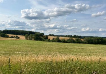
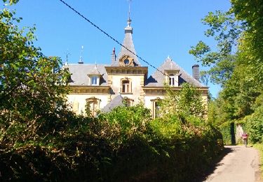
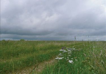
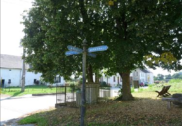
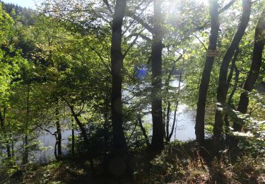
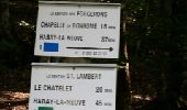
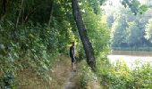
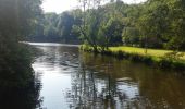
Au départ de la Mairie, un très beau parcours par l'étang du Châtelet, l'étang du Pont d'Oie et l'étang de la Fabrique ... trois étangs alimentés par la "Rulles". Une montée en pente douche dans la belle forêt d'Anlier et le retour par la Fagne Jean Simon.
Plaatsbepaling
Land:
Belgium
Regio :
Wallonië
Departement/Provincie :
Luxemburg
Gemeente :
Habay
Locatie:
Habay-la-Neuve
Vertrek:(Dec)
Vertrek:(UTM)
691198 ; 5512194 (31U) N.
Opmerkingen
Wandeltochten in de omgeving
![Tocht Stappen Habay - RB-LUX-11 - Au coeur de la forêt d’Anlier - Photo](https://media.geolcdn.com/t/375/260/ext.jpg?maxdim=2&url=https%3A%2F%2Fservices.sitytrail.com%2FGeolivesWS%2FDownloadMedia.ashx%3FTrailID%3D179616%26Media%3D08af71d9-c674-44b1-8950-c42d6cbce43a.jpg)
![Stappen Stappen](https://static1.geolcdn.com/sitytour/trail-icons/101.png)
RB-LUX-11 - Au coeur de la forêt d’Anlier
Stappen
Moeilijk
(8)
Habay,
Wallonië,
Luxemburg,
Belgium
![](/images/other/stat-length.png)
23 km | 29 km-effort
5h 56min
![](https://static1.geolcdn.com/siteimages/upload/files/16400158638029165_repeat_loop_refresh_sync_direction_icon.png)
Ja
![Tocht Paardrijden Habay - Forêt de Rulles - Photo](https://media.geolcdn.com/t/375/260/a38a8cb1-ff9c-4914-bcb7-5d901a1c22cc.jpg&format=jpg&maxdim=2)
![Paardrijden Paardrijden](https://static1.geolcdn.com/sitytour/trail-icons/301.png)
Forêt de Rulles
Paardrijden
Gemakkelijk
(1)
Habay,
Wallonië,
Luxemburg,
Belgium
![](/images/other/stat-length.png)
12,5 km | 15,3 km-effort
1h 56min
![](https://static1.geolcdn.com/siteimages/upload/files/16400158638029165_repeat_loop_refresh_sync_direction_icon.png)
Ja
![Tocht Fiets Habay - Balade du patrimoine - Photo](https://media.geolcdn.com/t/375/260/ext.jpg?maxdim=2&url=https%3A%2F%2Fservices.sitytrail.com%2FGeolivesWS%2FDownloadMedia.ashx%3FTrailID%3D619592%26Media%3Dfix__20160823152423.jpg)
![Fiets Fiets](https://static1.geolcdn.com/sitytour/trail-icons/200.png)
Balade du patrimoine
Fiets
Gemakkelijk
(1)
Habay,
Wallonië,
Luxemburg,
Belgium
![](/images/other/stat-length.png)
23 km | 28 km-effort
1h 36min
![](https://static1.geolcdn.com/siteimages/upload/files/16400158638029165_repeat_loop_refresh_sync_direction_icon.png)
Ja
![Tocht Paard Habay - Etang du Châtelet - Photo](https://media.geolcdn.com/t/375/260/ext.jpg?maxdim=2&url=https%3A%2F%2Fservices.sitytrail.com%2FGeolivesWS%2FDownloadMedia.ashx%3FTrailID%3D449819%26Media%3Dfix__20141207155625.jpg)
![Paard Paard](https://static1.geolcdn.com/sitytour/trail-icons/300.png)
Etang du Châtelet
Paard
Medium
(1)
Habay,
Wallonië,
Luxemburg,
Belgium
![](/images/other/stat-length.png)
11 km | 13,6 km-effort
1h 43min
![](https://static1.geolcdn.com/siteimages/upload/files/16400158638029165_repeat_loop_refresh_sync_direction_icon.png)
Ja
![Tocht Stappen Habay - RB-LUX-11 - Raccourci - Au coeur de la forêt d’Anlier - Photo](https://media.geolcdn.com/t/375/260/ext.jpg?maxdim=2&url=https%3A%2F%2Fservices.sitytrail.com%2FGeolivesWS%2FDownloadMedia.ashx%3FTrailID%3D216796%26Media%3D7c022f6c-85e7-4bd4-8bf7-3a772296d0f7.jpg)
![Stappen Stappen](https://static1.geolcdn.com/sitytour/trail-icons/101.png)
RB-LUX-11 - Raccourci - Au coeur de la forêt d’Anlier
Stappen
Gemakkelijk
(1)
Habay,
Wallonië,
Luxemburg,
Belgium
![](/images/other/stat-length.png)
14,5 km | 18,5 km-effort
3h 55min
![](https://static1.geolcdn.com/siteimages/upload/files/16400158638029165_repeat_loop_refresh_sync_direction_icon.png)
Ja
![Tocht Stappen Étalle - Sentier des mardelles - Photo](https://media.geolcdn.com/t/375/260/ext.jpg?maxdim=2&url=https%3A%2F%2Fservices.sitytrail.com%2FGeolivesWS%2FDownloadMedia.ashx%3FTrailID%3D67799%26Media%3D7cf7391b-4ead-4d15-8bef-379f53159afc.JPG)
![Stappen Stappen](https://static1.geolcdn.com/sitytour/trail-icons/101.png)
Sentier des mardelles
Stappen
Gemakkelijk
(1)
Étalle,
Wallonië,
Luxemburg,
Belgium
![](/images/other/stat-length.png)
3,7 km | 4,2 km-effort
1h 0min
![](https://static1.geolcdn.com/siteimages/upload/files/16400158638029165_repeat_loop_refresh_sync_direction_icon.png)
Ja
![Mountainbike Mountainbike](https://static1.geolcdn.com/sitytour/trail-icons/202.png)
forêt d Anlier
Mountainbike
Gemakkelijk
(1)
Habay,
Wallonië,
Luxemburg,
Belgium
![](/images/other/stat-length.png)
28 km | 34 km-effort
2h 43min
![](https://static1.geolcdn.com/siteimages/upload/files/16400158638029165_repeat_loop_refresh_sync_direction_icon.png)
Ja
![Tocht Andere activiteiten Attert - Nobressart-Burgknapp - Photo](https://media.geolcdn.com/t/375/260/ext.jpg?maxdim=2&url=https%3A%2F%2Fservices.sitytrail.com%2FGeolivesWS%2FDownloadMedia.ashx%3FTrailID%3D855557%26Media%3D20171101150204.jpg)
![Andere activiteiten Andere activiteiten](https://static1.geolcdn.com/sitytour/trail-icons/900.png)
Nobressart-Burgknapp
Andere activiteiten
Heel gemakkelijk
(1)
Attert,
Wallonië,
Luxemburg,
Belgium
![](/images/other/stat-length.png)
7,1 km | 9,1 km-effort
2h 42min
![](https://static1.geolcdn.com/siteimages/upload/files/16400158638029165_repeat_loop_refresh_sync_direction_icon.png)
Ja
![Tocht Stappen Habay - Fagne Jean-Simon (version longue) - Photo](https://media.geolcdn.com/t/375/260/ext.jpg?maxdim=2&url=https%3A%2F%2Fservices.sitytrail.com%2FGeolivesWS%2FDownloadMedia.ashx%3FTrailID%3D412594%26Media%3Dfix__20150426151407.jpg)
![Stappen Stappen](https://static1.geolcdn.com/sitytour/trail-icons/101.png)
Fagne Jean-Simon (version longue)
Stappen
Gemakkelijk
(1)
Habay,
Wallonië,
Luxemburg,
Belgium
![](/images/other/stat-length.png)
11,1 km | 13,7 km-effort
3h 0min
![](https://static1.geolcdn.com/siteimages/upload/files/16400158638029165_repeat_loop_refresh_sync_direction_icon.png)
Ja