![](/images/other/stat-length.png)
![Tocht Stappen Aielli - gole de celano 10 km - Photo](https://media.geolcdn.com/t/1900/400/ext.pjpeg?maxdim=2&url=https%3A%2F%2Fservices.sitytrail.com%2FGeolivesWS%2FDownloadMedia.ashx%3FTrailID%3D1004745%26Media%3D20180709171340.jpg)
gole de celano 10 km
rvapeldo
Gebruiker GUIDE
![Lengte](/images/other/stat-length.png)
![Max. hoogte](https://static1.geolcdn.com/siteimages/upload/files/1508320355ic_sort_altitude_max_24dp.png)
![Positief hoogteverschil](https://static1.geolcdn.com/siteimages/upload/files/1508320355ic_sort_den_pos_24dp.png)
![Km-Effort](/images/other/stat-length.png)
![Min. hoogte](https://static1.geolcdn.com/siteimages/upload/files/1508320355ic_sort_altitude_min_24dp.png)
![Negatief hoogteverschil](https://static1.geolcdn.com/siteimages/upload/files/1508320355ic_sort_den_neg_24dp.png)
![Boucle](https://static1.geolcdn.com/siteimages/upload/files/16400158638029165_repeat_loop_refresh_sync_direction_icon.png)
![Stappen](https://static1.geolcdn.com/sitytour/trail-icons/101.png)
4h07
Moeilijkheid : Medium
![Scan deze QR-code om de tocht te openen in de SityTrail-applicatie](https://capi.geolives.com/qq0zvz2zws4bq2lad0pu/sitytour/trails/1004745/qr.png?size=200)
Gratisgps-wandelapplicatie
Over ons
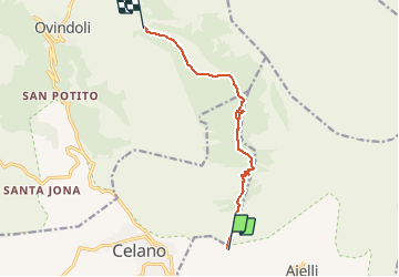
Tocht Stappen van 10 km beschikbaar op Abruzzen, L'Aquila, Aielli. Deze tocht wordt voorgesteld door rvapeldo.
Beschrijving
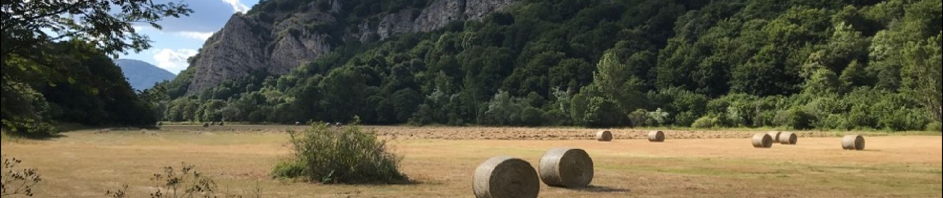
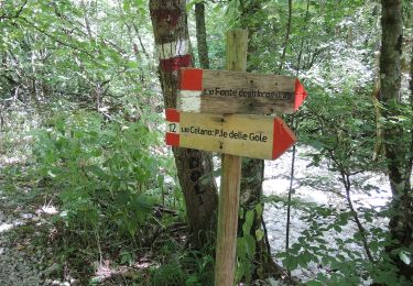
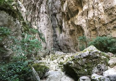
Les magnifiques gorges (gole) de Celano (parc naturel Sirente Velino) peuvent être parcourues de diverses manières. Nous avons choisi de la pratiquer en ligne, en montant depuis Celano jusqu'au parking près d'Ovindoli (ce qui impose l'usage de deux voitures, ou de recourir au bus entre Celano et Ovindoli, mais c'est plus long). Le plus simple est de faire un aller retour en partant du départ près de Celano. Cela évite un beau dénivelé un peu ardu de 250/300 m dans le nord du parcours. A faire hors des période de dégels où le cours d'eau qui parcours les gorges se ranime. Nous l'avons fait en été, un parcours idéal pour la saison, car il est fort ombragé.
Attention, le dénivelé indiqué est incorrect (c'est plutôt 600 mètres en positif en allant du sud vers le nord), car le gps a été perturbé par le contexte étroit du canyon, qui rend les satellites moins facilement détectables.Il y a donc des mesures erronées.
Plaatsbepaling
Opmerkingen
Wandeltochten in de omgeving
![Tocht Te voet Aielli - Gole di Celano - Photo](https://media.geolcdn.com/t/375/260/4dcd43be-fddc-4be1-a69c-9b1a691d2f41.jpeg&format=jpg&maxdim=2)
![Te voet Te voet](https://static1.geolcdn.com/sitytour/trail-icons/100.png)
Te voet
![](/images/other/stat-length.png)
![](https://static1.geolcdn.com/siteimages/upload/files/16400158638029165_repeat_loop_refresh_sync_direction_icon.png)
![Tocht Te voet Ovindoli - Ponticello di Val D'Arano - Prato di Cerro - Photo](https://media.geolcdn.com/t/375/260/898daba2-2440-431b-8ade-3ecc0082a5ae.jpeg&format=jpg&maxdim=2)
![Te voet Te voet](https://static1.geolcdn.com/sitytour/trail-icons/100.png)
Te voet
![](/images/other/stat-length.png)
![](https://static1.geolcdn.com/siteimages/upload/files/16400158638029165_repeat_loop_refresh_sync_direction_icon.png)
![Tocht Stappen Aielli - Gole de Celano aller retour 10 Km - Photo](https://media.geolcdn.com/t/375/260/1f34a35e-3932-46e0-a145-caef5df492d0.jpg&format=jpg&maxdim=2)
![Stappen Stappen](https://static1.geolcdn.com/sitytour/trail-icons/101.png)
Stappen
![](/images/other/stat-length.png)
![](https://static1.geolcdn.com/siteimages/upload/files/16400158638029165_repeat_loop_refresh_sync_direction_icon.png)
![Tocht Te voet Ovindoli - Bivio Santa Iona - Serra Di Celano - Photo](https://media.geolcdn.com/t/375/260/ext.jpg?maxdim=2&url=https%3A%2F%2Fstatic1.geolcdn.com%2Fsiteimages%2Fupload%2Ffiles%2F1545311037marcheuse_200dpi.jpg)
![Te voet Te voet](https://static1.geolcdn.com/sitytour/trail-icons/100.png)
Te voet
![](/images/other/stat-length.png)
![](https://static1.geolcdn.com/siteimages/upload/files/16400158638029165_repeat_loop_refresh_sync_direction_icon.png)