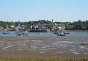
POI Muzillac - Le Site de Kerantré - Photo

Le Site de Kerantré

Beschrijving

Après avoir traversé  le village de Kerantré, qui conserve, à son entrée, une borne de l’ancienne abbaye, vous arrivez dans un chemin creux. Cet itinéraire emprunte une ancienne « Route du Sel ». Quelques mètres plus loin, on a un remarquable panorama sur La Vilaine. Ces coteaux étaient plantés de vignobles pendant toute la période médiévale et jusqu’au 19ème siècle.
Foto's

Ontdek Le Site de Kerantré met de volgende tochten...
Tocht Stappen Arzal - Arzal_Estuaire - Photo
Stappen
neoroll44

Stappen

Medium
Arzal, Bretagne, Morbihan, France
11,6 km | 13,4 km-effort
3h 0min
Ja
 neoroll44
neoroll44

Gebruiker

© OpenStreetMap contributors

Plaatsbepaling

Land:
France
Regio :
Bretagne
Departement/Provincie :
Morbihan
Gemeente :
Muzillac
Locatie:
Unknown
Datum van aanmaak :
2018-04-12 01:22:16.093
Laatste wijziging
2018-04-12 01:22:16.093

(0 Bericht)


POI's in de buurt

POI Arzal - Le Village de Bourgerel - Photo
neoroll44
POI Muzillac - Borne de Prières - Photo
neoroll44
POI Arzal - A découvrir - Photo
neoroll44
POI Arzal - Point 1 - Photo
legallo
ARZAL 
POI Arzal - Le Moustoir - Photo
neoroll44
POI Arzal - Intersection - Photo
neoroll44
POI Arzal - La Digue du Morillon - Photo
neoroll44
POI Arzal - Intersection - Photo
neoroll44


Sluiten
Mijn abonnementen