Home
World
NEW
Premium
Winkel
tochten
Artikels
Help - ondersteuning
Français
English
Nederlands
Español
Italiano
Deutsch
Aansluiting
Home
World
Premium
Winkel
tochten
Artikels
Help - ondersteuning
SityTrail
>
POI's
>
GCYQVQ
SityTrail
>
POI's
>
GCYQVQ
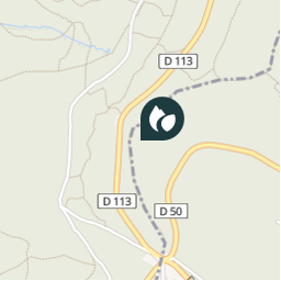
GCYQVQ
Beschrijving
Col de Malval by Rockley, Trad
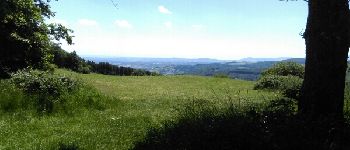
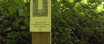
Foto's
Ontdek GCYQVQ met de volgende tochten...
tracegps
Lac-Bleu depuis Méribel-Altiport
Stappen
Moeilijk
(1)
Les Allues, Auvergne-Rhône-Alpes, Savoie, France
10 km | 18,1 km-effort
4h 30min
Ja
tracegps
Gebruiker
©
OpenStreetMap
contributors
Plaatsbepaling
Land:
France
Regio :
Auvergne-Rhône-Alpes
Departement/Provincie :
Rhône
Gemeente :
Vaugneray
Locatie:
Vaugneray
Plaatsbepaling
45.751067 / 4.610667
Datum van aanmaak :
2018-04-09 12:18:06.193
Laatste wijziging
2018-04-09 12:18:06.193
(0 Bericht)
Opmerkingen
Gelieve in te loggen om een commentaar of een beoordeling achter te laten
POI's in de buurt
tracegps
GCYQVQ
VAUGNERAY
tracegps
GCYQVQ
VAUGNERAY
tracegps
GCYQVQ
VAUGNERAY
tracegps
GCYQVQ
VAUGNERAY
tracegps
GCYQVQ
VAUGNERAY
Trotte-menu
vuePoint 4
POLLIONNAY
Trotte-menu
Vue
POLLIONNAY
Trotte-menu
sentier aqueduc romain terr...
VAUGNERAY
Sluiten
Mijn abonnementen