Enchastrayes, Alpes-de-Haute-Provence, Fiets: Top van de beste wandelroutes, trajecten, tochten en wandelingen

9 opmerkingen

Enchastrayes: Ontdek de beste tochten: 2 fiets, 1 wegfiets en 9 mountainbike. Al deze tochten, trajecten, routes en outdoor activiteiten zijn beschikbaar in onze SityTrail-apps voor smartphones en tablets.


De beste trajecten (12)
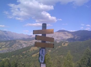
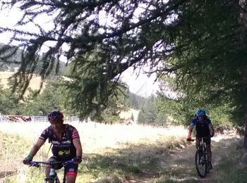
Tocht Mountainbike Enchastrayes - 9 août vae - Photo
Mountainbike 15.877
Km

Mountainbike

Heel gemakkelijk
Enchastrayes, Provence-Alpes-Côte d'Azur, Alpes-de-Haute-Provence, France
15,9 km | 24 km-effort
1h 48min
638 m
638 m
Ja
ajpbm

Tocht Mountainbike Enchastrayes - camping la chaup Jausiers Lac de Sagnes - Photo
Mountainbike 48.423
Km

Mountainbike

Medium
Enchastrayes, Provence-Alpes-Côte d'Azur, Alpes-de-Haute-Provence, France
48 km | 66 km-effort
4h 37min
1294 m
1294 m
Ja
ajpbm

Tocht Mountainbike Enchastrayes - Espace VTT FFC Vallée de l'Ubaye - Circuit n° 16 - Super Sauze - Col des Alaris - Photo
Mountainbike 8.911
Km

Mountainbike

Gemakkelijk
(1)
Enchastrayes, Provence-Alpes-Côte d'Azur, Alpes-de-Haute-Provence, France
8,9 km | 13 km-effort
1h 30min
301 m
311 m
Neen
tracegps

Tocht Wegfiets Enchastrayes - Sauze-montagne-Barcelonnette-retour - Photo
Wegfiets 11.872
Km

Wegfiets

Medium
Enchastrayes, Provence-Alpes-Côte d'Azur, Alpes-de-Haute-Provence, France
11,9 km | 15,9 km-effort
1h 47min
305 m
305 m
Ja
Reichling

Tocht Fiets Enchastrayes - J2_Cayolle_Allos - Photo
Fiets 100.172
Km

Fiets

Moeilijk
Enchastrayes, Provence-Alpes-Côte d'Azur, Alpes-de-Haute-Provence, France
100 km | 141 km-effort
7h 49min
3084 m
3086 m
Ja
bqu34

Tocht Fiets Enchastrayes - J1_La_Bonette - Photo
Fiets 89.624
Km

Fiets

Moeilijk
Enchastrayes, Provence-Alpes-Côte d'Azur, Alpes-de-Haute-Provence, France
90 km | 127 km-effort
7h 14min
2825 m
2827 m
Ja
bqu34

Tocht Mountainbike Enchastrayes - Espace VTT FFC Vallée de l'Ubaye - Circuit n° 15 - Descente du Super Sauze au Sauze - Photo
Mountainbike 1.823
Km

Mountainbike

Gemakkelijk
Enchastrayes, Provence-Alpes-Côte d'Azur, Alpes-de-Haute-Provence, France
1,8 km | 3 km-effort
19min
0 m
345 m
Neen
tracegps

Tocht Mountainbike Enchastrayes - la Boucle du Sauze  - Photo
Mountainbike 14.623
Km

Mountainbike

Medium
Enchastrayes, Provence-Alpes-Côte d'Azur, Alpes-de-Haute-Provence, France
14,6 km | 22 km-effort
3h 33min
568 m
555 m
Ja
samifly51

Tocht Mountainbike Enchastrayes - Super sauze  barcelonette - Photo
Mountainbike 22.491
Km

Mountainbike

Moeilijk
Enchastrayes, Provence-Alpes-Côte d'Azur, Alpes-de-Haute-Provence, France
22 km | 32 km-effort
2h 27min
735 m
735 m
Ja
phil21

Tocht Mountainbike Enchastrayes - Circuit no 10 - Photo
Mountainbike 24.094
Km

Mountainbike

Zeer moeilijk
Enchastrayes, Provence-Alpes-Côte d'Azur, Alpes-de-Haute-Provence, France
24 km | 34 km-effort
1h 57min
780 m
781 m
Ja
phil21

Tocht Mountainbike Enchastrayes - 7 août camping La Chaup transubayenne - Photo
Mountainbike 33.024
Km

Mountainbike

Gemakkelijk
Enchastrayes, Provence-Alpes-Côte d'Azur, Alpes-de-Haute-Provence, France
33 km | 40 km-effort
2h 57min
543 m
543 m
Ja
ajpbm

Tocht Mountainbike Enchastrayes - Circuit no 10 - Photo
Mountainbike 20.544
Km

Mountainbike

Enchastrayes, Provence-Alpes-Côte d'Azur, Alpes-de-Haute-Provence, France
21 km | 0 m-effort
1h 56min
0 m
0 m
Ja
phil21

12 tochten weergegeven op 12

Gratisgps-wandelapplicatie

Logo SityTrail SityTrail

IGN / Geografische instituten

SityTrail uit de App Store downloaden SityTrail uit Google Play downloaden

Logo SityTrail SityTrail World

De wereld gaat voor u open

SityTrail uit de App Store downloaden SityTrail uit Google Play downloaden SityTrail op Huawei AppGallery downloaden

Activiteiten

Sluiten
Mijn abonnementen