![](/images/other/stat-length.png)
Marlens, Val de Chaise, Fiets: Top van de beste wandelroutes, trajecten, tochten en wandelingen
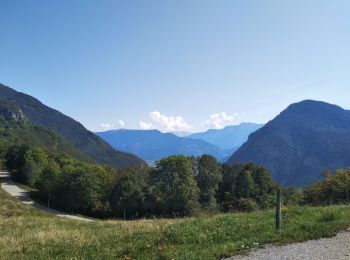
Marlens: Ontdek de beste tochten: 12 fiets, 1 wegfiets en 2 mountainbike. Al deze tochten, trajecten, routes en outdoor activiteiten zijn beschikbaar in onze SityTrail-apps voor smartphones en tablets.
De beste trajecten (15)
![Tocht Wegfiets Val de Chaise - 38 vélo autour lac annecy 04.08.22 - Photo](https://media.geolcdn.com/t/350/260/ext.jpg?maxdim=2&url=https%3A%2F%2Fstatic1.geolcdn.com%2Fsiteimages%2Fupload%2Ffiles%2F1524743154velo.jpg)
![Wegfiets Wegfiets](https://static1.geolcdn.com/sitytour/trail-icons/201.png)
Km
Wegfiets
![](/images/other/stat-length.png)
![](https://static1.geolcdn.com/siteimages/upload/files/1508320355ic_sort_den_pos_24dp.png)
![](https://static1.geolcdn.com/siteimages/upload/files/1508320355ic_sort_den_neg_24dp.png)
![](https://static1.geolcdn.com/siteimages/upload/files/16400158638029165_repeat_loop_refresh_sync_direction_icon.png)
![Tocht Mountainbike Val de Chaise - marlens #2 - Photo](https://media.geolcdn.com/t/350/260/ca709dfb-8146-4774-a021-6fc2930d4b9a.jpg&format=jpg&maxdim=2)
![Mountainbike Mountainbike](https://static1.geolcdn.com/sitytour/trail-icons/202.png)
Km
Mountainbike
![](/images/other/stat-length.png)
![](https://static1.geolcdn.com/siteimages/upload/files/1508320355ic_sort_den_pos_24dp.png)
![](https://static1.geolcdn.com/siteimages/upload/files/1508320355ic_sort_den_neg_24dp.png)
![](https://static1.geolcdn.com/siteimages/upload/files/16400158638029165_repeat_loop_refresh_sync_direction_icon.png)
![Tocht Fiets Val de Chaise - Marlens - Alpes 2015 - Parcours 7-variante - Photo](https://media.geolcdn.com/t/350/260/ext.jpg?maxdim=2&url=https%3A%2F%2Fstatic1.geolcdn.com%2Fsiteimages%2Fupload%2Ffiles%2F1524743154velo.jpg)
![Fiets Fiets](https://static1.geolcdn.com/sitytour/trail-icons/200.png)
Km
Fiets
![](/images/other/stat-length.png)
![](https://static1.geolcdn.com/siteimages/upload/files/1508320355ic_sort_den_pos_24dp.png)
![](https://static1.geolcdn.com/siteimages/upload/files/1508320355ic_sort_den_neg_24dp.png)
![](https://static1.geolcdn.com/siteimages/upload/files/16400158638029165_repeat_loop_refresh_sync_direction_icon.png)
• Col de la Forclaz de Queige - 871 m Signal de Bisanne - 1930 m Col des Saisies - 1633 m Col de la Lézette - 1786 m
![Tocht Fiets Val de Chaise - Marlens - Alpes 2015 - Parcours 8 - Photo](https://media.geolcdn.com/t/350/260/ext.jpg?maxdim=2&url=https%3A%2F%2Fstatic1.geolcdn.com%2Fsiteimages%2Fupload%2Ffiles%2F1524743154velo.jpg)
![Fiets Fiets](https://static1.geolcdn.com/sitytour/trail-icons/200.png)
Km
Fiets
![](/images/other/stat-length.png)
![](https://static1.geolcdn.com/siteimages/upload/files/1508320355ic_sort_den_pos_24dp.png)
![](https://static1.geolcdn.com/siteimages/upload/files/1508320355ic_sort_den_neg_24dp.png)
![](https://static1.geolcdn.com/siteimages/upload/files/16400158638029165_repeat_loop_refresh_sync_direction_icon.png)
• Col de la Forclaz de Montmin - 1150 m
![Tocht Fiets Val de Chaise - Alpes 2015 - Marlens - parcours 7 - Photo](https://media.geolcdn.com/t/350/260/ext.jpg?maxdim=2&url=https%3A%2F%2Fstatic1.geolcdn.com%2Fsiteimages%2Fupload%2Ffiles%2F1524743154velo.jpg)
![Fiets Fiets](https://static1.geolcdn.com/sitytour/trail-icons/200.png)
Km
Fiets
![](/images/other/stat-length.png)
![](https://static1.geolcdn.com/siteimages/upload/files/1508320355ic_sort_den_pos_24dp.png)
![](https://static1.geolcdn.com/siteimages/upload/files/1508320355ic_sort_den_neg_24dp.png)
![](https://static1.geolcdn.com/siteimages/upload/files/16400158638029165_repeat_loop_refresh_sync_direction_icon.png)
• Col des Saisies - 1633 m Col de la Lézette - 1786 m Signal de Bisanne - 1930 m Col de la Forclaz de Queige - 871 m
![Tocht Fiets Val de Chaise - Alpes 2015 - Marlens - parcours 10 - Photo](https://media.geolcdn.com/t/350/260/ext.jpg?maxdim=2&url=https%3A%2F%2Fstatic1.geolcdn.com%2Fsiteimages%2Fupload%2Ffiles%2F1524743154velo.jpg)
![Fiets Fiets](https://static1.geolcdn.com/sitytour/trail-icons/200.png)
Km
Fiets
![](/images/other/stat-length.png)
![](https://static1.geolcdn.com/siteimages/upload/files/1508320355ic_sort_den_pos_24dp.png)
![](https://static1.geolcdn.com/siteimages/upload/files/1508320355ic_sort_den_neg_24dp.png)
![](https://static1.geolcdn.com/siteimages/upload/files/16400158638029165_repeat_loop_refresh_sync_direction_icon.png)
• Col de Montessuit - 640 m Col des Cyclotouristes - 1315 m Col de la Forclaz de Queige - 871 m
![Tocht Fiets Val de Chaise - Alpes 2015 - Marlens - parcours 9 - Photo](https://media.geolcdn.com/t/350/260/ext.jpg?maxdim=2&url=https%3A%2F%2Fstatic1.geolcdn.com%2Fsiteimages%2Fupload%2Ffiles%2F1524743154velo.jpg)
![Fiets Fiets](https://static1.geolcdn.com/sitytour/trail-icons/200.png)
Km
Fiets
![](/images/other/stat-length.png)
![](https://static1.geolcdn.com/siteimages/upload/files/1508320355ic_sort_den_pos_24dp.png)
![](https://static1.geolcdn.com/siteimages/upload/files/1508320355ic_sort_den_neg_24dp.png)
![](https://static1.geolcdn.com/siteimages/upload/files/16400158638029165_repeat_loop_refresh_sync_direction_icon.png)
• Col de Leschaux - 897 m Crêt de Châtillon - 1699 m Pas de l'Echelle - 640 m
![Tocht Fiets Val de Chaise - Alpes 2015 - Marlens - parcours 6 - Photo](https://media.geolcdn.com/t/350/260/ext.jpg?maxdim=2&url=https%3A%2F%2Fstatic1.geolcdn.com%2Fsiteimages%2Fupload%2Ffiles%2F1524743154velo.jpg)
![Fiets Fiets](https://static1.geolcdn.com/sitytour/trail-icons/200.png)
Km
Fiets
![](/images/other/stat-length.png)
![](https://static1.geolcdn.com/siteimages/upload/files/1508320355ic_sort_den_pos_24dp.png)
![](https://static1.geolcdn.com/siteimages/upload/files/1508320355ic_sort_den_neg_24dp.png)
![](https://static1.geolcdn.com/siteimages/upload/files/16400158638029165_repeat_loop_refresh_sync_direction_icon.png)
• Col de Pré Vernet - 917 m Col des Contrebandiers - 1054 m Col de Bluffy - 630 m
![Tocht Fiets Val de Chaise - Alpes 2015 - Marlens - parcours 5 - Photo](https://media.geolcdn.com/t/350/260/ext.jpg?maxdim=2&url=https%3A%2F%2Fstatic1.geolcdn.com%2Fsiteimages%2Fupload%2Ffiles%2F1524743154velo.jpg)
![Fiets Fiets](https://static1.geolcdn.com/sitytour/trail-icons/200.png)
Km
Fiets
![](/images/other/stat-length.png)
![](https://static1.geolcdn.com/siteimages/upload/files/1508320355ic_sort_den_pos_24dp.png)
![](https://static1.geolcdn.com/siteimages/upload/files/1508320355ic_sort_den_neg_24dp.png)
![](https://static1.geolcdn.com/siteimages/upload/files/16400158638029165_repeat_loop_refresh_sync_direction_icon.png)
• Col des Essérieux - 755 m Col du Marais - 833 m Col de la Croix Fry - 1467 m Col de Merdassier - 1500 m Col des Aravi...
![Tocht Fiets Val de Chaise - Alpes 2015 - Marlens - parcours 4 - Photo](https://media.geolcdn.com/t/350/260/ext.jpg?maxdim=2&url=https%3A%2F%2Fstatic1.geolcdn.com%2Fsiteimages%2Fupload%2Ffiles%2F1524743154velo.jpg)
![Fiets Fiets](https://static1.geolcdn.com/sitytour/trail-icons/200.png)
Km
Fiets
![](/images/other/stat-length.png)
![](https://static1.geolcdn.com/siteimages/upload/files/1508320355ic_sort_den_pos_24dp.png)
![](https://static1.geolcdn.com/siteimages/upload/files/1508320355ic_sort_den_neg_24dp.png)
![](https://static1.geolcdn.com/siteimages/upload/files/16400158638029165_repeat_loop_refresh_sync_direction_icon.png)
• Col de la Forclaz de Montmin - 1150 m Col de Bluffy - 630 m
![Tocht Fiets Val de Chaise - Alpes 2015 - Marlens - parcours 3 - Photo](https://media.geolcdn.com/t/350/260/ext.jpg?maxdim=2&url=https%3A%2F%2Fstatic1.geolcdn.com%2Fsiteimages%2Fupload%2Ffiles%2F1524743154velo.jpg)
![Fiets Fiets](https://static1.geolcdn.com/sitytour/trail-icons/200.png)
Km
Fiets
![](/images/other/stat-length.png)
![](https://static1.geolcdn.com/siteimages/upload/files/1508320355ic_sort_den_pos_24dp.png)
![](https://static1.geolcdn.com/siteimages/upload/files/1508320355ic_sort_den_neg_24dp.png)
![](https://static1.geolcdn.com/siteimages/upload/files/16400158638029165_repeat_loop_refresh_sync_direction_icon.png)
• Col de l'Arpettaz - 1581 m
![Tocht Fiets Val de Chaise - Alpes 2015 - Marlens - parcours 2 - Photo](https://media.geolcdn.com/t/350/260/ext.jpg?maxdim=2&url=https%3A%2F%2Fstatic1.geolcdn.com%2Fsiteimages%2Fupload%2Ffiles%2F1524743154velo.jpg)
![Fiets Fiets](https://static1.geolcdn.com/sitytour/trail-icons/200.png)
Km
Fiets
![](/images/other/stat-length.png)
![](https://static1.geolcdn.com/siteimages/upload/files/1508320355ic_sort_den_pos_24dp.png)
![](https://static1.geolcdn.com/siteimages/upload/files/1508320355ic_sort_den_neg_24dp.png)
![](https://static1.geolcdn.com/siteimages/upload/files/16400158638029165_repeat_loop_refresh_sync_direction_icon.png)
• Col des Essérieux - 755 m Col du Marais - 833 m Col de Plan Bois - 1299 m Col de l'Epine - 947 m
![Tocht Fiets Val de Chaise - Alpes 2015 - Marlens - parcours 1 - Photo](https://media.geolcdn.com/t/350/260/ext.jpg?maxdim=2&url=https%3A%2F%2Fstatic1.geolcdn.com%2Fsiteimages%2Fupload%2Ffiles%2F1524743154velo.jpg)
![Fiets Fiets](https://static1.geolcdn.com/sitytour/trail-icons/200.png)
Km
Fiets
![](/images/other/stat-length.png)
![](https://static1.geolcdn.com/siteimages/upload/files/1508320355ic_sort_den_pos_24dp.png)
![](https://static1.geolcdn.com/siteimages/upload/files/1508320355ic_sort_den_neg_24dp.png)
![](https://static1.geolcdn.com/siteimages/upload/files/16400158638029165_repeat_loop_refresh_sync_direction_icon.png)
• Col de Tamié - 907 m Collet de Tamié - 955 m Col du Vorger - 707 m
![Tocht Mountainbike Val de Chaise - tour de sullens - Photo](https://media.geolcdn.com/t/350/260/ext.jpg?maxdim=2&url=https%3A%2F%2Fstatic1.geolcdn.com%2Fsiteimages%2Fupload%2Ffiles%2F1524743154velo.jpg)
![Mountainbike Mountainbike](https://static1.geolcdn.com/sitytour/trail-icons/202.png)
Km
Mountainbike
![](/images/other/stat-length.png)
![](https://static1.geolcdn.com/siteimages/upload/files/1508320355ic_sort_den_pos_24dp.png)
![](https://static1.geolcdn.com/siteimages/upload/files/1508320355ic_sort_den_neg_24dp.png)
![](https://static1.geolcdn.com/siteimages/upload/files/16400158638029165_repeat_loop_refresh_sync_direction_icon.png)
![Tocht Fiets Val de Chaise - Marlens - Alpes 2015 - Parcours 11 - Photo](https://media.geolcdn.com/t/350/260/ext.jpg?maxdim=2&url=https%3A%2F%2Fstatic1.geolcdn.com%2Fsiteimages%2Fupload%2Ffiles%2F1524743154velo.jpg)
![Fiets Fiets](https://static1.geolcdn.com/sitytour/trail-icons/200.png)
Km
Fiets
![](/images/other/stat-length.png)
![](https://static1.geolcdn.com/siteimages/upload/files/1508320355ic_sort_den_pos_24dp.png)
![](https://static1.geolcdn.com/siteimages/upload/files/1508320355ic_sort_den_neg_24dp.png)
![](https://static1.geolcdn.com/siteimages/upload/files/16400158638029165_repeat_loop_refresh_sync_direction_icon.png)
15 tochten weergegeven op 15
Gratisgps-wandelapplicatie