![](/images/other/stat-length.png)
- Tochten
- Outdoor
- Slovakia
- Trenčiansky kraj
- Onbekend
- okres Trenčín
okres Trenčín, Onbekend: Top van de beste wandelroutes, trajecten, tochten en wandelingen
okres Trenčín: Ontdek de beste tochten: 23 te voet. Al deze tochten, trajecten, routes en outdoor activiteiten zijn beschikbaar in onze SityTrail-apps voor smartphones en tablets.
De beste trajecten (23)
![Tocht Te voet okres Trenčín - Jastrabská](https://media.geolcdn.com/t/350/260/f5d2ba1c-1e38-4c67-a22d-c29bd6bc1e9a.jpeg&format=jpg&maxdim=2)
![Te voet Te voet](https://static1.geolcdn.com/sitytour/trail-icons/100.png)
Km
Te voet
![](/images/other/stat-length.png)
![](https://static1.geolcdn.com/siteimages/upload/files/1508320355ic_sort_den_pos_24dp.png)
![](https://static1.geolcdn.com/siteimages/upload/files/1508320355ic_sort_den_neg_24dp.png)
![](https://static1.geolcdn.com/siteimages/upload/files/16400158638029165_repeat_loop_refresh_sync_direction_icon.png)
• Tocht aangemaakt door Obec Trenčianske Jastrabie. Symbool: white:black
![Tocht Te voet okres Trenčín - IVV6 - VLADOV CHODNÍK (maratónska trasa) - Photo](https://media.geolcdn.com/t/350/260/6431251b-aa09-4a8f-af79-8add328de865.jpeg&format=jpg&maxdim=2)
![Te voet Te voet](https://static1.geolcdn.com/sitytour/trail-icons/100.png)
Km
Te voet
![](/images/other/stat-length.png)
![](https://static1.geolcdn.com/siteimages/upload/files/1508320355ic_sort_den_pos_24dp.png)
![](https://static1.geolcdn.com/siteimages/upload/files/1508320355ic_sort_den_neg_24dp.png)
![](https://static1.geolcdn.com/siteimages/upload/files/16400158638029165_repeat_loop_refresh_sync_direction_icon.png)
• Tocht aangemaakt door KST. Symbool: none
![Tocht Te voet okres Trenčín - Náučný chodník Putovanie za živou vodou - Photo](https://media.geolcdn.com/t/350/260/ac746b1f-6dc8-4b61-94b6-b4ce8051929e.jpeg&format=jpg&maxdim=2)
![Te voet Te voet](https://static1.geolcdn.com/sitytour/trail-icons/100.png)
Km
Te voet
![](/images/other/stat-length.png)
![](https://static1.geolcdn.com/siteimages/upload/files/1508320355ic_sort_den_pos_24dp.png)
![](https://static1.geolcdn.com/siteimages/upload/files/1508320355ic_sort_den_neg_24dp.png)
![](https://static1.geolcdn.com/siteimages/upload/files/16400158638029165_repeat_loop_refresh_sync_direction_icon.png)
• Symbool: none
![Tocht Te voet okres Trenčín - IVV5 - JANOV CHODNÍK (dlhá rodinná trasa) - Photo](https://media.geolcdn.com/t/350/260/4b9f1942-e6b0-405b-a1d0-c332aba9276a.jpeg&format=jpg&maxdim=2)
![Te voet Te voet](https://static1.geolcdn.com/sitytour/trail-icons/100.png)
Km
Te voet
![](/images/other/stat-length.png)
![](https://static1.geolcdn.com/siteimages/upload/files/1508320355ic_sort_den_pos_24dp.png)
![](https://static1.geolcdn.com/siteimages/upload/files/1508320355ic_sort_den_neg_24dp.png)
![](https://static1.geolcdn.com/siteimages/upload/files/16400158638029165_repeat_loop_refresh_sync_direction_icon.png)
• Tocht aangemaakt door KST. Symbool: none
![Tocht Te voet okres Trenčín - IVV4 - ANKIN CHODNÍK (stredná rodinná trasa) - Photo](https://media.geolcdn.com/t/350/260/4b9f1942-e6b0-405b-a1d0-c332aba9276a.jpeg&format=jpg&maxdim=2)
![Te voet Te voet](https://static1.geolcdn.com/sitytour/trail-icons/100.png)
Km
Te voet
![](/images/other/stat-length.png)
![](https://static1.geolcdn.com/siteimages/upload/files/1508320355ic_sort_den_pos_24dp.png)
![](https://static1.geolcdn.com/siteimages/upload/files/1508320355ic_sort_den_neg_24dp.png)
![](https://static1.geolcdn.com/siteimages/upload/files/16400158638029165_repeat_loop_refresh_sync_direction_icon.png)
• Tocht aangemaakt door KST. Symbool: none
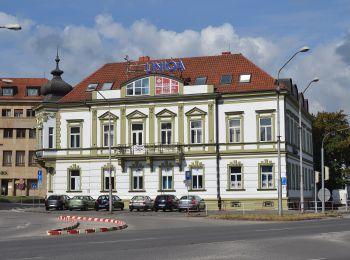
![Tocht Te voet okres Trenčín - IVV3 - STANOV CHODNÍK (krátka rodinná trasa) - Photo](https://media.geolcdn.com/t/350/260/b6c4c4f3-797f-4a80-8ec5-cec452c9efff.jpeg&format=jpg&maxdim=2)
![Te voet Te voet](https://static1.geolcdn.com/sitytour/trail-icons/100.png)
Km
Te voet
![](/images/other/stat-length.png)
![](https://static1.geolcdn.com/siteimages/upload/files/1508320355ic_sort_den_pos_24dp.png)
![](https://static1.geolcdn.com/siteimages/upload/files/1508320355ic_sort_den_neg_24dp.png)
![](https://static1.geolcdn.com/siteimages/upload/files/16400158638029165_repeat_loop_refresh_sync_direction_icon.png)
• Tocht aangemaakt door KST. Symbool: none
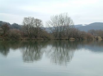
![Tocht Te voet okres Trenčín - IVV2 - JIRKOV CHODNÍK (dôchodcovská trasa) - Photo](https://media.geolcdn.com/t/350/260/9d79371f-43e4-403b-88ef-047fd77a3821.jpeg&format=jpg&maxdim=2)
![Te voet Te voet](https://static1.geolcdn.com/sitytour/trail-icons/100.png)
Km
Te voet
![](/images/other/stat-length.png)
![](https://static1.geolcdn.com/siteimages/upload/files/1508320355ic_sort_den_pos_24dp.png)
![](https://static1.geolcdn.com/siteimages/upload/files/1508320355ic_sort_den_neg_24dp.png)
![](https://static1.geolcdn.com/siteimages/upload/files/16400158638029165_repeat_loop_refresh_sync_direction_icon.png)
• Tocht aangemaakt door KST. Symbool: none
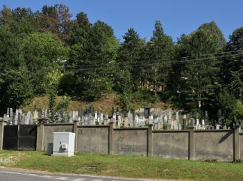
![Tocht Te voet okres Trenčín - IVV1 - MARTIN CHODNÍK (kočíkova trasa) - Photo](https://media.geolcdn.com/t/350/260/2c914681-0078-4832-9751-40a0134d2d40.jpeg&format=jpg&maxdim=2)
![Te voet Te voet](https://static1.geolcdn.com/sitytour/trail-icons/100.png)
Km
Te voet
![](/images/other/stat-length.png)
![](https://static1.geolcdn.com/siteimages/upload/files/1508320355ic_sort_den_pos_24dp.png)
![](https://static1.geolcdn.com/siteimages/upload/files/1508320355ic_sort_den_neg_24dp.png)
![](https://static1.geolcdn.com/siteimages/upload/files/16400158638029165_repeat_loop_refresh_sync_direction_icon.png)
• Tocht aangemaakt door KST. Symbool: none
![Tocht Te voet okres Trenčín - Kyslíková dráha - Photo](https://media.geolcdn.com/t/350/260/2c914681-0078-4832-9751-40a0134d2d40.jpeg&format=jpg&maxdim=2)
![Te voet Te voet](https://static1.geolcdn.com/sitytour/trail-icons/100.png)
Km
Te voet
![](/images/other/stat-length.png)
![](https://static1.geolcdn.com/siteimages/upload/files/1508320355ic_sort_den_pos_24dp.png)
![](https://static1.geolcdn.com/siteimages/upload/files/1508320355ic_sort_den_neg_24dp.png)
![](https://static1.geolcdn.com/siteimages/upload/files/16400158638029165_repeat_loop_refresh_sync_direction_icon.png)
• Symbool: major Website: http://stary.trencin.sk/index.php?s-cv-contentID=12288&s-cv-embeddedID=kyslikova_draha
![Tocht Te voet okres Trenčín - Mitická dvadsiatka - TRASA D – 25 km - Photo](https://media.geolcdn.com/t/350/260/52631547-5193-4600-bf87-dfcdf8992972.jpeg&format=jpg&maxdim=2)
![Te voet Te voet](https://static1.geolcdn.com/sitytour/trail-icons/100.png)
Km
Te voet
![](/images/other/stat-length.png)
![](https://static1.geolcdn.com/siteimages/upload/files/1508320355ic_sort_den_pos_24dp.png)
![](https://static1.geolcdn.com/siteimages/upload/files/1508320355ic_sort_den_neg_24dp.png)
![](https://static1.geolcdn.com/siteimages/upload/files/16400158638029165_repeat_loop_refresh_sync_direction_icon.png)
• https://www.trencianskemitice.sk/oznamy/miticka-dvadsiatka-2018.html Symbool: major Website: https://www.trencians...
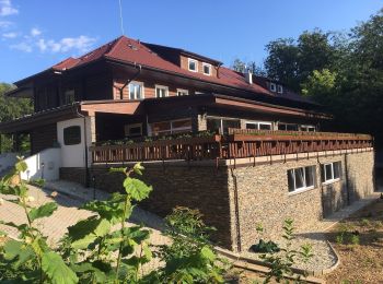
![Tocht Te voet okres Trenčín - Mitická dvadsiatka - TRASA A – 20 km - Photo](https://media.geolcdn.com/t/350/260/226136a2-7a13-4dbd-9b0a-4d3f6e52a39b.jpeg&format=jpg&maxdim=2)
![Te voet Te voet](https://static1.geolcdn.com/sitytour/trail-icons/100.png)
Km
Te voet
![](/images/other/stat-length.png)
![](https://static1.geolcdn.com/siteimages/upload/files/1508320355ic_sort_den_pos_24dp.png)
![](https://static1.geolcdn.com/siteimages/upload/files/1508320355ic_sort_den_neg_24dp.png)
![](https://static1.geolcdn.com/siteimages/upload/files/16400158638029165_repeat_loop_refresh_sync_direction_icon.png)
• https://www.trencianskemitice.sk/oznamy/miticka-dvadsiatka-2018.html Symbool: major Website: https://www.trencians...
![Tocht Te voet okres Trenčín - Mitická dvadsiatka - TRASA B – 10 km - Photo](https://media.geolcdn.com/t/350/260/226136a2-7a13-4dbd-9b0a-4d3f6e52a39b.jpeg&format=jpg&maxdim=2)
![Te voet Te voet](https://static1.geolcdn.com/sitytour/trail-icons/100.png)
Km
Te voet
![](/images/other/stat-length.png)
![](https://static1.geolcdn.com/siteimages/upload/files/1508320355ic_sort_den_pos_24dp.png)
![](https://static1.geolcdn.com/siteimages/upload/files/1508320355ic_sort_den_neg_24dp.png)
![](https://static1.geolcdn.com/siteimages/upload/files/16400158638029165_repeat_loop_refresh_sync_direction_icon.png)
• https://www.trencianskemitice.sk/oznamy/miticka-dvadsiatka-2018.html Symbool: major Website: https://www.trencians...
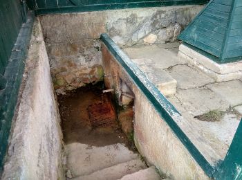
![Tocht Te voet okres Trenčín - Soblahovská 35-ka - Photo](https://media.geolcdn.com/t/350/260/b3692ef4-7d05-4222-8a83-8f116777015b.jpeg&format=jpg&maxdim=2)
![Te voet Te voet](https://static1.geolcdn.com/sitytour/trail-icons/100.png)
Km
Te voet
![](/images/other/stat-length.png)
![](https://static1.geolcdn.com/siteimages/upload/files/1508320355ic_sort_den_pos_24dp.png)
![](https://static1.geolcdn.com/siteimages/upload/files/1508320355ic_sort_den_neg_24dp.png)
![](https://static1.geolcdn.com/siteimages/upload/files/16400158638029165_repeat_loop_refresh_sync_direction_icon.png)
• https://www.soblahov.sk/soblahovska-35-ka/ Symbool: major
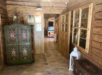
![Tocht Te voet okres Trenčín - Soblahovská 35-ka - 15km okruh - Photo](https://media.geolcdn.com/t/350/260/3677c767-9a84-49bb-a0bc-68c9973250bf.jpeg&format=jpg&maxdim=2)
![Te voet Te voet](https://static1.geolcdn.com/sitytour/trail-icons/100.png)
Km
Te voet
![](/images/other/stat-length.png)
![](https://static1.geolcdn.com/siteimages/upload/files/1508320355ic_sort_den_pos_24dp.png)
![](https://static1.geolcdn.com/siteimages/upload/files/1508320355ic_sort_den_neg_24dp.png)
![](https://static1.geolcdn.com/siteimages/upload/files/16400158638029165_repeat_loop_refresh_sync_direction_icon.png)
• https://www.soblahov.sk/soblahovska-35-ka/ Symbool: major
![Tocht Te voet okres Trenčín - Náučný chodník potok Svinica a okolie - Photo](https://media.geolcdn.com/t/350/260/ext.jpg?maxdim=2&url=https%3A%2F%2Fstatic1.geolcdn.com%2Fsiteimages%2Fupload%2Ffiles%2F1545311037marcheuse_200dpi.jpg)
![Te voet Te voet](https://static1.geolcdn.com/sitytour/trail-icons/100.png)
Km
Te voet
![](/images/other/stat-length.png)
![](https://static1.geolcdn.com/siteimages/upload/files/1508320355ic_sort_den_pos_24dp.png)
![](https://static1.geolcdn.com/siteimages/upload/files/1508320355ic_sort_den_neg_24dp.png)
![](https://static1.geolcdn.com/siteimages/upload/files/16400158638029165_repeat_loop_refresh_sync_direction_icon.png)
• Tocht aangemaakt door Štátna ochrana prírody správa Chránenej krajinnej oblasti Biele Karpaty. Symbool: education
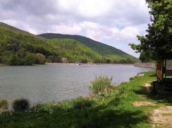
![Tocht Te voet okres Trenčín - Po skale na Baske - Photo](https://media.geolcdn.com/t/350/260/3bcd2c2a-781f-4d7e-b787-30bd1a2e6e03.jpeg&format=jpg&maxdim=2)
![Te voet Te voet](https://static1.geolcdn.com/sitytour/trail-icons/100.png)
Km
Te voet
![](/images/other/stat-length.png)
![](https://static1.geolcdn.com/siteimages/upload/files/1508320355ic_sort_den_pos_24dp.png)
![](https://static1.geolcdn.com/siteimages/upload/files/1508320355ic_sort_den_neg_24dp.png)
![](https://static1.geolcdn.com/siteimages/upload/files/16400158638029165_repeat_loop_refresh_sync_direction_icon.png)
• Symbool: local
![Tocht Te voet okres Trenčín - Náučný chodník Čvirigovec - Photo](https://media.geolcdn.com/t/350/260/adfed5d2-1eaf-4afd-b69b-d016f1dbb781.jpeg&format=jpg&maxdim=2)
![Te voet Te voet](https://static1.geolcdn.com/sitytour/trail-icons/100.png)
Km
Te voet
![](/images/other/stat-length.png)
![](https://static1.geolcdn.com/siteimages/upload/files/1508320355ic_sort_den_pos_24dp.png)
![](https://static1.geolcdn.com/siteimages/upload/files/1508320355ic_sort_den_neg_24dp.png)
![](https://static1.geolcdn.com/siteimages/upload/files/16400158638029165_repeat_loop_refresh_sync_direction_icon.png)
• Symbool: education
![Tocht Te voet okres Trenčín - SK-5400M - Photo](https://media.geolcdn.com/t/350/260/b2f29d45-eb4c-4cec-8fb4-e1e831fb8dfd.jpeg&format=jpg&maxdim=2)
![Te voet Te voet](https://static1.geolcdn.com/sitytour/trail-icons/100.png)
Km
Te voet
![](/images/other/stat-length.png)
![](https://static1.geolcdn.com/siteimages/upload/files/1508320355ic_sort_den_pos_24dp.png)
![](https://static1.geolcdn.com/siteimages/upload/files/1508320355ic_sort_den_neg_24dp.png)
![](https://static1.geolcdn.com/siteimages/upload/files/16400158638029165_repeat_loop_refresh_sync_direction_icon.png)
• Symbool: local
![Tocht Te voet okres Trenčín - Náučný poľovnícky a lesnícky chodník Nemšová - Ľuborčianska dolina - Photo](https://media.geolcdn.com/t/350/260/78d1ab13-acc1-4699-9f47-27044e55cce6.jpeg&format=jpg&maxdim=2)
![Te voet Te voet](https://static1.geolcdn.com/sitytour/trail-icons/100.png)
Km
Te voet
![](/images/other/stat-length.png)
![](https://static1.geolcdn.com/siteimages/upload/files/1508320355ic_sort_den_pos_24dp.png)
![](https://static1.geolcdn.com/siteimages/upload/files/1508320355ic_sort_den_neg_24dp.png)
![](https://static1.geolcdn.com/siteimages/upload/files/16400158638029165_repeat_loop_refresh_sync_direction_icon.png)
• Symbool: education
![Tocht Te voet okres Trenčín - Náučný chodník Janka Miklasa - Photo](https://media.geolcdn.com/t/350/260/cb0b46c5-5338-49e7-a5ef-28837e7d52fe.jpeg&format=jpg&maxdim=2)
![Te voet Te voet](https://static1.geolcdn.com/sitytour/trail-icons/100.png)
Km
Te voet
![](/images/other/stat-length.png)
![](https://static1.geolcdn.com/siteimages/upload/files/1508320355ic_sort_den_pos_24dp.png)
![](https://static1.geolcdn.com/siteimages/upload/files/1508320355ic_sort_den_neg_24dp.png)
![](https://static1.geolcdn.com/siteimages/upload/files/16400158638029165_repeat_loop_refresh_sync_direction_icon.png)
• Symbool: education
20 tochten weergegeven op 23
Gratisgps-wandelapplicatie