![](/images/other/stat-length.png)
- Tochten
- Outdoor
- Slovakia
- Žilinský kraj
- Onbekend
- okres Ružomberok
okres Ružomberok, Onbekend: Top van de beste wandelroutes, trajecten, tochten en wandelingen
okres Ružomberok: Ontdek de beste tochten: 7 te voet. Al deze tochten, trajecten, routes en outdoor activiteiten zijn beschikbaar in onze SityTrail-apps voor smartphones en tablets.
De beste trajecten (7)
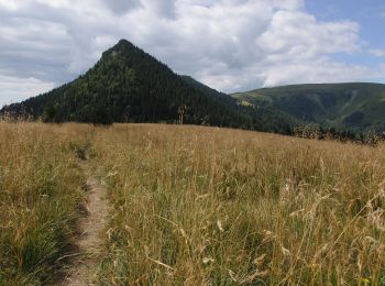
![Tocht Te voet okres Ružomberok - Náučný chodník Čierny kameň - Photo](https://media.geolcdn.com/t/350/260/37bb9b4f-68fe-4e1f-8ff6-e050106b6a96.jpeg&format=jpg&maxdim=2)
![Te voet Te voet](https://static1.geolcdn.com/sitytour/trail-icons/100.png)
Km
Te voet
![](/images/other/stat-length.png)
![](https://static1.geolcdn.com/siteimages/upload/files/1508320355ic_sort_den_pos_24dp.png)
![](https://static1.geolcdn.com/siteimages/upload/files/1508320355ic_sort_den_neg_24dp.png)
![](https://static1.geolcdn.com/siteimages/upload/files/16400158638029165_repeat_loop_refresh_sync_direction_icon.png)
• Tocht aangemaakt door Združenie na podporu a rozvoj cestovného ruchu v obci Liptovské Revúce. Symbool: education
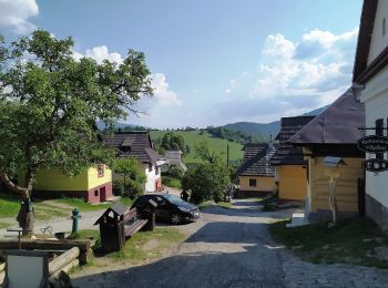
![Tocht Te voet okres Ružomberok - Medvedia cesta - Photo](https://media.geolcdn.com/t/350/260/08526067-6b0c-4dcb-ad67-6c959ad07983.jpeg&format=jpg&maxdim=2)
![Te voet Te voet](https://static1.geolcdn.com/sitytour/trail-icons/100.png)
Km
Te voet
![](/images/other/stat-length.png)
![](https://static1.geolcdn.com/siteimages/upload/files/1508320355ic_sort_den_pos_24dp.png)
![](https://static1.geolcdn.com/siteimages/upload/files/1508320355ic_sort_den_neg_24dp.png)
![](https://static1.geolcdn.com/siteimages/upload/files/16400158638029165_repeat_loop_refresh_sync_direction_icon.png)
• Tocht aangemaakt door Občianske združenie Hrabovská dolina. Zážitková naučná trasa Medvedia cesta Symbool: education
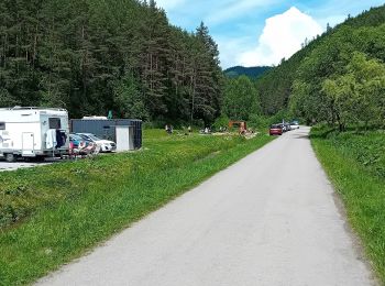
![Tocht Te voet okres Ružomberok - Naučný chodník Kalameny - Liptovský hrad - Photo](https://media.geolcdn.com/t/350/260/03f9ebdc-0cc7-483a-8d07-40ad2f87cf72.jpeg&format=jpg&maxdim=2)
![Te voet Te voet](https://static1.geolcdn.com/sitytour/trail-icons/100.png)
Km
Te voet
![](/images/other/stat-length.png)
![](https://static1.geolcdn.com/siteimages/upload/files/1508320355ic_sort_den_pos_24dp.png)
![](https://static1.geolcdn.com/siteimages/upload/files/1508320355ic_sort_den_neg_24dp.png)
![](https://static1.geolcdn.com/siteimages/upload/files/16400158638029165_repeat_loop_refresh_sync_direction_icon.png)
• Symbool: education
![Tocht Te voet okres Ružomberok - Lubochňa dolina - Photo](https://media.geolcdn.com/t/350/260/0afd7df2-f437-470f-98f2-e704acabbba1.jpeg&format=jpg&maxdim=2)
![Te voet Te voet](https://static1.geolcdn.com/sitytour/trail-icons/100.png)
Km
Te voet
![](/images/other/stat-length.png)
![](https://static1.geolcdn.com/siteimages/upload/files/1508320355ic_sort_den_pos_24dp.png)
![](https://static1.geolcdn.com/siteimages/upload/files/1508320355ic_sort_den_neg_24dp.png)
![](https://static1.geolcdn.com/siteimages/upload/files/16400158638029165_repeat_loop_refresh_sync_direction_icon.png)
• Symbool: education
![Tocht Te voet okres Ružomberok - Hubovský okruh - Photo](https://media.geolcdn.com/t/350/260/94f08181-df71-4d67-b5fa-03b1e869e0a1.jpeg&format=jpg&maxdim=2)
![Te voet Te voet](https://static1.geolcdn.com/sitytour/trail-icons/100.png)
Km
Te voet
![](/images/other/stat-length.png)
![](https://static1.geolcdn.com/siteimages/upload/files/1508320355ic_sort_den_pos_24dp.png)
![](https://static1.geolcdn.com/siteimages/upload/files/1508320355ic_sort_den_neg_24dp.png)
![](https://static1.geolcdn.com/siteimages/upload/files/16400158638029165_repeat_loop_refresh_sync_direction_icon.png)
• Symbool: education
![Tocht Te voet okres Ružomberok - Švošovský Turisticko-Náučný chodník - Photo](https://media.geolcdn.com/t/350/260/9f68d1c2-ca2c-41f4-ba75-1d0df30ed793.jpeg&format=jpg&maxdim=2)
![Te voet Te voet](https://static1.geolcdn.com/sitytour/trail-icons/100.png)
Km
Te voet
![](/images/other/stat-length.png)
![](https://static1.geolcdn.com/siteimages/upload/files/1508320355ic_sort_den_pos_24dp.png)
![](https://static1.geolcdn.com/siteimages/upload/files/1508320355ic_sort_den_neg_24dp.png)
![](https://static1.geolcdn.com/siteimages/upload/files/16400158638029165_repeat_loop_refresh_sync_direction_icon.png)
• Tocht aangemaakt door Švošovský turistický klub. Symbool: education
![Tocht Stappen okres Ružomberok - Slovaquie Jour 2 - Photo](https://media.geolcdn.com/t/350/260/ext.jpg?maxdim=2&url=https%3A%2F%2Fstatic1.geolcdn.com%2Fsiteimages%2Fupload%2Ffiles%2F1553511878bg_sport_marche.png)
![Stappen Stappen](https://static1.geolcdn.com/sitytour/trail-icons/101.png)
Km
Stappen
![](/images/other/stat-length.png)
![](https://static1.geolcdn.com/siteimages/upload/files/1508320355ic_sort_den_pos_24dp.png)
![](https://static1.geolcdn.com/siteimages/upload/files/1508320355ic_sort_den_neg_24dp.png)
![](https://static1.geolcdn.com/siteimages/upload/files/16400158638029165_repeat_loop_refresh_sync_direction_icon.png)
7 tochten weergegeven op 7
Gratisgps-wandelapplicatie