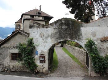
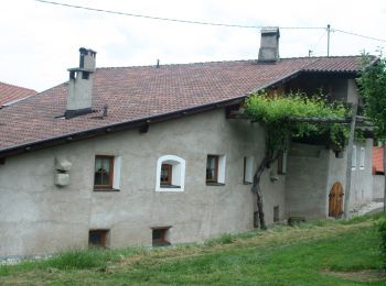
![](/images/other/stat-length.png)
- Tochten
- Outdoor
- Italy
- Trento-Zuid-Tirol
- Bolzano - Bozen
- Naturns - Naturno
Naturns - Naturno, Bolzano - Bozen: Top van de beste wandelroutes, trajecten, tochten en wandelingen
Naturns - Naturno: Ontdek de beste tochten: 11 te voet. Al deze tochten, trajecten, routes en outdoor activiteiten zijn beschikbaar in onze SityTrail-apps voor smartphones en tablets.
De beste trajecten (11)
![Tocht Te voet Naturns - Naturno - Sonnenberger Panoramaweg - Sentiero - Photo](https://media.geolcdn.com/t/350/260/bed8ed8c-b3fd-473e-a464-22a2b22f2cc8.jpeg&format=jpg&maxdim=2)
![Te voet Te voet](https://static1.geolcdn.com/sitytour/trail-icons/100.png)
Km
Te voet
![](/images/other/stat-length.png)
![](https://static1.geolcdn.com/siteimages/upload/files/1508320355ic_sort_den_pos_24dp.png)
![](https://static1.geolcdn.com/siteimages/upload/files/1508320355ic_sort_den_neg_24dp.png)
![](https://static1.geolcdn.com/siteimages/upload/files/16400158638029165_repeat_loop_refresh_sync_direction_icon.png)
• Symbol: gelb-weiß-gelb SP schwarz
![Tocht Te voet Naturns - Naturno - IT-91 - Photo](https://media.geolcdn.com/t/350/260/bed8ed8c-b3fd-473e-a464-22a2b22f2cc8.jpeg&format=jpg&maxdim=2)
![Te voet Te voet](https://static1.geolcdn.com/sitytour/trail-icons/100.png)
Km
Te voet
![](/images/other/stat-length.png)
![](https://static1.geolcdn.com/siteimages/upload/files/1508320355ic_sort_den_pos_24dp.png)
![](https://static1.geolcdn.com/siteimages/upload/files/1508320355ic_sort_den_neg_24dp.png)
![](https://static1.geolcdn.com/siteimages/upload/files/16400158638029165_repeat_loop_refresh_sync_direction_icon.png)
• Symbol: rot-weiß-rot 91 schwarz
![Tocht Te voet Naturns - Naturno - IT-9 - Photo](https://media.geolcdn.com/t/350/260/67405452-0650-4680-b7fd-0b07783d15d1.jpeg&format=jpg&maxdim=2)
![Te voet Te voet](https://static1.geolcdn.com/sitytour/trail-icons/100.png)
Km
Te voet
![](/images/other/stat-length.png)
![](https://static1.geolcdn.com/siteimages/upload/files/1508320355ic_sort_den_pos_24dp.png)
![](https://static1.geolcdn.com/siteimages/upload/files/1508320355ic_sort_den_neg_24dp.png)
![](https://static1.geolcdn.com/siteimages/upload/files/16400158638029165_repeat_loop_refresh_sync_direction_icon.png)
• Trail created by Alpenverein Südtirol. Symbol: rot-weiß-rot mit schwarzer 9
![Tocht Te voet Naturns - Naturno - Almenweg - Photo](https://media.geolcdn.com/t/350/260/fccbeaf4-a916-45ea-afc3-484959a3ebe5.jpeg&format=jpg&maxdim=2)
![Te voet Te voet](https://static1.geolcdn.com/sitytour/trail-icons/100.png)
Km
Te voet
![](/images/other/stat-length.png)
![](https://static1.geolcdn.com/siteimages/upload/files/1508320355ic_sort_den_pos_24dp.png)
![](https://static1.geolcdn.com/siteimages/upload/files/1508320355ic_sort_den_neg_24dp.png)
![](https://static1.geolcdn.com/siteimages/upload/files/16400158638029165_repeat_loop_refresh_sync_direction_icon.png)
• Symbol: teilweise schwarzes A auf rot-weiß-rot
![Tocht Te voet Naturns - Naturno - 16 - Photo](https://media.geolcdn.com/t/350/260/37774f4e-440e-4d15-9416-f8c9d19f19be.jpeg&format=jpg&maxdim=2)
![Te voet Te voet](https://static1.geolcdn.com/sitytour/trail-icons/100.png)
Km
Te voet
![](/images/other/stat-length.png)
![](https://static1.geolcdn.com/siteimages/upload/files/1508320355ic_sort_den_pos_24dp.png)
![](https://static1.geolcdn.com/siteimages/upload/files/1508320355ic_sort_den_neg_24dp.png)
![](https://static1.geolcdn.com/siteimages/upload/files/16400158638029165_repeat_loop_refresh_sync_direction_icon.png)
• Trail created by Alpenverein Südtirol. Symbol: rot-weiß-rot mit schwarzer 16
![Tocht Te voet Naturns - Naturno - IT-5 - Photo](https://media.geolcdn.com/t/350/260/78864a1d-60b5-4015-8a94-768b10e126a0.jpeg&format=jpg&maxdim=2)
![Te voet Te voet](https://static1.geolcdn.com/sitytour/trail-icons/100.png)
Km
Te voet
![](/images/other/stat-length.png)
![](https://static1.geolcdn.com/siteimages/upload/files/1508320355ic_sort_den_pos_24dp.png)
![](https://static1.geolcdn.com/siteimages/upload/files/1508320355ic_sort_den_neg_24dp.png)
![](https://static1.geolcdn.com/siteimages/upload/files/16400158638029165_repeat_loop_refresh_sync_direction_icon.png)
• Trail created by Alpenverein Südtirol. Symbol: rot-weiß-rot mit schwarzer 5
![Tocht Te voet Naturns - Naturno - Wallburgweg - Photo](https://media.geolcdn.com/t/350/260/56d8f103-df44-404b-b0f0-b029cc016d1b.jpeg&format=jpg&maxdim=2)
![Te voet Te voet](https://static1.geolcdn.com/sitytour/trail-icons/100.png)
Km
Te voet
![](/images/other/stat-length.png)
![](https://static1.geolcdn.com/siteimages/upload/files/1508320355ic_sort_den_pos_24dp.png)
![](https://static1.geolcdn.com/siteimages/upload/files/1508320355ic_sort_den_neg_24dp.png)
![](https://static1.geolcdn.com/siteimages/upload/files/16400158638029165_repeat_loop_refresh_sync_direction_icon.png)
• Trail created by Tourismusverein Naturns. Symbol: Pfad weiß auf grün mit Sonne
![Tocht Te voet Naturns - Naturno - Rittersteig - Photo](https://media.geolcdn.com/t/350/260/09772599-1133-43b8-8924-f4f7f47df0ef.jpeg&format=jpg&maxdim=2)
![Te voet Te voet](https://static1.geolcdn.com/sitytour/trail-icons/100.png)
Km
Te voet
![](/images/other/stat-length.png)
![](https://static1.geolcdn.com/siteimages/upload/files/1508320355ic_sort_den_pos_24dp.png)
![](https://static1.geolcdn.com/siteimages/upload/files/1508320355ic_sort_den_neg_24dp.png)
![](https://static1.geolcdn.com/siteimages/upload/files/16400158638029165_repeat_loop_refresh_sync_direction_icon.png)
• Symbol: Rot - Weiß - Rot mit schwarzer 1
![Tocht Te voet Naturns - Naturno - IT-18 - Photo](https://media.geolcdn.com/t/350/260/0d19e463-cb4d-4859-96cf-e37310b2322a.jpeg&format=jpg&maxdim=2)
![Te voet Te voet](https://static1.geolcdn.com/sitytour/trail-icons/100.png)
Km
Te voet
![](/images/other/stat-length.png)
![](https://static1.geolcdn.com/siteimages/upload/files/1508320355ic_sort_den_pos_24dp.png)
![](https://static1.geolcdn.com/siteimages/upload/files/1508320355ic_sort_den_neg_24dp.png)
![](https://static1.geolcdn.com/siteimages/upload/files/16400158638029165_repeat_loop_refresh_sync_direction_icon.png)
• Trail created by Alpenverein Südtirol. Symbol: rot-weiß-rot mit schwarzer 18
![Tocht Te voet Naturns - Naturno - Rundweg Gsindboden - Photo](https://media.geolcdn.com/t/350/260/991d8931-fc38-4008-80e8-d766b6c7c9dd.jpeg&format=jpg&maxdim=2)
![Te voet Te voet](https://static1.geolcdn.com/sitytour/trail-icons/100.png)
Km
Te voet
![](/images/other/stat-length.png)
![](https://static1.geolcdn.com/siteimages/upload/files/1508320355ic_sort_den_pos_24dp.png)
![](https://static1.geolcdn.com/siteimages/upload/files/1508320355ic_sort_den_neg_24dp.png)
![](https://static1.geolcdn.com/siteimages/upload/files/16400158638029165_repeat_loop_refresh_sync_direction_icon.png)
![Tocht Te voet Naturns - Naturno - IT-4 - Photo](https://media.geolcdn.com/t/350/260/57cc9056-7f37-4546-9265-b8e3b87280ca.jpeg&format=jpg&maxdim=2)
![Te voet Te voet](https://static1.geolcdn.com/sitytour/trail-icons/100.png)
Km
Te voet
![](/images/other/stat-length.png)
![](https://static1.geolcdn.com/siteimages/upload/files/1508320355ic_sort_den_pos_24dp.png)
![](https://static1.geolcdn.com/siteimages/upload/files/1508320355ic_sort_den_neg_24dp.png)
![](https://static1.geolcdn.com/siteimages/upload/files/16400158638029165_repeat_loop_refresh_sync_direction_icon.png)
• Trail created by Alpenverein Südtirol. Symbol: rot-weiß-rot mit schwarzer 4
11 tochten weergegeven op 11
Gratisgps-wandelapplicatie