![](/images/other/stat-length.png)
- Tochten
- Outdoor
- Italy
- Friuli-Venezia Giulia
- Onbekend
- Savogna d'Isonzo / Sovodnje ob Soči
Savogna d'Isonzo / Sovodnje ob Soči, Onbekend: Top van de beste wandelroutes, trajecten, tochten en wandelingen
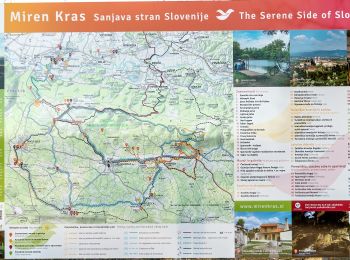
Savogna d'Isonzo / Sovodnje ob Soči: Ontdek de beste tochten: 4 te voet. Al deze tochten, trajecten, routes en outdoor activiteiten zijn beschikbaar in onze SityTrail-apps voor smartphones en tablets.
De beste trajecten (4)
![Tocht Te voet Savogna d'Isonzo / Sovodnje ob Soči - Sentiero CAI n. 75 - Photo](https://media.geolcdn.com/t/350/260/28686f26-e1c4-4a8d-98a8-ad245db17825.jpeg&format=jpg&maxdim=2)
![Te voet Te voet](https://static1.geolcdn.com/sitytour/trail-icons/100.png)
Km
Te voet
![](/images/other/stat-length.png)
![](https://static1.geolcdn.com/siteimages/upload/files/1508320355ic_sort_den_pos_24dp.png)
![](https://static1.geolcdn.com/siteimages/upload/files/1508320355ic_sort_den_neg_24dp.png)
![](https://static1.geolcdn.com/siteimages/upload/files/16400158638029165_repeat_loop_refresh_sync_direction_icon.png)
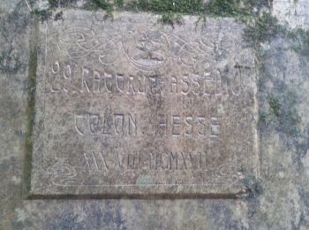
• Trail created by Club Alpino Italiano (C.A.I.). Symbol: rosso-bianco-rosso con il numero 75 in nero sulla striscia b...
![Tocht Te voet Savogna d'Isonzo / Sovodnje ob Soči - Sentiero CAI n. 74 - Photo](https://media.geolcdn.com/t/350/260/a42028e1-69b8-412f-91d3-557d9990a076.jpeg&format=jpg&maxdim=2)
![Te voet Te voet](https://static1.geolcdn.com/sitytour/trail-icons/100.png)
Km
Te voet
![](/images/other/stat-length.png)
![](https://static1.geolcdn.com/siteimages/upload/files/1508320355ic_sort_den_pos_24dp.png)
![](https://static1.geolcdn.com/siteimages/upload/files/1508320355ic_sort_den_neg_24dp.png)
![](https://static1.geolcdn.com/siteimages/upload/files/16400158638029165_repeat_loop_refresh_sync_direction_icon.png)
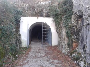
• Trail created by Club Alpino Italiano (C.A.I.). Symbol: rosso-bianco-rosso con il numero 74 in nero sulla striscia b...
![Tocht Te voet Savogna d'Isonzo / Sovodnje ob Soči - Sentiero CAI n. 71 - Photo](https://media.geolcdn.com/t/350/260/26ad6a9f-1117-4a4f-86b2-48e1d065d86d.jpeg&format=jpg&maxdim=2)
![Te voet Te voet](https://static1.geolcdn.com/sitytour/trail-icons/100.png)
Km
Te voet
![](/images/other/stat-length.png)
![](https://static1.geolcdn.com/siteimages/upload/files/1508320355ic_sort_den_pos_24dp.png)
![](https://static1.geolcdn.com/siteimages/upload/files/1508320355ic_sort_den_neg_24dp.png)
![](https://static1.geolcdn.com/siteimages/upload/files/16400158638029165_repeat_loop_refresh_sync_direction_icon.png)
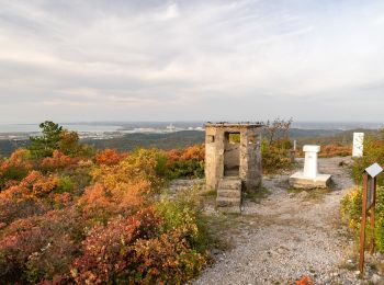
• Trail created by Club Alpino Italiano (C.A.I.). Symbol: rosso-bianco-rosso con il numero 71 in nero sulla striscia b...
![Tocht Te voet Savogna d'Isonzo / Sovodnje ob Soči - Sentiero Abramo Schmid - Photo](https://media.geolcdn.com/t/350/260/d3825a17-9b4b-4de5-8f3d-2ad5d15a1e13.jpeg&format=jpg&maxdim=2)
![Te voet Te voet](https://static1.geolcdn.com/sitytour/trail-icons/100.png)
Km
Te voet
![](/images/other/stat-length.png)
![](https://static1.geolcdn.com/siteimages/upload/files/1508320355ic_sort_den_pos_24dp.png)
![](https://static1.geolcdn.com/siteimages/upload/files/1508320355ic_sort_den_neg_24dp.png)
![](https://static1.geolcdn.com/siteimages/upload/files/16400158638029165_repeat_loop_refresh_sync_direction_icon.png)
• Trail created by Club Alpino Italiano (C.A.I.). Symbol: rosso-bianco-rosso con il numero 79 in nero sulla striscia b...
4 tochten weergegeven op 4
Gratisgps-wandelapplicatie