


18,5 km | 28 km-effort
Modena: Ontdek de beste tochten: 154 te voet. Al deze tochten, trajecten, routes en outdoor activiteiten zijn beschikbaar in onze SityTrail-apps voor smartphones en tablets.
Te voet


• Sentiero Italia CAI 2020
Te voet
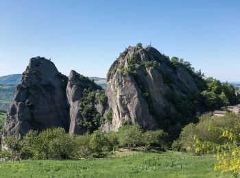
• Trail created by Parco Regionale dei Sassi di Roccamalatina.
Te voet
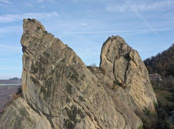
• Trail created by Parco Regionale dei Sassi di Roccamalatina.
Te voet
• Trail created by Parco Regionale dei Sassi di Roccamalatina.

Te voet
• Symbol: 520 on white red flags
Te voet
• Symbol: 488 on white red flags
Te voet
• Symbol: 526 on white red flags
Te voet
• Symbol: 518 on white red flags
Te voet
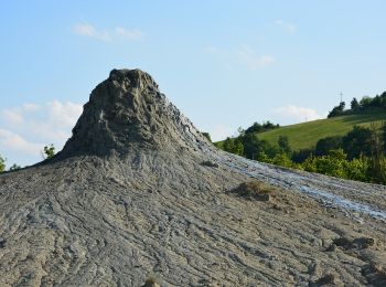
• Trail created by Riserva Naturale Regionale delle Salse di Nirano.

Te voet
• Trail created by Comunità Montana Modena Ovest.
Te voet
• Symbol: 572 on white red flags
Te voet
• Trail created by Comunità Montana Modena Ovest.
Te voet
• Trail created by CAI Serramazzoni.
Te voet
• Trail created by Comunità Montana Appennino Modena Est.
Te voet
• Trail created by Comunità Montana Appennino Modena Est. Symbol: 442 on white red flags
Te voet
• Trail created by CAI Modena.
Te voet
• Trail created by Comunità Montana Appennino Modena Est.
Te voet
• Trail created by Comunità Montana Appennino Modena Est.
Te voet
• Trail created by CAI Modena.

Te voet
• Trail created by Comunità Montana Appennino Modena Est.
20 tochten weergegeven op 154
Gratisgps-wandelapplicatie
 SityTrail
IGN / Geografische instituten
SityTrail World
De wereld gaat voor u open