


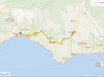
8,4 km | 16,3 km-effort
Napoli: Ontdek de beste tochten: 95 te voet. Al deze tochten, trajecten, routes en outdoor activiteiten zijn beschikbaar in onze SityTrail-apps voor smartphones en tablets.
Stappen


Te voet
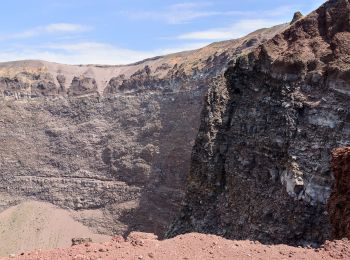
• Sentiero Italia CAI 2019

Te voet
• Sentiero Italia CAI 2019
Te voet
• Symbol: 105 on white red flags

Te voet
• Symbol: 117 on white red flags

Te voet
• Symbol: 106 on white red flags

Te voet
• Symbol: 550 on white red flags

Te voet
• Symbol: 553 on white red flags
Te voet
• Symbol: 551 on white red flags

Te voet
• Symbol: 554 on white red flags

Te voet
• Symbol: 500 on white red flags

Te voet
• Symbol: 502 on white red flags

Te voet
• Symbol: 503 on white red flags

Te voet
• Trail created by Club Alpino Italiano. Symbol: 501 on white red flags

Te voet
• Trail created by Club Alpino Italiano. Symbol: white strip on top of red strip

Te voet
• Trail created by Club Alpino Italiano. Symbol: white strip on top of red strip

Te voet
• Trail created by Club Alpino Italiano. Symbol: white strip on top of red strip

Te voet
• Trail created by Club Alpino Italiano. Symbol: white strip on top of red strip

Te voet
• Trail created by Club Alpino Italiano. Symbol: white strip on top of red strip

Te voet
• Trail created by Club Alpino Italiano. Symbol: Rosso bianco rosso
20 tochten weergegeven op 98
Gratisgps-wandelapplicatie
 SityTrail
IGN / Geografische instituten
SityTrail World
De wereld gaat voor u open