![](/images/other/stat-length.png)
- Tochten
- Outdoor
- Hungary
- Hongaarse Laagvlakte en Noord
- Nógrád megye
Nógrád megye, Hongaarse Laagvlakte en Noord: Top van de beste wandelroutes, trajecten, tochten en wandelingen
Nógrád megye: Ontdek de beste tochten: 76 te voet. Al deze tochten, trajecten, routes en outdoor activiteiten zijn beschikbaar in onze SityTrail-apps voor smartphones en tablets.
De beste trajecten (76)
![Tocht Te voet Salgótarján - Bányász körút - Photo](https://media.geolcdn.com/t/350/260/aac96509-b9ce-4f0d-b83e-bece29d9db4a.jpeg&format=jpg&maxdim=2)
![Te voet Te voet](https://static1.geolcdn.com/sitytour/trail-icons/100.png)
Km
Te voet
![](/images/other/stat-length.png)
![](https://static1.geolcdn.com/siteimages/upload/files/1508320355ic_sort_den_pos_24dp.png)
![](https://static1.geolcdn.com/siteimages/upload/files/1508320355ic_sort_den_neg_24dp.png)
![](https://static1.geolcdn.com/siteimages/upload/files/16400158638029165_repeat_loop_refresh_sync_direction_icon.png)
• Trail created by Zöld Út Természetjárók Egyesülete.
![Tocht Te voet Szurdokpüspöki - Mária Út M56-01 - Photo](https://media.geolcdn.com/t/350/260/2bc93b56-8d7b-4a64-b65d-8ffada04e206.jpeg&format=jpg&maxdim=2)
![Te voet Te voet](https://static1.geolcdn.com/sitytour/trail-icons/100.png)
Km
Te voet
![](/images/other/stat-length.png)
![](https://static1.geolcdn.com/siteimages/upload/files/1508320355ic_sort_den_pos_24dp.png)
![](https://static1.geolcdn.com/siteimages/upload/files/1508320355ic_sort_den_neg_24dp.png)
![](https://static1.geolcdn.com/siteimages/upload/files/16400158638029165_repeat_loop_refresh_sync_direction_icon.png)
• Trail created by MUTKE.
![Tocht Te voet Diósjenő - K4 (Hárombarát-nyereg - Pénzásás) - Photo](https://media.geolcdn.com/t/350/260/eadd69ce-cbec-4584-a066-fd6823eaf261.jpeg&format=jpg&maxdim=2)
![Te voet Te voet](https://static1.geolcdn.com/sitytour/trail-icons/100.png)
Km
Te voet
![](/images/other/stat-length.png)
![](https://static1.geolcdn.com/siteimages/upload/files/1508320355ic_sort_den_pos_24dp.png)
![](https://static1.geolcdn.com/siteimages/upload/files/1508320355ic_sort_den_neg_24dp.png)
![](https://static1.geolcdn.com/siteimages/upload/files/16400158638029165_repeat_loop_refresh_sync_direction_icon.png)
• Trail created by BTHE.
![Tocht Te voet Diósjenő - S■ Diósjenő - Photo](https://media.geolcdn.com/t/350/260/358eb930-42af-45d6-8f0e-f214943df28b.jpeg&format=jpg&maxdim=2)
![Te voet Te voet](https://static1.geolcdn.com/sitytour/trail-icons/100.png)
Km
Te voet
![](/images/other/stat-length.png)
![](https://static1.geolcdn.com/siteimages/upload/files/1508320355ic_sort_den_pos_24dp.png)
![](https://static1.geolcdn.com/siteimages/upload/files/1508320355ic_sort_den_neg_24dp.png)
![](https://static1.geolcdn.com/siteimages/upload/files/16400158638029165_repeat_loop_refresh_sync_direction_icon.png)
• Trail created by BTHE.
![Tocht Te voet Felsőpetény - Reformáció Emlékút 1 (Egyházasdengeleg - Nógrád) - Photo](https://media.geolcdn.com/t/350/260/0e16c49f-e8e0-4be0-b672-8ec9e04143b0.jpeg&format=jpg&maxdim=2)
![Te voet Te voet](https://static1.geolcdn.com/sitytour/trail-icons/100.png)
Km
Te voet
![](/images/other/stat-length.png)
![](https://static1.geolcdn.com/siteimages/upload/files/1508320355ic_sort_den_pos_24dp.png)
![](https://static1.geolcdn.com/siteimages/upload/files/1508320355ic_sort_den_neg_24dp.png)
![](https://static1.geolcdn.com/siteimages/upload/files/16400158638029165_repeat_loop_refresh_sync_direction_icon.png)
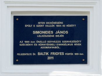
• Trail created by Magyarországi Evangélikus Egyház.
![Tocht Te voet Hollókő - Hollókő - Vártúra Ösvény és Biológiai Tanösvény - Photo](https://media.geolcdn.com/t/350/260/f30cfa37-465b-46c5-ac3d-d1b9c15fd940.jpeg&format=jpg&maxdim=2)
![Te voet Te voet](https://static1.geolcdn.com/sitytour/trail-icons/100.png)
Km
Te voet
![](/images/other/stat-length.png)
![](https://static1.geolcdn.com/siteimages/upload/files/1508320355ic_sort_den_pos_24dp.png)
![](https://static1.geolcdn.com/siteimages/upload/files/1508320355ic_sort_den_neg_24dp.png)
![](https://static1.geolcdn.com/siteimages/upload/files/16400158638029165_repeat_loop_refresh_sync_direction_icon.png)
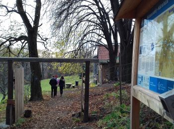
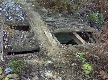
• Trail created by Bükki Nemzeti Park Igazgatóság. abandoned, most boards missing
![Tocht Te voet Nógrád - P+ (Szokolya vá-Nógrád) - Photo](https://media.geolcdn.com/t/350/260/683bbcfe-bb3a-44b9-8976-bd533e358ea8.jpeg&format=jpg&maxdim=2)
![Te voet Te voet](https://static1.geolcdn.com/sitytour/trail-icons/100.png)
Km
Te voet
![](/images/other/stat-length.png)
![](https://static1.geolcdn.com/siteimages/upload/files/1508320355ic_sort_den_pos_24dp.png)
![](https://static1.geolcdn.com/siteimages/upload/files/1508320355ic_sort_den_neg_24dp.png)
![](https://static1.geolcdn.com/siteimages/upload/files/16400158638029165_repeat_loop_refresh_sync_direction_icon.png)
• Symbol: red cross
![Tocht Te voet Bátonyterenye - P+ (Nagybátony-Ágasvár) - Photo](https://media.geolcdn.com/t/350/260/cd4ea16a-6a9e-40b2-82cb-abb7d171a055.jpeg&format=jpg&maxdim=2)
![Te voet Te voet](https://static1.geolcdn.com/sitytour/trail-icons/100.png)
Km
Te voet
![](/images/other/stat-length.png)
![](https://static1.geolcdn.com/siteimages/upload/files/1508320355ic_sort_den_pos_24dp.png)
![](https://static1.geolcdn.com/siteimages/upload/files/1508320355ic_sort_den_neg_24dp.png)
![](https://static1.geolcdn.com/siteimages/upload/files/16400158638029165_repeat_loop_refresh_sync_direction_icon.png)
• Symbol: red cross
![Tocht Te voet Szurdokpüspöki - P3 (Pásztó-Muzsla tető) - Photo](https://media.geolcdn.com/t/350/260/30a210c6-3454-4688-be41-523ead2c5efe.jpeg&format=jpg&maxdim=2)
![Te voet Te voet](https://static1.geolcdn.com/sitytour/trail-icons/100.png)
Km
Te voet
![](/images/other/stat-length.png)
![](https://static1.geolcdn.com/siteimages/upload/files/1508320355ic_sort_den_pos_24dp.png)
![](https://static1.geolcdn.com/siteimages/upload/files/1508320355ic_sort_den_neg_24dp.png)
![](https://static1.geolcdn.com/siteimages/upload/files/16400158638029165_repeat_loop_refresh_sync_direction_icon.png)
• Symbol: red triangle
![Tocht Te voet Pásztó - Z+ (Pásztó-Keresztesi nyereg) - Photo](https://media.geolcdn.com/t/350/260/458a34b0-255a-428f-91c9-43319923121d.jpeg&format=jpg&maxdim=2)
![Te voet Te voet](https://static1.geolcdn.com/sitytour/trail-icons/100.png)
Km
Te voet
![](/images/other/stat-length.png)
![](https://static1.geolcdn.com/siteimages/upload/files/1508320355ic_sort_den_pos_24dp.png)
![](https://static1.geolcdn.com/siteimages/upload/files/1508320355ic_sort_den_neg_24dp.png)
![](https://static1.geolcdn.com/siteimages/upload/files/16400158638029165_repeat_loop_refresh_sync_direction_icon.png)
• Symbol: green cross
![Tocht Te voet Mátraverebély - Mária út M10/09 Szécsény - Mátraverebély-Szentkút - Photo](https://media.geolcdn.com/t/350/260/3189fc4e-79c2-4044-aeb6-9f4baeb79e09.jpeg&format=jpg&maxdim=2)
![Te voet Te voet](https://static1.geolcdn.com/sitytour/trail-icons/100.png)
Km
Te voet
![](/images/other/stat-length.png)
![](https://static1.geolcdn.com/siteimages/upload/files/1508320355ic_sort_den_pos_24dp.png)
![](https://static1.geolcdn.com/siteimages/upload/files/1508320355ic_sort_den_neg_24dp.png)
![](https://static1.geolcdn.com/siteimages/upload/files/16400158638029165_repeat_loop_refresh_sync_direction_icon.png)
• Trail created by MUTKE. Symbol: purple m Website: http://mariaut.hu
![Tocht Te voet Szügy - Mária út M10/08 Szügy - Szécsény - Photo](https://media.geolcdn.com/t/350/260/3189fc4e-79c2-4044-aeb6-9f4baeb79e09.jpeg&format=jpg&maxdim=2)
![Te voet Te voet](https://static1.geolcdn.com/sitytour/trail-icons/100.png)
Km
Te voet
![](/images/other/stat-length.png)
![](https://static1.geolcdn.com/siteimages/upload/files/1508320355ic_sort_den_pos_24dp.png)
![](https://static1.geolcdn.com/siteimages/upload/files/1508320355ic_sort_den_neg_24dp.png)
![](https://static1.geolcdn.com/siteimages/upload/files/16400158638029165_repeat_loop_refresh_sync_direction_icon.png)
• Trail created by MUTKE. Symbol: purple m Website: http://mariaut.hu
![Tocht Te voet Nagyoroszi - Mária út M10/07 Nagyoroszi-Szügy - Photo](https://media.geolcdn.com/t/350/260/dce31873-1731-4323-a0ca-b3d934cc6feb.jpeg&format=jpg&maxdim=2)
![Te voet Te voet](https://static1.geolcdn.com/sitytour/trail-icons/100.png)
Km
Te voet
![](/images/other/stat-length.png)
![](https://static1.geolcdn.com/siteimages/upload/files/1508320355ic_sort_den_pos_24dp.png)
![](https://static1.geolcdn.com/siteimages/upload/files/1508320355ic_sort_den_neg_24dp.png)
![](https://static1.geolcdn.com/siteimages/upload/files/16400158638029165_repeat_loop_refresh_sync_direction_icon.png)
• Trail created by MUTKE. Symbol: purple m Website: http://mariaut.hu
![Tocht Te voet Drégelypalánk - P+ (Drégelypalánk-Drégelyvár) - Photo](https://media.geolcdn.com/t/350/260/b7028bd3-8e32-4b9a-9679-48451ef89c5a.jpeg&format=jpg&maxdim=2)
![Te voet Te voet](https://static1.geolcdn.com/sitytour/trail-icons/100.png)
Km
Te voet
![](/images/other/stat-length.png)
![](https://static1.geolcdn.com/siteimages/upload/files/1508320355ic_sort_den_pos_24dp.png)
![](https://static1.geolcdn.com/siteimages/upload/files/1508320355ic_sort_den_neg_24dp.png)
![](https://static1.geolcdn.com/siteimages/upload/files/16400158638029165_repeat_loop_refresh_sync_direction_icon.png)
• Trail created by BTHE. Symbol: red cross
![Tocht Te voet Alsópetény - HU-S+ - Photo](https://media.geolcdn.com/t/350/260/6dbf6a40-acf9-42a3-ae46-1309dd9f309a.jpeg&format=jpg&maxdim=2)
![Te voet Te voet](https://static1.geolcdn.com/sitytour/trail-icons/100.png)
Km
Te voet
![](/images/other/stat-length.png)
![](https://static1.geolcdn.com/siteimages/upload/files/1508320355ic_sort_den_pos_24dp.png)
![](https://static1.geolcdn.com/siteimages/upload/files/1508320355ic_sort_den_neg_24dp.png)
![](https://static1.geolcdn.com/siteimages/upload/files/16400158638029165_repeat_loop_refresh_sync_direction_icon.png)
• Symbol: yellow_cross
![Tocht Te voet Keszeg - P■ - Photo](https://media.geolcdn.com/t/350/260/45909f5b-332d-4464-b1ed-8219a16f5b63.jpeg&format=jpg&maxdim=2)
![Te voet Te voet](https://static1.geolcdn.com/sitytour/trail-icons/100.png)
Km
Te voet
![](/images/other/stat-length.png)
![](https://static1.geolcdn.com/siteimages/upload/files/1508320355ic_sort_den_pos_24dp.png)
![](https://static1.geolcdn.com/siteimages/upload/files/1508320355ic_sort_den_neg_24dp.png)
![](https://static1.geolcdn.com/siteimages/upload/files/16400158638029165_repeat_loop_refresh_sync_direction_icon.png)
• Symbol: red square
![Tocht Te voet Szuha - Zq (Galyatető-Verbőczy-forrás-Mátraalmás) - Photo](https://media.geolcdn.com/t/350/260/50a870c7-622b-4b8a-ac59-097c23c8e6d6.jpeg&format=jpg&maxdim=2)
![Te voet Te voet](https://static1.geolcdn.com/sitytour/trail-icons/100.png)
Km
Te voet
![](/images/other/stat-length.png)
![](https://static1.geolcdn.com/siteimages/upload/files/1508320355ic_sort_den_pos_24dp.png)
![](https://static1.geolcdn.com/siteimages/upload/files/1508320355ic_sort_den_neg_24dp.png)
![](https://static1.geolcdn.com/siteimages/upload/files/16400158638029165_repeat_loop_refresh_sync_direction_icon.png)
• Symbol: green circle
![Tocht Te voet Szurdokpüspöki - Z+ (Szurdokpüspöki) - Photo](https://media.geolcdn.com/t/350/260/ccd35f38-b2dc-40e2-91d5-1b7af52cbda0.jpeg&format=jpg&maxdim=2)
![Te voet Te voet](https://static1.geolcdn.com/sitytour/trail-icons/100.png)
Km
Te voet
![](/images/other/stat-length.png)
![](https://static1.geolcdn.com/siteimages/upload/files/1508320355ic_sort_den_pos_24dp.png)
![](https://static1.geolcdn.com/siteimages/upload/files/1508320355ic_sort_den_neg_24dp.png)
![](https://static1.geolcdn.com/siteimages/upload/files/16400158638029165_repeat_loop_refresh_sync_direction_icon.png)
• Folytatódik észak-kelet felé, együtt a P+ jelzéssel.
![Tocht Te voet Terény - Z24 - Photo](https://media.geolcdn.com/t/350/260/dad9d464-c769-4862-b2c2-fe29302ab2f3.jpeg&format=jpg&maxdim=2)
![Te voet Te voet](https://static1.geolcdn.com/sitytour/trail-icons/100.png)
Km
Te voet
![](/images/other/stat-length.png)
![](https://static1.geolcdn.com/siteimages/upload/files/1508320355ic_sort_den_pos_24dp.png)
![](https://static1.geolcdn.com/siteimages/upload/files/1508320355ic_sort_den_neg_24dp.png)
![](https://static1.geolcdn.com/siteimages/upload/files/16400158638029165_repeat_loop_refresh_sync_direction_icon.png)
![Tocht Te voet Szanda - Z27 - Photo](https://media.geolcdn.com/t/350/260/43baaed1-338d-43d7-87c6-bf2106967d7c.jpeg&format=jpg&maxdim=2)
![Te voet Te voet](https://static1.geolcdn.com/sitytour/trail-icons/100.png)
Km
Te voet
![](/images/other/stat-length.png)
![](https://static1.geolcdn.com/siteimages/upload/files/1508320355ic_sort_den_pos_24dp.png)
![](https://static1.geolcdn.com/siteimages/upload/files/1508320355ic_sort_den_neg_24dp.png)
![](https://static1.geolcdn.com/siteimages/upload/files/16400158638029165_repeat_loop_refresh_sync_direction_icon.png)
20 tochten weergegeven op 76
Gratisgps-wandelapplicatie
Activiteiten
Nabije regio's
- Alsópetény
- Alsótold
- Bátonyterenye
- Bercel
- Bokor
- Buják
- Cserhátszentiván
- Diósjenő
- Drégelypalánk
- Érsekvadkert
- Felsőpetény
- Herencsény
- Hollókő
- Hont
- Ipolytarnóc
- Karancsalja
- Karancslapujtő
- Kazár
- Keszeg
- Kétbodony
- Kishartyán
- Kozárd
- Legénd
- Mátranovák
- Mátraszőlős
- Mátraverebély
- Nagylóc
- Nagyoroszi
- Nógrád
- Nógrádsipek
- Ősagárd
- Pásztó
- Rimóc
- Salgótarján
- Szanda
- Szendehely
- Szirák
- Szügy
- Szuha
- Szurdokpüspöki
- Terény
- Vanyarc
- Varsány
- Zabar