![](/images/other/stat-length.png)
Hungary: Top van de beste wandelroutes, trajecten, tochten en wandelingen
Hungary: Ontdek de 858 beste wandel- en fietstochten. Onze catalogus die helemaal is samengesteld door wandelaars en toerfietsers staat vol prachtige landschappen die erop wachten om verkend te worden. Download deze routes in SityTrail, onze gratis gps wandel-app beschikbaar op Android en iOS.
De beste trajecten (858)
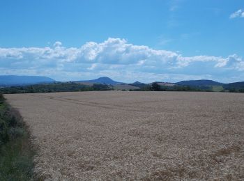
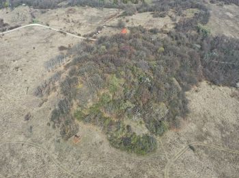
![Tocht Te voet Ipolydamásd - Z+ Letkés - Photo](https://media.geolcdn.com/t/350/260/ba923c56-303a-4e23-b32f-11bef08891cb.jpeg&format=jpg&maxdim=2)
![Te voet Te voet](https://static1.geolcdn.com/sitytour/trail-icons/100.png)
Km
Te voet
![](/images/other/stat-length.png)
![](https://static1.geolcdn.com/siteimages/upload/files/1508320355ic_sort_den_pos_24dp.png)
![](https://static1.geolcdn.com/siteimages/upload/files/1508320355ic_sort_den_neg_24dp.png)
![](https://static1.geolcdn.com/siteimages/upload/files/16400158638029165_repeat_loop_refresh_sync_direction_icon.png)
• Trail created by BTHE.
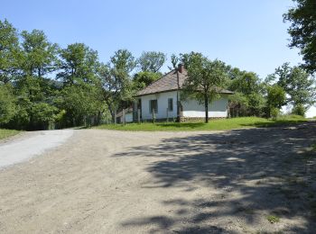
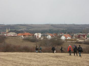
![Tocht Te voet Bajót - Z+ (Bajót - Panorámaút - Látóerdő ) - Photo](https://media.geolcdn.com/t/350/260/0fa52b20-8f2b-4ca2-be88-9977ac708bab.jpeg&format=jpg&maxdim=2)
![Te voet Te voet](https://static1.geolcdn.com/sitytour/trail-icons/100.png)
Km
Te voet
![](/images/other/stat-length.png)
![](https://static1.geolcdn.com/siteimages/upload/files/1508320355ic_sort_den_pos_24dp.png)
![](https://static1.geolcdn.com/siteimages/upload/files/1508320355ic_sort_den_neg_24dp.png)
![](https://static1.geolcdn.com/siteimages/upload/files/16400158638029165_repeat_loop_refresh_sync_direction_icon.png)
• Symbol: green cross
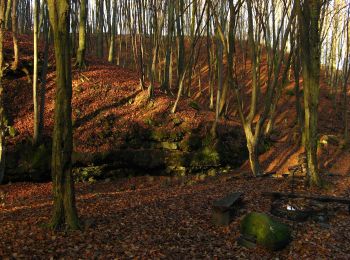
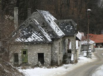
![Tocht Te voet Felsőtárkány - P+ (Varró-ház -Oldal-völgy) - Photo](https://media.geolcdn.com/t/350/260/2180e776-7797-4bbb-bd79-41399666d696.jpeg&format=jpg&maxdim=2)
![Te voet Te voet](https://static1.geolcdn.com/sitytour/trail-icons/100.png)
Km
Te voet
![](/images/other/stat-length.png)
![](https://static1.geolcdn.com/siteimages/upload/files/1508320355ic_sort_den_pos_24dp.png)
![](https://static1.geolcdn.com/siteimages/upload/files/1508320355ic_sort_den_neg_24dp.png)
![](https://static1.geolcdn.com/siteimages/upload/files/16400158638029165_repeat_loop_refresh_sync_direction_icon.png)
• Trail created by Kaptárkő. Symbol: red cross
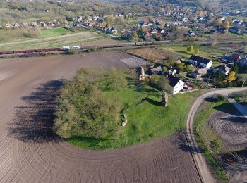
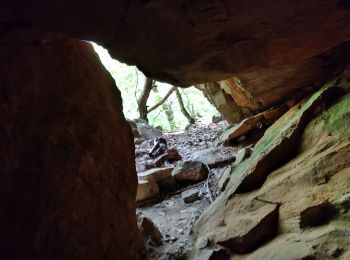
![Tocht Te voet Salgótarján - Bányász körút - Photo](https://media.geolcdn.com/t/350/260/aac96509-b9ce-4f0d-b83e-bece29d9db4a.jpeg&format=jpg&maxdim=2)
![Te voet Te voet](https://static1.geolcdn.com/sitytour/trail-icons/100.png)
Km
Te voet
![](/images/other/stat-length.png)
![](https://static1.geolcdn.com/siteimages/upload/files/1508320355ic_sort_den_pos_24dp.png)
![](https://static1.geolcdn.com/siteimages/upload/files/1508320355ic_sort_den_neg_24dp.png)
![](https://static1.geolcdn.com/siteimages/upload/files/16400158638029165_repeat_loop_refresh_sync_direction_icon.png)
• Trail created by Zöld Út Természetjárók Egyesülete.
![Tocht Te voet Neszmély - Piros négyzet (Neszmély - Dunaszentmiklós - Látó-hegyi szőlők, településhatár) - Photo](https://media.geolcdn.com/t/350/260/b684532d-2fa3-4a98-98c9-2922b12a7f31.jpeg&format=jpg&maxdim=2)
![Te voet Te voet](https://static1.geolcdn.com/sitytour/trail-icons/100.png)
Km
Te voet
![](/images/other/stat-length.png)
![](https://static1.geolcdn.com/siteimages/upload/files/1508320355ic_sort_den_pos_24dp.png)
![](https://static1.geolcdn.com/siteimages/upload/files/1508320355ic_sort_den_neg_24dp.png)
![](https://static1.geolcdn.com/siteimages/upload/files/16400158638029165_repeat_loop_refresh_sync_direction_icon.png)
• A felfestés jelenleg az elágazásig van kész
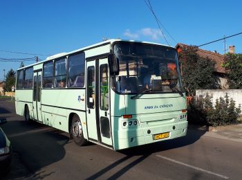
![Tocht Te voet Szurdokpüspöki - Mária Út M56-01 - Photo](https://media.geolcdn.com/t/350/260/2bc93b56-8d7b-4a64-b65d-8ffada04e206.jpeg&format=jpg&maxdim=2)
![Te voet Te voet](https://static1.geolcdn.com/sitytour/trail-icons/100.png)
Km
Te voet
![](/images/other/stat-length.png)
![](https://static1.geolcdn.com/siteimages/upload/files/1508320355ic_sort_den_pos_24dp.png)
![](https://static1.geolcdn.com/siteimages/upload/files/1508320355ic_sort_den_neg_24dp.png)
![](https://static1.geolcdn.com/siteimages/upload/files/16400158638029165_repeat_loop_refresh_sync_direction_icon.png)
• Trail created by MUTKE.
![Tocht Te voet Nagyréde - Mária Út M56-02 - Photo](https://media.geolcdn.com/t/350/260/45d757cc-93a4-49fe-871f-80afae3ee0c4.jpeg&format=jpg&maxdim=2)
![Te voet Te voet](https://static1.geolcdn.com/sitytour/trail-icons/100.png)
Km
Te voet
![](/images/other/stat-length.png)
![](https://static1.geolcdn.com/siteimages/upload/files/1508320355ic_sort_den_pos_24dp.png)
![](https://static1.geolcdn.com/siteimages/upload/files/1508320355ic_sort_den_neg_24dp.png)
![](https://static1.geolcdn.com/siteimages/upload/files/16400158638029165_repeat_loop_refresh_sync_direction_icon.png)
• Trail created by MUTKE.
![Tocht Te voet Jászárokszállás - Mária Út M56-03 - Photo](https://media.geolcdn.com/t/350/260/32a97334-9531-4a8d-96b7-5494edcd8f86.jpeg&format=jpg&maxdim=2)
![Te voet Te voet](https://static1.geolcdn.com/sitytour/trail-icons/100.png)
Km
Te voet
![](/images/other/stat-length.png)
![](https://static1.geolcdn.com/siteimages/upload/files/1508320355ic_sort_den_pos_24dp.png)
![](https://static1.geolcdn.com/siteimages/upload/files/1508320355ic_sort_den_neg_24dp.png)
![](https://static1.geolcdn.com/siteimages/upload/files/16400158638029165_repeat_loop_refresh_sync_direction_icon.png)
• Trail created by MUTKE.
![Tocht Te voet Jászapáti - Mária Út M56-04 - Photo](https://media.geolcdn.com/t/350/260/32a97334-9531-4a8d-96b7-5494edcd8f86.jpeg&format=jpg&maxdim=2)
![Te voet Te voet](https://static1.geolcdn.com/sitytour/trail-icons/100.png)
Km
Te voet
![](/images/other/stat-length.png)
![](https://static1.geolcdn.com/siteimages/upload/files/1508320355ic_sort_den_pos_24dp.png)
![](https://static1.geolcdn.com/siteimages/upload/files/1508320355ic_sort_den_neg_24dp.png)
![](https://static1.geolcdn.com/siteimages/upload/files/16400158638029165_repeat_loop_refresh_sync_direction_icon.png)
• Trail created by MUTKE.
![Tocht Te voet Diósjenő - K4 (Hárombarát-nyereg - Pénzásás) - Photo](https://media.geolcdn.com/t/350/260/eadd69ce-cbec-4584-a066-fd6823eaf261.jpeg&format=jpg&maxdim=2)
![Te voet Te voet](https://static1.geolcdn.com/sitytour/trail-icons/100.png)
Km
Te voet
![](/images/other/stat-length.png)
![](https://static1.geolcdn.com/siteimages/upload/files/1508320355ic_sort_den_pos_24dp.png)
![](https://static1.geolcdn.com/siteimages/upload/files/1508320355ic_sort_den_neg_24dp.png)
![](https://static1.geolcdn.com/siteimages/upload/files/16400158638029165_repeat_loop_refresh_sync_direction_icon.png)
• Trail created by BTHE.
![Tocht Te voet Nagyhajmás - S- Döbrököz - Nagyhajmás - Photo](https://media.geolcdn.com/t/350/260/c39b9cc8-2901-483e-b0d0-936e2fb3df93.jpeg&format=jpg&maxdim=2)
![Te voet Te voet](https://static1.geolcdn.com/sitytour/trail-icons/100.png)
Km
Te voet
![](/images/other/stat-length.png)
![](https://static1.geolcdn.com/siteimages/upload/files/1508320355ic_sort_den_pos_24dp.png)
![](https://static1.geolcdn.com/siteimages/upload/files/1508320355ic_sort_den_neg_24dp.png)
![](https://static1.geolcdn.com/siteimages/upload/files/16400158638029165_repeat_loop_refresh_sync_direction_icon.png)
• Symbol: yellow bar
![Tocht Te voet Esztergom - Z kápolna (Kis-Kúria-hegy - Hármas szikla utca - Kukländer-domb - Esztergomi bazilika - Hajóállomás) - Photo](https://media.geolcdn.com/t/350/260/d9b11386-52fe-4559-9ce4-7e0d8272f218.jpeg&format=jpg&maxdim=2)
![Te voet Te voet](https://static1.geolcdn.com/sitytour/trail-icons/100.png)
Km
Te voet
![](/images/other/stat-length.png)
![](https://static1.geolcdn.com/siteimages/upload/files/1508320355ic_sort_den_pos_24dp.png)
![](https://static1.geolcdn.com/siteimages/upload/files/1508320355ic_sort_den_neg_24dp.png)
![](https://static1.geolcdn.com/siteimages/upload/files/16400158638029165_repeat_loop_refresh_sync_direction_icon.png)
• Symbol: green chapel
![Tocht Te voet Zirc - Reguly Antal Emlékút-Zirc35 túraútvonal - Photo](https://media.geolcdn.com/t/350/260/be7e331e-d45d-4d53-bb2a-4781c957e5ee.jpeg&format=jpg&maxdim=2)
![Te voet Te voet](https://static1.geolcdn.com/sitytour/trail-icons/100.png)
Km
Te voet
![](/images/other/stat-length.png)
![](https://static1.geolcdn.com/siteimages/upload/files/1508320355ic_sort_den_pos_24dp.png)
![](https://static1.geolcdn.com/siteimages/upload/files/1508320355ic_sort_den_neg_24dp.png)
![](https://static1.geolcdn.com/siteimages/upload/files/16400158638029165_repeat_loop_refresh_sync_direction_icon.png)
• Trail created by Erdélyi Baráti Kör, Zirc.
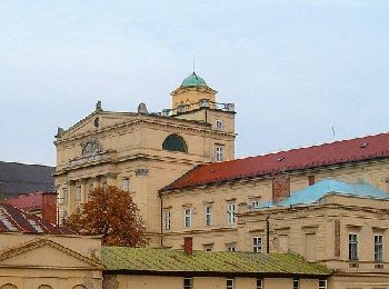
![Tocht Te voet Zirc - P3 ( Zirc-Papod ) - Photo](https://media.geolcdn.com/t/350/260/1d832f23-6a2e-4a79-bb13-89f70415fa4a.jpeg&format=jpg&maxdim=2)
![Te voet Te voet](https://static1.geolcdn.com/sitytour/trail-icons/100.png)
Km
Te voet
![](/images/other/stat-length.png)
![](https://static1.geolcdn.com/siteimages/upload/files/1508320355ic_sort_den_pos_24dp.png)
![](https://static1.geolcdn.com/siteimages/upload/files/1508320355ic_sort_den_neg_24dp.png)
![](https://static1.geolcdn.com/siteimages/upload/files/16400158638029165_repeat_loop_refresh_sync_direction_icon.png)
• Trail created by Zirc. Zirctől a piros sáv turistajelzésig nem igazán jó választás a piros háromszög, legközelebbi f...
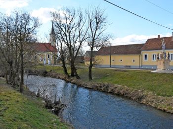
![Tocht Te voet Vaskeresztes - vaskeresztes p+ - Photo](https://media.geolcdn.com/t/350/260/f19b94b8-a145-449a-9838-f6d36a7b2841.jpeg&format=jpg&maxdim=2)
![Te voet Te voet](https://static1.geolcdn.com/sitytour/trail-icons/100.png)
Km
Te voet
![](/images/other/stat-length.png)
![](https://static1.geolcdn.com/siteimages/upload/files/1508320355ic_sort_den_pos_24dp.png)
![](https://static1.geolcdn.com/siteimages/upload/files/1508320355ic_sort_den_neg_24dp.png)
![](https://static1.geolcdn.com/siteimages/upload/files/16400158638029165_repeat_loop_refresh_sync_direction_icon.png)
• Symbol: red bar
![Tocht Te voet Miskolc - S+ Bánkút - Ómassa - Photo](https://media.geolcdn.com/t/350/260/0f14e777-c205-4dde-a3be-2eb3f108ce30.jpeg&format=jpg&maxdim=2)
![Te voet Te voet](https://static1.geolcdn.com/sitytour/trail-icons/100.png)
Km
Te voet
![](/images/other/stat-length.png)
![](https://static1.geolcdn.com/siteimages/upload/files/1508320355ic_sort_den_pos_24dp.png)
![](https://static1.geolcdn.com/siteimages/upload/files/1508320355ic_sort_den_neg_24dp.png)
![](https://static1.geolcdn.com/siteimages/upload/files/16400158638029165_repeat_loop_refresh_sync_direction_icon.png)
• Trail created by Borsod-Abaúj-Zemplén Megyei Természetjáró Szövetség.
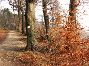
![Tocht Te voet Onbekend - Normafa Kardioösvény (Normafa - János-hegy - Normafa) - Photo](https://media.geolcdn.com/t/350/260/a210dd18-a33c-4463-a3e0-26216e4297bb.jpeg&format=jpg&maxdim=2)
![Te voet Te voet](https://static1.geolcdn.com/sitytour/trail-icons/100.png)
Km
Te voet
![](/images/other/stat-length.png)
![](https://static1.geolcdn.com/siteimages/upload/files/1508320355ic_sort_den_pos_24dp.png)
![](https://static1.geolcdn.com/siteimages/upload/files/1508320355ic_sort_den_neg_24dp.png)
![](https://static1.geolcdn.com/siteimages/upload/files/16400158638029165_repeat_loop_refresh_sync_direction_icon.png)
• Symbol: red T
![Tocht Te voet Pilisborosjenő - Pilisborosjenői Kevélyhegyi Tanösvény 1. (Pilisborosjenő - Kevély-nyereg - Pilisborosjenő) - Photo](https://media.geolcdn.com/t/350/260/14983b78-bf28-4244-a347-271dbd7f79f9.jpeg&format=jpg&maxdim=2)
![Te voet Te voet](https://static1.geolcdn.com/sitytour/trail-icons/100.png)
Km
Te voet
![](/images/other/stat-length.png)
![](https://static1.geolcdn.com/siteimages/upload/files/1508320355ic_sort_den_pos_24dp.png)
![](https://static1.geolcdn.com/siteimages/upload/files/1508320355ic_sort_den_neg_24dp.png)
![](https://static1.geolcdn.com/siteimages/upload/files/16400158638029165_repeat_loop_refresh_sync_direction_icon.png)
• Symbol: blue T
![Tocht Te voet Mogyoród - Z+ (Mogyoród, Szent László kilátó - Mogyoród, Sikáros) - Photo](https://media.geolcdn.com/t/350/260/124728ef-2489-4a32-8b65-e17277a36598.jpeg&format=jpg&maxdim=2)
![Te voet Te voet](https://static1.geolcdn.com/sitytour/trail-icons/100.png)
Km
Te voet
![](/images/other/stat-length.png)
![](https://static1.geolcdn.com/siteimages/upload/files/1508320355ic_sort_den_pos_24dp.png)
![](https://static1.geolcdn.com/siteimages/upload/files/1508320355ic_sort_den_neg_24dp.png)
![](https://static1.geolcdn.com/siteimages/upload/files/16400158638029165_repeat_loop_refresh_sync_direction_icon.png)
• Trail created by Margita 344,2 TSE.
![Tocht Te voet Bodolyabér - Hunza Ecolodge Red Tour - Photo](https://media.geolcdn.com/t/350/260/49f686d2-c0f6-49f6-9ce9-68d473e884fd.jpeg&format=jpg&maxdim=2)
![Te voet Te voet](https://static1.geolcdn.com/sitytour/trail-icons/100.png)
Km
Te voet
![](/images/other/stat-length.png)
![](https://static1.geolcdn.com/siteimages/upload/files/1508320355ic_sort_den_pos_24dp.png)
![](https://static1.geolcdn.com/siteimages/upload/files/1508320355ic_sort_den_neg_24dp.png)
![](https://static1.geolcdn.com/siteimages/upload/files/16400158638029165_repeat_loop_refresh_sync_direction_icon.png)
• Symbol: Red Square
20 tochten weergegeven op 858
Gratisgps-wandelapplicatie