Cette-Eygun, Pyrénées-Atlantiques: Top van de beste wandelroutes, trajecten, tochten en wandelingen

1 opmerkingen

Cette-Eygun: Ontdek de beste tochten: 9 te voet. Al deze tochten, trajecten, routes en outdoor activiteiten zijn beschikbaar in onze SityTrail-apps voor smartphones en tablets.


De beste trajecten (9)
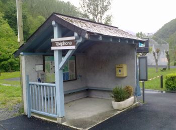
Tocht Te voet Cette-Eygun - Granges de Cette asp56 - Photo
Te voet 5.4
Km
GUIDE+

Te voet

Gemakkelijk
Cette-Eygun, Nieuw-Aquitanië, Pyrénées-Atlantiques, France
5,4 km | 10,2 km-effort
2h 18min
360 m
357 m
Ja
SityTrail - itinéraires balisés pédestres

• Trail created by Communauté de Communes du Haut-Béarn. Randonnée facile 2h40 boucle Website: https://umap.openstr...

Tocht Te voet Cette-Eygun - Cabane de Lhèze asp116 - Photo
Te voet 3.58
Km
GUIDE+

Te voet

Gemakkelijk
Cette-Eygun, Nieuw-Aquitanië, Pyrénées-Atlantiques, France
3,6 km | 9,7 km-effort
2h 11min
608 m
1 m
Neen
SityTrail - itinéraires balisés pédestres

• Trail created by Commune de Cette-Eygun. Randonnée moyenne 4h20 aller-retour Website: https://umap.openstreetmap....

Tocht Te voet Cette-Eygun - Cabanes de Narbèze asp117 - Photo
Te voet 6.531
Km
GUIDE+

Te voet

Gemakkelijk
Cette-Eygun, Nieuw-Aquitanië, Pyrénées-Atlantiques, France
6,5 km | 16,6 km-effort
3h 45min
997 m
15 m
Neen
SityTrail - itinéraires balisés pédestres

• Trail created by Commune de Cette-Eygun. Randonnée difficile 7h40 aller-retour Website: https://umap.openstreetma...
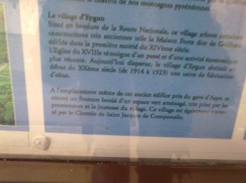
Tocht Te voet Cette-Eygun - Tour de Lasies asp115 - Photo
Te voet 4.318
Km
GUIDE+

Te voet

Gemakkelijk
Cette-Eygun, Nieuw-Aquitanië, Pyrénées-Atlantiques, France
4,3 km | 8,7 km-effort
1h 59min
356 m
259 m
Neen
SityTrail - itinéraires balisés pédestres

• Trail created by Commune de Cette-Eygun. Randonnée facile 2h15 semi-boucle Symbol: bar Website: https://umap.open...

Tocht Te voet Cette-Eygun - Panorama de Narbissat asp57 - Photo
Te voet 3.28
Km
GUIDE+

Te voet

Gemakkelijk
Cette-Eygun, Nieuw-Aquitanië, Pyrénées-Atlantiques, France
3,3 km | 9,3 km-effort
2h 6min
595 m
10 m
Neen
SityTrail - itinéraires balisés pédestres

• Trail created by Communauté de Communes du Haut-Béarn. Randonnée moyenne 4h00 aller-retour Website: https://umap....
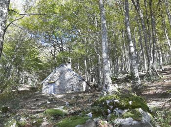
Tocht Stappen Cette-Eygun - Cette: Cabane de Sabas et col de Pène Blanque - Photo
Stappen 6.819
Km

Stappen

Moeilijk
Cette-Eygun, Nieuw-Aquitanië, Pyrénées-Atlantiques, France
6,8 km | 14 km-effort
3h 32min
537 m
542 m
Ja
bedous

Tocht Stappen Cette-Eygun - Chemin d'Arna - Photo
Stappen 5.401
Km

Stappen

Medium
(1)
Cette-Eygun, Nieuw-Aquitanië, Pyrénées-Atlantiques, France
5,4 km | 10,1 km-effort
1h 58min
351 m
357 m
Ja
bedous

Tocht Stappen Cette-Eygun - PIC ANCHE 9 MAI 2023 PRENDRE A GAUCHE BELLE CABANE  BIVOUAC - Photo
Stappen 15.248
Km

Stappen

Zeer moeilijk
Cette-Eygun, Nieuw-Aquitanië, Pyrénées-Atlantiques, France
15,2 km | 32 km-effort
7h 12min
1291 m
1291 m
Ja
bellocq

Tocht Stappen Cette-Eygun - rando jeudi aarapoup - Photo
Stappen 2.853
Km

Stappen

Medium
Cette-Eygun, Nieuw-Aquitanië, Pyrénées-Atlantiques, France
2,9 km | 7,9 km-effort
1h 58min
502 m
6 m
Neen
olivierGPS

9 tochten weergegeven op 9

Gratisgps-wandelapplicatie

Logo SityTrail SityTrail

IGN / Geografische instituten

SityTrail uit de App Store downloaden SityTrail uit Google Play downloaden

Logo SityTrail SityTrail World

De wereld gaat voor u open

SityTrail uit de App Store downloaden SityTrail uit Google Play downloaden SityTrail op Huawei AppGallery downloaden

Activiteiten

Sluiten
Mijn abonnementen