![](/images/other/stat-length.png)
La Coulonche, Orne: Top van de beste wandelroutes, trajecten, tochten en wandelingen
La Coulonche: Ontdek de beste tochten: 3 te voet. Al deze tochten, trajecten, routes en outdoor activiteiten zijn beschikbaar in onze SityTrail-apps voor smartphones en tablets.
De beste trajecten (3)
![Tocht Stappen La Coulonche - La coulonche - Photo](https://media.geolcdn.com/t/350/260/95c3eac8-30e6-4fa2-8846-ef805e476c7d.jpg&format=jpg&maxdim=2)
![Stappen Stappen](https://static1.geolcdn.com/sitytour/trail-icons/101.png)
Km
#1 - La coulonche
Stappen
Heel gemakkelijk
La Coulonche,
Normandië,
Orne,
France
![](/images/other/stat-length.png)
3,7 km | 4,9 km-effort
1h 22min
![](https://static1.geolcdn.com/siteimages/upload/files/1508320355ic_sort_den_pos_24dp.png)
83 m
![](https://static1.geolcdn.com/siteimages/upload/files/1508320355ic_sort_den_neg_24dp.png)
87 m
![](https://static1.geolcdn.com/siteimages/upload/files/16400158638029165_repeat_loop_refresh_sync_direction_icon.png)
Ja
Elisabeth Neveu
![Tocht Stappen La Coulonche - UIA LF 28/11/2018 - Photo](https://media.geolcdn.com/t/350/260/ext.jpg?maxdim=2&url=https%3A%2F%2Fstatic1.geolcdn.com%2Fsiteimages%2Fupload%2Ffiles%2F1553511878bg_sport_marche.png)
![Stappen Stappen](https://static1.geolcdn.com/sitytour/trail-icons/101.png)
Km
#2 - UIA LF 28/11/2018
Stappen
Gemakkelijk
La Coulonche,
Normandië,
Orne,
France
![](/images/other/stat-length.png)
7,5 km | 9,3 km-effort
2h 0min
![](https://static1.geolcdn.com/siteimages/upload/files/1508320355ic_sort_den_pos_24dp.png)
133 m
![](https://static1.geolcdn.com/siteimages/upload/files/1508320355ic_sort_den_neg_24dp.png)
130 m
![](https://static1.geolcdn.com/siteimages/upload/files/16400158638029165_repeat_loop_refresh_sync_direction_icon.png)
Ja
toporient
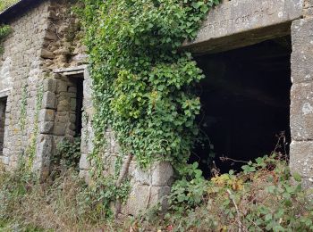
• Départ du parking du Stade à l'entrée sud de La Coulonche. Nota : Le circuit court (4050m) partira du village, passer...
![Tocht Stappen La Coulonche - ballade nois de dieufit - Photo](https://media.geolcdn.com/t/350/260/ext.jpg?maxdim=2&url=https%3A%2F%2Fstatic1.geolcdn.com%2Fsiteimages%2Fupload%2Ffiles%2F1553511878bg_sport_marche.png)
![Stappen Stappen](https://static1.geolcdn.com/sitytour/trail-icons/101.png)
Km
#3 - ballade nois de dieufit
Stappen
Gemakkelijk
La Coulonche,
Normandië,
Orne,
France
![](/images/other/stat-length.png)
5,7 km | 6,8 km-effort
1h 59min
![](https://static1.geolcdn.com/siteimages/upload/files/1508320355ic_sort_den_pos_24dp.png)
79 m
![](https://static1.geolcdn.com/siteimages/upload/files/1508320355ic_sort_den_neg_24dp.png)
79 m
![](https://static1.geolcdn.com/siteimages/upload/files/16400158638029165_repeat_loop_refresh_sync_direction_icon.png)
Ja
ptimi
•
3 tochten weergegeven op 3
Gratisgps-wandelapplicatie