Saint-Christol-lez-Alès, Gard: Top van de beste wandelroutes, trajecten, tochten en wandelingen

Saint-Christol-lez-Alès: Ontdek de beste tochten: 10 te voet en 3 met de fiets of mountainbike. Al deze tochten, trajecten, routes en outdoor activiteiten zijn beschikbaar in onze SityTrail-apps voor smartphones en tablets.


De beste trajecten (13)
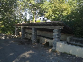
Tocht Stappen Saint-Christol-lez-Alès - Randonnée Domaine du Rouret 20 mai 2020  - Photo
Stappen 7.29
Km

Stappen

Heel gemakkelijk
Saint-Christol-lez-Alès, Occitanië, Gard, France
7,3 km | 8,3 km-effort
1h 49min
73 m
73 m
Ja
Khoe Khoe

Tocht Stappen Saint-Christol-lez-Alès - Valz - Photo
Stappen 8.172
Km

Stappen

Medium
Saint-Christol-lez-Alès, Occitanië, Gard, France
8,2 km | 11 km-effort
2h 10min
216 m
214 m
Ja
access

Tocht Stappen Saint-Christol-lez-Alès - St Christol les Ales(Le Rouret) - Photo
Stappen 8.249
Km

Stappen

Gemakkelijk
Saint-Christol-lez-Alès, Occitanië, Gard, France
8,2 km | 9,1 km-effort
2h 1min
67 m
67 m
Ja
jeanjacques13

• cheminement dans les vignes et retour par les bords du Gardon d'Alès.Facile. Pas de dénivelé

Tocht Stappen Saint-Christol-lez-Alès - boujac - Photo
Stappen 4.918
Km

Stappen

Medium
Saint-Christol-lez-Alès, Occitanië, Gard, France
4,9 km | 6,8 km-effort
1h 33min
144 m
142 m
Ja
jpfrobert

Tocht Stappen Saint-Christol-lez-Alès - autour de bagard - Photo
Stappen 6.439
Km

Stappen

Medium
Saint-Christol-lez-Alès, Occitanië, Gard, France
6,4 km | 9 km-effort
1h 54min
194 m
196 m
Ja
jpfrobert

Tocht Stappen Saint-Christol-lez-Alès - Saint christol  - Photo
Stappen 4.999
Km

Stappen

Saint-Christol-lez-Alès, Occitanië, Gard, France
5 km | 6,4 km-effort
1h 14min
103 m
103 m
Neen
bohynm

Tocht Te voet Saint-Christol-lez-Alès - valz 3 - Photo
Te voet 14.469
Km

Te voet

Medium
Saint-Christol-lez-Alès, Occitanië, Gard, France
14,5 km | 21 km-effort
Onbekend
501 m
501 m
Ja
christineb

Tocht Stappen Saint-Christol-lez-Alès - Bagard - Photo
Stappen 7.073
Km

Stappen

Heel gemakkelijk
Saint-Christol-lez-Alès, Occitanië, Gard, France
7,1 km | 10,1 km-effort
2h 20min
225 m
227 m
Ja
access

Tocht Stappen Saint-Christol-lez-Alès - boujac - Photo
Stappen 7.239
Km

Stappen

Medium
Saint-Christol-lez-Alès, Occitanië, Gard, France
7,2 km | 10,2 km-effort
2h 13min
225 m
225 m
Ja
access

Tocht Stappen Saint-Christol-lez-Alès - Saint christol les alès - Photo
Stappen 9.465
Km

Stappen

Gemakkelijk
Saint-Christol-lez-Alès, Occitanië, Gard, France
9,5 km | 11,8 km-effort
3h 5min
174 m
178 m
Ja
bernardgouttiere

Tocht Mountainbike Saint-Christol-lez-Alès - Montèze - St Germain - Photo
Mountainbike 38.298
Km

Mountainbike

Medium
Saint-Christol-lez-Alès, Occitanië, Gard, France
38 km | 49 km-effort
3h 44min
775 m
771 m
Ja
ledrede30

Tocht Mountainbike Saint-Christol-lez-Alès - Montèze - St jean du pin - Photo
Mountainbike 42.455
Km

Mountainbike

Moeilijk
Saint-Christol-lez-Alès, Occitanië, Gard, France
42 km | 53 km-effort
3h 27min
757 m
757 m
Ja
ledrede30

Tocht Mountainbike Saint-Christol-lez-Alès - bagard - Photo
Mountainbike 33.093
Km

Mountainbike

Moeilijk
Saint-Christol-lez-Alès, Occitanië, Gard, France
33 km | 41 km-effort
2h 42min
600 m
594 m
Ja
ledrede30

13 tochten weergegeven op 13

Gratisgps-wandelapplicatie

Logo SityTrail SityTrail

IGN / Geografische instituten

SityTrail uit de App Store downloaden SityTrail uit Google Play downloaden

Logo SityTrail SityTrail World

De wereld gaat voor u open

SityTrail uit de App Store downloaden SityTrail uit Google Play downloaden SityTrail op Huawei AppGallery downloaden

Activiteiten

Sluiten
Mijn abonnementen