Le Poizat-Lalleyriat, Ain: Top van de beste wandelroutes, trajecten, tochten en wandelingen

1 opmerkingen

Le Poizat-Lalleyriat: Ontdek de beste tochten: 13 te voet en 6 met de fiets of mountainbike. Al deze tochten, trajecten, routes en outdoor activiteiten zijn beschikbaar in onze SityTrail-apps voor smartphones en tablets.


De beste trajecten (20)
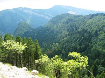
Tocht Stappen Le Poizat-Lalleyriat - Le poizat - Photo
Stappen 10.116
Km

Stappen

Gemakkelijk
Le Poizat-Lalleyriat, Auvergne-Rhône-Alpes, Ain, France
10,1 km | 14 km-effort
3h 38min
295 m
295 m
Ja
loca.yves

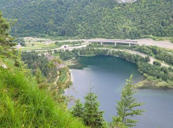
Tocht Stappen Le Poizat-Lalleyriat - lalleyriat - Photo
Stappen 11.483
Km

Stappen

Gemakkelijk
Le Poizat-Lalleyriat, Auvergne-Rhône-Alpes, Ain, France
11,5 km | 17,6 km-effort
3h 52min
459 m
461 m
Ja
loca.yves

Tocht Te voet Le Poizat-Lalleyriat - Sentier des Ecureuils - Photo
Te voet 7.293
Km
GUIDE+

Te voet

Gemakkelijk
Le Poizat-Lalleyriat, Auvergne-Rhône-Alpes, Ain, France
7,3 km | 10,1 km-effort
2h 17min
191 m
269 m
Neen
SityTrail - itinéraires balisés pédestres

Tocht Stappen Le Poizat-Lalleyriat -  le chemin de l'écureuil - Photo
Stappen 12.087
Km

Stappen

Gemakkelijk
Le Poizat-Lalleyriat, Auvergne-Rhône-Alpes, Ain, France
12,1 km | 16,6 km-effort
2h 34min
340 m
349 m
Neen
Heidy Le gall

Tocht Mountainbike Le Poizat-Lalleyriat - Espace VTT FFC du Bugey - Circuit n° 08 - Le Poizat - Photo
Mountainbike 28.108
Km

Mountainbike

Zeer moeilijk
Le Poizat-Lalleyriat, Auvergne-Rhône-Alpes, Ain, France
28 km | 38 km-effort
2h 30min
762 m
762 m
Ja
tracegps

Tocht Mountainbike Le Poizat-Lalleyriat - Espace VTT FFC du Bugey - Circuit n° 11 - Le Poizat - Photo
Mountainbike 5.987
Km

Mountainbike

Gemakkelijk
Le Poizat-Lalleyriat, Auvergne-Rhône-Alpes, Ain, France
6 km | 8 km-effort
30min
150 m
150 m
Ja
tracegps

Tocht Mountainbike Le Poizat-Lalleyriat - Espace VTT FFC du Bugey - Circuit n° 10 - Le Poizat  - Photo
Mountainbike 9.874
Km

Mountainbike

Medium
Le Poizat-Lalleyriat, Auvergne-Rhône-Alpes, Ain, France
9,9 km | 12,8 km-effort
45min
223 m
224 m
Ja
tracegps

Tocht Mountainbike Le Poizat-Lalleyriat - Espace VTT FFC du Bugey - Circuit n° 09 - Le Poizat  - Photo
Mountainbike 21.402
Km

Mountainbike

Medium
Le Poizat-Lalleyriat, Auvergne-Rhône-Alpes, Ain, France
21 km | 29 km-effort
2h 0min
589 m
589 m
Ja
tracegps

Tocht Stappen Le Poizat-Lalleyriat - le sentier des écureuils - Photo
Stappen 10.225
Km

Stappen

Gemakkelijk
(1)
Le Poizat-Lalleyriat, Auvergne-Rhône-Alpes, Ain, France
10,2 km | 14,2 km-effort
3h 35min
298 m
298 m
Ja
Filkine

• Départ du Replat

Tocht Stappen Le Poizat-Lalleyriat - l poizat - Photo
Stappen 8.408
Km

Stappen

Gemakkelijk
Le Poizat-Lalleyriat, Auvergne-Rhône-Alpes, Ain, France
8,4 km | 11,9 km-effort
2h 3min
263 m
259 m
Ja
jjjf01

Tocht Stappen Le Poizat-Lalleyriat - poizat - Photo
Stappen 8.234
Km

Stappen

Heel gemakkelijk
Le Poizat-Lalleyriat, Auvergne-Rhône-Alpes, Ain, France
8,2 km | 10,4 km-effort
2h 20min
160 m
159 m
Ja
cartouche

Tocht Stappen Le Poizat-Lalleyriat - Vers le Poizat  - Photo
Stappen 7.131
Km

Stappen

Heel gemakkelijk
Le Poizat-Lalleyriat, Auvergne-Rhône-Alpes, Ain, France
7,1 km | 9,3 km-effort
1h 43min
159 m
163 m
Ja
sandrine-s01

Tocht Stappen Le Poizat-Lalleyriat - chemin des écureuils  - Photo
Stappen 7.178
Km

Stappen

Gemakkelijk
Le Poizat-Lalleyriat, Auvergne-Rhône-Alpes, Ain, France
7,2 km | 10,2 km-effort
2h 15min
228 m
230 m
Ja
jjjf01

Tocht Stappen Le Poizat-Lalleyriat - lalleyriat la conay - Photo
Stappen 13.721
Km

Stappen

Moeilijk
Le Poizat-Lalleyriat, Auvergne-Rhône-Alpes, Ain, France
13,7 km | 21 km-effort
3h 53min
576 m
582 m
Ja
loca.yves

Tocht Stappen Le Poizat-Lalleyriat - le Poizat lalleyriat jusqu'au chalet en rondins - Photo
Stappen 9.488
Km

Stappen

Gemakkelijk
Le Poizat-Lalleyriat, Auvergne-Rhône-Alpes, Ain, France
9,5 km | 12,4 km-effort
2h 0min
223 m
213 m
Neen
Heidy Le gall

Tocht Wegfiets Le Poizat-Lalleyriat - Le Poizat Lachat - Photo
Wegfiets 21.365
Km

Wegfiets

Medium
Le Poizat-Lalleyriat, Auvergne-Rhône-Alpes, Ain, France
21 km | 26 km-effort
1h 26min
364 m
362 m
Ja
Heidy Le gall

Tocht Stappen Le Poizat-Lalleyriat - lalleiriat - Photo
Stappen 8.018
Km

Stappen

Heel gemakkelijk
Le Poizat-Lalleyriat, Auvergne-Rhône-Alpes, Ain, France
8 km | 10,8 km-effort
2h 35min
208 m
200 m
Ja
cartouche

Tocht Mountainbike Le Poizat-Lalleyriat - Trail - Photo
Mountainbike 13.521
Km

Mountainbike

Le Poizat-Lalleyriat, Auvergne-Rhône-Alpes, Ain, France
13,5 km | 17,4 km-effort
1h 14min
293 m
294 m
Ja
aricherd

Tocht Stappen Le Poizat-Lalleyriat - le poizat - Photo
Stappen 10.137
Km

Stappen

Gemakkelijk
Le Poizat-Lalleyriat, Auvergne-Rhône-Alpes, Ain, France
10,1 km | 13 km-effort
3h 22min
218 m
219 m
Ja
jjjf01

Tocht Sneeuwschoenen Le Poizat-Lalleyriat - IRRaquette 2 - Photo
Sneeuwschoenen 37.009
Km

Sneeuwschoenen

Moeilijk
Le Poizat-Lalleyriat, Auvergne-Rhône-Alpes, Ain, France
37 km | 52 km-effort
15h 0min
1159 m
1159 m
Ja
jlv05

20 tochten weergegeven op 20

Gratisgps-wandelapplicatie

Logo SityTrail SityTrail

IGN / Geografische instituten

SityTrail uit de App Store downloaden SityTrail uit Google Play downloaden

Logo SityTrail SityTrail World

De wereld gaat voor u open

SityTrail uit de App Store downloaden SityTrail uit Google Play downloaden SityTrail op Huawei AppGallery downloaden

Activiteiten

Nabije regio's

Sluiten
Mijn abonnementen