![](/images/other/stat-length.png)
- Tochten
- Outdoor
- Germany
- Hessen
- Main-Kinzig-Kreis
- Rodenbach
Rodenbach, Main-Kinzig-Kreis: Top van de beste wandelroutes, trajecten, tochten en wandelingen
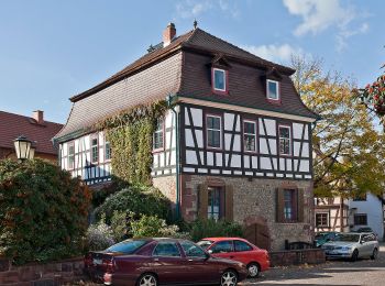
Rodenbach: Ontdek de beste tochten: 7 te voet. Al deze tochten, trajecten, routes en outdoor activiteiten zijn beschikbaar in onze SityTrail-apps voor smartphones en tablets.
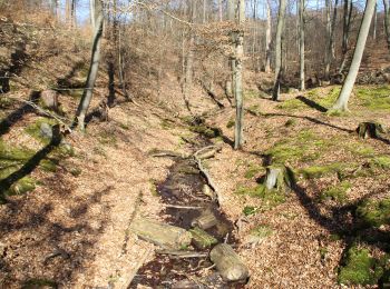
De beste trajecten (7)
![Tocht Te voet Rodenbach - Rodenbach - Rundwanderweg Fuchs - Photo](https://media.geolcdn.com/t/350/260/33d9f344-0467-4633-8ac3-2274a87c27a3.jpeg&format=jpg&maxdim=2)
![Te voet Te voet](https://static1.geolcdn.com/sitytour/trail-icons/100.png)
Km
Te voet
![](/images/other/stat-length.png)
![](https://static1.geolcdn.com/siteimages/upload/files/1508320355ic_sort_den_pos_24dp.png)
![](https://static1.geolcdn.com/siteimages/upload/files/1508320355ic_sort_den_neg_24dp.png)
![](https://static1.geolcdn.com/siteimages/upload/files/16400158638029165_repeat_loop_refresh_sync_direction_icon.png)
• Trail created by Naturpark Spessart. Symbol: Roter Fuchs auf weißem Hintergrund
![Tocht Te voet Rodenbach - Spessartbogen Zubringer Niederrodenbach - Burgberg - Photo](https://media.geolcdn.com/t/350/260/7ff6a68d-a567-492a-aadd-6ec4ce0530b1.jpeg&format=jpg&maxdim=2)
![Te voet Te voet](https://static1.geolcdn.com/sitytour/trail-icons/100.png)
Km
Te voet
![](/images/other/stat-length.png)
![](https://static1.geolcdn.com/siteimages/upload/files/1508320355ic_sort_den_pos_24dp.png)
![](https://static1.geolcdn.com/siteimages/upload/files/1508320355ic_sort_den_neg_24dp.png)
![](https://static1.geolcdn.com/siteimages/upload/files/16400158638029165_repeat_loop_refresh_sync_direction_icon.png)
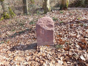
• Trail created by Naturpark Hessischer Spessart. Symbol: dunkelgrauer Strich und mittelgrauer Bogen über hellgrauem R...
![Tocht Te voet Rodenbach - Spessartspuren - Oberrodenbach – Dicke Tanne und Edelweißhütte - Photo](https://media.geolcdn.com/t/350/260/ddedb35d-8344-4408-bf85-eb128d9e1caf.jpeg&format=jpg&maxdim=2)
![Te voet Te voet](https://static1.geolcdn.com/sitytour/trail-icons/100.png)
Km
Te voet
![](/images/other/stat-length.png)
![](https://static1.geolcdn.com/siteimages/upload/files/1508320355ic_sort_den_pos_24dp.png)
![](https://static1.geolcdn.com/siteimages/upload/files/1508320355ic_sort_den_neg_24dp.png)
![](https://static1.geolcdn.com/siteimages/upload/files/16400158638029165_repeat_loop_refresh_sync_direction_icon.png)
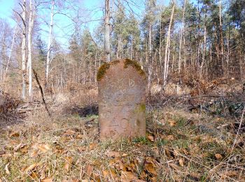
• Trail created by Naturpark Hessischer Spessart. Symbol: Blauer Strich und grüner Bogen über gelbem Rechteck auf hell...
![Tocht Te voet Rodenbach - Rodenbach - Rundwanderweg Eichhörnchen - Photo](https://media.geolcdn.com/t/350/260/4edd19d2-9eac-4e06-88dd-1291b55c0a88.jpeg&format=jpg&maxdim=2)
![Te voet Te voet](https://static1.geolcdn.com/sitytour/trail-icons/100.png)
Km
Te voet
![](/images/other/stat-length.png)
![](https://static1.geolcdn.com/siteimages/upload/files/1508320355ic_sort_den_pos_24dp.png)
![](https://static1.geolcdn.com/siteimages/upload/files/1508320355ic_sort_den_neg_24dp.png)
![](https://static1.geolcdn.com/siteimages/upload/files/16400158638029165_repeat_loop_refresh_sync_direction_icon.png)
• Trail created by Naturpark Spessart. Symbol: Braunes Eichhörnchen auf weißem Hintergrund
![Tocht Te voet Rodenbach - Rodenbach - Rundwanderweg Hase - Photo](https://media.geolcdn.com/t/350/260/ddedb35d-8344-4408-bf85-eb128d9e1caf.jpeg&format=jpg&maxdim=2)
![Te voet Te voet](https://static1.geolcdn.com/sitytour/trail-icons/100.png)
Km
Te voet
![](/images/other/stat-length.png)
![](https://static1.geolcdn.com/siteimages/upload/files/1508320355ic_sort_den_pos_24dp.png)
![](https://static1.geolcdn.com/siteimages/upload/files/1508320355ic_sort_den_neg_24dp.png)
![](https://static1.geolcdn.com/siteimages/upload/files/16400158638029165_repeat_loop_refresh_sync_direction_icon.png)
• Trail created by Naturpark Spessart. Symbol: Schwarzer Hase auf weißem Hintergrund
![Tocht Te voet Rodenbach - Rodenbach - Rundwanderweg Eule - Photo](https://media.geolcdn.com/t/350/260/ddedb35d-8344-4408-bf85-eb128d9e1caf.jpeg&format=jpg&maxdim=2)
![Te voet Te voet](https://static1.geolcdn.com/sitytour/trail-icons/100.png)
Km
Te voet
![](/images/other/stat-length.png)
![](https://static1.geolcdn.com/siteimages/upload/files/1508320355ic_sort_den_pos_24dp.png)
![](https://static1.geolcdn.com/siteimages/upload/files/1508320355ic_sort_den_neg_24dp.png)
![](https://static1.geolcdn.com/siteimages/upload/files/16400158638029165_repeat_loop_refresh_sync_direction_icon.png)
• Trail created by Naturpark Spessart. Symbol: Schwarze Eule auf weißem Hintergrund
![Tocht Te voet Rodenbach - Rodenbach - Rundwanderweg Libelle - Photo](https://media.geolcdn.com/t/350/260/ddedb35d-8344-4408-bf85-eb128d9e1caf.jpeg&format=jpg&maxdim=2)
![Te voet Te voet](https://static1.geolcdn.com/sitytour/trail-icons/100.png)
Km
Te voet
![](/images/other/stat-length.png)
![](https://static1.geolcdn.com/siteimages/upload/files/1508320355ic_sort_den_pos_24dp.png)
![](https://static1.geolcdn.com/siteimages/upload/files/1508320355ic_sort_den_neg_24dp.png)
![](https://static1.geolcdn.com/siteimages/upload/files/16400158638029165_repeat_loop_refresh_sync_direction_icon.png)
• Trail created by Naturpark Spessart. Symbol: Blaue Libelle auf weißem Hintergrund
7 tochten weergegeven op 7
Gratisgps-wandelapplicatie