![](/images/other/stat-length.png)
Landkreis Gießen, Hessen: Top van de beste wandelroutes, trajecten, tochten en wandelingen
Landkreis Gießen: Ontdek de beste tochten: 34 te voet. Al deze tochten, trajecten, routes en outdoor activiteiten zijn beschikbaar in onze SityTrail-apps voor smartphones en tablets.
De beste trajecten (35)
![Tocht Te voet Pohlheim - Wasserversorgung von Watzenborn-Steinberg - Photo](https://media.geolcdn.com/t/350/260/de4926ca-74ae-4bc4-ac0e-58c983837aae.jpeg&format=jpg&maxdim=2)
![Te voet Te voet](https://static1.geolcdn.com/sitytour/trail-icons/100.png)
Km
Te voet
![](/images/other/stat-length.png)
![](https://static1.geolcdn.com/siteimages/upload/files/1508320355ic_sort_den_pos_24dp.png)
![](https://static1.geolcdn.com/siteimages/upload/files/1508320355ic_sort_den_neg_24dp.png)
![](https://static1.geolcdn.com/siteimages/upload/files/16400158638029165_repeat_loop_refresh_sync_direction_icon.png)
• Trail created by Gießener Land.
![Tocht Te voet Langgöns - Wanderwege Cleeberg Panoramaweg Cleeberg - Photo](https://media.geolcdn.com/t/350/260/44d39550-d88a-4259-b472-ba797342fc2f.jpeg&format=jpg&maxdim=2)
![Te voet Te voet](https://static1.geolcdn.com/sitytour/trail-icons/100.png)
Km
Te voet
![](/images/other/stat-length.png)
![](https://static1.geolcdn.com/siteimages/upload/files/1508320355ic_sort_den_pos_24dp.png)
![](https://static1.geolcdn.com/siteimages/upload/files/1508320355ic_sort_den_neg_24dp.png)
![](https://static1.geolcdn.com/siteimages/upload/files/16400158638029165_repeat_loop_refresh_sync_direction_icon.png)
• Trail created by Naturpark Hochtaunus. Symbol: Schwarzer Turm auf weißem Grund
![Tocht Te voet Biebertal - Rennweg Bierbertal - Herborn - Photo](https://media.geolcdn.com/t/350/260/85a8254c-d21a-4f61-a2b5-a242100db251.jpeg&format=jpg&maxdim=2)
![Te voet Te voet](https://static1.geolcdn.com/sitytour/trail-icons/100.png)
Km
Te voet
![](/images/other/stat-length.png)
![](https://static1.geolcdn.com/siteimages/upload/files/1508320355ic_sort_den_pos_24dp.png)
![](https://static1.geolcdn.com/siteimages/upload/files/1508320355ic_sort_den_neg_24dp.png)
![](https://static1.geolcdn.com/siteimages/upload/files/16400158638029165_repeat_loop_refresh_sync_direction_icon.png)
• Trail created by Vogelsberger Höhenclub.
![Tocht Te voet Lollar - Zugangsweg zum Lahnwanderweg (ab Bahnhof Lollar) - Photo](https://media.geolcdn.com/t/350/260/95dc28df-3cea-47c5-a19a-750e8278aee0.jpeg&format=jpg&maxdim=2)
![Te voet Te voet](https://static1.geolcdn.com/sitytour/trail-icons/100.png)
Km
Te voet
![](/images/other/stat-length.png)
![](https://static1.geolcdn.com/siteimages/upload/files/1508320355ic_sort_den_pos_24dp.png)
![](https://static1.geolcdn.com/siteimages/upload/files/1508320355ic_sort_den_neg_24dp.png)
![](https://static1.geolcdn.com/siteimages/upload/files/16400158638029165_repeat_loop_refresh_sync_direction_icon.png)
• Trail created by Lahntal Tourismus Verband e.V.. Symbol: Stilisiertes LW in roter Schrift auf gelbem Grund mit rotem...
![Tocht Te voet Gießen - Zugangsweg zum Lahnwanderweg (ab Hbf Gießen) - Photo](https://media.geolcdn.com/t/350/260/2380cef4-2f6d-44d0-a8a4-ca8f82d38147.jpeg&format=jpg&maxdim=2)
![Te voet Te voet](https://static1.geolcdn.com/sitytour/trail-icons/100.png)
Km
Te voet
![](/images/other/stat-length.png)
![](https://static1.geolcdn.com/siteimages/upload/files/1508320355ic_sort_den_pos_24dp.png)
![](https://static1.geolcdn.com/siteimages/upload/files/1508320355ic_sort_den_neg_24dp.png)
![](https://static1.geolcdn.com/siteimages/upload/files/16400158638029165_repeat_loop_refresh_sync_direction_icon.png)
• Trail created by Lahntal Tourismus Verband e.V.. Symbol: Stilisiertes LW in roter Schrift auf gelbem Grund mit rotem...
![Tocht Te voet Lich - Rundweg Lich - Photo](https://media.geolcdn.com/t/350/260/2d741cc5-c255-4246-be9e-bd68c4fda97a.jpeg&format=jpg&maxdim=2)
![Te voet Te voet](https://static1.geolcdn.com/sitytour/trail-icons/100.png)
Km
Te voet
![](/images/other/stat-length.png)
![](https://static1.geolcdn.com/siteimages/upload/files/1508320355ic_sort_den_pos_24dp.png)
![](https://static1.geolcdn.com/siteimages/upload/files/1508320355ic_sort_den_neg_24dp.png)
![](https://static1.geolcdn.com/siteimages/upload/files/16400158638029165_repeat_loop_refresh_sync_direction_icon.png)
• Trail created by Vogelsberger Höhenclub. complete (Überprüft und Ergänzt von be-ju nach Beschilderung) Stand Oktober...
![Tocht Te voet Lich - Residenzenring - Photo](https://media.geolcdn.com/t/350/260/aee27a27-353f-460f-83c9-efe1bf08d435.jpeg&format=jpg&maxdim=2)
![Te voet Te voet](https://static1.geolcdn.com/sitytour/trail-icons/100.png)
Km
Te voet
![](/images/other/stat-length.png)
![](https://static1.geolcdn.com/siteimages/upload/files/1508320355ic_sort_den_pos_24dp.png)
![](https://static1.geolcdn.com/siteimages/upload/files/1508320355ic_sort_den_neg_24dp.png)
![](https://static1.geolcdn.com/siteimages/upload/files/16400158638029165_repeat_loop_refresh_sync_direction_icon.png)
• Trail created by Vogelsberger Höhenclub. complete (Überprüft und Ergänzt von be-ju nach Beschilderung; Wegführung we...
![Tocht Te voet Rabenau - Rabenauer Höhenweg - Photo](https://media.geolcdn.com/t/350/260/13f4e9de-ac86-4bf2-906e-e759a2a00f7c.jpeg&format=jpg&maxdim=2)
![Te voet Te voet](https://static1.geolcdn.com/sitytour/trail-icons/100.png)
Km
Te voet
![](/images/other/stat-length.png)
![](https://static1.geolcdn.com/siteimages/upload/files/1508320355ic_sort_den_pos_24dp.png)
![](https://static1.geolcdn.com/siteimages/upload/files/1508320355ic_sort_den_neg_24dp.png)
![](https://static1.geolcdn.com/siteimages/upload/files/16400158638029165_repeat_loop_refresh_sync_direction_icon.png)
• Trail created by Oberhessischer Gebirgsverein. Symbol: Rotes "R" auf weißem Grund
![Tocht Te voet Grünberg - Rundweg Grünberg - Photo](https://media.geolcdn.com/t/350/260/aefb5773-fc8e-45bb-b4bf-010d0e2109b8.jpeg&format=jpg&maxdim=2)
![Te voet Te voet](https://static1.geolcdn.com/sitytour/trail-icons/100.png)
Km
Te voet
![](/images/other/stat-length.png)
![](https://static1.geolcdn.com/siteimages/upload/files/1508320355ic_sort_den_pos_24dp.png)
![](https://static1.geolcdn.com/siteimages/upload/files/1508320355ic_sort_den_neg_24dp.png)
![](https://static1.geolcdn.com/siteimages/upload/files/16400158638029165_repeat_loop_refresh_sync_direction_icon.png)
• Trail created by Vogelsberger Höhenclub. complete (Überprüft und Ergänzt von be-ju nach Beschilderung; Wegführung we...
![Tocht Te voet Gießen - Theodors-Ruh-Weg - Photo](https://media.geolcdn.com/t/350/260/e7ae5f0c-b32b-46dc-a32a-eb71f4664511.jpeg&format=jpg&maxdim=2)
![Te voet Te voet](https://static1.geolcdn.com/sitytour/trail-icons/100.png)
Km
Te voet
![](/images/other/stat-length.png)
![](https://static1.geolcdn.com/siteimages/upload/files/1508320355ic_sort_den_pos_24dp.png)
![](https://static1.geolcdn.com/siteimages/upload/files/1508320355ic_sort_den_neg_24dp.png)
![](https://static1.geolcdn.com/siteimages/upload/files/16400158638029165_repeat_loop_refresh_sync_direction_icon.png)
• Trail created by Vogelsberger Höhenclub. Symbol: roter punkt auf weiss
![Tocht Te voet Hungen - Hungen Rundweg Nordschleife - Photo](https://media.geolcdn.com/t/350/260/f1b267f5-226a-4c06-a34e-a07600d64611.jpeg&format=jpg&maxdim=2)
![Te voet Te voet](https://static1.geolcdn.com/sitytour/trail-icons/100.png)
Km
Te voet
![](/images/other/stat-length.png)
![](https://static1.geolcdn.com/siteimages/upload/files/1508320355ic_sort_den_pos_24dp.png)
![](https://static1.geolcdn.com/siteimages/upload/files/1508320355ic_sort_den_neg_24dp.png)
![](https://static1.geolcdn.com/siteimages/upload/files/16400158638029165_repeat_loop_refresh_sync_direction_icon.png)
• Trail created by Vogelsberger Höhenclub. incomplete (Wegführung neu gestaltet vom Operator Q4-2012) Symbol: blauer ...
![Tocht Te voet Laubach - Wetterweg - Photo](https://media.geolcdn.com/t/350/260/2100a7e7-50ec-49f5-a2a2-5fae1b4dcbe5.jpeg&format=jpg&maxdim=2)
![Te voet Te voet](https://static1.geolcdn.com/sitytour/trail-icons/100.png)
Km
Te voet
![](/images/other/stat-length.png)
![](https://static1.geolcdn.com/siteimages/upload/files/1508320355ic_sort_den_pos_24dp.png)
![](https://static1.geolcdn.com/siteimages/upload/files/1508320355ic_sort_den_neg_24dp.png)
![](https://static1.geolcdn.com/siteimages/upload/files/16400158638029165_repeat_loop_refresh_sync_direction_icon.png)
• Trail created by Vogelsberger Höhenclub. complete (Markierungswanderung VHC 09-2011) Symbol: rotes W und 2 Wellen a...
![Tocht Te voet Grünberg - Pfannenweg - Photo](https://media.geolcdn.com/t/350/260/aefb5773-fc8e-45bb-b4bf-010d0e2109b8.jpeg&format=jpg&maxdim=2)
![Te voet Te voet](https://static1.geolcdn.com/sitytour/trail-icons/100.png)
Km
Te voet
![](/images/other/stat-length.png)
![](https://static1.geolcdn.com/siteimages/upload/files/1508320355ic_sort_den_pos_24dp.png)
![](https://static1.geolcdn.com/siteimages/upload/files/1508320355ic_sort_den_neg_24dp.png)
![](https://static1.geolcdn.com/siteimages/upload/files/16400158638029165_repeat_loop_refresh_sync_direction_icon.png)
• Trail created by Vogelsberger Höhenclub. complete (Überprüft und Ergänzt von be-ju nach Beschilderung; Wegführung we...
![Tocht Te voet Langgöns - Wanderwege Cleeberg Seegrund Rundweg - Photo](https://media.geolcdn.com/t/350/260/44d39550-d88a-4259-b472-ba797342fc2f.jpeg&format=jpg&maxdim=2)
![Te voet Te voet](https://static1.geolcdn.com/sitytour/trail-icons/100.png)
Km
Te voet
![](/images/other/stat-length.png)
![](https://static1.geolcdn.com/siteimages/upload/files/1508320355ic_sort_den_pos_24dp.png)
![](https://static1.geolcdn.com/siteimages/upload/files/1508320355ic_sort_den_neg_24dp.png)
![](https://static1.geolcdn.com/siteimages/upload/files/16400158638029165_repeat_loop_refresh_sync_direction_icon.png)
• Trail created by Naturpark Hochtaunus. Symbol: roter Fuchs auf weißem Grund
![Tocht Te voet Lich - Kulturhistorischer Weg Muschenheim - Photo](https://media.geolcdn.com/t/350/260/46d70c8e-d041-4d91-95ca-51b0f1f78f73.jpeg&format=jpg&maxdim=2)
![Te voet Te voet](https://static1.geolcdn.com/sitytour/trail-icons/100.png)
Km
Te voet
![](/images/other/stat-length.png)
![](https://static1.geolcdn.com/siteimages/upload/files/1508320355ic_sort_den_pos_24dp.png)
![](https://static1.geolcdn.com/siteimages/upload/files/1508320355ic_sort_den_neg_24dp.png)
![](https://static1.geolcdn.com/siteimages/upload/files/16400158638029165_repeat_loop_refresh_sync_direction_icon.png)
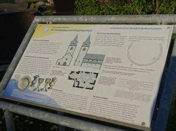
• Trail created by Landkreis Gießen. altes Symbol=Wappen von Muschenheim Symbol: KHW
![Tocht Te voet Biebertal - Forstweg - Photo](https://media.geolcdn.com/t/350/260/4ba721a6-0723-440e-b0c3-072278c37bba.jpeg&format=jpg&maxdim=2)
![Te voet Te voet](https://static1.geolcdn.com/sitytour/trail-icons/100.png)
Km
Te voet
![](/images/other/stat-length.png)
![](https://static1.geolcdn.com/siteimages/upload/files/1508320355ic_sort_den_pos_24dp.png)
![](https://static1.geolcdn.com/siteimages/upload/files/1508320355ic_sort_den_neg_24dp.png)
![](https://static1.geolcdn.com/siteimages/upload/files/16400158638029165_repeat_loop_refresh_sync_direction_icon.png)
• Trail created by Vogelsberger Höhenclub. zunaechst an der Lahn entlang Symbol: schwarzer balken auf weiss
![Tocht Te voet Gießen - Lumdatal-Bergweg - Photo](https://media.geolcdn.com/t/350/260/8f76bc30-51e7-4a6f-9f3b-53d39ce14045.jpeg&format=jpg&maxdim=2)
![Te voet Te voet](https://static1.geolcdn.com/sitytour/trail-icons/100.png)
Km
Te voet
![](/images/other/stat-length.png)
![](https://static1.geolcdn.com/siteimages/upload/files/1508320355ic_sort_den_pos_24dp.png)
![](https://static1.geolcdn.com/siteimages/upload/files/1508320355ic_sort_den_neg_24dp.png)
![](https://static1.geolcdn.com/siteimages/upload/files/16400158638029165_repeat_loop_refresh_sync_direction_icon.png)
• Trail created by Vogelsberger Höhenclub. Symbol: blauer balken auf weiss
![Tocht Te voet Gießen - Gießener Panoramaweg - Photo](https://media.geolcdn.com/t/350/260/5ad82f30-f50f-4761-9d63-4a0090f3af4d.jpeg&format=jpg&maxdim=2)
![Te voet Te voet](https://static1.geolcdn.com/sitytour/trail-icons/100.png)
Km
Te voet
![](/images/other/stat-length.png)
![](https://static1.geolcdn.com/siteimages/upload/files/1508320355ic_sort_den_pos_24dp.png)
![](https://static1.geolcdn.com/siteimages/upload/files/1508320355ic_sort_den_neg_24dp.png)
![](https://static1.geolcdn.com/siteimages/upload/files/16400158638029165_repeat_loop_refresh_sync_direction_icon.png)
• Trail created by Vogelsberger Höhenclub. Symbol: roter punkt auf weiss
![Tocht Te voet Buseck - Nordschleife - Photo](https://media.geolcdn.com/t/350/260/554e4a21-7e4b-45be-8c0d-84e996e51c4a.jpeg&format=jpg&maxdim=2)
![Te voet Te voet](https://static1.geolcdn.com/sitytour/trail-icons/100.png)
Km
Te voet
![](/images/other/stat-length.png)
![](https://static1.geolcdn.com/siteimages/upload/files/1508320355ic_sort_den_pos_24dp.png)
![](https://static1.geolcdn.com/siteimages/upload/files/1508320355ic_sort_den_neg_24dp.png)
![](https://static1.geolcdn.com/siteimages/upload/files/16400158638029165_repeat_loop_refresh_sync_direction_icon.png)
• Trail created by Vogelsberger Höhenclub. Symbol: roter punkt auf weiss
![Tocht Te voet Laubach - Laubach Panoramaweg - Photo](https://media.geolcdn.com/t/350/260/e34012cc-d8aa-4f6c-9a87-671f68d3e4a4.jpeg&format=jpg&maxdim=2)
![Te voet Te voet](https://static1.geolcdn.com/sitytour/trail-icons/100.png)
Km
Te voet
![](/images/other/stat-length.png)
![](https://static1.geolcdn.com/siteimages/upload/files/1508320355ic_sort_den_pos_24dp.png)
![](https://static1.geolcdn.com/siteimages/upload/files/1508320355ic_sort_den_neg_24dp.png)
![](https://static1.geolcdn.com/siteimages/upload/files/16400158638029165_repeat_loop_refresh_sync_direction_icon.png)
• Trail created by Laubach & VHC. complete ; neu angelegt 2014-02 VHC Laubach Symbol: Gelber Hintergrund mit weißem R...
20 tochten weergegeven op 35
Gratisgps-wandelapplicatie