![](/images/other/stat-length.png)
Waldrach, Landkreis Trier-Saarburg: Top van de beste wandelroutes, trajecten, tochten en wandelingen
Waldrach: Ontdek de beste tochten: 3 te voet. Al deze tochten, trajecten, routes en outdoor activiteiten zijn beschikbaar in onze SityTrail-apps voor smartphones en tablets.
De beste trajecten (3)
![Tocht Te voet Waldrach - Waldrach 2 - Photo](https://media.geolcdn.com/t/350/260/5223fab9-3bc2-41d1-a8df-c5d9f817918c.jpeg&format=jpg&maxdim=2)
![Te voet Te voet](https://static1.geolcdn.com/sitytour/trail-icons/100.png)
Km
Te voet
![](/images/other/stat-length.png)
![](https://static1.geolcdn.com/siteimages/upload/files/1508320355ic_sort_den_pos_24dp.png)
![](https://static1.geolcdn.com/siteimages/upload/files/1508320355ic_sort_den_neg_24dp.png)
![](https://static1.geolcdn.com/siteimages/upload/files/16400158638029165_repeat_loop_refresh_sync_direction_icon.png)
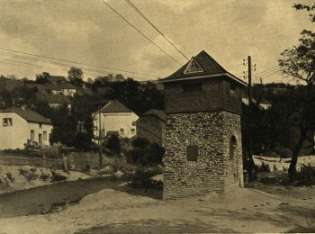
• noch nicht vollständig erkundet. KK-O 16.10.2013
![Tocht Te voet Waldrach - RT1 - Photo](https://media.geolcdn.com/t/350/260/8f5b3fc9-ca42-431f-babc-0124f8354220.jpeg&format=jpg&maxdim=2)
![Te voet Te voet](https://static1.geolcdn.com/sitytour/trail-icons/100.png)
Km
Te voet
![](/images/other/stat-length.png)
![](https://static1.geolcdn.com/siteimages/upload/files/1508320355ic_sort_den_pos_24dp.png)
![](https://static1.geolcdn.com/siteimages/upload/files/1508320355ic_sort_den_neg_24dp.png)
![](https://static1.geolcdn.com/siteimages/upload/files/16400158638029165_repeat_loop_refresh_sync_direction_icon.png)
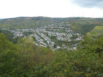
• Trail created by Naturpark Saar-Hunsrück. Wanderweg hatte vor 2013 die Bezeichnung RT2 Symbol: Roter Text RT1 in ro...
![Tocht Te voet Waldrach - Waldrach 1 - Photo](https://media.geolcdn.com/t/350/260/7bdd65e6-b6fc-4760-9425-0bce8293422b.jpeg&format=jpg&maxdim=2)
![Te voet Te voet](https://static1.geolcdn.com/sitytour/trail-icons/100.png)
Km
Te voet
![](/images/other/stat-length.png)
![](https://static1.geolcdn.com/siteimages/upload/files/1508320355ic_sort_den_pos_24dp.png)
![](https://static1.geolcdn.com/siteimages/upload/files/1508320355ic_sort_den_neg_24dp.png)
![](https://static1.geolcdn.com/siteimages/upload/files/16400158638029165_repeat_loop_refresh_sync_direction_icon.png)
• Trail created by Naturpark Saar-Hunsrück.
3 tochten weergegeven op 3
Gratisgps-wandelapplicatie