![](/images/other/stat-length.png)
- Tochten
- Outdoor
- Germany
- Rijnland-Palts
- Eifelkreis Bitburg-Prüm
Eifelkreis Bitburg-Prüm, Rijnland-Palts: Top van de beste wandelroutes, trajecten, tochten en wandelingen
Eifelkreis Bitburg-Prüm: Ontdek de beste tochten: 49 te voet, 3 met de fiets of mountainbike en 1 te paard. Al deze tochten, trajecten, routes en outdoor activiteiten zijn beschikbaar in onze SityTrail-apps voor smartphones en tablets.
De beste trajecten (60)
![Tocht Stappen Ernzen - DeLux Wanderpark Felsenweg1, Weilerbach-Houllay - Photo](https://media.geolcdn.com/t/350/260/ext.jpg?maxdim=2&url=https%3A%2F%2Fstatic1.geolcdn.com%2Fsiteimages%2Fupload%2Ffiles%2F1553511878bg_sport_marche.png)
![Stappen Stappen](https://static1.geolcdn.com/sitytour/trail-icons/101.png)
Km
Stappen
![](/images/other/stat-length.png)
![](https://static1.geolcdn.com/siteimages/upload/files/1508320355ic_sort_den_pos_24dp.png)
![](https://static1.geolcdn.com/siteimages/upload/files/1508320355ic_sort_den_neg_24dp.png)
![](https://static1.geolcdn.com/siteimages/upload/files/16400158638029165_repeat_loop_refresh_sync_direction_icon.png)
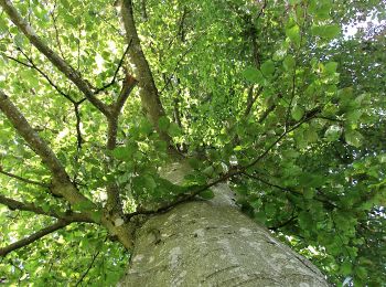
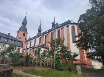
• Kulturelle Schätze Bizzare Felslandschaften, blütenreiche Wiesen und farnreiche Wälder kennzeichnen diese Route. Ab...
![Tocht Te voet Buchet - Bach-Pfad - Photo](https://media.geolcdn.com/t/350/260/a174b371-33dd-4c4f-93ea-12350612fc49.jpeg&format=jpg&maxdim=2)
![Te voet Te voet](https://static1.geolcdn.com/sitytour/trail-icons/100.png)
Km
Te voet
![](/images/other/stat-length.png)
![](https://static1.geolcdn.com/siteimages/upload/files/1508320355ic_sort_den_pos_24dp.png)
![](https://static1.geolcdn.com/siteimages/upload/files/1508320355ic_sort_den_neg_24dp.png)
![](https://static1.geolcdn.com/siteimages/upload/files/16400158638029165_repeat_loop_refresh_sync_direction_icon.png)
• Trail created by Eifel Tourismus GmbH.
![Tocht Te voet Echternacherbrück - Felsenweg 1 - Photo](https://media.geolcdn.com/t/350/260/2e9ebe84-c1e3-4839-8a8a-11176ceb2a5c.jpeg&format=jpg&maxdim=2)
![Te voet Te voet](https://static1.geolcdn.com/sitytour/trail-icons/100.png)
Km
Te voet
![](/images/other/stat-length.png)
![](https://static1.geolcdn.com/siteimages/upload/files/1508320355ic_sort_den_pos_24dp.png)
![](https://static1.geolcdn.com/siteimages/upload/files/1508320355ic_sort_den_neg_24dp.png)
![](https://static1.geolcdn.com/siteimages/upload/files/16400158638029165_repeat_loop_refresh_sync_direction_icon.png)
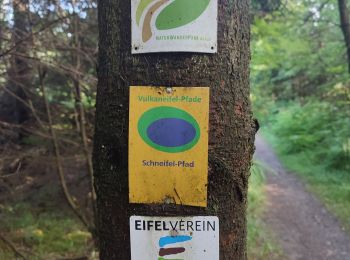
• Symbol: Grünes stilisiertes Blatt auf weißem Grund
![Tocht Te voet Irrhausen - Wanderweg 13 Olmscheid Naturpark Südeifel - Photo](https://media.geolcdn.com/t/350/260/453c458d-4266-4b3c-be73-e2bbaaaf2e0e.jpeg&format=jpg&maxdim=2)
![Te voet Te voet](https://static1.geolcdn.com/sitytour/trail-icons/100.png)
Km
Te voet
![](/images/other/stat-length.png)
![](https://static1.geolcdn.com/siteimages/upload/files/1508320355ic_sort_den_pos_24dp.png)
![](https://static1.geolcdn.com/siteimages/upload/files/1508320355ic_sort_den_neg_24dp.png)
![](https://static1.geolcdn.com/siteimages/upload/files/16400158638029165_repeat_loop_refresh_sync_direction_icon.png)
• Symbol: Rote Schrift 13 auf weißem Grund
![Tocht Te voet Dackscheid - Rundweg D - Photo](https://media.geolcdn.com/t/350/260/13152dbd-04e5-4c84-b169-158ed04a5da0.jpeg&format=jpg&maxdim=2)
![Te voet Te voet](https://static1.geolcdn.com/sitytour/trail-icons/100.png)
Km
Te voet
![](/images/other/stat-length.png)
![](https://static1.geolcdn.com/siteimages/upload/files/1508320355ic_sort_den_pos_24dp.png)
![](https://static1.geolcdn.com/siteimages/upload/files/1508320355ic_sort_den_neg_24dp.png)
![](https://static1.geolcdn.com/siteimages/upload/files/16400158638029165_repeat_loop_refresh_sync_direction_icon.png)
• Trail created by Eifelverein Waxweiler ?. Symbol: Blaues D in blauem Kreis auf weißem Grund
![Tocht Te voet Heisdorf - Rundweg A - Photo](https://media.geolcdn.com/t/350/260/dc1dc3d1-ff4e-40ab-99c8-e6bcace94871.jpeg&format=jpg&maxdim=2)
![Te voet Te voet](https://static1.geolcdn.com/sitytour/trail-icons/100.png)
Km
Te voet
![](/images/other/stat-length.png)
![](https://static1.geolcdn.com/siteimages/upload/files/1508320355ic_sort_den_pos_24dp.png)
![](https://static1.geolcdn.com/siteimages/upload/files/1508320355ic_sort_den_neg_24dp.png)
![](https://static1.geolcdn.com/siteimages/upload/files/16400158638029165_repeat_loop_refresh_sync_direction_icon.png)
• Trail created by Eifelverein Waxweiler ?. Symbol: Rotes A in rotem Kreis auf weißem Grund
![Tocht Stappen Ernzen - Balade Ernzen Allemagne - Photo](https://media.geolcdn.com/t/350/260/efe60b51-604b-4195-ab83-3dfa9e55ea7a.jpg&format=jpg&maxdim=2)
![Stappen Stappen](https://static1.geolcdn.com/sitytour/trail-icons/101.png)
Km
Stappen
![](/images/other/stat-length.png)
![](https://static1.geolcdn.com/siteimages/upload/files/1508320355ic_sort_den_pos_24dp.png)
![](https://static1.geolcdn.com/siteimages/upload/files/1508320355ic_sort_den_neg_24dp.png)
![](https://static1.geolcdn.com/siteimages/upload/files/16400158638029165_repeat_loop_refresh_sync_direction_icon.png)
![Tocht Te voet Gondenbrett - DE-2 - Photo](https://media.geolcdn.com/t/350/260/26220d83-c371-421e-a4f8-513152ca2822.jpeg&format=jpg&maxdim=2)
![Te voet Te voet](https://static1.geolcdn.com/sitytour/trail-icons/100.png)
Km
Te voet
![](/images/other/stat-length.png)
![](https://static1.geolcdn.com/siteimages/upload/files/1508320355ic_sort_den_pos_24dp.png)
![](https://static1.geolcdn.com/siteimages/upload/files/1508320355ic_sort_den_neg_24dp.png)
![](https://static1.geolcdn.com/siteimages/upload/files/16400158638029165_repeat_loop_refresh_sync_direction_icon.png)
![Tocht Te voet Buchet - DE-12 - Photo](https://media.geolcdn.com/t/350/260/3165d235-b82b-44f0-a921-1c296a4e75ed.jpeg&format=jpg&maxdim=2)
![Te voet Te voet](https://static1.geolcdn.com/sitytour/trail-icons/100.png)
Km
Te voet
![](/images/other/stat-length.png)
![](https://static1.geolcdn.com/siteimages/upload/files/1508320355ic_sort_den_pos_24dp.png)
![](https://static1.geolcdn.com/siteimages/upload/files/1508320355ic_sort_den_neg_24dp.png)
![](https://static1.geolcdn.com/siteimages/upload/files/16400158638029165_repeat_loop_refresh_sync_direction_icon.png)
![Tocht Te voet Waxweiler - Devon-Pfad - Photo](https://media.geolcdn.com/t/350/260/c1c6ae80-533d-4bf8-98eb-7b729bccfec7.jpeg&format=jpg&maxdim=2)
![Te voet Te voet](https://static1.geolcdn.com/sitytour/trail-icons/100.png)
Km
Te voet
![](/images/other/stat-length.png)
![](https://static1.geolcdn.com/siteimages/upload/files/1508320355ic_sort_den_pos_24dp.png)
![](https://static1.geolcdn.com/siteimages/upload/files/1508320355ic_sort_den_neg_24dp.png)
![](https://static1.geolcdn.com/siteimages/upload/files/16400158638029165_repeat_loop_refresh_sync_direction_icon.png)
• Trail created by Eifel Tourismus GmbH.
![Tocht Te voet Auw bei Prüm - Westwallweg Schneifel - Photo](https://media.geolcdn.com/t/350/260/3165d235-b82b-44f0-a921-1c296a4e75ed.jpeg&format=jpg&maxdim=2)
![Te voet Te voet](https://static1.geolcdn.com/sitytour/trail-icons/100.png)
Km
Te voet
![](/images/other/stat-length.png)
![](https://static1.geolcdn.com/siteimages/upload/files/1508320355ic_sort_den_pos_24dp.png)
![](https://static1.geolcdn.com/siteimages/upload/files/1508320355ic_sort_den_neg_24dp.png)
![](https://static1.geolcdn.com/siteimages/upload/files/16400158638029165_repeat_loop_refresh_sync_direction_icon.png)
![Tocht Te voet Irrhausen - Irsental - Photo](https://media.geolcdn.com/t/350/260/fb2d7a91-6db7-4651-b978-d955dde60a2d.jpeg&format=jpg&maxdim=2)
![Te voet Te voet](https://static1.geolcdn.com/sitytour/trail-icons/100.png)
Km
Te voet
![](/images/other/stat-length.png)
![](https://static1.geolcdn.com/siteimages/upload/files/1508320355ic_sort_den_pos_24dp.png)
![](https://static1.geolcdn.com/siteimages/upload/files/1508320355ic_sort_den_neg_24dp.png)
![](https://static1.geolcdn.com/siteimages/upload/files/16400158638029165_repeat_loop_refresh_sync_direction_icon.png)
![Tocht Te voet Bleialf - Prümer Land Tour Route 4 - Bergbaupfad Bleialf - Photo](https://media.geolcdn.com/t/350/260/a174b371-33dd-4c4f-93ea-12350612fc49.jpeg&format=jpg&maxdim=2)
![Te voet Te voet](https://static1.geolcdn.com/sitytour/trail-icons/100.png)
Km
Te voet
![](/images/other/stat-length.png)
![](https://static1.geolcdn.com/siteimages/upload/files/1508320355ic_sort_den_pos_24dp.png)
![](https://static1.geolcdn.com/siteimages/upload/files/1508320355ic_sort_den_neg_24dp.png)
![](https://static1.geolcdn.com/siteimages/upload/files/16400158638029165_repeat_loop_refresh_sync_direction_icon.png)
![Tocht Te voet Krautscheid - Berkoth - Photo](https://media.geolcdn.com/t/350/260/ed1ef1a8-8017-4a67-9353-58ffccae3a41.jpeg&format=jpg&maxdim=2)
![Te voet Te voet](https://static1.geolcdn.com/sitytour/trail-icons/100.png)
Km
Te voet
![](/images/other/stat-length.png)
![](https://static1.geolcdn.com/siteimages/upload/files/1508320355ic_sort_den_pos_24dp.png)
![](https://static1.geolcdn.com/siteimages/upload/files/1508320355ic_sort_den_neg_24dp.png)
![](https://static1.geolcdn.com/siteimages/upload/files/16400158638029165_repeat_loop_refresh_sync_direction_icon.png)
![Tocht Te voet Lascheid - Panoramaweg 100 - Photo](https://media.geolcdn.com/t/350/260/a8373515-28a6-4f66-bb4f-e1e2d577132e.jpeg&format=jpg&maxdim=2)
![Te voet Te voet](https://static1.geolcdn.com/sitytour/trail-icons/100.png)
Km
Te voet
![](/images/other/stat-length.png)
![](https://static1.geolcdn.com/siteimages/upload/files/1508320355ic_sort_den_pos_24dp.png)
![](https://static1.geolcdn.com/siteimages/upload/files/1508320355ic_sort_den_neg_24dp.png)
![](https://static1.geolcdn.com/siteimages/upload/files/16400158638029165_repeat_loop_refresh_sync_direction_icon.png)
• Trail created by Eifelverein Waxweiler. Symbol: Schwarzer Text 100 auf weißem Grund
![Tocht Stappen Waldhof-Falkenstein - 2023-09-30_23h26m24_nat-our-route5-1 - Photo](https://media.geolcdn.com/t/350/260/ext.jpg?maxdim=2&url=https%3A%2F%2Fstatic1.geolcdn.com%2Fsiteimages%2Fupload%2Ffiles%2F1553511878bg_sport_marche.png)
![Stappen Stappen](https://static1.geolcdn.com/sitytour/trail-icons/101.png)
Km
Stappen
![](/images/other/stat-length.png)
![](https://static1.geolcdn.com/siteimages/upload/files/1508320355ic_sort_den_pos_24dp.png)
![](https://static1.geolcdn.com/siteimages/upload/files/1508320355ic_sort_den_neg_24dp.png)
![](https://static1.geolcdn.com/siteimages/upload/files/16400158638029165_repeat_loop_refresh_sync_direction_icon.png)
![Tocht Stappen Weinsheim - Weinsheim dag 3 - Photo](https://media.geolcdn.com/t/350/260/15517789-7171-48cd-9f7a-a3f91aeb6293.jpg&format=jpg&maxdim=2)
![Stappen Stappen](https://static1.geolcdn.com/sitytour/trail-icons/101.png)
Km
Stappen
![](/images/other/stat-length.png)
![](https://static1.geolcdn.com/siteimages/upload/files/1508320355ic_sort_den_pos_24dp.png)
![](https://static1.geolcdn.com/siteimages/upload/files/1508320355ic_sort_den_neg_24dp.png)
![](https://static1.geolcdn.com/siteimages/upload/files/16400158638029165_repeat_loop_refresh_sync_direction_icon.png)
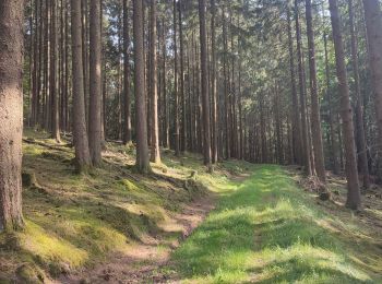
• Grotendeels verharde paden en wegen. Heel af en toe door het bos.
![Tocht Stappen Auw bei Prüm - Moore pad - Photo](https://media.geolcdn.com/t/350/260/313a8d0b-59fb-4f60-8a34-0b8e45702d77.jpg&format=jpg&maxdim=2)
![Stappen Stappen](https://static1.geolcdn.com/sitytour/trail-icons/101.png)
Km
Stappen
![](/images/other/stat-length.png)
![](https://static1.geolcdn.com/siteimages/upload/files/1508320355ic_sort_den_pos_24dp.png)
![](https://static1.geolcdn.com/siteimages/upload/files/1508320355ic_sort_den_neg_24dp.png)
![](https://static1.geolcdn.com/siteimages/upload/files/16400158638029165_repeat_loop_refresh_sync_direction_icon.png)
![Tocht Stappen Weinsheim - Weinsheim dag 2 - Photo](https://media.geolcdn.com/t/350/260/a14efac0-e794-4341-8b03-822e01440dbd.jpg&format=jpg&maxdim=2)
![Stappen Stappen](https://static1.geolcdn.com/sitytour/trail-icons/101.png)
Km
Stappen
![](/images/other/stat-length.png)
![](https://static1.geolcdn.com/siteimages/upload/files/1508320355ic_sort_den_pos_24dp.png)
![](https://static1.geolcdn.com/siteimages/upload/files/1508320355ic_sort_den_neg_24dp.png)
![](https://static1.geolcdn.com/siteimages/upload/files/16400158638029165_repeat_loop_refresh_sync_direction_icon.png)
![Tocht Stappen Prüm - Prüm - Photo](https://media.geolcdn.com/t/350/260/eabcb1c6-485f-4964-a483-d03c51e4f251.jpg&format=jpg&maxdim=2)
![Stappen Stappen](https://static1.geolcdn.com/sitytour/trail-icons/101.png)
Km
Stappen
![](/images/other/stat-length.png)
![](https://static1.geolcdn.com/siteimages/upload/files/1508320355ic_sort_den_pos_24dp.png)
![](https://static1.geolcdn.com/siteimages/upload/files/1508320355ic_sort_den_neg_24dp.png)
![](https://static1.geolcdn.com/siteimages/upload/files/16400158638029165_repeat_loop_refresh_sync_direction_icon.png)
20 tochten weergegeven op 60
Gratisgps-wandelapplicatie
Activiteiten
Nabije regio's
- Affler
- Ammeldingen an der Our
- Arzfeld
- Auw an der Kyll
- Auw bei Prüm
- Bauler
- Berkoth
- Bettingen
- Biersdorf am See
- Bitburg
- Bleialf
- Bollendorf
- Buchet
- Dackscheid
- Dahnen
- Dasburg
- Echternacherbrück
- Ernzen
- Ferschweiler
- Fischbach-Oberraden
- Fleringen
- Gemünd
- Gentingen
- Gondenbrett
- Gondorf
- Großlangenfeld
- Heckhuscheid
- Heisdorf
- Herzfeld
- Hüttingen an der Kyll
- Irrel
- Irrhausen
- Jucken
- Kaschenbach
- Keppeshausen
- Körperich
- Krautscheid
- Kyllburg
- Lascheid
- Lasel
- Lauperath
- Leimbach
- Lützkampen
- Malberg
- Mauel
- Mettendorf
- Metterich
- Minden
- Mützenich
- Neuerburg
- Nusbaum
- Oberlascheid
- Oberpierscheid
- Orenhofen
- Pittenbach
- Preischeid
- Prüm
- Prümzurlay
- Reipeldingen
- Rittersdorf
- Rommersheim
- Roth an der Our
- Roth bei Prüm
- Sankt Thomas
- Schankweiler
- Schönecken
- Sellerich
- Sinspelt
- Speicher
- Übereisenbach
- Utscheid
- Waldhof-Falkenstein
- Wallendorf
- Watzerath
- Waxweiler
- Weidingen
- Weinsheim
- Wiersdorf
- Winterscheid
- Winterspelt