![](/images/other/stat-length.png)
- Tochten
- Outdoor
- Germany
- Rijnland-Palts
- Landkreis Neuwied
- Neustadt (Wied)
Neustadt (Wied), Landkreis Neuwied: Top van de beste wandelroutes, trajecten, tochten en wandelingen
Neustadt (Wied): Ontdek de beste tochten: 7 te voet. Al deze tochten, trajecten, routes en outdoor activiteiten zijn beschikbaar in onze SityTrail-apps voor smartphones en tablets.
De beste trajecten (7)
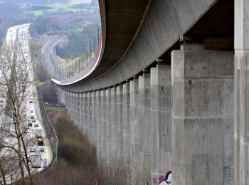
![Tocht Te voet Neustadt (Wied) - [N1] Bertenauer Weg - Photo](https://media.geolcdn.com/t/350/260/23673f5b-8e9e-4aac-bd57-d7ced4e8cded.jpeg&format=jpg&maxdim=2)
![Te voet Te voet](https://static1.geolcdn.com/sitytour/trail-icons/100.png)
Km
Te voet
![](/images/other/stat-length.png)
![](https://static1.geolcdn.com/siteimages/upload/files/1508320355ic_sort_den_pos_24dp.png)
![](https://static1.geolcdn.com/siteimages/upload/files/1508320355ic_sort_den_neg_24dp.png)
![](https://static1.geolcdn.com/siteimages/upload/files/16400158638029165_repeat_loop_refresh_sync_direction_icon.png)
• Trail created by Verbandsgemeinde Asbach. Symbol: Weißer Text N1 auf rotem Grund
![Tocht Te voet Neustadt (Wied) - N3 Neustädter Wanderweg 3 - Photo](https://media.geolcdn.com/t/350/260/e89ca6e9-1f21-4815-a33f-c9a8d227dac0.jpeg&format=jpg&maxdim=2)
![Te voet Te voet](https://static1.geolcdn.com/sitytour/trail-icons/100.png)
Km
Te voet
![](/images/other/stat-length.png)
![](https://static1.geolcdn.com/siteimages/upload/files/1508320355ic_sort_den_pos_24dp.png)
![](https://static1.geolcdn.com/siteimages/upload/files/1508320355ic_sort_den_neg_24dp.png)
![](https://static1.geolcdn.com/siteimages/upload/files/16400158638029165_repeat_loop_refresh_sync_direction_icon.png)
• Trail created by Ortsgemeinde Neustadt (Wied). Symbol: Weißes N3 auf rotem Grund
![Tocht Te voet Neustadt (Wied) - N4 - Photo](https://media.geolcdn.com/t/350/260/23673f5b-8e9e-4aac-bd57-d7ced4e8cded.jpeg&format=jpg&maxdim=2)
![Te voet Te voet](https://static1.geolcdn.com/sitytour/trail-icons/100.png)
Km
Te voet
![](/images/other/stat-length.png)
![](https://static1.geolcdn.com/siteimages/upload/files/1508320355ic_sort_den_pos_24dp.png)
![](https://static1.geolcdn.com/siteimages/upload/files/1508320355ic_sort_den_neg_24dp.png)
![](https://static1.geolcdn.com/siteimages/upload/files/16400158638029165_repeat_loop_refresh_sync_direction_icon.png)
• Trail created by Verbandsgemeinde Asbach. Symbol: Weißer Text N4 auf rotem Grund
![Tocht Te voet Neustadt (Wied) - Erlebnistag Wandern - Photo](https://media.geolcdn.com/t/350/260/23673f5b-8e9e-4aac-bd57-d7ced4e8cded.jpeg&format=jpg&maxdim=2)
![Te voet Te voet](https://static1.geolcdn.com/sitytour/trail-icons/100.png)
Km
Te voet
![](/images/other/stat-length.png)
![](https://static1.geolcdn.com/siteimages/upload/files/1508320355ic_sort_den_pos_24dp.png)
![](https://static1.geolcdn.com/siteimages/upload/files/1508320355ic_sort_den_neg_24dp.png)
![](https://static1.geolcdn.com/siteimages/upload/files/16400158638029165_repeat_loop_refresh_sync_direction_icon.png)
• Trail created by Neustadt. Symbol: W
![Tocht Te voet Neustadt (Wied) - Route Strauscheid 1b Nordic Walking Neustadt (Wied) - Photo](https://media.geolcdn.com/t/350/260/23673f5b-8e9e-4aac-bd57-d7ced4e8cded.jpeg&format=jpg&maxdim=2)
![Te voet Te voet](https://static1.geolcdn.com/sitytour/trail-icons/100.png)
Km
Te voet
![](/images/other/stat-length.png)
![](https://static1.geolcdn.com/siteimages/upload/files/1508320355ic_sort_den_pos_24dp.png)
![](https://static1.geolcdn.com/siteimages/upload/files/1508320355ic_sort_den_neg_24dp.png)
![](https://static1.geolcdn.com/siteimages/upload/files/16400158638029165_repeat_loop_refresh_sync_direction_icon.png)
• Trail created by Neustadt (Wied). Symbol: Weißer Nordic Walker auf hellblauem Grund
![Tocht Te voet Neustadt (Wied) - Bühlinger Weg - Photo](https://media.geolcdn.com/t/350/260/ext.jpg?maxdim=2&url=https%3A%2F%2Fstatic1.geolcdn.com%2Fsiteimages%2Fupload%2Ffiles%2F1545311037marcheuse_200dpi.jpg)
![Te voet Te voet](https://static1.geolcdn.com/sitytour/trail-icons/100.png)
Km
Te voet
![](/images/other/stat-length.png)
![](https://static1.geolcdn.com/siteimages/upload/files/1508320355ic_sort_den_pos_24dp.png)
![](https://static1.geolcdn.com/siteimages/upload/files/1508320355ic_sort_den_neg_24dp.png)
![](https://static1.geolcdn.com/siteimages/upload/files/16400158638029165_repeat_loop_refresh_sync_direction_icon.png)
• Trail created by Verbandsgemeinde Asbach. Symbol: Weißer Text N2 auf rotem Grund
![Tocht Te voet Neustadt (Wied) - Route Strauscheid 1a Nordic Walking Neustadt (Wied) - Photo](https://media.geolcdn.com/t/350/260/ext.jpg?maxdim=2&url=https%3A%2F%2Fstatic1.geolcdn.com%2Fsiteimages%2Fupload%2Ffiles%2F1545311037marcheuse_200dpi.jpg)
![Te voet Te voet](https://static1.geolcdn.com/sitytour/trail-icons/100.png)
Km
Te voet
![](/images/other/stat-length.png)
![](https://static1.geolcdn.com/siteimages/upload/files/1508320355ic_sort_den_pos_24dp.png)
![](https://static1.geolcdn.com/siteimages/upload/files/1508320355ic_sort_den_neg_24dp.png)
![](https://static1.geolcdn.com/siteimages/upload/files/16400158638029165_repeat_loop_refresh_sync_direction_icon.png)
• Trail created by Neustadt (Wied). Symbol: Weißer Nordic Walker auf hellblauem Grund
7 tochten weergegeven op 7
Gratisgps-wandelapplicatie