![](/images/other/stat-length.png)
- Tochten
- Outdoor
- Germany
- Noordrijn-Westfalen
- Kreis Paderborn
- Bad Lippspringe
Bad Lippspringe, Kreis Paderborn: Top van de beste wandelroutes, trajecten, tochten en wandelingen
Bad Lippspringe: Ontdek de beste tochten: 18 te voet. Al deze tochten, trajecten, routes en outdoor activiteiten zijn beschikbaar in onze SityTrail-apps voor smartphones en tablets.
De beste trajecten (18)
![Tocht Te voet Bad Lippspringe - Buchen-Wildnis-Pfad (Naturerbe Wanderwelt Altenbeken) - Photo](https://media.geolcdn.com/t/350/260/092b50ca-0a38-4367-9c3b-580ce26d07c4.jpeg&format=jpg&maxdim=2)
![Te voet Te voet](https://static1.geolcdn.com/sitytour/trail-icons/100.png)
Km
Te voet
![](/images/other/stat-length.png)
![](https://static1.geolcdn.com/siteimages/upload/files/1508320355ic_sort_den_pos_24dp.png)
![](https://static1.geolcdn.com/siteimages/upload/files/1508320355ic_sort_den_neg_24dp.png)
![](https://static1.geolcdn.com/siteimages/upload/files/16400158638029165_repeat_loop_refresh_sync_direction_icon.png)
• In der Naturerbe Wanderwelt bei Altenbeken können Sie wilde Natur erleben. Unterwegs auf attraktiven Wanderwegen lass...
![Tocht Te voet Bad Lippspringe - = (Bad Lippspringe) - Photo](https://media.geolcdn.com/t/350/260/3373c4ee-ec63-4287-93d3-4012117969b2.jpeg&format=jpg&maxdim=2)
![Te voet Te voet](https://static1.geolcdn.com/sitytour/trail-icons/100.png)
Km
Te voet
![](/images/other/stat-length.png)
![](https://static1.geolcdn.com/siteimages/upload/files/1508320355ic_sort_den_pos_24dp.png)
![](https://static1.geolcdn.com/siteimages/upload/files/1508320355ic_sort_den_neg_24dp.png)
![](https://static1.geolcdn.com/siteimages/upload/files/16400158638029165_repeat_loop_refresh_sync_direction_icon.png)
• Trail created by Sauerländer Gebirgsverein.
![Tocht Te voet Bad Lippspringe - Delta (Bad Lippspringe) - Photo](https://media.geolcdn.com/t/350/260/092b50ca-0a38-4367-9c3b-580ce26d07c4.jpeg&format=jpg&maxdim=2)
![Te voet Te voet](https://static1.geolcdn.com/sitytour/trail-icons/100.png)
Km
Te voet
![](/images/other/stat-length.png)
![](https://static1.geolcdn.com/siteimages/upload/files/1508320355ic_sort_den_pos_24dp.png)
![](https://static1.geolcdn.com/siteimages/upload/files/1508320355ic_sort_den_neg_24dp.png)
![](https://static1.geolcdn.com/siteimages/upload/files/16400158638029165_repeat_loop_refresh_sync_direction_icon.png)
• Trail created by Sauerländer Gebirgsverein.
![Tocht Te voet Bad Lippspringe - U (Bad Lippspringe) - Photo](https://media.geolcdn.com/t/350/260/27839eed-47c3-495c-889c-58c382e13422.jpeg&format=jpg&maxdim=2)
![Te voet Te voet](https://static1.geolcdn.com/sitytour/trail-icons/100.png)
Km
Te voet
![](/images/other/stat-length.png)
![](https://static1.geolcdn.com/siteimages/upload/files/1508320355ic_sort_den_pos_24dp.png)
![](https://static1.geolcdn.com/siteimages/upload/files/1508320355ic_sort_den_neg_24dp.png)
![](https://static1.geolcdn.com/siteimages/upload/files/16400158638029165_repeat_loop_refresh_sync_direction_icon.png)
• Trail created by Sauerländer Gebirgsverein.
![Tocht Te voet Bad Lippspringe - Leopoldstal - Photo](https://media.geolcdn.com/t/350/260/602c2ead-73bf-434c-bd75-7d6891902759.jpeg&format=jpg&maxdim=2)
![Te voet Te voet](https://static1.geolcdn.com/sitytour/trail-icons/100.png)
Km
Te voet
![](/images/other/stat-length.png)
![](https://static1.geolcdn.com/siteimages/upload/files/1508320355ic_sort_den_pos_24dp.png)
![](https://static1.geolcdn.com/siteimages/upload/files/1508320355ic_sort_den_neg_24dp.png)
![](https://static1.geolcdn.com/siteimages/upload/files/16400158638029165_repeat_loop_refresh_sync_direction_icon.png)
• Trail created by Eggegebirgsverein. Symbol: white vertical bar on black background
![Tocht Te voet Bad Lippspringe - Z (Bad Lippspringe) - Photo](https://media.geolcdn.com/t/350/260/5cab8cad-5ebf-458d-8a58-9bacb9236896.jpeg&format=jpg&maxdim=2)
![Te voet Te voet](https://static1.geolcdn.com/sitytour/trail-icons/100.png)
Km
Te voet
![](/images/other/stat-length.png)
![](https://static1.geolcdn.com/siteimages/upload/files/1508320355ic_sort_den_pos_24dp.png)
![](https://static1.geolcdn.com/siteimages/upload/files/1508320355ic_sort_den_neg_24dp.png)
![](https://static1.geolcdn.com/siteimages/upload/files/16400158638029165_repeat_loop_refresh_sync_direction_icon.png)
• Trail created by Sauerländer Gebirgsverein.
![Tocht Te voet Bad Lippspringe - Rundwanderweg KlimaErlebnisRoute Lippspringer Wald - Photo](https://media.geolcdn.com/t/350/260/b3c20bf7-f874-44bd-9c2d-5515f1c68d96.jpeg&format=jpg&maxdim=2)
![Te voet Te voet](https://static1.geolcdn.com/sitytour/trail-icons/100.png)
Km
Te voet
![](/images/other/stat-length.png)
![](https://static1.geolcdn.com/siteimages/upload/files/1508320355ic_sort_den_pos_24dp.png)
![](https://static1.geolcdn.com/siteimages/upload/files/1508320355ic_sort_den_neg_24dp.png)
![](https://static1.geolcdn.com/siteimages/upload/files/16400158638029165_repeat_loop_refresh_sync_direction_icon.png)
• Symbol: rotes 'k' auf weißem Grund
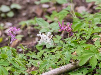
![Tocht Te voet Bad Lippspringe - Rundwanderweg A8 [Bad Lippspringe] - Photo](https://media.geolcdn.com/t/350/260/94d020f6-33f7-44ea-b7b2-78c80cea5a23.jpeg&format=jpg&maxdim=2)
![Te voet Te voet](https://static1.geolcdn.com/sitytour/trail-icons/100.png)
Km
Te voet
![](/images/other/stat-length.png)
![](https://static1.geolcdn.com/siteimages/upload/files/1508320355ic_sort_den_pos_24dp.png)
![](https://static1.geolcdn.com/siteimages/upload/files/1508320355ic_sort_den_neg_24dp.png)
![](https://static1.geolcdn.com/siteimages/upload/files/16400158638029165_repeat_loop_refresh_sync_direction_icon.png)
• Trail created by Egegebirgsverein.
![Tocht Te voet Bad Lippspringe - Wanderroute A7 (Bad Lippspringe) - Photo](https://media.geolcdn.com/t/350/260/6c766745-8769-46fc-8766-07bfd8a24036.jpeg&format=jpg&maxdim=2)
![Te voet Te voet](https://static1.geolcdn.com/sitytour/trail-icons/100.png)
Km
Te voet
![](/images/other/stat-length.png)
![](https://static1.geolcdn.com/siteimages/upload/files/1508320355ic_sort_den_pos_24dp.png)
![](https://static1.geolcdn.com/siteimages/upload/files/1508320355ic_sort_den_neg_24dp.png)
![](https://static1.geolcdn.com/siteimages/upload/files/16400158638029165_repeat_loop_refresh_sync_direction_icon.png)
• Trail created by Eggegebirgsverein. Symbol: white text "A7" on black background
![Tocht Te voet Bad Lippspringe - Rundwanderweg Möllenberg [Hindahls Kreuz] - Photo](https://media.geolcdn.com/t/350/260/6c766745-8769-46fc-8766-07bfd8a24036.jpeg&format=jpg&maxdim=2)
![Te voet Te voet](https://static1.geolcdn.com/sitytour/trail-icons/100.png)
Km
Te voet
![](/images/other/stat-length.png)
![](https://static1.geolcdn.com/siteimages/upload/files/1508320355ic_sort_den_pos_24dp.png)
![](https://static1.geolcdn.com/siteimages/upload/files/1508320355ic_sort_den_neg_24dp.png)
![](https://static1.geolcdn.com/siteimages/upload/files/16400158638029165_repeat_loop_refresh_sync_direction_icon.png)
• Trail created by Stadt Paderborn.
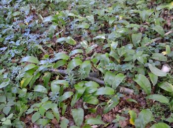
![Tocht Te voet Bad Lippspringe - Rundwanderweg Ellenberg [Hindahls Kreuz] - Photo](https://media.geolcdn.com/t/350/260/b5d0d3df-b18a-49ce-847b-09c83599e24d.jpeg&format=jpg&maxdim=2)
![Te voet Te voet](https://static1.geolcdn.com/sitytour/trail-icons/100.png)
Km
Te voet
![](/images/other/stat-length.png)
![](https://static1.geolcdn.com/siteimages/upload/files/1508320355ic_sort_den_pos_24dp.png)
![](https://static1.geolcdn.com/siteimages/upload/files/1508320355ic_sort_den_neg_24dp.png)
![](https://static1.geolcdn.com/siteimages/upload/files/16400158638029165_repeat_loop_refresh_sync_direction_icon.png)
• Trail created by Stadt Paderborn.
![Tocht Te voet Bad Lippspringe - Planetenweg Bad Lippspringe - Photo](https://media.geolcdn.com/t/350/260/bb326df9-7264-4a9c-bd29-07a4660a74a4.jpeg&format=jpg&maxdim=2)
![Te voet Te voet](https://static1.geolcdn.com/sitytour/trail-icons/100.png)
Km
Te voet
![](/images/other/stat-length.png)
![](https://static1.geolcdn.com/siteimages/upload/files/1508320355ic_sort_den_pos_24dp.png)
![](https://static1.geolcdn.com/siteimages/upload/files/1508320355ic_sort_den_neg_24dp.png)
![](https://static1.geolcdn.com/siteimages/upload/files/16400158638029165_repeat_loop_refresh_sync_direction_icon.png)
• Trail created by Planetariumsgesellschaft OWL. Symbol: Saturngrafik auf Schildern
![Tocht Te voet Bad Lippspringe - Rundwanderweg A5 [Hindahls Kreuz] - Photo](https://media.geolcdn.com/t/350/260/6c766745-8769-46fc-8766-07bfd8a24036.jpeg&format=jpg&maxdim=2)
![Te voet Te voet](https://static1.geolcdn.com/sitytour/trail-icons/100.png)
Km
Te voet
![](/images/other/stat-length.png)
![](https://static1.geolcdn.com/siteimages/upload/files/1508320355ic_sort_den_pos_24dp.png)
![](https://static1.geolcdn.com/siteimages/upload/files/1508320355ic_sort_den_neg_24dp.png)
![](https://static1.geolcdn.com/siteimages/upload/files/16400158638029165_repeat_loop_refresh_sync_direction_icon.png)
• Trail created by Naturpark Eggegebirge.
![Tocht Te voet Bad Lippspringe - Wanderroute A4 [Hindahls Kreuz / Steinbeke] - Photo](https://media.geolcdn.com/t/350/260/6c766745-8769-46fc-8766-07bfd8a24036.jpeg&format=jpg&maxdim=2)
![Te voet Te voet](https://static1.geolcdn.com/sitytour/trail-icons/100.png)
Km
Te voet
![](/images/other/stat-length.png)
![](https://static1.geolcdn.com/siteimages/upload/files/1508320355ic_sort_den_pos_24dp.png)
![](https://static1.geolcdn.com/siteimages/upload/files/1508320355ic_sort_den_neg_24dp.png)
![](https://static1.geolcdn.com/siteimages/upload/files/16400158638029165_repeat_loop_refresh_sync_direction_icon.png)
• Trail created by Naturpark Eggegebirge.
![Tocht Te voet Bad Lippspringe - Rundwanderweg A3 [Hindahls Kreuz] - Photo](https://media.geolcdn.com/t/350/260/6c766745-8769-46fc-8766-07bfd8a24036.jpeg&format=jpg&maxdim=2)
![Te voet Te voet](https://static1.geolcdn.com/sitytour/trail-icons/100.png)
Km
Te voet
![](/images/other/stat-length.png)
![](https://static1.geolcdn.com/siteimages/upload/files/1508320355ic_sort_den_pos_24dp.png)
![](https://static1.geolcdn.com/siteimages/upload/files/1508320355ic_sort_den_neg_24dp.png)
![](https://static1.geolcdn.com/siteimages/upload/files/16400158638029165_repeat_loop_refresh_sync_direction_icon.png)
• Trail created by Naturpark Eggegebirge.
![Tocht Te voet Bad Lippspringe - U-Wanderroute (Kempen) - Photo](https://media.geolcdn.com/t/350/260/3373c4ee-ec63-4287-93d3-4012117969b2.jpeg&format=jpg&maxdim=2)
![Te voet Te voet](https://static1.geolcdn.com/sitytour/trail-icons/100.png)
Km
Te voet
![](/images/other/stat-length.png)
![](https://static1.geolcdn.com/siteimages/upload/files/1508320355ic_sort_den_pos_24dp.png)
![](https://static1.geolcdn.com/siteimages/upload/files/1508320355ic_sort_den_neg_24dp.png)
![](https://static1.geolcdn.com/siteimages/upload/files/16400158638029165_repeat_loop_refresh_sync_direction_icon.png)
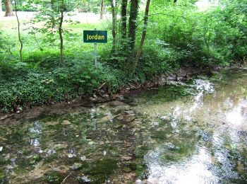
![Tocht Te voet Bad Lippspringe - Rundwanderweg A1 [Steinbeke] - Photo](https://media.geolcdn.com/t/350/260/c38a49a6-988d-47e8-b458-422218964d22.jpeg&format=jpg&maxdim=2)
![Te voet Te voet](https://static1.geolcdn.com/sitytour/trail-icons/100.png)
Km
Te voet
![](/images/other/stat-length.png)
![](https://static1.geolcdn.com/siteimages/upload/files/1508320355ic_sort_den_pos_24dp.png)
![](https://static1.geolcdn.com/siteimages/upload/files/1508320355ic_sort_den_neg_24dp.png)
![](https://static1.geolcdn.com/siteimages/upload/files/16400158638029165_repeat_loop_refresh_sync_direction_icon.png)
![Tocht Te voet Bad Lippspringe - Rundwanderweg A3 [Bauernkamp] - Photo](https://media.geolcdn.com/t/350/260/3373c4ee-ec63-4287-93d3-4012117969b2.jpeg&format=jpg&maxdim=2)
![Te voet Te voet](https://static1.geolcdn.com/sitytour/trail-icons/100.png)
Km
Te voet
![](/images/other/stat-length.png)
![](https://static1.geolcdn.com/siteimages/upload/files/1508320355ic_sort_den_pos_24dp.png)
![](https://static1.geolcdn.com/siteimages/upload/files/1508320355ic_sort_den_neg_24dp.png)
![](https://static1.geolcdn.com/siteimages/upload/files/16400158638029165_repeat_loop_refresh_sync_direction_icon.png)
18 tochten weergegeven op 18
Gratisgps-wandelapplicatie