![](/images/other/stat-length.png)
- Tochten
- Outdoor
- Germany
- Noordrijn-Westfalen
- Kleef
- Wachtendonk
Wachtendonk, Kleef: Top van de beste wandelroutes, trajecten, tochten en wandelingen
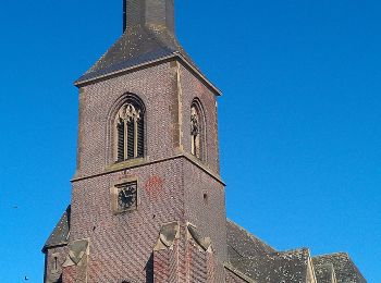
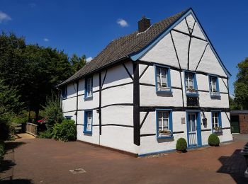
Wachtendonk: Ontdek de beste tochten: 5 te voet. Al deze tochten, trajecten, routes en outdoor activiteiten zijn beschikbaar in onze SityTrail-apps voor smartphones en tablets.
De beste trajecten (5)
![Tocht Te voet Wachtendonk - Rundweg](https://media.geolcdn.com/t/350/260/4d1ecc39-892a-4a40-918c-e6a757afbcf8.jpeg&format=jpg&maxdim=2)
![Te voet Te voet](https://static1.geolcdn.com/sitytour/trail-icons/100.png)
Km
Te voet
![](/images/other/stat-length.png)
![](https://static1.geolcdn.com/siteimages/upload/files/1508320355ic_sort_den_pos_24dp.png)
![](https://static1.geolcdn.com/siteimages/upload/files/1508320355ic_sort_den_neg_24dp.png)
![](https://static1.geolcdn.com/siteimages/upload/files/16400158638029165_repeat_loop_refresh_sync_direction_icon.png)
• Trail created by Naturpark Schwalm-Nette. Symbol: Weißer Text "A3" auf schwarzem Grund
![Tocht Te voet Wachtendonk - Rundweg](https://media.geolcdn.com/t/350/260/31e7471b-86f3-4832-860b-02e50596be4d.jpeg&format=jpg&maxdim=2)
![Te voet Te voet](https://static1.geolcdn.com/sitytour/trail-icons/100.png)
Km
Te voet
![](/images/other/stat-length.png)
![](https://static1.geolcdn.com/siteimages/upload/files/1508320355ic_sort_den_pos_24dp.png)
![](https://static1.geolcdn.com/siteimages/upload/files/1508320355ic_sort_den_neg_24dp.png)
![](https://static1.geolcdn.com/siteimages/upload/files/16400158638029165_repeat_loop_refresh_sync_direction_icon.png)
• Trail created by Naturpark Schwalm-Nette. nur in einer Richtung gezeichnet Symbol: Weißer Text "A7" auf schwarzem G...
![Tocht Te voet Wachtendonk - Rundweg](https://media.geolcdn.com/t/350/260/31e7471b-86f3-4832-860b-02e50596be4d.jpeg&format=jpg&maxdim=2)
![Te voet Te voet](https://static1.geolcdn.com/sitytour/trail-icons/100.png)
Km
Te voet
![](/images/other/stat-length.png)
![](https://static1.geolcdn.com/siteimages/upload/files/1508320355ic_sort_den_pos_24dp.png)
![](https://static1.geolcdn.com/siteimages/upload/files/1508320355ic_sort_den_neg_24dp.png)
![](https://static1.geolcdn.com/siteimages/upload/files/16400158638029165_repeat_loop_refresh_sync_direction_icon.png)
• Trail created by Naturpark Schwalm-Nette. nur in einer Richtung gezeichnet Symbol: Weißer Text "A4" auf schwarzem G...
![Tocht Te voet Wachtendonk - Wankumer Heide Rundweg A13 - Photo](https://media.geolcdn.com/t/350/260/8fb68e9c-f842-4f23-9f41-2353cf569021.jpeg&format=jpg&maxdim=2)
![Te voet Te voet](https://static1.geolcdn.com/sitytour/trail-icons/100.png)
Km
Te voet
![](/images/other/stat-length.png)
![](https://static1.geolcdn.com/siteimages/upload/files/1508320355ic_sort_den_pos_24dp.png)
![](https://static1.geolcdn.com/siteimages/upload/files/1508320355ic_sort_den_neg_24dp.png)
![](https://static1.geolcdn.com/siteimages/upload/files/16400158638029165_repeat_loop_refresh_sync_direction_icon.png)
• Trail created by Verein Niederrhein.
![Tocht Stappen Wachtendonk - Wachtendonk 10,5km - Photo](https://media.geolcdn.com/t/350/260/ext.jpg?maxdim=2&url=https%3A%2F%2Fstatic1.geolcdn.com%2Fsiteimages%2Fupload%2Ffiles%2F1553511878bg_sport_marche.png)
![Stappen Stappen](https://static1.geolcdn.com/sitytour/trail-icons/101.png)
Km
Stappen
![](/images/other/stat-length.png)
![](https://static1.geolcdn.com/siteimages/upload/files/1508320355ic_sort_den_pos_24dp.png)
![](https://static1.geolcdn.com/siteimages/upload/files/1508320355ic_sort_den_neg_24dp.png)
![](https://static1.geolcdn.com/siteimages/upload/files/16400158638029165_repeat_loop_refresh_sync_direction_icon.png)
• More information on : http://www.wandelgidszuidlimburg.com
5 tochten weergegeven op 5
Gratisgps-wandelapplicatie