![](/images/other/stat-length.png)
- Tochten
- Outdoor
- Germany
- Saksen-Anhalt
- Börde
Börde, Saksen-Anhalt: Top van de beste wandelroutes, trajecten, tochten en wandelingen
Börde: Ontdek de beste tochten: 10 te voet. Al deze tochten, trajecten, routes en outdoor activiteiten zijn beschikbaar in onze SityTrail-apps voor smartphones en tablets.
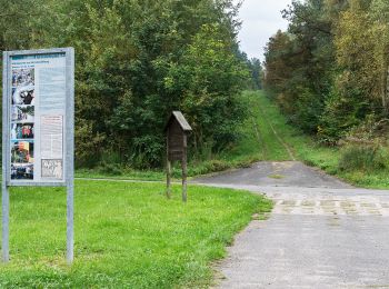
De beste trajecten (10)
![Tocht Te voet Beendorf - Lappwald Rundwanderweg 19 - Photo](https://media.geolcdn.com/t/350/260/2bf3e6f9-52b4-44ec-a147-141bad110d1b.jpeg&format=jpg&maxdim=2)
![Te voet Te voet](https://static1.geolcdn.com/sitytour/trail-icons/100.png)
Km
Te voet
![](/images/other/stat-length.png)
![](https://static1.geolcdn.com/siteimages/upload/files/1508320355ic_sort_den_pos_24dp.png)
![](https://static1.geolcdn.com/siteimages/upload/files/1508320355ic_sort_den_neg_24dp.png)
![](https://static1.geolcdn.com/siteimages/upload/files/16400158638029165_repeat_loop_refresh_sync_direction_icon.png)
• Trail created by Naturpark Elm-Lappwald. Symbol: schwarze 19 auf weißem Quadrat
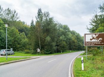
![Tocht Te voet Beendorf - Lappwald Rundwanderweg 18 - Photo](https://media.geolcdn.com/t/350/260/9783ffb9-1fe0-4b38-9f71-7fb6430cc314.jpeg&format=jpg&maxdim=2)
![Te voet Te voet](https://static1.geolcdn.com/sitytour/trail-icons/100.png)
Km
Te voet
![](/images/other/stat-length.png)
![](https://static1.geolcdn.com/siteimages/upload/files/1508320355ic_sort_den_pos_24dp.png)
![](https://static1.geolcdn.com/siteimages/upload/files/1508320355ic_sort_den_neg_24dp.png)
![](https://static1.geolcdn.com/siteimages/upload/files/16400158638029165_repeat_loop_refresh_sync_direction_icon.png)
• Trail created by Naturpark Elm-Lappwald. Symbol: schwarze 18 auf weißem Quadrat
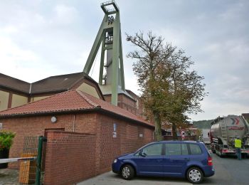
![Tocht Te voet Oebisfelde-Weferlingen - Lappwald Rundwanderweg 14 - Photo](https://media.geolcdn.com/t/350/260/6e1543b3-cd7f-46ca-9c99-985ed19239a9.jpeg&format=jpg&maxdim=2)
![Te voet Te voet](https://static1.geolcdn.com/sitytour/trail-icons/100.png)
Km
Te voet
![](/images/other/stat-length.png)
![](https://static1.geolcdn.com/siteimages/upload/files/1508320355ic_sort_den_pos_24dp.png)
![](https://static1.geolcdn.com/siteimages/upload/files/1508320355ic_sort_den_neg_24dp.png)
![](https://static1.geolcdn.com/siteimages/upload/files/16400158638029165_repeat_loop_refresh_sync_direction_icon.png)
• Trail created by Naturpark Elm-Lappwald. Symbol: schwarze 14 auf weißem Quadrat
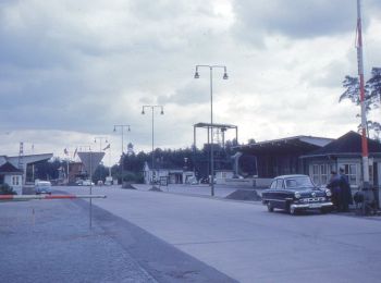
![Tocht Te voet Harbke - Lappwald Rundwanderweg 24 - Photo](https://media.geolcdn.com/t/350/260/5e2cc03e-716e-464f-9bb5-7251531e9e49.jpeg&format=jpg&maxdim=2)
![Te voet Te voet](https://static1.geolcdn.com/sitytour/trail-icons/100.png)
Km
Te voet
![](/images/other/stat-length.png)
![](https://static1.geolcdn.com/siteimages/upload/files/1508320355ic_sort_den_pos_24dp.png)
![](https://static1.geolcdn.com/siteimages/upload/files/1508320355ic_sort_den_neg_24dp.png)
![](https://static1.geolcdn.com/siteimages/upload/files/16400158638029165_repeat_loop_refresh_sync_direction_icon.png)
• Trail created by Naturpark Elm-Lappwald. Symbol: schwarze 24 auf weißem Quadrat
![Tocht Te voet Sommersdorf - Lappwald Rundwanderweg 28 - Photo](https://media.geolcdn.com/t/350/260/7b461665-6a8f-400b-ab8c-65c8d71dc9c4.jpeg&format=jpg&maxdim=2)
![Te voet Te voet](https://static1.geolcdn.com/sitytour/trail-icons/100.png)
Km
Te voet
![](/images/other/stat-length.png)
![](https://static1.geolcdn.com/siteimages/upload/files/1508320355ic_sort_den_pos_24dp.png)
![](https://static1.geolcdn.com/siteimages/upload/files/1508320355ic_sort_den_neg_24dp.png)
![](https://static1.geolcdn.com/siteimages/upload/files/16400158638029165_repeat_loop_refresh_sync_direction_icon.png)
• Trail created by Naturpark Elm-Lappwald. Symbol: schwarze 28 auf weißem Quadrat
![Tocht Te voet Harbke - Lappwald Rundwanderweg 27 - Photo](https://media.geolcdn.com/t/350/260/3f74f975-1e9e-45ec-a545-b2071c368a5b.jpeg&format=jpg&maxdim=2)
![Te voet Te voet](https://static1.geolcdn.com/sitytour/trail-icons/100.png)
Km
Te voet
![](/images/other/stat-length.png)
![](https://static1.geolcdn.com/siteimages/upload/files/1508320355ic_sort_den_pos_24dp.png)
![](https://static1.geolcdn.com/siteimages/upload/files/1508320355ic_sort_den_neg_24dp.png)
![](https://static1.geolcdn.com/siteimages/upload/files/16400158638029165_repeat_loop_refresh_sync_direction_icon.png)
• Trail created by Naturpark Elm-Lappwald. Symbol: schwarze 27 auf weißem Quadrat
![Tocht Te voet Sommersdorf - Lappwald Rundwanderweg 26 - Photo](https://media.geolcdn.com/t/350/260/dfb987a7-961b-4ee0-a2d4-f41d06fb954d.jpeg&format=jpg&maxdim=2)
![Te voet Te voet](https://static1.geolcdn.com/sitytour/trail-icons/100.png)
Km
Te voet
![](/images/other/stat-length.png)
![](https://static1.geolcdn.com/siteimages/upload/files/1508320355ic_sort_den_pos_24dp.png)
![](https://static1.geolcdn.com/siteimages/upload/files/1508320355ic_sort_den_neg_24dp.png)
![](https://static1.geolcdn.com/siteimages/upload/files/16400158638029165_repeat_loop_refresh_sync_direction_icon.png)
• Trail created by Naturpark Elm-Lappwald. Symbol: schwarze 26 auf weißem Quadrat
![Tocht Te voet Oebisfelde-Weferlingen - Lappwald Rundwanderweg 16 - Photo](https://media.geolcdn.com/t/350/260/b5ca48e1-401f-4a48-ad25-8fd40f4f809e.jpeg&format=jpg&maxdim=2)
![Te voet Te voet](https://static1.geolcdn.com/sitytour/trail-icons/100.png)
Km
Te voet
![](/images/other/stat-length.png)
![](https://static1.geolcdn.com/siteimages/upload/files/1508320355ic_sort_den_pos_24dp.png)
![](https://static1.geolcdn.com/siteimages/upload/files/1508320355ic_sort_den_neg_24dp.png)
![](https://static1.geolcdn.com/siteimages/upload/files/16400158638029165_repeat_loop_refresh_sync_direction_icon.png)
• Trail created by Naturpark Elm-Lappwald. Symbol: schwarze 16 auf weißem Quadrat
![Tocht Te voet Oebisfelde-Weferlingen - Lappwald Rundwanderweg 17 - Photo](https://media.geolcdn.com/t/350/260/3b53d28b-7668-4c3c-a4d0-5bdcea838cd6.jpeg&format=jpg&maxdim=2)
![Te voet Te voet](https://static1.geolcdn.com/sitytour/trail-icons/100.png)
Km
Te voet
![](/images/other/stat-length.png)
![](https://static1.geolcdn.com/siteimages/upload/files/1508320355ic_sort_den_pos_24dp.png)
![](https://static1.geolcdn.com/siteimages/upload/files/1508320355ic_sort_den_neg_24dp.png)
![](https://static1.geolcdn.com/siteimages/upload/files/16400158638029165_repeat_loop_refresh_sync_direction_icon.png)
• Trail created by Naturpark Elm-Lappwald. Symbol: schwarze 17 auf weißem Quadrat
![Tocht Te voet Calvörde - Wanderweg Mannhausen (klein) - Photo](https://media.geolcdn.com/t/350/260/ext.jpg?maxdim=2&url=https%3A%2F%2Fstatic1.geolcdn.com%2Fsiteimages%2Fupload%2Ffiles%2F1545311037marcheuse_200dpi.jpg)
![Te voet Te voet](https://static1.geolcdn.com/sitytour/trail-icons/100.png)
Km
Te voet
![](/images/other/stat-length.png)
![](https://static1.geolcdn.com/siteimages/upload/files/1508320355ic_sort_den_pos_24dp.png)
![](https://static1.geolcdn.com/siteimages/upload/files/1508320355ic_sort_den_neg_24dp.png)
![](https://static1.geolcdn.com/siteimages/upload/files/16400158638029165_repeat_loop_refresh_sync_direction_icon.png)
10 tochten weergegeven op 10
Gratisgps-wandelapplicatie