


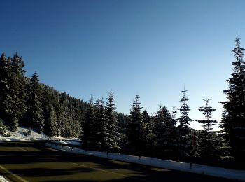
19,5 km | 26 km-effort
Ortenaukreis: Ontdek de beste tochten: 217 te voet en 11 met de fiets of mountainbike. Al deze tochten, trajecten, routes en outdoor activiteiten zijn beschikbaar in onze SityTrail-apps voor smartphones en tablets.
Stappen


Te voet
• Die insgesamt 44 Genießerpfade im Schwarzwald greifen alle ein bestimmtes Genussthema auf. Website: https://www.schw...
Te voet
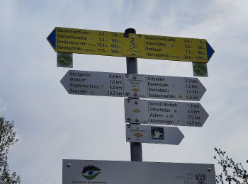
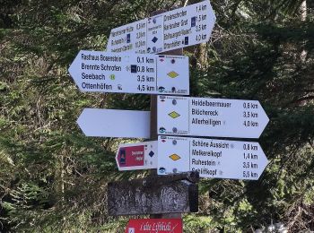
• Symbol: Genießerpfad (Bollenhut)
Te voet
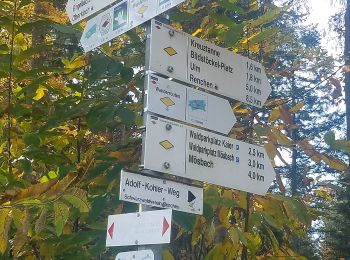
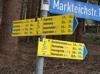
• Trail created by Schwarzwaldverein. Symbol: Liegende gelbe Raute auf weißem Grund
Te voet
• Symbol: Blaue Weintraube in roter Raute auf weißem Grund
Te voet
• Symbol: Blaue Weintraube in roter Raute auf weißem Grund
Te voet
• Trail created by Schwarzwaldverein. Symbol: Liegende gelbe Raute auf weißem Grund
Te voet
• Trail created by Verein für Ortsgeschichte Memprechtshofen.
Te voet
• Trail created by Schwarzwaldverein. Symbol: Liegende gelbe Raute auf weißem Grund
Te voet
• Trail created by Schwarzwaldverein Kehl-Hanauerland e.V..
Te voet
• Trail created by Schwarzwaldverein Kehl-Hanauerland e.V..
Te voet
• Trail created by Schwarzwaldverein. Symbol: Liegende gelbe Raute auf weißem Grund
Te voet
• Trail created by Schwarzwaldverein. Symbol: Liegende gelbe Raute auf weißem Grund
Te voet
• Trail created by Schwarzwaldverein. Symbol: Liegende gelbe Raute auf weißem Grund
Te voet
• Trail created by Schwarzwaldverein. Symbol: Liegende gelbe Raute auf weißem Grund
Te voet
• Trail created by Schwarzwaldverein. Symbol: Liegende gelbe Raute auf weißem Grund
Te voet
• Symbol: Genießerpfad (Bollenhut)
Te voet
• Trail created by Schwarzwaldverein. Symbol: Liegende gelbe Raute auf weißem Grund
Te voet
• Trail created by Gemeinde Schuttertal.
Te voet
• Trail created by Schwarzwaldverein. Symbol: yellow diamond on white
20 tochten weergegeven op 241
Gratisgps-wandelapplicatie
 SityTrail
IGN / Geografische instituten
SityTrail World
De wereld gaat voor u open