![](/images/other/stat-length.png)
- Tochten
- Outdoor
- Germany
- Baden-Württemberg
- Landkreis Ravensburg
Landkreis Ravensburg, Baden-Württemberg: Top van de beste wandelroutes, trajecten, tochten en wandelingen
Landkreis Ravensburg: Ontdek de beste tochten: 46 te voet en 1 met de fiets of mountainbike. Al deze tochten, trajecten, routes en outdoor activiteiten zijn beschikbaar in onze SityTrail-apps voor smartphones en tablets.
De beste trajecten (47)
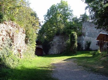
![Tocht Te voet Aitrach - Aitracher Seeweg - Photo](https://media.geolcdn.com/t/350/260/0ed825fe-629f-4cb8-8ce9-a42c557bd563.jpeg&format=jpg&maxdim=2)
![Te voet Te voet](https://static1.geolcdn.com/sitytour/trail-icons/100.png)
Km
Te voet
![](/images/other/stat-length.png)
![](https://static1.geolcdn.com/siteimages/upload/files/1508320355ic_sort_den_pos_24dp.png)
![](https://static1.geolcdn.com/siteimages/upload/files/1508320355ic_sort_den_neg_24dp.png)
![](https://static1.geolcdn.com/siteimages/upload/files/16400158638029165_repeat_loop_refresh_sync_direction_icon.png)
• Trail created by Wanderfreunde Aitrach. Symbol: Holzschilder mit Text (Wanderweg Nummer 4)
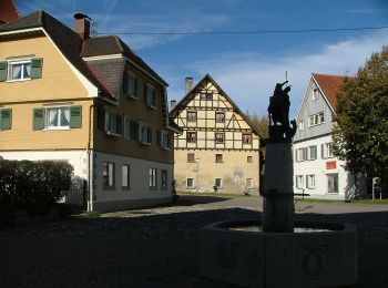
![Tocht Te voet Argenbühl - Wanderung Panoramahöhenweg durch Wald und Flur (Argenbühl: 8) - Photo](https://media.geolcdn.com/t/350/260/6de3db41-f370-497f-aafd-47914aa226bb.jpeg&format=jpg&maxdim=2)
![Te voet Te voet](https://static1.geolcdn.com/sitytour/trail-icons/100.png)
Km
Te voet
![](/images/other/stat-length.png)
![](https://static1.geolcdn.com/siteimages/upload/files/1508320355ic_sort_den_pos_24dp.png)
![](https://static1.geolcdn.com/siteimages/upload/files/1508320355ic_sort_den_neg_24dp.png)
![](https://static1.geolcdn.com/siteimages/upload/files/16400158638029165_repeat_loop_refresh_sync_direction_icon.png)
• Trail created by Argenbühl. Symbol: Weiße 8 auf grünem Hintergrund Website: http://www.argenbuehl.de/index.php?Wan...
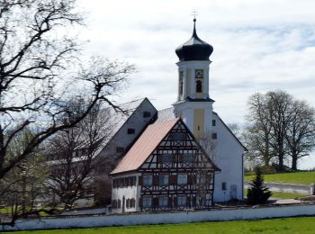
![Tocht Te voet Kißlegg - Kißlegg: W 11 - Photo](https://media.geolcdn.com/t/350/260/70309e82-a8f7-419a-a41c-b2b83c9e6f98.jpeg&format=jpg&maxdim=2)
![Te voet Te voet](https://static1.geolcdn.com/sitytour/trail-icons/100.png)
Km
Te voet
![](/images/other/stat-length.png)
![](https://static1.geolcdn.com/siteimages/upload/files/1508320355ic_sort_den_pos_24dp.png)
![](https://static1.geolcdn.com/siteimages/upload/files/1508320355ic_sort_den_neg_24dp.png)
![](https://static1.geolcdn.com/siteimages/upload/files/16400158638029165_repeat_loop_refresh_sync_direction_icon.png)
• Trail created by Kißlegg. Symbol: Schwarze W 11 auf weißem Hintergrund
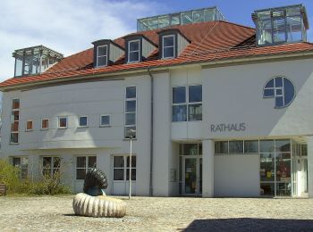
![Tocht Te voet Grünkraut - Rundwanderweg 1 Ortsrunde Gemeinde Grünkraut - Photo](https://media.geolcdn.com/t/350/260/199c5d3a-ed67-4f83-8095-4c30c8deb8f5.jpeg&format=jpg&maxdim=2)
![Te voet Te voet](https://static1.geolcdn.com/sitytour/trail-icons/100.png)
Km
Te voet
![](/images/other/stat-length.png)
![](https://static1.geolcdn.com/siteimages/upload/files/1508320355ic_sort_den_pos_24dp.png)
![](https://static1.geolcdn.com/siteimages/upload/files/1508320355ic_sort_den_neg_24dp.png)
![](https://static1.geolcdn.com/siteimages/upload/files/16400158638029165_repeat_loop_refresh_sync_direction_icon.png)
• Trail created by Gemeinde Grünkraut.
![Tocht Te voet Waldburg - Wanderweg 8 der Gemeinde Waldburg - Photo](https://media.geolcdn.com/t/350/260/e37998ad-ec32-4427-b60c-78135f7e802a.jpeg&format=jpg&maxdim=2)
![Te voet Te voet](https://static1.geolcdn.com/sitytour/trail-icons/100.png)
Km
Te voet
![](/images/other/stat-length.png)
![](https://static1.geolcdn.com/siteimages/upload/files/1508320355ic_sort_den_pos_24dp.png)
![](https://static1.geolcdn.com/siteimages/upload/files/1508320355ic_sort_den_neg_24dp.png)
![](https://static1.geolcdn.com/siteimages/upload/files/16400158638029165_repeat_loop_refresh_sync_direction_icon.png)
• Trail created by Gemeinde Waldburg. Symbol: grünes W8 auf gelbem Grund
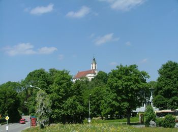
![Tocht Te voet Bodnegg - Rundwanderweg 3 der Gemeinde Bodnegg - Photo](https://media.geolcdn.com/t/350/260/6322cb85-9120-4fb5-b2ea-3e9156101e2a.jpeg&format=jpg&maxdim=2)
![Te voet Te voet](https://static1.geolcdn.com/sitytour/trail-icons/100.png)
Km
Te voet
![](/images/other/stat-length.png)
![](https://static1.geolcdn.com/siteimages/upload/files/1508320355ic_sort_den_pos_24dp.png)
![](https://static1.geolcdn.com/siteimages/upload/files/1508320355ic_sort_den_neg_24dp.png)
![](https://static1.geolcdn.com/siteimages/upload/files/16400158638029165_repeat_loop_refresh_sync_direction_icon.png)
• Trail created by Gemeinde Bodnegg. Symbol: neu: braune Zahl 2 in braunem Ring alt: Pfeilsymbol blau mit Brotfresserf...
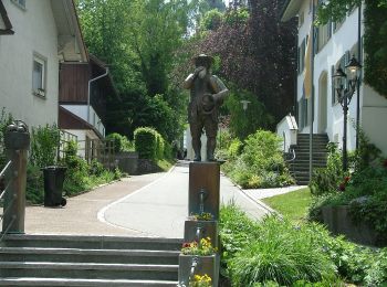
![Tocht Te voet Bodnegg - Rundwanderweg 1 der Gemeinde Bodnegg - Photo](https://media.geolcdn.com/t/350/260/4bd5687c-aa18-424b-b766-107cbddd7980.jpeg&format=jpg&maxdim=2)
![Te voet Te voet](https://static1.geolcdn.com/sitytour/trail-icons/100.png)
Km
Te voet
![](/images/other/stat-length.png)
![](https://static1.geolcdn.com/siteimages/upload/files/1508320355ic_sort_den_pos_24dp.png)
![](https://static1.geolcdn.com/siteimages/upload/files/1508320355ic_sort_den_neg_24dp.png)
![](https://static1.geolcdn.com/siteimages/upload/files/16400158638029165_repeat_loop_refresh_sync_direction_icon.png)
• Trail created by Gemeinde Bodnegg. Symbol: neu: rote Zahl 1 in rotem Ring alt: Pfeilsymbol blau mit Brotfresserfigur...
![Tocht Te voet Grünkraut - Rundwanderweg 5 Gemeinde Grünkraut - Photo](https://media.geolcdn.com/t/350/260/199c5d3a-ed67-4f83-8095-4c30c8deb8f5.jpeg&format=jpg&maxdim=2)
![Te voet Te voet](https://static1.geolcdn.com/sitytour/trail-icons/100.png)
Km
Te voet
![](/images/other/stat-length.png)
![](https://static1.geolcdn.com/siteimages/upload/files/1508320355ic_sort_den_pos_24dp.png)
![](https://static1.geolcdn.com/siteimages/upload/files/1508320355ic_sort_den_neg_24dp.png)
![](https://static1.geolcdn.com/siteimages/upload/files/16400158638029165_repeat_loop_refresh_sync_direction_icon.png)
• Trail created by Gemeinde Grünkraut. Symbol: Ziffer 5, oben und unten gerundeter Pfeil mit Schrift Rundwanderweg Grü...
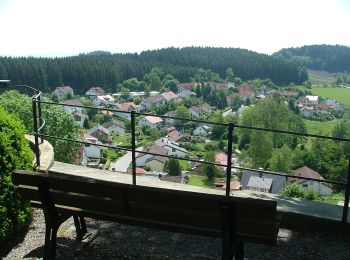
![Tocht Te voet Bodnegg - Rundwanderweg 2 der Gemeinde Bodnegg - Photo](https://media.geolcdn.com/t/350/260/d3d216a8-2119-46fe-9bbf-81601b547ee1.jpeg&format=jpg&maxdim=2)
![Te voet Te voet](https://static1.geolcdn.com/sitytour/trail-icons/100.png)
Km
Te voet
![](/images/other/stat-length.png)
![](https://static1.geolcdn.com/siteimages/upload/files/1508320355ic_sort_den_pos_24dp.png)
![](https://static1.geolcdn.com/siteimages/upload/files/1508320355ic_sort_den_neg_24dp.png)
![](https://static1.geolcdn.com/siteimages/upload/files/16400158638029165_repeat_loop_refresh_sync_direction_icon.png)
• Trail created by Gemeinde Bodnegg. Symbol: neu: grüne Zahl 2 in grünem Ring alt: Pfeilsymbol blau mit Brotfresserfig...
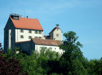
![Tocht Te voet Waldburg - Wanderweg 7 der Gemeinde Waldburg - Photo](https://media.geolcdn.com/t/350/260/114ad953-f94e-47b2-be64-c83ffcb89c3a.jpeg&format=jpg&maxdim=2)
![Te voet Te voet](https://static1.geolcdn.com/sitytour/trail-icons/100.png)
Km
Te voet
![](/images/other/stat-length.png)
![](https://static1.geolcdn.com/siteimages/upload/files/1508320355ic_sort_den_pos_24dp.png)
![](https://static1.geolcdn.com/siteimages/upload/files/1508320355ic_sort_den_neg_24dp.png)
![](https://static1.geolcdn.com/siteimages/upload/files/16400158638029165_repeat_loop_refresh_sync_direction_icon.png)
• Trail created by Gemeinde Waldburg. Symbol: grünes W7 auf gelbem Grund
![Tocht Te voet Grünkraut - Rundwanderweg 7 Gemeinde Grünkraut - Photo](https://media.geolcdn.com/t/350/260/199c5d3a-ed67-4f83-8095-4c30c8deb8f5.jpeg&format=jpg&maxdim=2)
![Te voet Te voet](https://static1.geolcdn.com/sitytour/trail-icons/100.png)
Km
Te voet
![](/images/other/stat-length.png)
![](https://static1.geolcdn.com/siteimages/upload/files/1508320355ic_sort_den_pos_24dp.png)
![](https://static1.geolcdn.com/siteimages/upload/files/1508320355ic_sort_den_neg_24dp.png)
![](https://static1.geolcdn.com/siteimages/upload/files/16400158638029165_repeat_loop_refresh_sync_direction_icon.png)
• Trail created by Gemeinde Grünkraut. Symbol: Ziffer 7, oben und unten gerundeter Pfeil mit Schrift Rundwanderweg Grü...
![Tocht Te voet Grünkraut - Rundwanderweg 2 Gemeinde Grünkraut - Photo](https://media.geolcdn.com/t/350/260/199c5d3a-ed67-4f83-8095-4c30c8deb8f5.jpeg&format=jpg&maxdim=2)
![Te voet Te voet](https://static1.geolcdn.com/sitytour/trail-icons/100.png)
Km
Te voet
![](/images/other/stat-length.png)
![](https://static1.geolcdn.com/siteimages/upload/files/1508320355ic_sort_den_pos_24dp.png)
![](https://static1.geolcdn.com/siteimages/upload/files/1508320355ic_sort_den_neg_24dp.png)
![](https://static1.geolcdn.com/siteimages/upload/files/16400158638029165_repeat_loop_refresh_sync_direction_icon.png)
• Trail created by Gemeinde Grünkraut. Symbol: Ziffer 2, oben und unten gerundeter Pfeil mit Schrift Rundwanderweg Grü...
![Tocht Te voet Wangen im Allgäu - Wanderweg 9 Wangen im Allgäu - Photo](https://media.geolcdn.com/t/350/260/c2db4e21-2a63-4a8f-a16b-ad03541e6899.jpeg&format=jpg&maxdim=2)
![Te voet Te voet](https://static1.geolcdn.com/sitytour/trail-icons/100.png)
Km
Te voet
![](/images/other/stat-length.png)
![](https://static1.geolcdn.com/siteimages/upload/files/1508320355ic_sort_den_pos_24dp.png)
![](https://static1.geolcdn.com/siteimages/upload/files/1508320355ic_sort_den_neg_24dp.png)
![](https://static1.geolcdn.com/siteimages/upload/files/16400158638029165_repeat_loop_refresh_sync_direction_icon.png)
• keiner echten Name?
![Tocht Te voet Wangen im Allgäu - Wanderweg 5 Wangen im Allgäu - Photo](https://media.geolcdn.com/t/350/260/de410b16-b0ff-4236-af55-4c7b888cf055.jpeg&format=jpg&maxdim=2)
![Te voet Te voet](https://static1.geolcdn.com/sitytour/trail-icons/100.png)
Km
Te voet
![](/images/other/stat-length.png)
![](https://static1.geolcdn.com/siteimages/upload/files/1508320355ic_sort_den_pos_24dp.png)
![](https://static1.geolcdn.com/siteimages/upload/files/1508320355ic_sort_den_neg_24dp.png)
![](https://static1.geolcdn.com/siteimages/upload/files/16400158638029165_repeat_loop_refresh_sync_direction_icon.png)
• Trail created by Stadt Wangen im Allgäu.
![Tocht Te voet Aitrach - Aitracher Nestbaumweg - Photo](https://media.geolcdn.com/t/350/260/b1d72b6d-c834-48f1-af53-417be327d141.jpeg&format=jpg&maxdim=2)
![Te voet Te voet](https://static1.geolcdn.com/sitytour/trail-icons/100.png)
Km
Te voet
![](/images/other/stat-length.png)
![](https://static1.geolcdn.com/siteimages/upload/files/1508320355ic_sort_den_pos_24dp.png)
![](https://static1.geolcdn.com/siteimages/upload/files/1508320355ic_sort_den_neg_24dp.png)
![](https://static1.geolcdn.com/siteimages/upload/files/16400158638029165_repeat_loop_refresh_sync_direction_icon.png)
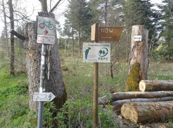
• Trail created by Wanderfreunde Aitrach. Symbol: Holzschilder mit Text NBW (Wanderweg Nummer 2)
![Tocht Te voet Wangen im Allgäu - Wanderweg 4 Wangen im Allgäu - Photo](https://media.geolcdn.com/t/350/260/aab50352-4a81-44a2-9a3d-dd3e3b9cfe0a.jpeg&format=jpg&maxdim=2)
![Te voet Te voet](https://static1.geolcdn.com/sitytour/trail-icons/100.png)
Km
Te voet
![](/images/other/stat-length.png)
![](https://static1.geolcdn.com/siteimages/upload/files/1508320355ic_sort_den_pos_24dp.png)
![](https://static1.geolcdn.com/siteimages/upload/files/1508320355ic_sort_den_neg_24dp.png)
![](https://static1.geolcdn.com/siteimages/upload/files/16400158638029165_repeat_loop_refresh_sync_direction_icon.png)
• Trail created by Stadt Wangen im Allgäu.
![Tocht Te voet Wangen im Allgäu - Halbmarathonstrecke bei Wangen - Photo](https://media.geolcdn.com/t/350/260/aab50352-4a81-44a2-9a3d-dd3e3b9cfe0a.jpeg&format=jpg&maxdim=2)
![Te voet Te voet](https://static1.geolcdn.com/sitytour/trail-icons/100.png)
Km
Te voet
![](/images/other/stat-length.png)
![](https://static1.geolcdn.com/siteimages/upload/files/1508320355ic_sort_den_pos_24dp.png)
![](https://static1.geolcdn.com/siteimages/upload/files/1508320355ic_sort_den_neg_24dp.png)
![](https://static1.geolcdn.com/siteimages/upload/files/16400158638029165_repeat_loop_refresh_sync_direction_icon.png)
• Symbol: roter Fuß
![Tocht Te voet Aitrach - Aitracher Illerweg - Photo](https://media.geolcdn.com/t/350/260/c6df8191-4624-4dea-af83-51fa75ab85c5.jpeg&format=jpg&maxdim=2)
![Te voet Te voet](https://static1.geolcdn.com/sitytour/trail-icons/100.png)
Km
Te voet
![](/images/other/stat-length.png)
![](https://static1.geolcdn.com/siteimages/upload/files/1508320355ic_sort_den_pos_24dp.png)
![](https://static1.geolcdn.com/siteimages/upload/files/1508320355ic_sort_den_neg_24dp.png)
![](https://static1.geolcdn.com/siteimages/upload/files/16400158638029165_repeat_loop_refresh_sync_direction_icon.png)
• Trail created by Wanderfreunde Aitrach. Symbol: Holzschilder mit Text (Wanderweg Nummer 5)
![Tocht Te voet Aitrach - Aitracher Höhenweg - Photo](https://media.geolcdn.com/t/350/260/7355a90a-527c-451a-9719-ca4aeb039ce6.jpeg&format=jpg&maxdim=2)
![Te voet Te voet](https://static1.geolcdn.com/sitytour/trail-icons/100.png)
Km
Te voet
![](/images/other/stat-length.png)
![](https://static1.geolcdn.com/siteimages/upload/files/1508320355ic_sort_den_pos_24dp.png)
![](https://static1.geolcdn.com/siteimages/upload/files/1508320355ic_sort_den_neg_24dp.png)
![](https://static1.geolcdn.com/siteimages/upload/files/16400158638029165_repeat_loop_refresh_sync_direction_icon.png)
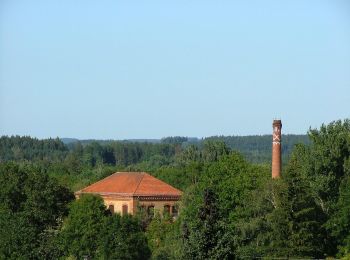
• Trail created by Wanderfreunde Aitrach. Symbol: Holzschilder mit Text AHW oder Aitracher Höhenweg (Wanderweg Nummer 1)
![Tocht Te voet Bad Wurzach - 5-Seen-Wanderung - Photo](https://media.geolcdn.com/t/350/260/1479d498-4115-4402-942a-0ab8b3ad5350.jpeg&format=jpg&maxdim=2)
![Te voet Te voet](https://static1.geolcdn.com/sitytour/trail-icons/100.png)
Km
Te voet
![](/images/other/stat-length.png)
![](https://static1.geolcdn.com/siteimages/upload/files/1508320355ic_sort_den_pos_24dp.png)
![](https://static1.geolcdn.com/siteimages/upload/files/1508320355ic_sort_den_neg_24dp.png)
![](https://static1.geolcdn.com/siteimages/upload/files/16400158638029165_repeat_loop_refresh_sync_direction_icon.png)
• Trail created by Gemeinde Bad Wurzach. Symbol: White number on red background with rounded corners
20 tochten weergegeven op 47
Gratisgps-wandelapplicatie