![](/images/other/stat-length.png)
Waldhof, Onbekend: Top van de beste wandelroutes, trajecten, tochten en wandelingen
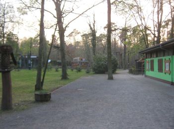
Waldhof: Ontdek de beste tochten: 9 te voet. Al deze tochten, trajecten, routes en outdoor activiteiten zijn beschikbaar in onze SityTrail-apps voor smartphones en tablets.
De beste trajecten (9)
![Tocht Te voet Onbekend - Rundweg 6, Kugelfangweg - Photo](https://media.geolcdn.com/t/350/260/9a596df5-aac4-42ee-ab97-e5c2c84f8c63.jpeg&format=jpg&maxdim=2)
![Te voet Te voet](https://static1.geolcdn.com/sitytour/trail-icons/100.png)
Km
Te voet
![](/images/other/stat-length.png)
![](https://static1.geolcdn.com/siteimages/upload/files/1508320355ic_sort_den_pos_24dp.png)
![](https://static1.geolcdn.com/siteimages/upload/files/1508320355ic_sort_den_neg_24dp.png)
![](https://static1.geolcdn.com/siteimages/upload/files/16400158638029165_repeat_loop_refresh_sync_direction_icon.png)
• Trail created by Geo-Naturpark Bergstraße-Odenwald e.V.. Symbol: Yellow 6 in yellow circle
![Tocht Te voet Onbekend - Rundweg 5, Waldschulweg - Photo](https://media.geolcdn.com/t/350/260/9a596df5-aac4-42ee-ab97-e5c2c84f8c63.jpeg&format=jpg&maxdim=2)
![Te voet Te voet](https://static1.geolcdn.com/sitytour/trail-icons/100.png)
Km
Te voet
![](/images/other/stat-length.png)
![](https://static1.geolcdn.com/siteimages/upload/files/1508320355ic_sort_den_pos_24dp.png)
![](https://static1.geolcdn.com/siteimages/upload/files/1508320355ic_sort_den_neg_24dp.png)
![](https://static1.geolcdn.com/siteimages/upload/files/16400158638029165_repeat_loop_refresh_sync_direction_icon.png)
• Trail created by Geo-Naturpark Bergstraße-Odenwald e.V.. Symbol: Yellow 5 in yellow circle
![Tocht Te voet Onbekend - Rundweg 3, Dünenweg - Photo](https://media.geolcdn.com/t/350/260/6f1ef17d-bbc3-4fcd-aeb3-082e6cba05eb.jpeg&format=jpg&maxdim=2)
![Te voet Te voet](https://static1.geolcdn.com/sitytour/trail-icons/100.png)
Km
Te voet
![](/images/other/stat-length.png)
![](https://static1.geolcdn.com/siteimages/upload/files/1508320355ic_sort_den_pos_24dp.png)
![](https://static1.geolcdn.com/siteimages/upload/files/1508320355ic_sort_den_neg_24dp.png)
![](https://static1.geolcdn.com/siteimages/upload/files/16400158638029165_repeat_loop_refresh_sync_direction_icon.png)
• Trail created by Geo-Naturpark Bergstraße-Odenwald e.V.. Symbol: Yellow 3 in yellow circle
![Tocht Te voet Onbekend - Rundweg 2, Buckelalleeweg - Photo](https://media.geolcdn.com/t/350/260/6b68e678-53ac-407d-8dee-955ad97be3ca.jpeg&format=jpg&maxdim=2)
![Te voet Te voet](https://static1.geolcdn.com/sitytour/trail-icons/100.png)
Km
Te voet
![](/images/other/stat-length.png)
![](https://static1.geolcdn.com/siteimages/upload/files/1508320355ic_sort_den_pos_24dp.png)
![](https://static1.geolcdn.com/siteimages/upload/files/1508320355ic_sort_den_neg_24dp.png)
![](https://static1.geolcdn.com/siteimages/upload/files/16400158638029165_repeat_loop_refresh_sync_direction_icon.png)
• Trail created by Geo-Naturpark Bergstraße-Odenwald e.V.. Symbol: Yellow 2 in yellow circle
![Tocht Te voet Onbekend - Rundweg 1, Frondweg - Photo](https://media.geolcdn.com/t/350/260/6b68e678-53ac-407d-8dee-955ad97be3ca.jpeg&format=jpg&maxdim=2)
![Te voet Te voet](https://static1.geolcdn.com/sitytour/trail-icons/100.png)
Km
Te voet
![](/images/other/stat-length.png)
![](https://static1.geolcdn.com/siteimages/upload/files/1508320355ic_sort_den_pos_24dp.png)
![](https://static1.geolcdn.com/siteimages/upload/files/1508320355ic_sort_den_neg_24dp.png)
![](https://static1.geolcdn.com/siteimages/upload/files/16400158638029165_repeat_loop_refresh_sync_direction_icon.png)
• Trail created by Geo-Naturpark Bergstraße-Odenwald e.V.. Symbol: Yellow 1 in yellow circle
![Tocht Te voet Onbekend - Rundweg 4, Wasserwerkweg - Photo](https://media.geolcdn.com/t/350/260/1e922d0e-2d55-4c93-842f-53069a76c48d.jpeg&format=jpg&maxdim=2)
![Te voet Te voet](https://static1.geolcdn.com/sitytour/trail-icons/100.png)
Km
Te voet
![](/images/other/stat-length.png)
![](https://static1.geolcdn.com/siteimages/upload/files/1508320355ic_sort_den_pos_24dp.png)
![](https://static1.geolcdn.com/siteimages/upload/files/1508320355ic_sort_den_neg_24dp.png)
![](https://static1.geolcdn.com/siteimages/upload/files/16400158638029165_repeat_loop_refresh_sync_direction_icon.png)
• Trail created by Geo-Naturpark Bergstraße-Odenwald e.V.. Symbol: Yellow 4 in yellow circle
![Tocht Te voet Onbekend - Rundweg 7, Schützenhausweg - Photo](https://media.geolcdn.com/t/350/260/6b68e678-53ac-407d-8dee-955ad97be3ca.jpeg&format=jpg&maxdim=2)
![Te voet Te voet](https://static1.geolcdn.com/sitytour/trail-icons/100.png)
Km
Te voet
![](/images/other/stat-length.png)
![](https://static1.geolcdn.com/siteimages/upload/files/1508320355ic_sort_den_pos_24dp.png)
![](https://static1.geolcdn.com/siteimages/upload/files/1508320355ic_sort_den_neg_24dp.png)
![](https://static1.geolcdn.com/siteimages/upload/files/16400158638029165_repeat_loop_refresh_sync_direction_icon.png)
• Trail created by Geo-Naturpark Bergstraße-Odenwald e.V.. Symbol: Yellow 7 in yellow circle
![Tocht Te voet Onbekend - Rundweg 9, Heideweg (aufgegeben) - Photo](https://media.geolcdn.com/t/350/260/650f771d-c883-4649-9e51-ad38d435a983.jpeg&format=jpg&maxdim=2)
![Te voet Te voet](https://static1.geolcdn.com/sitytour/trail-icons/100.png)
Km
Te voet
![](/images/other/stat-length.png)
![](https://static1.geolcdn.com/siteimages/upload/files/1508320355ic_sort_den_pos_24dp.png)
![](https://static1.geolcdn.com/siteimages/upload/files/1508320355ic_sort_den_neg_24dp.png)
![](https://static1.geolcdn.com/siteimages/upload/files/16400158638029165_repeat_loop_refresh_sync_direction_icon.png)
• wird auf hessischer Seite nicht mehr gepflegt und wurde deshalb komplett aufgegeben Symbol: Yellow 9 in yellow circle
![Tocht Te voet Onbekend - Rundweg 8, Vogelstangweg - Photo](https://media.geolcdn.com/t/350/260/6f1ef17d-bbc3-4fcd-aeb3-082e6cba05eb.jpeg&format=jpg&maxdim=2)
![Te voet Te voet](https://static1.geolcdn.com/sitytour/trail-icons/100.png)
Km
Te voet
![](/images/other/stat-length.png)
![](https://static1.geolcdn.com/siteimages/upload/files/1508320355ic_sort_den_pos_24dp.png)
![](https://static1.geolcdn.com/siteimages/upload/files/1508320355ic_sort_den_neg_24dp.png)
![](https://static1.geolcdn.com/siteimages/upload/files/16400158638029165_repeat_loop_refresh_sync_direction_icon.png)
• Trail created by Geo-Naturpark Bergstraße-Odenwald e.V.. Symbol: yellow 8 in yellow circle
9 tochten weergegeven op 9
Gratisgps-wandelapplicatie