![](/images/other/stat-length.png)
- Tochten
- Outdoor
- Germany
- Baden-Württemberg
- Landkreis Ludwigsburg
Landkreis Ludwigsburg, Baden-Württemberg: Top van de beste wandelroutes, trajecten, tochten en wandelingen
Landkreis Ludwigsburg: Ontdek de beste tochten: 62 te voet en 1 met de fiets of mountainbike. Al deze tochten, trajecten, routes en outdoor activiteiten zijn beschikbaar in onze SityTrail-apps voor smartphones en tablets.
De beste trajecten (63)
![Tocht Te voet Sachsenheim - Weitblickweg Hohenhaslach - Photo](https://media.geolcdn.com/t/350/260/73a964b1-a005-48ed-b878-27938e88a5ff.jpeg&format=jpg&maxdim=2)
![Te voet Te voet](https://static1.geolcdn.com/sitytour/trail-icons/100.png)
Km
Te voet
![](/images/other/stat-length.png)
![](https://static1.geolcdn.com/siteimages/upload/files/1508320355ic_sort_den_pos_24dp.png)
![](https://static1.geolcdn.com/siteimages/upload/files/1508320355ic_sort_den_neg_24dp.png)
![](https://static1.geolcdn.com/siteimages/upload/files/16400158638029165_repeat_loop_refresh_sync_direction_icon.png)
• Website: https://www.weitblickweg.de/
![Tocht Te voet Hessigheim - Neckarhöhen - Photo](https://media.geolcdn.com/t/350/260/4f8b40f3-92f6-41d6-bd04-fae811183b0a.jpeg&format=jpg&maxdim=2)
![Te voet Te voet](https://static1.geolcdn.com/sitytour/trail-icons/100.png)
Km
Te voet
![](/images/other/stat-length.png)
![](https://static1.geolcdn.com/siteimages/upload/files/1508320355ic_sort_den_pos_24dp.png)
![](https://static1.geolcdn.com/siteimages/upload/files/1508320355ic_sort_den_neg_24dp.png)
![](https://static1.geolcdn.com/siteimages/upload/files/16400158638029165_repeat_loop_refresh_sync_direction_icon.png)
• Trail created by 3B-Tourismus-Team Bietigheim-Bissingen. Symbol: weißer Rotmilan auf blauem Grund
![Tocht Te voet Kirchheim am Neckar - Weinterrassen - Photo](https://media.geolcdn.com/t/350/260/35ba73c6-5a71-4f63-bf37-f4aa5f37458e.jpeg&format=jpg&maxdim=2)
![Te voet Te voet](https://static1.geolcdn.com/sitytour/trail-icons/100.png)
Km
Te voet
![](/images/other/stat-length.png)
![](https://static1.geolcdn.com/siteimages/upload/files/1508320355ic_sort_den_pos_24dp.png)
![](https://static1.geolcdn.com/siteimages/upload/files/1508320355ic_sort_den_neg_24dp.png)
![](https://static1.geolcdn.com/siteimages/upload/files/16400158638029165_repeat_loop_refresh_sync_direction_icon.png)
• Trail created by 3B-Tourismus-Team Bietigheim-Bissingen. Symbol: weiß/rotes Weinglas und weißer Zebrastreifen auf ro...
![Tocht Te voet Bönnigheim - Lemberger - Photo](https://media.geolcdn.com/t/350/260/f286ce49-5a5f-4ac3-b719-b48ba6e7cf1c.jpeg&format=jpg&maxdim=2)
![Te voet Te voet](https://static1.geolcdn.com/sitytour/trail-icons/100.png)
Km
Te voet
![](/images/other/stat-length.png)
![](https://static1.geolcdn.com/siteimages/upload/files/1508320355ic_sort_den_pos_24dp.png)
![](https://static1.geolcdn.com/siteimages/upload/files/1508320355ic_sort_den_neg_24dp.png)
![](https://static1.geolcdn.com/siteimages/upload/files/16400158638029165_repeat_loop_refresh_sync_direction_icon.png)
• Trail created by 3B-Tourismus-Team Bietigheim-Bissingen. Symbol: weiße Traube und weiße Flasche auf rotem Grund
![Tocht Te voet Löchgau - Weinsichten - Photo](https://media.geolcdn.com/t/350/260/8aba19e8-6aa1-4f56-bb11-6ef30c3d7192.jpeg&format=jpg&maxdim=2)
![Te voet Te voet](https://static1.geolcdn.com/sitytour/trail-icons/100.png)
Km
Te voet
![](/images/other/stat-length.png)
![](https://static1.geolcdn.com/siteimages/upload/files/1508320355ic_sort_den_pos_24dp.png)
![](https://static1.geolcdn.com/siteimages/upload/files/1508320355ic_sort_den_neg_24dp.png)
![](https://static1.geolcdn.com/siteimages/upload/files/16400158638029165_repeat_loop_refresh_sync_direction_icon.png)
• Trail created by 3B-Tourismus-Team Bietigheim-Bissingen. Symbol: grüne Traube auf weißer Pupille auf grünem Grund
![Tocht Te voet Hessigheim - Felsengarten - Photo](https://media.geolcdn.com/t/350/260/94d1a7db-0b71-43b4-a9cb-da845a33a94e.jpeg&format=jpg&maxdim=2)
![Te voet Te voet](https://static1.geolcdn.com/sitytour/trail-icons/100.png)
Km
Te voet
![](/images/other/stat-length.png)
![](https://static1.geolcdn.com/siteimages/upload/files/1508320355ic_sort_den_pos_24dp.png)
![](https://static1.geolcdn.com/siteimages/upload/files/1508320355ic_sort_den_neg_24dp.png)
![](https://static1.geolcdn.com/siteimages/upload/files/16400158638029165_repeat_loop_refresh_sync_direction_icon.png)
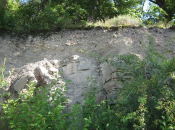
• Trail created by 3B-Tourismus-Team Bietigheim-Bissingen. Symbol: weiße Felsen auf blauem Grund
![Tocht Te voet Besigheim - Flößerweg - Photo](https://media.geolcdn.com/t/350/260/68bfbb0c-c7e8-4e0e-9029-fe8075bb2d6f.jpeg&format=jpg&maxdim=2)
![Te voet Te voet](https://static1.geolcdn.com/sitytour/trail-icons/100.png)
Km
Te voet
![](/images/other/stat-length.png)
![](https://static1.geolcdn.com/siteimages/upload/files/1508320355ic_sort_den_pos_24dp.png)
![](https://static1.geolcdn.com/siteimages/upload/files/1508320355ic_sort_den_neg_24dp.png)
![](https://static1.geolcdn.com/siteimages/upload/files/16400158638029165_repeat_loop_refresh_sync_direction_icon.png)
• Trail created by 3B-Tourismus-Team Bietigheim-Bissingen.
![Tocht Te voet Bietigheim-Bissingen - 3B-Land - Photo](https://media.geolcdn.com/t/350/260/b0eda3da-3b94-4d10-b2c2-152567bb5569.jpeg&format=jpg&maxdim=2)
![Te voet Te voet](https://static1.geolcdn.com/sitytour/trail-icons/100.png)
Km
Te voet
![](/images/other/stat-length.png)
![](https://static1.geolcdn.com/siteimages/upload/files/1508320355ic_sort_den_pos_24dp.png)
![](https://static1.geolcdn.com/siteimages/upload/files/1508320355ic_sort_den_neg_24dp.png)
![](https://static1.geolcdn.com/siteimages/upload/files/16400158638029165_repeat_loop_refresh_sync_direction_icon.png)
• Trail created by 3B-Tourismus-Team Bietigheim-Bissingen. Symbol: grüne 3 mit blauem B auf rotem Punkt auf grünem Grund
![Tocht Te voet Bietigheim-Bissingen - Enztal - Photo](https://media.geolcdn.com/t/350/260/dd1e2e23-3e60-4276-888c-780058dad728.jpeg&format=jpg&maxdim=2)
![Te voet Te voet](https://static1.geolcdn.com/sitytour/trail-icons/100.png)
Km
Te voet
![](/images/other/stat-length.png)
![](https://static1.geolcdn.com/siteimages/upload/files/1508320355ic_sort_den_pos_24dp.png)
![](https://static1.geolcdn.com/siteimages/upload/files/1508320355ic_sort_den_neg_24dp.png)
![](https://static1.geolcdn.com/siteimages/upload/files/16400158638029165_repeat_loop_refresh_sync_direction_icon.png)
• Trail created by 3B-Tourismus-Team Bietigheim-Bissingen. Symbol: 2 weiße Enten auf blauem Grund
![Tocht Te voet Bietigheim-Bissingen - Steillagen - Photo](https://media.geolcdn.com/t/350/260/d13e7358-1d16-4f09-a6ce-003e04ef697f.jpeg&format=jpg&maxdim=2)
![Te voet Te voet](https://static1.geolcdn.com/sitytour/trail-icons/100.png)
Km
Te voet
![](/images/other/stat-length.png)
![](https://static1.geolcdn.com/siteimages/upload/files/1508320355ic_sort_den_pos_24dp.png)
![](https://static1.geolcdn.com/siteimages/upload/files/1508320355ic_sort_den_neg_24dp.png)
![](https://static1.geolcdn.com/siteimages/upload/files/16400158638029165_repeat_loop_refresh_sync_direction_icon.png)
• Trail created by 3B-Tourismus-Team Bietigheim-Bissingen. Symbol: weißer Wanderstiefel auf grünem Grund
![Tocht Te voet Ludwigsburg - Ludwigsburg - Aldingen - Photo](https://media.geolcdn.com/t/350/260/18a799d4-0e72-44a6-95b4-7702eb00aa6f.jpeg&format=jpg&maxdim=2)
![Te voet Te voet](https://static1.geolcdn.com/sitytour/trail-icons/100.png)
Km
Te voet
![](/images/other/stat-length.png)
![](https://static1.geolcdn.com/siteimages/upload/files/1508320355ic_sort_den_pos_24dp.png)
![](https://static1.geolcdn.com/siteimages/upload/files/1508320355ic_sort_den_neg_24dp.png)
![](https://static1.geolcdn.com/siteimages/upload/files/16400158638029165_repeat_loop_refresh_sync_direction_icon.png)
• Trail created by Schwäbischer Albverein.
![Tocht Te voet Ditzingen - DE-Leonberg-Höfingen Glaunhalde - Talmühle - Photo](https://media.geolcdn.com/t/350/260/6f8c3baa-b209-4fd9-99fd-bcb00fca6bf3.jpeg&format=jpg&maxdim=2)
![Te voet Te voet](https://static1.geolcdn.com/sitytour/trail-icons/100.png)
Km
Te voet
![](/images/other/stat-length.png)
![](https://static1.geolcdn.com/siteimages/upload/files/1508320355ic_sort_den_pos_24dp.png)
![](https://static1.geolcdn.com/siteimages/upload/files/1508320355ic_sort_den_neg_24dp.png)
![](https://static1.geolcdn.com/siteimages/upload/files/16400158638029165_repeat_loop_refresh_sync_direction_icon.png)
• Trail created by Schwäbischer Albverein. Leonberg-Höfingen Glaunhalde - Talmühle
![Tocht Te voet Ludwigsburg - DE-SAV Rotes Kreuz, Lemberg-Poppenweiler - Photo](https://media.geolcdn.com/t/350/260/d83aa8a1-cca9-406c-84ad-f0dc20d6461e.jpeg&format=jpg&maxdim=2)
![Te voet Te voet](https://static1.geolcdn.com/sitytour/trail-icons/100.png)
Km
Te voet
![](/images/other/stat-length.png)
![](https://static1.geolcdn.com/siteimages/upload/files/1508320355ic_sort_den_pos_24dp.png)
![](https://static1.geolcdn.com/siteimages/upload/files/1508320355ic_sort_den_neg_24dp.png)
![](https://static1.geolcdn.com/siteimages/upload/files/16400158638029165_repeat_loop_refresh_sync_direction_icon.png)
• Trail created by Schwäbischer Albverein. SAV Rotes Kreuz, Lemberg-Poppenweiler Symbol: Rotes Kreuz auf weissem Grund
![Tocht Te voet Bietigheim-Bissingen - Besen - Photo](https://media.geolcdn.com/t/350/260/3c45a647-3063-49ce-837b-2d560935088a.jpeg&format=jpg&maxdim=2)
![Te voet Te voet](https://static1.geolcdn.com/sitytour/trail-icons/100.png)
Km
Te voet
![](/images/other/stat-length.png)
![](https://static1.geolcdn.com/siteimages/upload/files/1508320355ic_sort_den_pos_24dp.png)
![](https://static1.geolcdn.com/siteimages/upload/files/1508320355ic_sort_den_neg_24dp.png)
![](https://static1.geolcdn.com/siteimages/upload/files/16400158638029165_repeat_loop_refresh_sync_direction_icon.png)
• Trail created by 3B-Tourismus-Team Bietigheim-Bissingen. Symbol: weißer Besen und weißes Rotweinglas auf rotem Grund
![Tocht Te voet Vaihingen an der Enz - VE4 Eselsberg-Rundweg - Photo](https://media.geolcdn.com/t/350/260/9440ab72-c697-499c-a81b-d3877f92bd81.jpeg&format=jpg&maxdim=2)
![Te voet Te voet](https://static1.geolcdn.com/sitytour/trail-icons/100.png)
Km
Te voet
![](/images/other/stat-length.png)
![](https://static1.geolcdn.com/siteimages/upload/files/1508320355ic_sort_den_pos_24dp.png)
![](https://static1.geolcdn.com/siteimages/upload/files/1508320355ic_sort_den_neg_24dp.png)
![](https://static1.geolcdn.com/siteimages/upload/files/16400158638029165_repeat_loop_refresh_sync_direction_icon.png)
• Trail created by Stadt Vaihingen an der Enz.
![Tocht Te voet Vaihingen an der Enz - VE6 Bartenberg-Rundweg - Photo](https://media.geolcdn.com/t/350/260/b0b0a0e5-3ae7-42e5-82fb-d87fe2f4b127.jpeg&format=jpg&maxdim=2)
![Te voet Te voet](https://static1.geolcdn.com/sitytour/trail-icons/100.png)
Km
Te voet
![](/images/other/stat-length.png)
![](https://static1.geolcdn.com/siteimages/upload/files/1508320355ic_sort_den_pos_24dp.png)
![](https://static1.geolcdn.com/siteimages/upload/files/1508320355ic_sort_den_neg_24dp.png)
![](https://static1.geolcdn.com/siteimages/upload/files/16400158638029165_repeat_loop_refresh_sync_direction_icon.png)
• Trail created by Stadt Vaihingen an der Enz.
![Tocht Te voet Eberdingen - DE-SAV Blauer Balken, Vaihingen/Enz - Weissach - Silbertor - Photo](https://media.geolcdn.com/t/350/260/c24efb42-dd27-4cee-9352-2140c35598fd.jpeg&format=jpg&maxdim=2)
![Te voet Te voet](https://static1.geolcdn.com/sitytour/trail-icons/100.png)
Km
Te voet
![](/images/other/stat-length.png)
![](https://static1.geolcdn.com/siteimages/upload/files/1508320355ic_sort_den_pos_24dp.png)
![](https://static1.geolcdn.com/siteimages/upload/files/1508320355ic_sort_den_neg_24dp.png)
![](https://static1.geolcdn.com/siteimages/upload/files/16400158638029165_repeat_loop_refresh_sync_direction_icon.png)
• Trail created by Schwäbischer Albverein. SAV Blauer Balken, Vaihingen/Enz - Weissach - Silbertor Symbol: Blauer Bal...
![Tocht Te voet Vaihingen an der Enz - DE-SAV Blauer Balken, von - nach? - Photo](https://media.geolcdn.com/t/350/260/f9092b76-d924-468e-8943-30b97ac020e3.jpeg&format=jpg&maxdim=2)
![Te voet Te voet](https://static1.geolcdn.com/sitytour/trail-icons/100.png)
Km
Te voet
![](/images/other/stat-length.png)
![](https://static1.geolcdn.com/siteimages/upload/files/1508320355ic_sort_den_pos_24dp.png)
![](https://static1.geolcdn.com/siteimages/upload/files/1508320355ic_sort_den_neg_24dp.png)
![](https://static1.geolcdn.com/siteimages/upload/files/16400158638029165_repeat_loop_refresh_sync_direction_icon.png)
• Trail created by Schwäbischer Albverein. SAV Blauer Balken, von - nach? Symbol: Blauer Balken auf weißem Grund
![Tocht Te voet Markgröningen - DE-SAV Blaues Kreuz, von - nach? - Photo](https://media.geolcdn.com/t/350/260/97c16da8-e676-46a5-8a4a-8d187c17ab5f.jpeg&format=jpg&maxdim=2)
![Te voet Te voet](https://static1.geolcdn.com/sitytour/trail-icons/100.png)
Km
Te voet
![](/images/other/stat-length.png)
![](https://static1.geolcdn.com/siteimages/upload/files/1508320355ic_sort_den_pos_24dp.png)
![](https://static1.geolcdn.com/siteimages/upload/files/1508320355ic_sort_den_neg_24dp.png)
![](https://static1.geolcdn.com/siteimages/upload/files/16400158638029165_repeat_loop_refresh_sync_direction_icon.png)
• Trail created by Schwäbischer Albverein. SAV Blaues Kreuz, von - nach? Symbol: blaues Kreuz auf weissem Grund
![Tocht Te voet Korntal-Münchingen - DE-SAV Roter Punkt, Schwieberdingen - ? - Photo](https://media.geolcdn.com/t/350/260/091f6905-6337-48ff-8c61-4d31e0b22934.jpeg&format=jpg&maxdim=2)
![Te voet Te voet](https://static1.geolcdn.com/sitytour/trail-icons/100.png)
Km
Te voet
![](/images/other/stat-length.png)
![](https://static1.geolcdn.com/siteimages/upload/files/1508320355ic_sort_den_pos_24dp.png)
![](https://static1.geolcdn.com/siteimages/upload/files/1508320355ic_sort_den_neg_24dp.png)
![](https://static1.geolcdn.com/siteimages/upload/files/16400158638029165_repeat_loop_refresh_sync_direction_icon.png)
• Trail created by Schwäbischer Albverein. SAV Roter Punkt, Schwieberdingen - ? Symbol: Roter Punkt auf weißem Grund
20 tochten weergegeven op 63
Gratisgps-wandelapplicatie
Activiteiten
Nabije regio's
- Asperg
- Besigheim
- Bietigheim-Bissingen
- Bönnigheim
- Ditzingen
- Eberdingen
- Erligheim
- Freudental
- Gemmrigheim
- Gerlingen
- Großbottwar
- Hemmingen
- Hessigheim
- Kirchheim am Neckar
- Korntal-Münchingen
- Löchgau
- Ludwigsburg
- Markgröningen
- Mundelsheim
- Oberstenfeld
- Remseck am Neckar
- Sachsenheim
- Schwieberdingen
- Vaihingen an der Enz