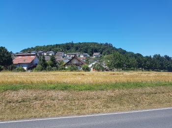
![](/images/other/stat-length.png)
- Tochten
- Outdoor
- Germany
- Baden-Württemberg
- Main-Tauber-Kreis
Main-Tauber-Kreis, Baden-Württemberg: Top van de beste wandelroutes, trajecten, tochten en wandelingen
Main-Tauber-Kreis: Ontdek de beste tochten: 54 te voet. Al deze tochten, trajecten, routes en outdoor activiteiten zijn beschikbaar in onze SityTrail-apps voor smartphones en tablets.
De beste trajecten (54)
![Tocht Te voet Wertheim - Kulturweg Bronnbach Höhefeld - Photo](https://media.geolcdn.com/t/350/260/d419287f-d06a-4f1a-8bf9-699abcc1ffba.jpeg&format=jpg&maxdim=2)
![Te voet Te voet](https://static1.geolcdn.com/sitytour/trail-icons/100.png)
Km
Te voet
![](/images/other/stat-length.png)
![](https://static1.geolcdn.com/siteimages/upload/files/1508320355ic_sort_den_pos_24dp.png)
![](https://static1.geolcdn.com/siteimages/upload/files/1508320355ic_sort_den_neg_24dp.png)
![](https://static1.geolcdn.com/siteimages/upload/files/16400158638029165_repeat_loop_refresh_sync_direction_icon.png)
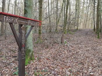
• Trail created by Archäologisches Spessartprojekt. Website: https://www.spessartprojekt.de/kulturwege/bronnbach-gam...
![Tocht Te voet Werbach - Rundwanderweg Gamburg 1 - Photo](https://media.geolcdn.com/t/350/260/bf6f2131-076c-419d-9b06-e72ce843a917.jpeg&format=jpg&maxdim=2)
![Te voet Te voet](https://static1.geolcdn.com/sitytour/trail-icons/100.png)
Km
Te voet
![](/images/other/stat-length.png)
![](https://static1.geolcdn.com/siteimages/upload/files/1508320355ic_sort_den_pos_24dp.png)
![](https://static1.geolcdn.com/siteimages/upload/files/1508320355ic_sort_den_neg_24dp.png)
![](https://static1.geolcdn.com/siteimages/upload/files/16400158638029165_repeat_loop_refresh_sync_direction_icon.png)
• Symbol: zumeist "G1" schwarz auf weißem Schild
![Tocht Te voet Niederstetten - Liebliches Taubertal 24 Vorbach - Photo](https://media.geolcdn.com/t/350/260/b02915de-f11c-4379-88bf-c89e4b85aa5a.jpeg&format=jpg&maxdim=2)
![Te voet Te voet](https://static1.geolcdn.com/sitytour/trail-icons/100.png)
Km
Te voet
![](/images/other/stat-length.png)
![](https://static1.geolcdn.com/siteimages/upload/files/1508320355ic_sort_den_pos_24dp.png)
![](https://static1.geolcdn.com/siteimages/upload/files/1508320355ic_sort_den_neg_24dp.png)
![](https://static1.geolcdn.com/siteimages/upload/files/16400158638029165_repeat_loop_refresh_sync_direction_icon.png)
• Symbol: blaues Schild mit weißer Schrift, in der Mitte durch eine weiße Linie getrennt. Obehalb "LT", darunter "24"
![Tocht Te voet Freudenberg - Liebliches Taubertal 1 - Photo](https://media.geolcdn.com/t/350/260/a1a1ddd0-299d-46dc-a79b-92d4fb751b83.jpeg&format=jpg&maxdim=2)
![Te voet Te voet](https://static1.geolcdn.com/sitytour/trail-icons/100.png)
Km
Te voet
![](/images/other/stat-length.png)
![](https://static1.geolcdn.com/siteimages/upload/files/1508320355ic_sort_den_pos_24dp.png)
![](https://static1.geolcdn.com/siteimages/upload/files/1508320355ic_sort_den_neg_24dp.png)
![](https://static1.geolcdn.com/siteimages/upload/files/16400158638029165_repeat_loop_refresh_sync_direction_icon.png)
• Symbol: blaues Schild mit weißer Schrift, in der Mitte durch eine weiße Linie getrennt. Obehalb "LT", darunter "1" ...
![Tocht Te voet Großrinderfeld - Liebliches Taubertal – Rundwanderweg 8 – Ins Welzbachtal - Photo](https://media.geolcdn.com/t/350/260/1fdb2358-9b1a-47c1-99aa-4a329dd5204c.jpeg&format=jpg&maxdim=2)
![Te voet Te voet](https://static1.geolcdn.com/sitytour/trail-icons/100.png)
Km
Te voet
![](/images/other/stat-length.png)
![](https://static1.geolcdn.com/siteimages/upload/files/1508320355ic_sort_den_pos_24dp.png)
![](https://static1.geolcdn.com/siteimages/upload/files/1508320355ic_sort_den_neg_24dp.png)
![](https://static1.geolcdn.com/siteimages/upload/files/16400158638029165_repeat_loop_refresh_sync_direction_icon.png)
• Trail created by Tourismusverband „Liebliches Taubertal“. Symbol: weißes LT 8 auf blauen Grund Website: https://ww...
![Tocht Te voet Großrinderfeld - Liebliches Taubertal – Rundwanderweg 12 – Bildstöcke und Wegkreuze - Photo](https://media.geolcdn.com/t/350/260/17e3c757-0ae2-43f0-b543-8768a8332dc8.jpeg&format=jpg&maxdim=2)
![Te voet Te voet](https://static1.geolcdn.com/sitytour/trail-icons/100.png)
Km
Te voet
![](/images/other/stat-length.png)
![](https://static1.geolcdn.com/siteimages/upload/files/1508320355ic_sort_den_pos_24dp.png)
![](https://static1.geolcdn.com/siteimages/upload/files/1508320355ic_sort_den_neg_24dp.png)
![](https://static1.geolcdn.com/siteimages/upload/files/16400158638029165_repeat_loop_refresh_sync_direction_icon.png)
• Trail created by Tourismusverband „Liebliches Taubertal“. Symbol: weißes LT 12 auf blauen Grund Website: https://w...
![Tocht Te voet Wertheim - Liebliches Taubertal – Ehemaliger Rundwanderweg 3 – Wein und Glaube - Photo](https://media.geolcdn.com/t/350/260/64281ffd-8dc4-4e28-9991-2cf77bad6a86.jpeg&format=jpg&maxdim=2)
![Te voet Te voet](https://static1.geolcdn.com/sitytour/trail-icons/100.png)
Km
Te voet
![](/images/other/stat-length.png)
![](https://static1.geolcdn.com/siteimages/upload/files/1508320355ic_sort_den_pos_24dp.png)
![](https://static1.geolcdn.com/siteimages/upload/files/1508320355ic_sort_den_neg_24dp.png)
![](https://static1.geolcdn.com/siteimages/upload/files/16400158638029165_repeat_loop_refresh_sync_direction_icon.png)
• Trail created by Tourismusverband „Liebliches Taubertal“. Symbol: weißes LT 3 auf blauen Grund Website: https://ww...
![Tocht Te voet Külsheim - Liebliches Taubertal - Photo](https://media.geolcdn.com/t/350/260/a4aac17d-803e-4ec5-a967-c70042af1b40.jpeg&format=jpg&maxdim=2)
![Te voet Te voet](https://static1.geolcdn.com/sitytour/trail-icons/100.png)
Km
Te voet
![](/images/other/stat-length.png)
![](https://static1.geolcdn.com/siteimages/upload/files/1508320355ic_sort_den_pos_24dp.png)
![](https://static1.geolcdn.com/siteimages/upload/files/1508320355ic_sort_den_neg_24dp.png)
![](https://static1.geolcdn.com/siteimages/upload/files/16400158638029165_repeat_loop_refresh_sync_direction_icon.png)
• Trail created by Tourismusverband „Liebliches Taubertal“. Symbol: weißes LT 4 auf blauen Grund Website: https://ww...
![Tocht Te voet Werbach - Liebliches Taubertal – Rundwanderweg 7 – Muschelkalk und Orchideen - Photo](https://media.geolcdn.com/t/350/260/1fdb2358-9b1a-47c1-99aa-4a329dd5204c.jpeg&format=jpg&maxdim=2)
![Te voet Te voet](https://static1.geolcdn.com/sitytour/trail-icons/100.png)
Km
Te voet
![](/images/other/stat-length.png)
![](https://static1.geolcdn.com/siteimages/upload/files/1508320355ic_sort_den_pos_24dp.png)
![](https://static1.geolcdn.com/siteimages/upload/files/1508320355ic_sort_den_neg_24dp.png)
![](https://static1.geolcdn.com/siteimages/upload/files/16400158638029165_repeat_loop_refresh_sync_direction_icon.png)
• Trail created by Tourismusverband „Liebliches Taubertal“. Symbol: weißes LT 7 auf blauen Grund Website: https://ww...
![Tocht Te voet Werbach - Rundwanderweg Gamburg 6 - Photo](https://media.geolcdn.com/t/350/260/83afd43d-bbd6-4c00-a4de-95dd32ba431b.jpeg&format=jpg&maxdim=2)
![Te voet Te voet](https://static1.geolcdn.com/sitytour/trail-icons/100.png)
Km
Te voet
![](/images/other/stat-length.png)
![](https://static1.geolcdn.com/siteimages/upload/files/1508320355ic_sort_den_pos_24dp.png)
![](https://static1.geolcdn.com/siteimages/upload/files/1508320355ic_sort_den_neg_24dp.png)
![](https://static1.geolcdn.com/siteimages/upload/files/16400158638029165_repeat_loop_refresh_sync_direction_icon.png)
• Symbol: zumeist "G6" schwarz auf weißem Schild
![Tocht Te voet Werbach - Rundwanderweg Gamburg 4 - Photo](https://media.geolcdn.com/t/350/260/83afd43d-bbd6-4c00-a4de-95dd32ba431b.jpeg&format=jpg&maxdim=2)
![Te voet Te voet](https://static1.geolcdn.com/sitytour/trail-icons/100.png)
Km
Te voet
![](/images/other/stat-length.png)
![](https://static1.geolcdn.com/siteimages/upload/files/1508320355ic_sort_den_pos_24dp.png)
![](https://static1.geolcdn.com/siteimages/upload/files/1508320355ic_sort_den_neg_24dp.png)
![](https://static1.geolcdn.com/siteimages/upload/files/16400158638029165_repeat_loop_refresh_sync_direction_icon.png)
• Symbol: zumeist "G4" schwarz auf weißem Schild
![Tocht Te voet Werbach - Rundwanderweg Gamburg 3 - Photo](https://media.geolcdn.com/t/350/260/bf6f2131-076c-419d-9b06-e72ce843a917.jpeg&format=jpg&maxdim=2)
![Te voet Te voet](https://static1.geolcdn.com/sitytour/trail-icons/100.png)
Km
Te voet
![](/images/other/stat-length.png)
![](https://static1.geolcdn.com/siteimages/upload/files/1508320355ic_sort_den_pos_24dp.png)
![](https://static1.geolcdn.com/siteimages/upload/files/1508320355ic_sort_den_neg_24dp.png)
![](https://static1.geolcdn.com/siteimages/upload/files/16400158638029165_repeat_loop_refresh_sync_direction_icon.png)
• Symbol: zumeist "G3" schwarz auf weißem Schild
![Tocht Te voet Werbach - Rundwanderweg Gamburg 2 - Photo](https://media.geolcdn.com/t/350/260/da22b0cf-be0c-4c09-9908-d3b298519672.jpeg&format=jpg&maxdim=2)
![Te voet Te voet](https://static1.geolcdn.com/sitytour/trail-icons/100.png)
Km
Te voet
![](/images/other/stat-length.png)
![](https://static1.geolcdn.com/siteimages/upload/files/1508320355ic_sort_den_pos_24dp.png)
![](https://static1.geolcdn.com/siteimages/upload/files/1508320355ic_sort_den_neg_24dp.png)
![](https://static1.geolcdn.com/siteimages/upload/files/16400158638029165_repeat_loop_refresh_sync_direction_icon.png)
• Symbol: zumeist "G2" schwarz auf weißem Schild
![Tocht Te voet Bad Mergentheim - Wanderweg 14 - Photo](https://media.geolcdn.com/t/350/260/189d946a-134c-4286-80bb-1ab9fdf9a976.jpeg&format=jpg&maxdim=2)
![Te voet Te voet](https://static1.geolcdn.com/sitytour/trail-icons/100.png)
Km
Te voet
![](/images/other/stat-length.png)
![](https://static1.geolcdn.com/siteimages/upload/files/1508320355ic_sort_den_pos_24dp.png)
![](https://static1.geolcdn.com/siteimages/upload/files/1508320355ic_sort_den_neg_24dp.png)
![](https://static1.geolcdn.com/siteimages/upload/files/16400158638029165_repeat_loop_refresh_sync_direction_icon.png)
• Symbol: schwarze 14 auf weißem Grund
![Tocht Te voet Bad Mergentheim - Wanderweg 27 - Photo](https://media.geolcdn.com/t/350/260/c5f9c2b6-27f8-4ab1-b862-9d0027afbd91.jpeg&format=jpg&maxdim=2)
![Te voet Te voet](https://static1.geolcdn.com/sitytour/trail-icons/100.png)
Km
Te voet
![](/images/other/stat-length.png)
![](https://static1.geolcdn.com/siteimages/upload/files/1508320355ic_sort_den_pos_24dp.png)
![](https://static1.geolcdn.com/siteimages/upload/files/1508320355ic_sort_den_neg_24dp.png)
![](https://static1.geolcdn.com/siteimages/upload/files/16400158638029165_repeat_loop_refresh_sync_direction_icon.png)
• Symbol: schwarze 27 auf weißem Grund
![Tocht Te voet Bad Mergentheim - Liebliches Taubertal 15 - Photo](https://media.geolcdn.com/t/350/260/489bae20-f786-4b9c-89f6-a8cea704cf53.jpeg&format=jpg&maxdim=2)
![Te voet Te voet](https://static1.geolcdn.com/sitytour/trail-icons/100.png)
Km
Te voet
![](/images/other/stat-length.png)
![](https://static1.geolcdn.com/siteimages/upload/files/1508320355ic_sort_den_pos_24dp.png)
![](https://static1.geolcdn.com/siteimages/upload/files/1508320355ic_sort_den_neg_24dp.png)
![](https://static1.geolcdn.com/siteimages/upload/files/16400158638029165_repeat_loop_refresh_sync_direction_icon.png)
• Symbol: blaues Schild mit weißer Schrift, in der Mitte durch eine weiße Linie getrennt. Obehalb "LT", darunter "15"
![Tocht Te voet Freudenberg - Rundwanderweg Ebenheid, Eb4, Winnengrund-Weg - Photo](https://media.geolcdn.com/t/350/260/d227ce58-2889-487b-8c66-0c05d20cef6d.jpeg&format=jpg&maxdim=2)
![Te voet Te voet](https://static1.geolcdn.com/sitytour/trail-icons/100.png)
Km
Te voet
![](/images/other/stat-length.png)
![](https://static1.geolcdn.com/siteimages/upload/files/1508320355ic_sort_den_pos_24dp.png)
![](https://static1.geolcdn.com/siteimages/upload/files/1508320355ic_sort_den_neg_24dp.png)
![](https://static1.geolcdn.com/siteimages/upload/files/16400158638029165_repeat_loop_refresh_sync_direction_icon.png)
• Trail created by Geo-Naturpark Bergstraße-Odenwald. Symbol: Weiße "4" im Kreis darüber weißes "Eb"
![Tocht Te voet Freudenberg - Rundwanderweg Ebenheid, Eb2, Hohbusch-Weg - Photo](https://media.geolcdn.com/t/350/260/f4bd72ff-557f-42b8-bbea-87c658ada1d9.jpeg&format=jpg&maxdim=2)
![Te voet Te voet](https://static1.geolcdn.com/sitytour/trail-icons/100.png)
Km
Te voet
![](/images/other/stat-length.png)
![](https://static1.geolcdn.com/siteimages/upload/files/1508320355ic_sort_den_pos_24dp.png)
![](https://static1.geolcdn.com/siteimages/upload/files/1508320355ic_sort_den_neg_24dp.png)
![](https://static1.geolcdn.com/siteimages/upload/files/16400158638029165_repeat_loop_refresh_sync_direction_icon.png)
• Trail created by Geo-Naturpark Bergstraße-Odenwald. Symbol: Weiße "2" im Kreis darüber weißes "Eb"
![Tocht Te voet Freudenberg - Rundwanderweg Wessental, We1, Wildbach-Weg - Photo](https://media.geolcdn.com/t/350/260/11fa59e4-1bfd-4f8c-9bc2-f60c3fabebe3.jpeg&format=jpg&maxdim=2)
![Te voet Te voet](https://static1.geolcdn.com/sitytour/trail-icons/100.png)
Km
Te voet
![](/images/other/stat-length.png)
![](https://static1.geolcdn.com/siteimages/upload/files/1508320355ic_sort_den_pos_24dp.png)
![](https://static1.geolcdn.com/siteimages/upload/files/1508320355ic_sort_den_neg_24dp.png)
![](https://static1.geolcdn.com/siteimages/upload/files/16400158638029165_repeat_loop_refresh_sync_direction_icon.png)
• Trail created by Geo-Naturpark Bergstraße-Odenwald. Symbol: Weiße "1" im Kreis darüber weißes "We"
![Tocht Te voet Freudenberg - Rundwanderweg Boxtal, Bo2, Hossert-Weg - Photo](https://media.geolcdn.com/t/350/260/ab6acd5a-3f98-480b-af95-2be7a0cd7d70.jpeg&format=jpg&maxdim=2)
![Te voet Te voet](https://static1.geolcdn.com/sitytour/trail-icons/100.png)
Km
Te voet
![](/images/other/stat-length.png)
![](https://static1.geolcdn.com/siteimages/upload/files/1508320355ic_sort_den_pos_24dp.png)
![](https://static1.geolcdn.com/siteimages/upload/files/1508320355ic_sort_den_neg_24dp.png)
![](https://static1.geolcdn.com/siteimages/upload/files/16400158638029165_repeat_loop_refresh_sync_direction_icon.png)
• Trail created by Geo-Naturpark Bergstraße-Odenwald. Symbol: Weiße "2" im Kreis darüber weißes "Bo"
20 tochten weergegeven op 54
Gratisgps-wandelapplicatie