![](/images/other/stat-length.png)
- Tochten
- Outdoor
- Germany
- Baden-Württemberg
- Baden-Baden
Baden-Baden, Baden-Württemberg: Top van de beste wandelroutes, trajecten, tochten en wandelingen
Baden-Baden: Ontdek de beste tochten: 42 te voet. Al deze tochten, trajecten, routes en outdoor activiteiten zijn beschikbaar in onze SityTrail-apps voor smartphones en tablets.
De beste trajecten (45)
![Tocht Te voet - Yburg Rundweg - Photo](https://media.geolcdn.com/t/350/260/9465470a-9321-4702-8d92-bf53a6692fd2.jpeg&format=jpg&maxdim=2)
![Te voet Te voet](https://static1.geolcdn.com/sitytour/trail-icons/100.png)
Km
Te voet
![](/images/other/stat-length.png)
![](https://static1.geolcdn.com/siteimages/upload/files/1508320355ic_sort_den_pos_24dp.png)
![](https://static1.geolcdn.com/siteimages/upload/files/1508320355ic_sort_den_neg_24dp.png)
![](https://static1.geolcdn.com/siteimages/upload/files/16400158638029165_repeat_loop_refresh_sync_direction_icon.png)
• Wandern im Rebland Website: https://visit.baden-baden.de/media/touren/yburg-rundweg
![Tocht Te voet - AugenBlickrunde Baden-Baden-Neuweier - Photo](https://media.geolcdn.com/t/350/260/d1172795-6511-4e52-b758-160061946c72.jpeg&format=jpg&maxdim=2)
![Te voet Te voet](https://static1.geolcdn.com/sitytour/trail-icons/100.png)
Km
Te voet
![](/images/other/stat-length.png)
![](https://static1.geolcdn.com/siteimages/upload/files/1508320355ic_sort_den_pos_24dp.png)
![](https://static1.geolcdn.com/siteimages/upload/files/1508320355ic_sort_den_neg_24dp.png)
![](https://static1.geolcdn.com/siteimages/upload/files/16400158638029165_repeat_loop_refresh_sync_direction_icon.png)
• Trail created by Stadt Baden-Baden. Website: https://www.naturpark-augenblicke.de/augenblicke/badenbaden.html
![Tocht Te voet - Sandglöckchenweg - Photo](https://media.geolcdn.com/t/350/260/e9e4ca25-21d9-467f-9a63-5d7a2af07fea.jpeg&format=jpg&maxdim=2)
![Te voet Te voet](https://static1.geolcdn.com/sitytour/trail-icons/100.png)
Km
Te voet
![](/images/other/stat-length.png)
![](https://static1.geolcdn.com/siteimages/upload/files/1508320355ic_sort_den_pos_24dp.png)
![](https://static1.geolcdn.com/siteimages/upload/files/1508320355ic_sort_den_neg_24dp.png)
![](https://static1.geolcdn.com/siteimages/upload/files/16400158638029165_repeat_loop_refresh_sync_direction_icon.png)
• Symbol: 3 blaue Sandglöckchen
![Tocht Te voet - Schartenberg-Rundweg - Photo](https://media.geolcdn.com/t/350/260/ecc99695-d39c-4f25-835c-9ea6c2afc47b.jpeg&format=jpg&maxdim=2)
![Te voet Te voet](https://static1.geolcdn.com/sitytour/trail-icons/100.png)
Km
Te voet
![](/images/other/stat-length.png)
![](https://static1.geolcdn.com/siteimages/upload/files/1508320355ic_sort_den_pos_24dp.png)
![](https://static1.geolcdn.com/siteimages/upload/files/1508320355ic_sort_den_neg_24dp.png)
![](https://static1.geolcdn.com/siteimages/upload/files/16400158638029165_repeat_loop_refresh_sync_direction_icon.png)
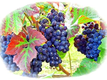
• Wanderung durch die Weinberge Neuweiers. Website: https://www.baden-baden.com/media/touren/schartenberg-rundweg
![Tocht Te voet - Am Froschbach - Am Urbach - Photo](https://media.geolcdn.com/t/350/260/822c358c-9ebc-4500-af5c-9a6c2c3c1dad.jpeg&format=jpg&maxdim=2)
![Te voet Te voet](https://static1.geolcdn.com/sitytour/trail-icons/100.png)
Km
Te voet
![](/images/other/stat-length.png)
![](https://static1.geolcdn.com/siteimages/upload/files/1508320355ic_sort_den_pos_24dp.png)
![](https://static1.geolcdn.com/siteimages/upload/files/1508320355ic_sort_den_neg_24dp.png)
![](https://static1.geolcdn.com/siteimages/upload/files/16400158638029165_repeat_loop_refresh_sync_direction_icon.png)
• Trail created by Stadt Baden-Baden. Symbol: Liegende gelbe Raute auf weißem Grund
![Tocht Te voet - Kreuzfelsen-Rundweg - Photo](https://media.geolcdn.com/t/350/260/f9dace17-edc3-438b-97fc-f5c4b4d7572a.jpeg&format=jpg&maxdim=2)
![Te voet Te voet](https://static1.geolcdn.com/sitytour/trail-icons/100.png)
Km
Te voet
![](/images/other/stat-length.png)
![](https://static1.geolcdn.com/siteimages/upload/files/1508320355ic_sort_den_pos_24dp.png)
![](https://static1.geolcdn.com/siteimages/upload/files/1508320355ic_sort_den_neg_24dp.png)
![](https://static1.geolcdn.com/siteimages/upload/files/16400158638029165_repeat_loop_refresh_sync_direction_icon.png)
• Wandeurng zum Aussichtspunkt Dreiburgenblick am Kreuzfelsen Website: https://visit.baden-baden.de/media/touren/kreuz...
![Tocht Te voet - Einmündung Littersbach - Bernickel - Photo](https://media.geolcdn.com/t/350/260/bea8d541-e7ea-450b-a556-e23b7df34437.jpeg&format=jpg&maxdim=2)
![Te voet Te voet](https://static1.geolcdn.com/sitytour/trail-icons/100.png)
Km
Te voet
![](/images/other/stat-length.png)
![](https://static1.geolcdn.com/siteimages/upload/files/1508320355ic_sort_den_pos_24dp.png)
![](https://static1.geolcdn.com/siteimages/upload/files/1508320355ic_sort_den_neg_24dp.png)
![](https://static1.geolcdn.com/siteimages/upload/files/16400158638029165_repeat_loop_refresh_sync_direction_icon.png)
• Trail created by Stadt Baden-Baden. Symbol: Liegende gelbe Raute auf weißem Grund
![Tocht Te voet - Ebersteinburg-Rundweg - Photo](https://media.geolcdn.com/t/350/260/f643df66-7945-4966-9111-c1873db1eaf8.jpeg&format=jpg&maxdim=2)
![Te voet Te voet](https://static1.geolcdn.com/sitytour/trail-icons/100.png)
Km
Te voet
![](/images/other/stat-length.png)
![](https://static1.geolcdn.com/siteimages/upload/files/1508320355ic_sort_den_pos_24dp.png)
![](https://static1.geolcdn.com/siteimages/upload/files/1508320355ic_sort_den_neg_24dp.png)
![](https://static1.geolcdn.com/siteimages/upload/files/16400158638029165_repeat_loop_refresh_sync_direction_icon.png)
• Perfekter Galerie- und Höhenweg: Der Premiumweg Ebersteinburg-Rundwanderweg begeistert mit sensationellen Ausblicken ...
![Tocht Te voet - Zimmerplatz - Bildeiche - Photo](https://media.geolcdn.com/t/350/260/d36c0341-f6bb-4a42-a8d2-35e91d9bea23.jpeg&format=jpg&maxdim=2)
![Te voet Te voet](https://static1.geolcdn.com/sitytour/trail-icons/100.png)
Km
Te voet
![](/images/other/stat-length.png)
![](https://static1.geolcdn.com/siteimages/upload/files/1508320355ic_sort_den_pos_24dp.png)
![](https://static1.geolcdn.com/siteimages/upload/files/1508320355ic_sort_den_neg_24dp.png)
![](https://static1.geolcdn.com/siteimages/upload/files/16400158638029165_repeat_loop_refresh_sync_direction_icon.png)
• Symbol: Liegende gelbe Raute auf weißem Grund
![Tocht Te voet - Oostalzugang Ost - Rote Lache - Photo](https://media.geolcdn.com/t/350/260/a590b01a-ee10-4d9f-beb6-8980dc73ca0d.jpeg&format=jpg&maxdim=2)
![Te voet Te voet](https://static1.geolcdn.com/sitytour/trail-icons/100.png)
Km
Te voet
![](/images/other/stat-length.png)
![](https://static1.geolcdn.com/siteimages/upload/files/1508320355ic_sort_den_pos_24dp.png)
![](https://static1.geolcdn.com/siteimages/upload/files/1508320355ic_sort_den_neg_24dp.png)
![](https://static1.geolcdn.com/siteimages/upload/files/16400158638029165_repeat_loop_refresh_sync_direction_icon.png)
• Trail created by Stadt Baden-Baden. Symbol: Liegende gelbe Raute auf weißem Grund
![Tocht Te voet - Oostal Rundweg - Photo](https://media.geolcdn.com/t/350/260/f6dc3586-d17b-471d-9820-7fdb503f90c7.jpeg&format=jpg&maxdim=2)
![Te voet Te voet](https://static1.geolcdn.com/sitytour/trail-icons/100.png)
Km
Te voet
![](/images/other/stat-length.png)
![](https://static1.geolcdn.com/siteimages/upload/files/1508320355ic_sort_den_pos_24dp.png)
![](https://static1.geolcdn.com/siteimages/upload/files/1508320355ic_sort_den_neg_24dp.png)
![](https://static1.geolcdn.com/siteimages/upload/files/16400158638029165_repeat_loop_refresh_sync_direction_icon.png)
• kurze Variante nur bis Querwegbücke 3,7 km
![Tocht Te voet - Rehgarten Rundweg - Photo](https://media.geolcdn.com/t/350/260/bab156c0-31c8-4076-8528-62ab4461ec9b.jpeg&format=jpg&maxdim=2)
![Te voet Te voet](https://static1.geolcdn.com/sitytour/trail-icons/100.png)
Km
Te voet
![](/images/other/stat-length.png)
![](https://static1.geolcdn.com/siteimages/upload/files/1508320355ic_sort_den_pos_24dp.png)
![](https://static1.geolcdn.com/siteimages/upload/files/1508320355ic_sort_den_neg_24dp.png)
![](https://static1.geolcdn.com/siteimages/upload/files/16400158638029165_repeat_loop_refresh_sync_direction_icon.png)
• Trail created by Stadt Baden-Baden.
![Tocht Te voet - Weinweg Eckberg/Schafberg - Photo](https://media.geolcdn.com/t/350/260/772f91b0-f13c-4626-b3a1-146449a3abc4.jpeg&format=jpg&maxdim=2)
![Te voet Te voet](https://static1.geolcdn.com/sitytour/trail-icons/100.png)
Km
Te voet
![](/images/other/stat-length.png)
![](https://static1.geolcdn.com/siteimages/upload/files/1508320355ic_sort_den_pos_24dp.png)
![](https://static1.geolcdn.com/siteimages/upload/files/1508320355ic_sort_den_neg_24dp.png)
![](https://static1.geolcdn.com/siteimages/upload/files/16400158638029165_repeat_loop_refresh_sync_direction_icon.png)
• Trail created by Weingut Knapp.
![Tocht Te voet - Panoramaweg - Etappe 3 - Photo](https://media.geolcdn.com/t/350/260/bab156c0-31c8-4076-8528-62ab4461ec9b.jpeg&format=jpg&maxdim=2)
![Te voet Te voet](https://static1.geolcdn.com/sitytour/trail-icons/100.png)
Km
Te voet
![](/images/other/stat-length.png)
![](https://static1.geolcdn.com/siteimages/upload/files/1508320355ic_sort_den_pos_24dp.png)
![](https://static1.geolcdn.com/siteimages/upload/files/1508320355ic_sort_den_neg_24dp.png)
![](https://static1.geolcdn.com/siteimages/upload/files/16400158638029165_repeat_loop_refresh_sync_direction_icon.png)
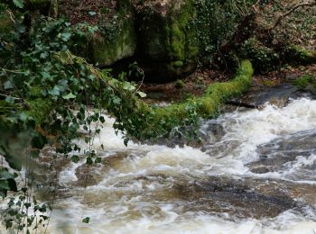
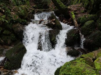
• Blühende Täler so weit das Auge reicht, wildromantische Wasserfälle und herausragende Pflanzenvielfalt bis in die Tie...
![Tocht Te voet - Panoramaweg - Etappe 1 - Photo](https://media.geolcdn.com/t/350/260/116a981b-765e-457e-a141-ece084bfaa15.jpeg&format=jpg&maxdim=2)
![Te voet Te voet](https://static1.geolcdn.com/sitytour/trail-icons/100.png)
Km
Te voet
![](/images/other/stat-length.png)
![](https://static1.geolcdn.com/siteimages/upload/files/1508320355ic_sort_den_pos_24dp.png)
![](https://static1.geolcdn.com/siteimages/upload/files/1508320355ic_sort_den_neg_24dp.png)
![](https://static1.geolcdn.com/siteimages/upload/files/16400158638029165_repeat_loop_refresh_sync_direction_icon.png)
• Von zauberhaftem Altstadtflair, historischen Monumenten bis zu rauen Klippen mit atemberaubender Aussicht – die Etapp...
![Tocht Te voet - Panoramaweg - Etappe 2 - Photo](https://media.geolcdn.com/t/350/260/772f91b0-f13c-4626-b3a1-146449a3abc4.jpeg&format=jpg&maxdim=2)
![Te voet Te voet](https://static1.geolcdn.com/sitytour/trail-icons/100.png)
Km
Te voet
![](/images/other/stat-length.png)
![](https://static1.geolcdn.com/siteimages/upload/files/1508320355ic_sort_den_pos_24dp.png)
![](https://static1.geolcdn.com/siteimages/upload/files/1508320355ic_sort_den_neg_24dp.png)
![](https://static1.geolcdn.com/siteimages/upload/files/16400158638029165_repeat_loop_refresh_sync_direction_icon.png)
• Idyllische Streuobstwiesen, malerische Aussichten, Begegnungen mit friedlich weidenden Hochlandrindern – Bilderbuchla...
![Tocht Te voet - Panoramaweg - Etappe 4 - Photo](https://media.geolcdn.com/t/350/260/8cbd1eb3-7746-46bd-9a33-f1e017a1cd66.jpeg&format=jpg&maxdim=2)
![Te voet Te voet](https://static1.geolcdn.com/sitytour/trail-icons/100.png)
Km
Te voet
![](/images/other/stat-length.png)
![](https://static1.geolcdn.com/siteimages/upload/files/1508320355ic_sort_den_pos_24dp.png)
![](https://static1.geolcdn.com/siteimages/upload/files/1508320355ic_sort_den_neg_24dp.png)
![](https://static1.geolcdn.com/siteimages/upload/files/16400158638029165_repeat_loop_refresh_sync_direction_icon.png)
• Schattige Wälder, traumhafte Aussichten und duftende Rosen – das alles und noch mehr erwartet Sie auf der vierten Eta...
![Tocht Te voet - Gaggenau - Ebersteinburg - Photo](https://media.geolcdn.com/t/350/260/50550a88-3b20-4b91-8b79-7613c80a746a.jpeg&format=jpg&maxdim=2)
![Te voet Te voet](https://static1.geolcdn.com/sitytour/trail-icons/100.png)
Km
Te voet
![](/images/other/stat-length.png)
![](https://static1.geolcdn.com/siteimages/upload/files/1508320355ic_sort_den_pos_24dp.png)
![](https://static1.geolcdn.com/siteimages/upload/files/1508320355ic_sort_den_neg_24dp.png)
![](https://static1.geolcdn.com/siteimages/upload/files/16400158638029165_repeat_loop_refresh_sync_direction_icon.png)
• Trail created by Schwarzwaldverein. Symbol: Liegende gelbe Raute auf weißem Grund
![Tocht Te voet - Nellele-Rundweg - Photo](https://media.geolcdn.com/t/350/260/e11b049c-e788-4421-9a9e-dde4f2c3db21.jpeg&format=jpg&maxdim=2)
![Te voet Te voet](https://static1.geolcdn.com/sitytour/trail-icons/100.png)
Km
Te voet
![](/images/other/stat-length.png)
![](https://static1.geolcdn.com/siteimages/upload/files/1508320355ic_sort_den_pos_24dp.png)
![](https://static1.geolcdn.com/siteimages/upload/files/1508320355ic_sort_den_neg_24dp.png)
![](https://static1.geolcdn.com/siteimages/upload/files/16400158638029165_repeat_loop_refresh_sync_direction_icon.png)
• Trail created by Stadt Baden-Baden. 2019 neue Wegführung am Nellele in Richtung Josefskapelle
![Tocht Te voet - Wildnispfad - Photo](https://media.geolcdn.com/t/350/260/dbc018e5-eb33-434b-a2da-0acf93c98ce3.jpeg&format=jpg&maxdim=2)
![Te voet Te voet](https://static1.geolcdn.com/sitytour/trail-icons/100.png)
Km
Te voet
![](/images/other/stat-length.png)
![](https://static1.geolcdn.com/siteimages/upload/files/1508320355ic_sort_den_pos_24dp.png)
![](https://static1.geolcdn.com/siteimages/upload/files/1508320355ic_sort_den_neg_24dp.png)
![](https://static1.geolcdn.com/siteimages/upload/files/16400158638029165_repeat_loop_refresh_sync_direction_icon.png)
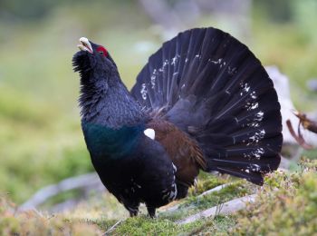
• approaches symbol as much as possible Symbol: Black woodpecker siluhette on a white background in a green circle
20 tochten weergegeven op 45
Gratisgps-wandelapplicatie