![](/images/other/stat-length.png)
- Tochten
- Outdoor
- Germany
- Beieren
- Landkreis Bad Kissingen
- Wildflecken
Wildflecken, Landkreis Bad Kissingen: Top van de beste wandelroutes, trajecten, tochten en wandelingen
Wildflecken: Ontdek de beste tochten: 3 te voet. Al deze tochten, trajecten, routes en outdoor activiteiten zijn beschikbaar in onze SityTrail-apps voor smartphones en tablets.
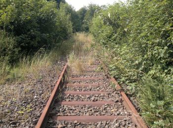
De beste trajecten (3)
![Tocht Te voet Wildflecken - Rhön-Rundweg 1 Wildflecken - Photo](https://media.geolcdn.com/t/350/260/8206c457-0216-4645-ad8a-77e2ccf1ad99.jpeg&format=jpg&maxdim=2)
![Te voet Te voet](https://static1.geolcdn.com/sitytour/trail-icons/100.png)
Km
Te voet
![](/images/other/stat-length.png)
![](https://static1.geolcdn.com/siteimages/upload/files/1508320355ic_sort_den_pos_24dp.png)
![](https://static1.geolcdn.com/siteimages/upload/files/1508320355ic_sort_den_neg_24dp.png)
![](https://static1.geolcdn.com/siteimages/upload/files/16400158638029165_repeat_loop_refresh_sync_direction_icon.png)
• Symbol: Weiße 1 auf blauem Hintergrund
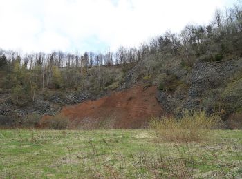
![Tocht Te voet Wildflecken - Extratour](https://media.geolcdn.com/t/350/260/7ac5f081-1782-49b3-bd2a-13bafb5e2b69.jpeg&format=jpg&maxdim=2)
![Te voet Te voet](https://static1.geolcdn.com/sitytour/trail-icons/100.png)
Km
Te voet
![](/images/other/stat-length.png)
![](https://static1.geolcdn.com/siteimages/upload/files/1508320355ic_sort_den_pos_24dp.png)
![](https://static1.geolcdn.com/siteimages/upload/files/1508320355ic_sort_den_neg_24dp.png)
![](https://static1.geolcdn.com/siteimages/upload/files/16400158638029165_repeat_loop_refresh_sync_direction_icon.png)
• Trail created by Rhönclub. Website: http://rhoenklub.de/wanderungen/17-extratour-basaltweg
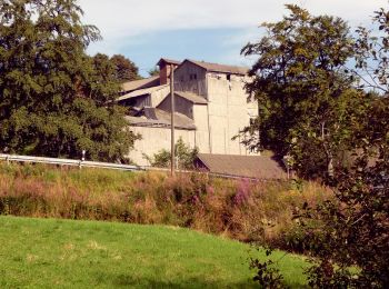
![Tocht Te voet Wildflecken - Rhön Rundweg 4 - Photo](https://media.geolcdn.com/t/350/260/12ba59c9-dd1b-4bb8-96c9-5fbacebaf3ae.jpeg&format=jpg&maxdim=2)
![Te voet Te voet](https://static1.geolcdn.com/sitytour/trail-icons/100.png)
Km
Te voet
![](/images/other/stat-length.png)
![](https://static1.geolcdn.com/siteimages/upload/files/1508320355ic_sort_den_pos_24dp.png)
![](https://static1.geolcdn.com/siteimages/upload/files/1508320355ic_sort_den_neg_24dp.png)
![](https://static1.geolcdn.com/siteimages/upload/files/16400158638029165_repeat_loop_refresh_sync_direction_icon.png)
• Trail created by Rhön Klub. Symbol: blue:white:4
3 tochten weergegeven op 3
Gratisgps-wandelapplicatie