![](/images/other/stat-length.png)
Landkreis Rhön-Grabfeld, Beieren: Top van de beste wandelroutes, trajecten, tochten en wandelingen
Landkreis Rhön-Grabfeld: Ontdek de beste tochten: 34 te voet. Al deze tochten, trajecten, routes en outdoor activiteiten zijn beschikbaar in onze SityTrail-apps voor smartphones en tablets.
De beste trajecten (34)
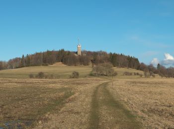
![Tocht Te voet Burgwallbacher Forst - Rhön-Rundweg 5 Schönau - Photo](https://media.geolcdn.com/t/350/260/99a27c99-25ca-4dd2-9d94-5c066608cde7.jpeg&format=jpg&maxdim=2)
![Te voet Te voet](https://static1.geolcdn.com/sitytour/trail-icons/100.png)
Km
Te voet
![](/images/other/stat-length.png)
![](https://static1.geolcdn.com/siteimages/upload/files/1508320355ic_sort_den_pos_24dp.png)
![](https://static1.geolcdn.com/siteimages/upload/files/1508320355ic_sort_den_neg_24dp.png)
![](https://static1.geolcdn.com/siteimages/upload/files/16400158638029165_repeat_loop_refresh_sync_direction_icon.png)
• Trail created by Rhönklub. Symbol: Weiße 5 auf blauem Grund
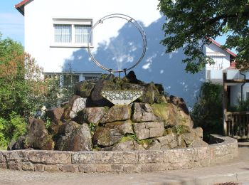
![Tocht Te voet Salz - Geologischer Rundweg - Durch den Muschelkalk - Photo](https://media.geolcdn.com/t/350/260/e40914cf-984e-458a-adbf-776caab338f6.jpeg&format=jpg&maxdim=2)
![Te voet Te voet](https://static1.geolcdn.com/sitytour/trail-icons/100.png)
Km
Te voet
![](/images/other/stat-length.png)
![](https://static1.geolcdn.com/siteimages/upload/files/1508320355ic_sort_den_pos_24dp.png)
![](https://static1.geolcdn.com/siteimages/upload/files/1508320355ic_sort_den_neg_24dp.png)
![](https://static1.geolcdn.com/siteimages/upload/files/16400158638029165_repeat_loop_refresh_sync_direction_icon.png)
• Trail created by Stadt Bad Neustadt. Symbol: Weißer Ammonit auf weißem Grund
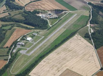
![Tocht Te voet Strahlungen - Extratour Strahlungen - Photo](https://media.geolcdn.com/t/350/260/568424cf-aed0-4e8d-ae29-510a754600b0.jpeg&format=jpg&maxdim=2)
![Te voet Te voet](https://static1.geolcdn.com/sitytour/trail-icons/100.png)
Km
Te voet
![](/images/other/stat-length.png)
![](https://static1.geolcdn.com/siteimages/upload/files/1508320355ic_sort_den_pos_24dp.png)
![](https://static1.geolcdn.com/siteimages/upload/files/1508320355ic_sort_den_neg_24dp.png)
![](https://static1.geolcdn.com/siteimages/upload/files/16400158638029165_repeat_loop_refresh_sync_direction_icon.png)
• Symbol: Rotes S auf weißem Grund
![Tocht Te voet Hausen - Rhön-Rundweg Hausen 6 - Photo](https://media.geolcdn.com/t/350/260/ce58b82d-635b-4292-a930-77ddec40da9b.jpeg&format=jpg&maxdim=2)
![Te voet Te voet](https://static1.geolcdn.com/sitytour/trail-icons/100.png)
Km
Te voet
![](/images/other/stat-length.png)
![](https://static1.geolcdn.com/siteimages/upload/files/1508320355ic_sort_den_pos_24dp.png)
![](https://static1.geolcdn.com/siteimages/upload/files/1508320355ic_sort_den_neg_24dp.png)
![](https://static1.geolcdn.com/siteimages/upload/files/16400158638029165_repeat_loop_refresh_sync_direction_icon.png)
• Trail created by Rhönklub. Symbol: weiße 6 auf blauem Grund mit kleiner Unterschrift Rhön-Rundweg
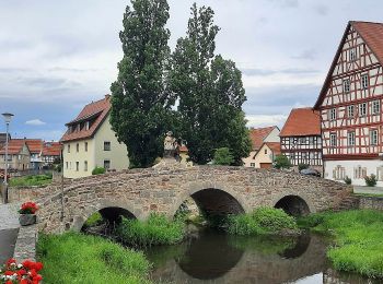
![Tocht Te voet Nordheim v.d.Rhön - Rhön-Rundweg Ostheim 5 - Photo](https://media.geolcdn.com/t/350/260/69671785-8cb7-4f78-9c66-a72d6aa62a06.jpeg&format=jpg&maxdim=2)
![Te voet Te voet](https://static1.geolcdn.com/sitytour/trail-icons/100.png)
Km
Te voet
![](/images/other/stat-length.png)
![](https://static1.geolcdn.com/siteimages/upload/files/1508320355ic_sort_den_pos_24dp.png)
![](https://static1.geolcdn.com/siteimages/upload/files/1508320355ic_sort_den_neg_24dp.png)
![](https://static1.geolcdn.com/siteimages/upload/files/16400158638029165_repeat_loop_refresh_sync_direction_icon.png)
• Trail created by Rhönklub. Symbol: weiße 5 auf blauem Quadrat
![Tocht Te voet Sondheim v.d.Rhön - Rundweg Rother Kuppe - Photo](https://media.geolcdn.com/t/350/260/69671785-8cb7-4f78-9c66-a72d6aa62a06.jpeg&format=jpg&maxdim=2)
![Te voet Te voet](https://static1.geolcdn.com/sitytour/trail-icons/100.png)
Km
Te voet
![](/images/other/stat-length.png)
![](https://static1.geolcdn.com/siteimages/upload/files/1508320355ic_sort_den_pos_24dp.png)
![](https://static1.geolcdn.com/siteimages/upload/files/1508320355ic_sort_den_neg_24dp.png)
![](https://static1.geolcdn.com/siteimages/upload/files/16400158638029165_repeat_loop_refresh_sync_direction_icon.png)
• Symbol: Schwarzes R auf weißem Grund
![Tocht Te voet Willmars - Fladungen-Mellrichstadt - Photo](https://media.geolcdn.com/t/350/260/9f12fb27-f252-4356-aec9-a4f912d4df26.jpeg&format=jpg&maxdim=2)
![Te voet Te voet](https://static1.geolcdn.com/sitytour/trail-icons/100.png)
Km
Te voet
![](/images/other/stat-length.png)
![](https://static1.geolcdn.com/siteimages/upload/files/1508320355ic_sort_den_pos_24dp.png)
![](https://static1.geolcdn.com/siteimages/upload/files/1508320355ic_sort_den_neg_24dp.png)
![](https://static1.geolcdn.com/siteimages/upload/files/16400158638029165_repeat_loop_refresh_sync_direction_icon.png)
• Trail created by Rhönklub. Symbol: blauer Keil auf weißem Grund
![Tocht Te voet Nordheim v.d.Rhön - Rhön-Rundweg](https://media.geolcdn.com/t/350/260/69671785-8cb7-4f78-9c66-a72d6aa62a06.jpeg&format=jpg&maxdim=2)
![Te voet Te voet](https://static1.geolcdn.com/sitytour/trail-icons/100.png)
Km
Te voet
![](/images/other/stat-length.png)
![](https://static1.geolcdn.com/siteimages/upload/files/1508320355ic_sort_den_pos_24dp.png)
![](https://static1.geolcdn.com/siteimages/upload/files/1508320355ic_sort_den_neg_24dp.png)
![](https://static1.geolcdn.com/siteimages/upload/files/16400158638029165_repeat_loop_refresh_sync_direction_icon.png)
• Trail created by Rhönklub. Symbol: weiße 2 auf blauem Quadrat
![Tocht Te voet Nordheim v.d.Rhön - Rhön-Rundweg](https://media.geolcdn.com/t/350/260/69671785-8cb7-4f78-9c66-a72d6aa62a06.jpeg&format=jpg&maxdim=2)
![Te voet Te voet](https://static1.geolcdn.com/sitytour/trail-icons/100.png)
Km
Te voet
![](/images/other/stat-length.png)
![](https://static1.geolcdn.com/siteimages/upload/files/1508320355ic_sort_den_pos_24dp.png)
![](https://static1.geolcdn.com/siteimages/upload/files/1508320355ic_sort_den_neg_24dp.png)
![](https://static1.geolcdn.com/siteimages/upload/files/16400158638029165_repeat_loop_refresh_sync_direction_icon.png)
• Trail created by Rhönklub. Symbol: weiße 1 auf blauem Grund mit kleiner Unterschrift Rhön-Rundweg
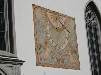
![Tocht Te voet Bischofsheim i.d.Rhön - Bischofsheim Rundweg 5 - Auf den Käuling - Photo](https://media.geolcdn.com/t/350/260/0eadad41-9bf4-4749-8598-1313c0d854e3.jpeg&format=jpg&maxdim=2)
![Te voet Te voet](https://static1.geolcdn.com/sitytour/trail-icons/100.png)
Km
Te voet
![](/images/other/stat-length.png)
![](https://static1.geolcdn.com/siteimages/upload/files/1508320355ic_sort_den_pos_24dp.png)
![](https://static1.geolcdn.com/siteimages/upload/files/1508320355ic_sort_den_neg_24dp.png)
![](https://static1.geolcdn.com/siteimages/upload/files/16400158638029165_repeat_loop_refresh_sync_direction_icon.png)
• Trail created by Naturpark Hessische Rhön. Symbol: white 5 on blue square
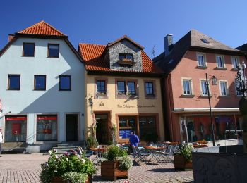
![Tocht Te voet Bischofsheim i.d.Rhön - Bischofsheim Rundweg 4 - Rund um den Finkelberg - Photo](https://media.geolcdn.com/t/350/260/40b76fc1-3ef7-463c-9480-43a7050dea62.jpeg&format=jpg&maxdim=2)
![Te voet Te voet](https://static1.geolcdn.com/sitytour/trail-icons/100.png)
Km
Te voet
![](/images/other/stat-length.png)
![](https://static1.geolcdn.com/siteimages/upload/files/1508320355ic_sort_den_pos_24dp.png)
![](https://static1.geolcdn.com/siteimages/upload/files/1508320355ic_sort_den_neg_24dp.png)
![](https://static1.geolcdn.com/siteimages/upload/files/16400158638029165_repeat_loop_refresh_sync_direction_icon.png)
• Trail created by Naturpark Hessische Rhön. Symbol: white 4 on blue square
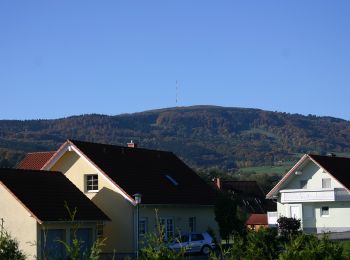
![Tocht Te voet Bischofsheim i.d.Rhön - Bischofsheim Rundweg 2 (Unterweißenbrunn) - Zur Lourdesgrotte - Photo](https://media.geolcdn.com/t/350/260/19fd5735-0ead-443e-8d8a-a1500e3ed88e.jpeg&format=jpg&maxdim=2)
![Te voet Te voet](https://static1.geolcdn.com/sitytour/trail-icons/100.png)
Km
Te voet
![](/images/other/stat-length.png)
![](https://static1.geolcdn.com/siteimages/upload/files/1508320355ic_sort_den_pos_24dp.png)
![](https://static1.geolcdn.com/siteimages/upload/files/1508320355ic_sort_den_neg_24dp.png)
![](https://static1.geolcdn.com/siteimages/upload/files/16400158638029165_repeat_loop_refresh_sync_direction_icon.png)
• Trail created by Naturpark Hessische Rhön. Symbol: white 2 on blue square
![Tocht Te voet Bischofsheim i.d.Rhön - Bischofsheim Rundweg 1 - Zum Bauersberg - Photo](https://media.geolcdn.com/t/350/260/0eadad41-9bf4-4749-8598-1313c0d854e3.jpeg&format=jpg&maxdim=2)
![Te voet Te voet](https://static1.geolcdn.com/sitytour/trail-icons/100.png)
Km
Te voet
![](/images/other/stat-length.png)
![](https://static1.geolcdn.com/siteimages/upload/files/1508320355ic_sort_den_pos_24dp.png)
![](https://static1.geolcdn.com/siteimages/upload/files/1508320355ic_sort_den_neg_24dp.png)
![](https://static1.geolcdn.com/siteimages/upload/files/16400158638029165_repeat_loop_refresh_sync_direction_icon.png)
• Trail created by Naturpark Hessische Rhön. Symbol: white 1 on blue square
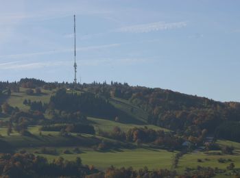
![Tocht Te voet Bischofsheim i.d.Rhön - Osterburg - Gemündener Hütte und Kreuzberg - Photo](https://media.geolcdn.com/t/350/260/b30704d0-ef83-4bcc-9322-e37b8c462709.jpeg&format=jpg&maxdim=2)
![Te voet Te voet](https://static1.geolcdn.com/sitytour/trail-icons/100.png)
Km
Te voet
![](/images/other/stat-length.png)
![](https://static1.geolcdn.com/siteimages/upload/files/1508320355ic_sort_den_pos_24dp.png)
![](https://static1.geolcdn.com/siteimages/upload/files/1508320355ic_sort_den_neg_24dp.png)
![](https://static1.geolcdn.com/siteimages/upload/files/16400158638029165_repeat_loop_refresh_sync_direction_icon.png)
• Trail created by Naturpark Hessische Rhön. Symbol: white 6 on blue square
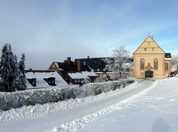
![Tocht Te voet Bischofsheim i.d.Rhön - Kreuzberg - Rund ums Kloster - Photo](https://media.geolcdn.com/t/350/260/9af2d83d-556b-4c7c-9ae5-0bac678385ff.jpeg&format=jpg&maxdim=2)
![Te voet Te voet](https://static1.geolcdn.com/sitytour/trail-icons/100.png)
Km
Te voet
![](/images/other/stat-length.png)
![](https://static1.geolcdn.com/siteimages/upload/files/1508320355ic_sort_den_pos_24dp.png)
![](https://static1.geolcdn.com/siteimages/upload/files/1508320355ic_sort_den_neg_24dp.png)
![](https://static1.geolcdn.com/siteimages/upload/files/16400158638029165_repeat_loop_refresh_sync_direction_icon.png)
• Trail created by Naturpark Hessische Rhön. Symbol: white 2 on blue square
![Tocht Te voet Bischofsheim i.d.Rhön - Zubringer Der Hochrhöner, Bischofsheim - Photo](https://media.geolcdn.com/t/350/260/b30704d0-ef83-4bcc-9322-e37b8c462709.jpeg&format=jpg&maxdim=2)
![Te voet Te voet](https://static1.geolcdn.com/sitytour/trail-icons/100.png)
Km
Te voet
![](/images/other/stat-length.png)
![](https://static1.geolcdn.com/siteimages/upload/files/1508320355ic_sort_den_pos_24dp.png)
![](https://static1.geolcdn.com/siteimages/upload/files/1508320355ic_sort_den_neg_24dp.png)
![](https://static1.geolcdn.com/siteimages/upload/files/16400158638029165_repeat_loop_refresh_sync_direction_icon.png)
• Trail created by Rhönclub. Symbol: grünes Ö auf weissem Grund
![Tocht Te voet Bad Neustadt an der Saale - Karl-Straub-Rundweg - Photo](https://media.geolcdn.com/t/350/260/e40914cf-984e-458a-adbf-776caab338f6.jpeg&format=jpg&maxdim=2)
![Te voet Te voet](https://static1.geolcdn.com/sitytour/trail-icons/100.png)
Km
Te voet
![](/images/other/stat-length.png)
![](https://static1.geolcdn.com/siteimages/upload/files/1508320355ic_sort_den_pos_24dp.png)
![](https://static1.geolcdn.com/siteimages/upload/files/1508320355ic_sort_den_neg_24dp.png)
![](https://static1.geolcdn.com/siteimages/upload/files/16400158638029165_repeat_loop_refresh_sync_direction_icon.png)
• Trail created by Rhönklub. Symbol: Blue pointer on white Website: http://www.naturerlebnis-rhoen.de/wanderwege/rho...
![Tocht Te voet Bad Neustadt an der Saale - Rederkreuz-Rundweg - Photo](https://media.geolcdn.com/t/350/260/ebc371ad-1f49-46e4-ab39-5f58c13d04f0.jpeg&format=jpg&maxdim=2)
![Te voet Te voet](https://static1.geolcdn.com/sitytour/trail-icons/100.png)
Km
Te voet
![](/images/other/stat-length.png)
![](https://static1.geolcdn.com/siteimages/upload/files/1508320355ic_sort_den_pos_24dp.png)
![](https://static1.geolcdn.com/siteimages/upload/files/1508320355ic_sort_den_neg_24dp.png)
![](https://static1.geolcdn.com/siteimages/upload/files/16400158638029165_repeat_loop_refresh_sync_direction_icon.png)
• Trail created by Rhönklub. Symbol: Black R on white ground
![Tocht Te voet Ostheim v.d.Rhön - Extratour Ostheimer (Rhön-Extratouren) - Photo](https://media.geolcdn.com/t/350/260/9f12fb27-f252-4356-aec9-a4f912d4df26.jpeg&format=jpg&maxdim=2)
![Te voet Te voet](https://static1.geolcdn.com/sitytour/trail-icons/100.png)
Km
Te voet
![](/images/other/stat-length.png)
![](https://static1.geolcdn.com/siteimages/upload/files/1508320355ic_sort_den_pos_24dp.png)
![](https://static1.geolcdn.com/siteimages/upload/files/1508320355ic_sort_den_neg_24dp.png)
![](https://static1.geolcdn.com/siteimages/upload/files/16400158638029165_repeat_loop_refresh_sync_direction_icon.png)
• Eine harmonische Runde, die ein breites Spektrum der landschaftlichen Schönheiten und kulturellen Besonderheiten zeig...
![Tocht Te voet Sandberg - Extratour Kreuzbergtour - Photo](https://media.geolcdn.com/t/350/260/3dee08aa-12cf-460c-abcc-1b4bb7823d9b.jpeg&format=jpg&maxdim=2)
![Te voet Te voet](https://static1.geolcdn.com/sitytour/trail-icons/100.png)
Km
Te voet
![](/images/other/stat-length.png)
![](https://static1.geolcdn.com/siteimages/upload/files/1508320355ic_sort_den_pos_24dp.png)
![](https://static1.geolcdn.com/siteimages/upload/files/1508320355ic_sort_den_neg_24dp.png)
![](https://static1.geolcdn.com/siteimages/upload/files/16400158638029165_repeat_loop_refresh_sync_direction_icon.png)
• Trail created by Rhönclub.
20 tochten weergegeven op 34
Gratisgps-wandelapplicatie