![](/images/other/stat-length.png)
Landkreis Forchheim, Beieren: Top van de beste wandelroutes, trajecten, tochten en wandelingen
Landkreis Forchheim: Ontdek de beste tochten: 122 te voet. Al deze tochten, trajecten, routes en outdoor activiteiten zijn beschikbaar in onze SityTrail-apps voor smartphones en tablets.
De beste trajecten (122)
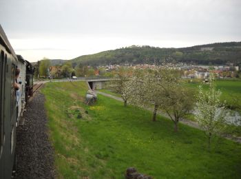
![Tocht Te voet Pretzfeld - Lauferlebnis Fränkische Schweiz W2 - Photo](https://media.geolcdn.com/t/350/260/16fede52-043b-4da7-a7fe-785f18fe0af6.jpeg&format=jpg&maxdim=2)
![Te voet Te voet](https://static1.geolcdn.com/sitytour/trail-icons/100.png)
Km
Te voet
![](/images/other/stat-length.png)
![](https://static1.geolcdn.com/siteimages/upload/files/1508320355ic_sort_den_pos_24dp.png)
![](https://static1.geolcdn.com/siteimages/upload/files/1508320355ic_sort_den_neg_24dp.png)
![](https://static1.geolcdn.com/siteimages/upload/files/16400158638029165_repeat_loop_refresh_sync_direction_icon.png)
• Trail created by Landkreis Forchheim. Symbol: W2 in weiß auf blauem Hintergrund
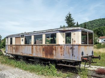
![Tocht Te voet Pretzfeld - Lauferlebnis Fränkische Schweiz W1 - Photo](https://media.geolcdn.com/t/350/260/97a9afd1-03e1-4c76-befb-634ebb2476e3.jpeg&format=jpg&maxdim=2)
![Te voet Te voet](https://static1.geolcdn.com/sitytour/trail-icons/100.png)
Km
Te voet
![](/images/other/stat-length.png)
![](https://static1.geolcdn.com/siteimages/upload/files/1508320355ic_sort_den_pos_24dp.png)
![](https://static1.geolcdn.com/siteimages/upload/files/1508320355ic_sort_den_neg_24dp.png)
![](https://static1.geolcdn.com/siteimages/upload/files/16400158638029165_repeat_loop_refresh_sync_direction_icon.png)
• Trail created by Landkreis Forchheim. Symbol: W1 in weiß auf grünem Hintergrund
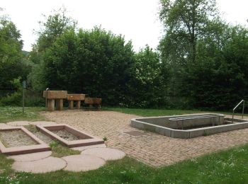
![Tocht Te voet Forchheim - Lauferlebnis Fränkische Schweiz F1 - Photo](https://media.geolcdn.com/t/350/260/26c4143f-324a-4388-92bc-ca4f4fd11244.jpeg&format=jpg&maxdim=2)
![Te voet Te voet](https://static1.geolcdn.com/sitytour/trail-icons/100.png)
Km
Te voet
![](/images/other/stat-length.png)
![](https://static1.geolcdn.com/siteimages/upload/files/1508320355ic_sort_den_pos_24dp.png)
![](https://static1.geolcdn.com/siteimages/upload/files/1508320355ic_sort_den_neg_24dp.png)
![](https://static1.geolcdn.com/siteimages/upload/files/16400158638029165_repeat_loop_refresh_sync_direction_icon.png)
• Trail created by Landkreis Forchheim. Symbol: F1 in weiß auf grünem Hintergrund
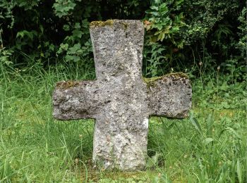
![Tocht Te voet Wiesenttal - Gebürgsweg - Photo](https://media.geolcdn.com/t/350/260/4b3fc851-c600-47ea-b4d8-49568b0b3e58.jpeg&format=jpg&maxdim=2)
![Te voet Te voet](https://static1.geolcdn.com/sitytour/trail-icons/100.png)
Km
Te voet
![](/images/other/stat-length.png)
![](https://static1.geolcdn.com/siteimages/upload/files/1508320355ic_sort_den_pos_24dp.png)
![](https://static1.geolcdn.com/siteimages/upload/files/1508320355ic_sort_den_neg_24dp.png)
![](https://static1.geolcdn.com/siteimages/upload/files/16400158638029165_repeat_loop_refresh_sync_direction_icon.png)
• Verlauf in Engelhardsberg und Muggendorf unklar Symbol: Grüner Ring auf weißem Grund

![Tocht Te voet Weilersbach - Wanderweg Roter Schrägbalken - Photo](https://media.geolcdn.com/t/350/260/3d96a8d8-1ce4-4292-a682-9cf55a71460e.jpeg&format=jpg&maxdim=2)
![Te voet Te voet](https://static1.geolcdn.com/sitytour/trail-icons/100.png)
Km
Te voet
![](/images/other/stat-length.png)
![](https://static1.geolcdn.com/siteimages/upload/files/1508320355ic_sort_den_pos_24dp.png)
![](https://static1.geolcdn.com/siteimages/upload/files/1508320355ic_sort_den_neg_24dp.png)
![](https://static1.geolcdn.com/siteimages/upload/files/16400158638029165_repeat_loop_refresh_sync_direction_icon.png)
• Symbol: Roter Strägbalken auf weißem Hintergrund
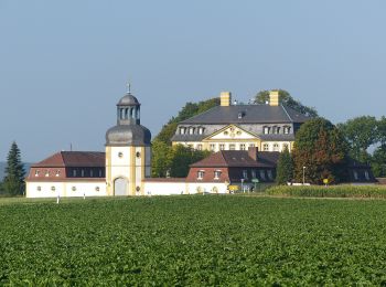
![Tocht Te voet Eggolsheim - Lauferlebnis Fränkische Schweiz E5 - Photo](https://media.geolcdn.com/t/350/260/23786ceb-0bf2-42ab-806f-dd63532c4e0f.jpeg&format=jpg&maxdim=2)
![Te voet Te voet](https://static1.geolcdn.com/sitytour/trail-icons/100.png)
Km
Te voet
![](/images/other/stat-length.png)
![](https://static1.geolcdn.com/siteimages/upload/files/1508320355ic_sort_den_pos_24dp.png)
![](https://static1.geolcdn.com/siteimages/upload/files/1508320355ic_sort_den_neg_24dp.png)
![](https://static1.geolcdn.com/siteimages/upload/files/16400158638029165_repeat_loop_refresh_sync_direction_icon.png)
• Trail created by Landkreis Forchheim. Symbol: E5 in weiß auf schwarzem Hintergrund
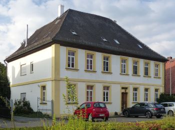
![Tocht Te voet Eggolsheim - Lauferlebnis Fränkische Schweiz E4 - Photo](https://media.geolcdn.com/t/350/260/bc496789-c933-459c-b5dd-3592a5fb8500.jpeg&format=jpg&maxdim=2)
![Te voet Te voet](https://static1.geolcdn.com/sitytour/trail-icons/100.png)
Km
Te voet
![](/images/other/stat-length.png)
![](https://static1.geolcdn.com/siteimages/upload/files/1508320355ic_sort_den_pos_24dp.png)
![](https://static1.geolcdn.com/siteimages/upload/files/1508320355ic_sort_den_neg_24dp.png)
![](https://static1.geolcdn.com/siteimages/upload/files/16400158638029165_repeat_loop_refresh_sync_direction_icon.png)
• Symbol: E4 in weiß auf dunkelgrünem Hintergrund
![Tocht Te voet Ebermannstadt - Zielwanderweg Ebermannstadt - Vexierkapelle - Photo](https://media.geolcdn.com/t/350/260/3d96a8d8-1ce4-4292-a682-9cf55a71460e.jpeg&format=jpg&maxdim=2)
![Te voet Te voet](https://static1.geolcdn.com/sitytour/trail-icons/100.png)
Km
Te voet
![](/images/other/stat-length.png)
![](https://static1.geolcdn.com/siteimages/upload/files/1508320355ic_sort_den_pos_24dp.png)
![](https://static1.geolcdn.com/siteimages/upload/files/1508320355ic_sort_den_neg_24dp.png)
![](https://static1.geolcdn.com/siteimages/upload/files/16400158638029165_repeat_loop_refresh_sync_direction_icon.png)
• Symbol: Grüne Spitze auf weißem Hintergrund
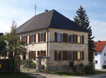
![Tocht Te voet Eggolsheim - Hauptweg Eggolsheim - Photo](https://media.geolcdn.com/t/350/260/1e2b4bf5-178c-448a-814e-cd7193781c68.jpeg&format=jpg&maxdim=2)
![Te voet Te voet](https://static1.geolcdn.com/sitytour/trail-icons/100.png)
Km
Te voet
![](/images/other/stat-length.png)
![](https://static1.geolcdn.com/siteimages/upload/files/1508320355ic_sort_den_pos_24dp.png)
![](https://static1.geolcdn.com/siteimages/upload/files/1508320355ic_sort_den_neg_24dp.png)
![](https://static1.geolcdn.com/siteimages/upload/files/16400158638029165_repeat_loop_refresh_sync_direction_icon.png)
• Trail created by Gemeinde Eggolsheim. Wanderwegesystem der Gemeinde Eggolsheim Symbol: Eggolsheimer Wappen (Kirche)...
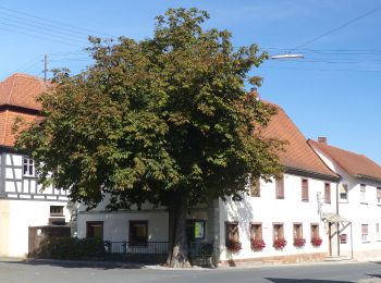
![Tocht Te voet Eggolsheim - Trailsdorf-Ebermannstadt - Photo](https://media.geolcdn.com/t/350/260/65f7428d-daff-4887-b063-8ad0c3a64375.jpeg&format=jpg&maxdim=2)
![Te voet Te voet](https://static1.geolcdn.com/sitytour/trail-icons/100.png)
Km
Te voet
![](/images/other/stat-length.png)
![](https://static1.geolcdn.com/siteimages/upload/files/1508320355ic_sort_den_pos_24dp.png)
![](https://static1.geolcdn.com/siteimages/upload/files/1508320355ic_sort_den_neg_24dp.png)
![](https://static1.geolcdn.com/siteimages/upload/files/16400158638029165_repeat_loop_refresh_sync_direction_icon.png)
• Symbol: Grüner senkrechter Strich auf weißem Hintergrund
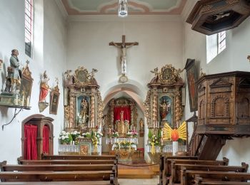
![Tocht Te voet Hallerndorf - Lauferlebnis Fränkische Schweiz - Photo](https://media.geolcdn.com/t/350/260/4bc79608-ffff-4ef8-a4ab-2102567a6836.jpeg&format=jpg&maxdim=2)
![Te voet Te voet](https://static1.geolcdn.com/sitytour/trail-icons/100.png)
Km
Te voet
![](/images/other/stat-length.png)
![](https://static1.geolcdn.com/siteimages/upload/files/1508320355ic_sort_den_pos_24dp.png)
![](https://static1.geolcdn.com/siteimages/upload/files/1508320355ic_sort_den_neg_24dp.png)
![](https://static1.geolcdn.com/siteimages/upload/files/16400158638029165_repeat_loop_refresh_sync_direction_icon.png)
• Trail created by Landratsamt Forchheim. Symbol: F4 in weiß auf grünem Hintergrund
![Tocht Te voet Hallerndorf - Lauferlebnis Fränkische Schweiz - Photo](https://media.geolcdn.com/t/350/260/4bc79608-ffff-4ef8-a4ab-2102567a6836.jpeg&format=jpg&maxdim=2)
![Te voet Te voet](https://static1.geolcdn.com/sitytour/trail-icons/100.png)
Km
Te voet
![](/images/other/stat-length.png)
![](https://static1.geolcdn.com/siteimages/upload/files/1508320355ic_sort_den_pos_24dp.png)
![](https://static1.geolcdn.com/siteimages/upload/files/1508320355ic_sort_den_neg_24dp.png)
![](https://static1.geolcdn.com/siteimages/upload/files/16400158638029165_repeat_loop_refresh_sync_direction_icon.png)
• Trail created by Landratsamt Forchheim. Symbol: F5 in weiß auf schwarzem Hintergrund
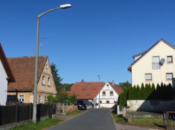
![Tocht Te voet Hallerndorf - Rundweg Hallerndorf Grüner Ring - Photo](https://media.geolcdn.com/t/350/260/6da8a365-f38e-40dc-b530-85407b928a56.jpeg&format=jpg&maxdim=2)
![Te voet Te voet](https://static1.geolcdn.com/sitytour/trail-icons/100.png)
Km
Te voet
![](/images/other/stat-length.png)
![](https://static1.geolcdn.com/siteimages/upload/files/1508320355ic_sort_den_pos_24dp.png)
![](https://static1.geolcdn.com/siteimages/upload/files/1508320355ic_sort_den_neg_24dp.png)
![](https://static1.geolcdn.com/siteimages/upload/files/16400158638029165_repeat_loop_refresh_sync_direction_icon.png)
• Trail created by Gemeinde Hallerndorf. Symbol: Grüner Ring auf weißem Grund
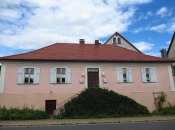
![Tocht Te voet Pretzfeld - Lauferlebnis Fränkische Schweiz W3 - Photo](https://media.geolcdn.com/t/350/260/25b32ced-785c-40a5-a240-9c1e7f2b920b.jpeg&format=jpg&maxdim=2)
![Te voet Te voet](https://static1.geolcdn.com/sitytour/trail-icons/100.png)
Km
Te voet
![](/images/other/stat-length.png)
![](https://static1.geolcdn.com/siteimages/upload/files/1508320355ic_sort_den_pos_24dp.png)
![](https://static1.geolcdn.com/siteimages/upload/files/1508320355ic_sort_den_neg_24dp.png)
![](https://static1.geolcdn.com/siteimages/upload/files/16400158638029165_repeat_loop_refresh_sync_direction_icon.png)
• Symbol: W3 in weiß auf rotem Hintergrund
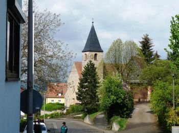
![Tocht Te voet Forchheim - Jubiläumsweg 1914 - Photo](https://media.geolcdn.com/t/350/260/3c94f5e2-8d5c-478a-bffe-ecaca4655e99.jpeg&format=jpg&maxdim=2)
![Te voet Te voet](https://static1.geolcdn.com/sitytour/trail-icons/100.png)
Km
Te voet
![](/images/other/stat-length.png)
![](https://static1.geolcdn.com/siteimages/upload/files/1508320355ic_sort_den_pos_24dp.png)
![](https://static1.geolcdn.com/siteimages/upload/files/1508320355ic_sort_den_neg_24dp.png)
![](https://static1.geolcdn.com/siteimages/upload/files/16400158638029165_repeat_loop_refresh_sync_direction_icon.png)
• Trail created by Fränkischer Albverein. Symbol: FAV-Emblem auf grünem Hintergrund
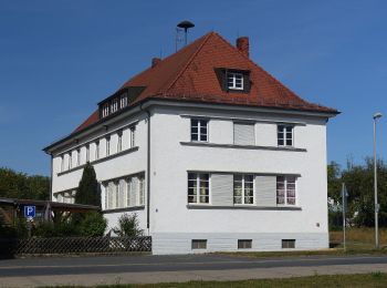
![Tocht Te voet Hallerndorf - Rundweg Hallerndorf - Photo](https://media.geolcdn.com/t/350/260/fb21268b-bb1a-4f10-86d6-abec2697bf4f.jpeg&format=jpg&maxdim=2)
![Te voet Te voet](https://static1.geolcdn.com/sitytour/trail-icons/100.png)
Km
Te voet
![](/images/other/stat-length.png)
![](https://static1.geolcdn.com/siteimages/upload/files/1508320355ic_sort_den_pos_24dp.png)
![](https://static1.geolcdn.com/siteimages/upload/files/1508320355ic_sort_den_neg_24dp.png)
![](https://static1.geolcdn.com/siteimages/upload/files/16400158638029165_repeat_loop_refresh_sync_direction_icon.png)
• Symbol: gelber Ring auf weißem Grund
![Tocht Te voet Eggolsheim - Lauferlebnis Fränkische Schweiz E3 - Photo](https://media.geolcdn.com/t/350/260/bc496789-c933-459c-b5dd-3592a5fb8500.jpeg&format=jpg&maxdim=2)
![Te voet Te voet](https://static1.geolcdn.com/sitytour/trail-icons/100.png)
Km
Te voet
![](/images/other/stat-length.png)
![](https://static1.geolcdn.com/siteimages/upload/files/1508320355ic_sort_den_pos_24dp.png)
![](https://static1.geolcdn.com/siteimages/upload/files/1508320355ic_sort_den_neg_24dp.png)
![](https://static1.geolcdn.com/siteimages/upload/files/16400158638029165_repeat_loop_refresh_sync_direction_icon.png)
• Trail created by Landkreis Forchheim. Symbol: E3 in weiß auf rotem Hintergrund
![Tocht Te voet Eggolsheim - Lauferlebnis Fränkische Schweiz E2 - Photo](https://media.geolcdn.com/t/350/260/bc496789-c933-459c-b5dd-3592a5fb8500.jpeg&format=jpg&maxdim=2)
![Te voet Te voet](https://static1.geolcdn.com/sitytour/trail-icons/100.png)
Km
Te voet
![](/images/other/stat-length.png)
![](https://static1.geolcdn.com/siteimages/upload/files/1508320355ic_sort_den_pos_24dp.png)
![](https://static1.geolcdn.com/siteimages/upload/files/1508320355ic_sort_den_neg_24dp.png)
![](https://static1.geolcdn.com/siteimages/upload/files/16400158638029165_repeat_loop_refresh_sync_direction_icon.png)
• Trail created by Landkreis Forchheim. Symbol: E2 in weiß auf blauem Hintergrund
![Tocht Te voet Eggolsheim - Lauferlebnis Fränkische Schweiz E1 - Photo](https://media.geolcdn.com/t/350/260/bc496789-c933-459c-b5dd-3592a5fb8500.jpeg&format=jpg&maxdim=2)
![Te voet Te voet](https://static1.geolcdn.com/sitytour/trail-icons/100.png)
Km
Te voet
![](/images/other/stat-length.png)
![](https://static1.geolcdn.com/siteimages/upload/files/1508320355ic_sort_den_pos_24dp.png)
![](https://static1.geolcdn.com/siteimages/upload/files/1508320355ic_sort_den_neg_24dp.png)
![](https://static1.geolcdn.com/siteimages/upload/files/16400158638029165_repeat_loop_refresh_sync_direction_icon.png)
• Trail created by Landkreis Forchheim. Symbol: E1 in weiß auf grünem Hintergrund
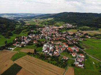
![Tocht Te voet Leutenbach - Georg-Kanzler-Gedächtnisweg - Photo](https://media.geolcdn.com/t/350/260/cd12a3b7-e274-4861-b00d-2df38576a40b.jpeg&format=jpg&maxdim=2)
![Te voet Te voet](https://static1.geolcdn.com/sitytour/trail-icons/100.png)
Km
Te voet
![](/images/other/stat-length.png)
![](https://static1.geolcdn.com/siteimages/upload/files/1508320355ic_sort_den_pos_24dp.png)
![](https://static1.geolcdn.com/siteimages/upload/files/1508320355ic_sort_den_neg_24dp.png)
![](https://static1.geolcdn.com/siteimages/upload/files/16400158638029165_repeat_loop_refresh_sync_direction_icon.png)
• Trail created by Gemeinde Leutenbach. abgeschlossen (Feb. 2013 by cycling_zno) Symbol: Blauer Ring auf weißem Grund
20 tochten weergegeven op 122
Gratisgps-wandelapplicatie