![](/images/other/stat-length.png)
- Tochten
- Outdoor
- Germany
- Beieren
- Landkreis Roth
- Abenberg
Abenberg, Landkreis Roth: Top van de beste wandelroutes, trajecten, tochten en wandelingen
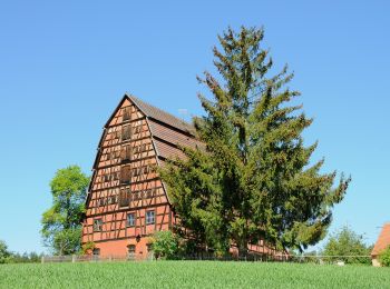
Abenberg: Ontdek de beste tochten: 9 te voet. Al deze tochten, trajecten, routes en outdoor activiteiten zijn beschikbaar in onze SityTrail-apps voor smartphones en tablets.
De beste trajecten (9)
![Tocht Te voet Abenberg - Rundwanderweg 6 Abenberg - Photo](https://media.geolcdn.com/t/350/260/2bca8ff8-358f-42c5-a833-73085f9104aa.jpeg&format=jpg&maxdim=2)
![Te voet Te voet](https://static1.geolcdn.com/sitytour/trail-icons/100.png)
Km
Te voet
![](/images/other/stat-length.png)
![](https://static1.geolcdn.com/siteimages/upload/files/1508320355ic_sort_den_pos_24dp.png)
![](https://static1.geolcdn.com/siteimages/upload/files/1508320355ic_sort_den_neg_24dp.png)
![](https://static1.geolcdn.com/siteimages/upload/files/16400158638029165_repeat_loop_refresh_sync_direction_icon.png)
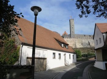
• Trail created by Gemeinde Abenberg. abgeschlossen (Nov.2013 by cycling_zno) Symbol: Weiße 6 auf blauem Grund
![Tocht Te voet Abenberg - Rundwanderweg 7 Abenberg - Photo](https://media.geolcdn.com/t/350/260/647767ef-aedc-4271-a504-b46ad074fc6e.jpeg&format=jpg&maxdim=2)
![Te voet Te voet](https://static1.geolcdn.com/sitytour/trail-icons/100.png)
Km
Te voet
![](/images/other/stat-length.png)
![](https://static1.geolcdn.com/siteimages/upload/files/1508320355ic_sort_den_pos_24dp.png)
![](https://static1.geolcdn.com/siteimages/upload/files/1508320355ic_sort_den_neg_24dp.png)
![](https://static1.geolcdn.com/siteimages/upload/files/16400158638029165_repeat_loop_refresh_sync_direction_icon.png)
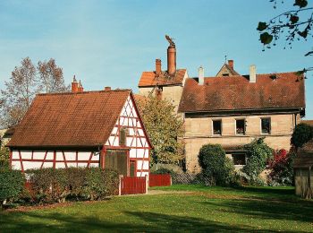
• Trail created by Gemeinde Abenberg. abgeschlossen (Nov.2013 by cycling_zno) Symbol: Weiße 7 auf blauem Grund
![Tocht Te voet Abenberg - Rundwanderweg 8 Abenberg - Photo](https://media.geolcdn.com/t/350/260/7934fe6a-ea92-40de-b0cd-02779518a453.jpeg&format=jpg&maxdim=2)
![Te voet Te voet](https://static1.geolcdn.com/sitytour/trail-icons/100.png)
Km
Te voet
![](/images/other/stat-length.png)
![](https://static1.geolcdn.com/siteimages/upload/files/1508320355ic_sort_den_pos_24dp.png)
![](https://static1.geolcdn.com/siteimages/upload/files/1508320355ic_sort_den_neg_24dp.png)
![](https://static1.geolcdn.com/siteimages/upload/files/16400158638029165_repeat_loop_refresh_sync_direction_icon.png)
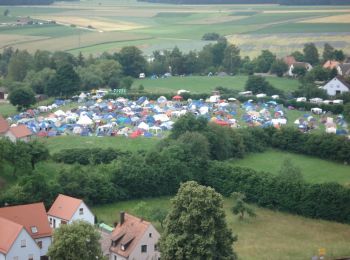
• Trail created by Gemeinde Abenberg. abgeschlossen (Nov.2013 by cycling_zno) Symbol: Weiße 8 auf blauem Grund
![Tocht Te voet Abenberg - Rundwanderweg 5 Abenberg - Photo](https://media.geolcdn.com/t/350/260/16b392c1-78ee-460b-a356-ace229947276.jpeg&format=jpg&maxdim=2)
![Te voet Te voet](https://static1.geolcdn.com/sitytour/trail-icons/100.png)
Km
Te voet
![](/images/other/stat-length.png)
![](https://static1.geolcdn.com/siteimages/upload/files/1508320355ic_sort_den_pos_24dp.png)
![](https://static1.geolcdn.com/siteimages/upload/files/1508320355ic_sort_den_neg_24dp.png)
![](https://static1.geolcdn.com/siteimages/upload/files/16400158638029165_repeat_loop_refresh_sync_direction_icon.png)
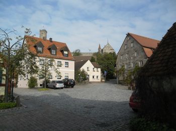
• Trail created by Gemeinde Abenberg. abgeschlossen (Nov.2013 by cycling_zno) Symbol: Weiße 5 auf blauem Grund
![Tocht Te voet Abenberg - Spalt IVV 10 - Photo](https://media.geolcdn.com/t/350/260/0c04d5f6-772b-404f-890e-571c9178301d.jpeg&format=jpg&maxdim=2)
![Te voet Te voet](https://static1.geolcdn.com/sitytour/trail-icons/100.png)
Km
Te voet
![](/images/other/stat-length.png)
![](https://static1.geolcdn.com/siteimages/upload/files/1508320355ic_sort_den_pos_24dp.png)
![](https://static1.geolcdn.com/siteimages/upload/files/1508320355ic_sort_den_neg_24dp.png)
![](https://static1.geolcdn.com/siteimages/upload/files/16400158638029165_repeat_loop_refresh_sync_direction_icon.png)
• Trail created by Stadt Spalt. Symbol: t.b.d.
![Tocht Te voet Abenberg - 22 Im Spalter Hügelland - Photo](https://media.geolcdn.com/t/350/260/a395efaa-abe4-496a-ae17-e07ca207932c.jpeg&format=jpg&maxdim=2)
![Te voet Te voet](https://static1.geolcdn.com/sitytour/trail-icons/100.png)
Km
Te voet
![](/images/other/stat-length.png)
![](https://static1.geolcdn.com/siteimages/upload/files/1508320355ic_sort_den_pos_24dp.png)
![](https://static1.geolcdn.com/siteimages/upload/files/1508320355ic_sort_den_neg_24dp.png)
![](https://static1.geolcdn.com/siteimages/upload/files/16400158638029165_repeat_loop_refresh_sync_direction_icon.png)
• Trail created by Stadt Spalt. abgeschlossen (Juni 2013 by cycling_zno) Symbol: Blaue Tafel mit weißer 22
![Tocht Te voet Abenberg - Abenberger Wasser (er)leben - Photo](https://media.geolcdn.com/t/350/260/6e0bcfb6-c55c-46db-b04f-15cbd0ff2979.jpeg&format=jpg&maxdim=2)
![Te voet Te voet](https://static1.geolcdn.com/sitytour/trail-icons/100.png)
Km
Te voet
![](/images/other/stat-length.png)
![](https://static1.geolcdn.com/siteimages/upload/files/1508320355ic_sort_den_pos_24dp.png)
![](https://static1.geolcdn.com/siteimages/upload/files/1508320355ic_sort_den_neg_24dp.png)
![](https://static1.geolcdn.com/siteimages/upload/files/16400158638029165_repeat_loop_refresh_sync_direction_icon.png)
![Tocht Te voet Abenberg - Die Burg Abenberg und der Abenberger Wald - Photo](https://media.geolcdn.com/t/350/260/a7555058-93fe-43ee-883f-615a3d55297f.jpeg&format=jpg&maxdim=2)
![Te voet Te voet](https://static1.geolcdn.com/sitytour/trail-icons/100.png)
Km
Te voet
![](/images/other/stat-length.png)
![](https://static1.geolcdn.com/siteimages/upload/files/1508320355ic_sort_den_pos_24dp.png)
![](https://static1.geolcdn.com/siteimages/upload/files/1508320355ic_sort_den_neg_24dp.png)
![](https://static1.geolcdn.com/siteimages/upload/files/16400158638029165_repeat_loop_refresh_sync_direction_icon.png)
![Tocht Te voet Abenberg - Rundwanderweg 9 Abenberg - Photo](https://media.geolcdn.com/t/350/260/f16b6473-7570-4b6a-b8e3-ae3cf245a4a6.jpeg&format=jpg&maxdim=2)
![Te voet Te voet](https://static1.geolcdn.com/sitytour/trail-icons/100.png)
Km
Te voet
![](/images/other/stat-length.png)
![](https://static1.geolcdn.com/siteimages/upload/files/1508320355ic_sort_den_pos_24dp.png)
![](https://static1.geolcdn.com/siteimages/upload/files/1508320355ic_sort_den_neg_24dp.png)
![](https://static1.geolcdn.com/siteimages/upload/files/16400158638029165_repeat_loop_refresh_sync_direction_icon.png)
• Trail created by Gemeinde Abenberg. abgeschlossen (Nov.2013 by cycling_zno) Symbol: Weiße 9 auf blauem Grund
9 tochten weergegeven op 9
Gratisgps-wandelapplicatie