![](/images/other/stat-length.png)
- Tochten
- Outdoor
- Germany
- Beieren
- Landkreis Schwandorf
- Thanstein
Thanstein, Landkreis Schwandorf: Top van de beste wandelroutes, trajecten, tochten en wandelingen
Thanstein: Ontdek de beste tochten: 8 te voet. Al deze tochten, trajecten, routes en outdoor activiteiten zijn beschikbaar in onze SityTrail-apps voor smartphones en tablets.
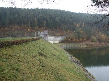
De beste trajecten (8)
![Tocht Te voet Thanstein - Moosweg - Photo](https://media.geolcdn.com/t/350/260/1b793e07-7979-45a2-b2ee-2247369056e3.jpeg&format=jpg&maxdim=2)
![Te voet Te voet](https://static1.geolcdn.com/sitytour/trail-icons/100.png)
Km
Te voet
![](/images/other/stat-length.png)
![](https://static1.geolcdn.com/siteimages/upload/files/1508320355ic_sort_den_pos_24dp.png)
![](https://static1.geolcdn.com/siteimages/upload/files/1508320355ic_sort_den_neg_24dp.png)
![](https://static1.geolcdn.com/siteimages/upload/files/16400158638029165_repeat_loop_refresh_sync_direction_icon.png)
• Trail created by Verwaltungsgem. Neunburg v. Wald. Symbol: weißes Rechteck mit schwarzer Schrift K 4 oder gelbes Rec...
![Tocht Te voet Thanstein - Kaisereichenweg - Photo](https://media.geolcdn.com/t/350/260/cda28eb4-819a-4750-a893-aa0bfcb85ab1.jpeg&format=jpg&maxdim=2)
![Te voet Te voet](https://static1.geolcdn.com/sitytour/trail-icons/100.png)
Km
Te voet
![](/images/other/stat-length.png)
![](https://static1.geolcdn.com/siteimages/upload/files/1508320355ic_sort_den_pos_24dp.png)
![](https://static1.geolcdn.com/siteimages/upload/files/1508320355ic_sort_den_neg_24dp.png)
![](https://static1.geolcdn.com/siteimages/upload/files/16400158638029165_repeat_loop_refresh_sync_direction_icon.png)
• Trail created by Verwaltungsgem. Neunburg v. Wald. Symbol: Rechteck weiß mit schwarzer Schrift T 6
![Tocht Te voet Thanstein - Mühlweiherweg](https://media.geolcdn.com/t/350/260/1b793e07-7979-45a2-b2ee-2247369056e3.jpeg&format=jpg&maxdim=2)
![Te voet Te voet](https://static1.geolcdn.com/sitytour/trail-icons/100.png)
Km
Te voet
![](/images/other/stat-length.png)
![](https://static1.geolcdn.com/siteimages/upload/files/1508320355ic_sort_den_pos_24dp.png)
![](https://static1.geolcdn.com/siteimages/upload/files/1508320355ic_sort_den_neg_24dp.png)
![](https://static1.geolcdn.com/siteimages/upload/files/16400158638029165_repeat_loop_refresh_sync_direction_icon.png)
• Trail created by Verwaltungsgem. Neunburg v. Wald.
![Tocht Te voet Thanstein - Eibensteinweg T 5 - Photo](https://media.geolcdn.com/t/350/260/1b793e07-7979-45a2-b2ee-2247369056e3.jpeg&format=jpg&maxdim=2)
![Te voet Te voet](https://static1.geolcdn.com/sitytour/trail-icons/100.png)
Km
Te voet
![](/images/other/stat-length.png)
![](https://static1.geolcdn.com/siteimages/upload/files/1508320355ic_sort_den_pos_24dp.png)
![](https://static1.geolcdn.com/siteimages/upload/files/1508320355ic_sort_den_neg_24dp.png)
![](https://static1.geolcdn.com/siteimages/upload/files/16400158638029165_repeat_loop_refresh_sync_direction_icon.png)
• Trail created by Verwaltungsgem. Neunburg v. Wald.
![Tocht Te voet Thanstein - Engelbildweg T 7 - Photo](https://media.geolcdn.com/t/350/260/1b793e07-7979-45a2-b2ee-2247369056e3.jpeg&format=jpg&maxdim=2)
![Te voet Te voet](https://static1.geolcdn.com/sitytour/trail-icons/100.png)
Km
Te voet
![](/images/other/stat-length.png)
![](https://static1.geolcdn.com/siteimages/upload/files/1508320355ic_sort_den_pos_24dp.png)
![](https://static1.geolcdn.com/siteimages/upload/files/1508320355ic_sort_den_neg_24dp.png)
![](https://static1.geolcdn.com/siteimages/upload/files/16400158638029165_repeat_loop_refresh_sync_direction_icon.png)
• Trail created by Verwaltungsgem. Neunburg v. Wald.
![Tocht Te voet Thanstein - Bründelsteinweg](https://media.geolcdn.com/t/350/260/1b793e07-7979-45a2-b2ee-2247369056e3.jpeg&format=jpg&maxdim=2)
![Te voet Te voet](https://static1.geolcdn.com/sitytour/trail-icons/100.png)
Km
Te voet
![](/images/other/stat-length.png)
![](https://static1.geolcdn.com/siteimages/upload/files/1508320355ic_sort_den_pos_24dp.png)
![](https://static1.geolcdn.com/siteimages/upload/files/1508320355ic_sort_den_neg_24dp.png)
![](https://static1.geolcdn.com/siteimages/upload/files/16400158638029165_repeat_loop_refresh_sync_direction_icon.png)
• Trail created by Verwaltungsgem. Neunburg v. Wald.
![Tocht Te voet Thanstein - Thanstein-Bauhof-Weg](https://media.geolcdn.com/t/350/260/1b793e07-7979-45a2-b2ee-2247369056e3.jpeg&format=jpg&maxdim=2)
![Te voet Te voet](https://static1.geolcdn.com/sitytour/trail-icons/100.png)
Km
Te voet
![](/images/other/stat-length.png)
![](https://static1.geolcdn.com/siteimages/upload/files/1508320355ic_sort_den_pos_24dp.png)
![](https://static1.geolcdn.com/siteimages/upload/files/1508320355ic_sort_den_neg_24dp.png)
![](https://static1.geolcdn.com/siteimages/upload/files/16400158638029165_repeat_loop_refresh_sync_direction_icon.png)
• Trail created by Verwaltungsgem. Neunburg v. Wald. Symbol: Rechteckiger gelber Hintergrund (Querformat) mit schwarze...
![Tocht Te voet Thanstein - Thanstein-Warberg-Weg](https://media.geolcdn.com/t/350/260/ext.jpg?maxdim=2&url=https%3A%2F%2Fstatic1.geolcdn.com%2Fsiteimages%2Fupload%2Ffiles%2F1545311037marcheuse_200dpi.jpg)
![Te voet Te voet](https://static1.geolcdn.com/sitytour/trail-icons/100.png)
Km
Te voet
![](/images/other/stat-length.png)
![](https://static1.geolcdn.com/siteimages/upload/files/1508320355ic_sort_den_pos_24dp.png)
![](https://static1.geolcdn.com/siteimages/upload/files/1508320355ic_sort_den_neg_24dp.png)
![](https://static1.geolcdn.com/siteimages/upload/files/16400158638029165_repeat_loop_refresh_sync_direction_icon.png)
• Trail created by Verwaltungsgem. Neunburg v. Wald. Symbol: weißes Rechteck mit schwarzer Schrift T 11 oder gelbes Re...
8 tochten weergegeven op 8
Gratisgps-wandelapplicatie