Maxhütte-Haidhof, Landkreis Schwandorf: Top van de beste wandelroutes, trajecten, tochten en wandelingen

Maxhütte-Haidhof: Ontdek de beste tochten: 8 te voet. Al deze tochten, trajecten, routes en outdoor activiteiten zijn beschikbaar in onze SityTrail-apps voor smartphones en tablets.


De beste trajecten (8)

Tocht Te voet Maxhütte-Haidhof - Regentalsteig nach Hirschling (Gelbe 8) - Photo
Te voet 8.307
Km
PRO

Te voet

Gemakkelijk
Maxhütte-Haidhof, Beieren, Landkreis Schwandorf, Germany
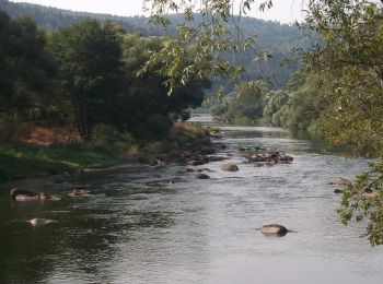
8,3 km | 11,6 km-effort
2h 38min
260 m
220 m
Neen
SityTrail - itinéraires balisés pédestres

• Trail created by Stadt Burglengenfeld, Stadt Teublitz, Stadt Maxhütte-Haidhof.

Tocht Te voet Maxhütte-Haidhof - Ökumenischer Besinnungsweg Thema
Te voet 4.424
Km
PRO

Te voet

Gemakkelijk
Maxhütte-Haidhof, Beieren, Landkreis Schwandorf, Germany
4,4 km | 5,3 km-effort
1h 11min
60 m
76 m
Neen
SityTrail - itinéraires balisés pédestres

• Trail created by Stadt Burglengenfeld, Stadt Teublitz, Stadt Maxhütte-Haidhof. Symbol: yellow_round with white 14

Tocht Te voet Maxhütte-Haidhof - O 78 Leonberg - Ramspau (Rotes Rechteck) - Photo
Te voet 5.235
Km
PRO

Te voet

Gemakkelijk
Maxhütte-Haidhof, Beieren, Landkreis Schwandorf, Germany
5,2 km | 6,7 km-effort
1h 31min
96 m
162 m
Neen
SityTrail - itinéraires balisés pédestres

• Trail created by Waldverein Regensburg. Symbol: Rotes Rechteck auf weißem Grund

Tocht Te voet Maxhütte-Haidhof - O 46 Bahnhof Maxhütte-Haidhof - Knotenpunkt Geilenberg (Rotes Rechteck) - Photo
Te voet 9.024
Km
PRO

Te voet

Gemakkelijk
Maxhütte-Haidhof, Beieren, Landkreis Schwandorf, Germany
9 km | 12,8 km-effort
2h 54min
315 m
184 m
Neen
SityTrail - itinéraires balisés pédestres

• Trail created by Waldverein Regensburg. Symbol: Rotes Rechteck auf weißem Grund

Tocht Te voet Maxhütte-Haidhof - O 48 Bahnhof Maxhütte-Haidhof - Marienthal (Blaues Rechteck) - Photo
Te voet 7.077
Km
PRO

Te voet

Gemakkelijk
Maxhütte-Haidhof, Beieren, Landkreis Schwandorf, Germany
7,1 km | 9,4 km-effort
2h 8min
165 m
204 m
Neen
SityTrail - itinéraires balisés pédestres

• Trail created by Waldverein Regensburg. Symbol: Blaues Rechteck auf weißem Grund

Tocht Te voet Maxhütte-Haidhof - Sagensteig (Rote 7) - Photo
Te voet 6.752
Km
PRO

Te voet

Gemakkelijk
Maxhütte-Haidhof, Beieren, Landkreis Schwandorf, Germany
6,8 km | 9,1 km-effort
2h 3min
177 m
159 m
Neen
SityTrail - itinéraires balisés pédestres

• Trail created by Stadt Burglengenfeld, Stadt Teublitz, Stadt Maxhütte-Haidhof.

Tocht Te voet Maxhütte-Haidhof - Sauforstrunde (Lila 9) - Photo
Te voet 11.871
Km
PRO

Te voet

Gemakkelijk
Maxhütte-Haidhof, Beieren, Landkreis Schwandorf, Germany
11,9 km | 13,8 km-effort
3h 7min
142 m
145 m
Ja
SityTrail - itinéraires balisés pédestres

• Trail created by Städte Burglengenfeld/Maxhütte-Haidhof/Teublitz.

Tocht Te voet Maxhütte-Haidhof - Leonberger Panoramaweg (Graue 11) - Photo
Te voet 6.266
Km
PRO

Te voet

Gemakkelijk
Maxhütte-Haidhof, Beieren, Landkreis Schwandorf, Germany
6,3 km | 8,3 km-effort
1h 53min
155 m
143 m
Ja
SityTrail - itinéraires balisés pédestres

8 tochten weergegeven op 8

Gratisgps-wandelapplicatie

Logo SityTrail SityTrail

IGN / Geografische instituten

SityTrail uit de App Store downloaden SityTrail uit Google Play downloaden

Logo SityTrail SityTrail World

De wereld gaat voor u open

SityTrail uit de App Store downloaden SityTrail uit Google Play downloaden SityTrail op Huawei AppGallery downloaden

Activiteiten

Sluiten
Mijn abonnementen