![](/images/other/stat-length.png)
Landkreis Kelheim, Beieren: Top van de beste wandelroutes, trajecten, tochten en wandelingen
Landkreis Kelheim: Ontdek de beste tochten: 30 te voet. Al deze tochten, trajecten, routes en outdoor activiteiten zijn beschikbaar in onze SityTrail-apps voor smartphones en tablets.
De beste trajecten (31)
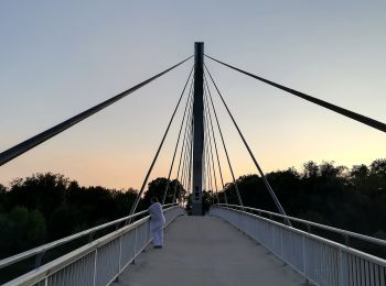
![Tocht Te voet Bad Abbach - K3 Kurpark, Donaupromenade, Fußgängerbrücke, Schleuse BA und zurück - Photo](https://media.geolcdn.com/t/350/260/adcf0f95-6bf4-40b1-8631-ddd4ae6d05a9.jpeg&format=jpg&maxdim=2)
![Te voet Te voet](https://static1.geolcdn.com/sitytour/trail-icons/100.png)
Km
Te voet
![](/images/other/stat-length.png)
![](https://static1.geolcdn.com/siteimages/upload/files/1508320355ic_sort_den_pos_24dp.png)
![](https://static1.geolcdn.com/siteimages/upload/files/1508320355ic_sort_den_neg_24dp.png)
![](https://static1.geolcdn.com/siteimages/upload/files/16400158638029165_repeat_loop_refresh_sync_direction_icon.png)
• Trail created by Bad Abbach. Symbol: Schwarzes K3 auf weißem Hintergrund
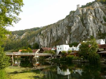
![Tocht Te voet Essing - Rundweg Essing 21 - Photo](https://media.geolcdn.com/t/350/260/2368d308-79f9-4df8-8bcc-98dfb34a40bd.jpeg&format=jpg&maxdim=2)
![Te voet Te voet](https://static1.geolcdn.com/sitytour/trail-icons/100.png)
Km
Te voet
![](/images/other/stat-length.png)
![](https://static1.geolcdn.com/siteimages/upload/files/1508320355ic_sort_den_pos_24dp.png)
![](https://static1.geolcdn.com/siteimages/upload/files/1508320355ic_sort_den_neg_24dp.png)
![](https://static1.geolcdn.com/siteimages/upload/files/16400158638029165_repeat_loop_refresh_sync_direction_icon.png)
• Trail created by Gemeinde Essing. abgeschlossen (August 2014, by cycling_zno) Symbol: Schwarze 19 auf gelbem Grund
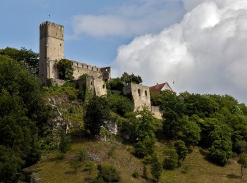
![Tocht Te voet Essing - Rundweg Essing 6 - Photo](https://media.geolcdn.com/t/350/260/eeb119c7-393b-4f05-94e7-a22a6dbbe75b.jpeg&format=jpg&maxdim=2)
![Te voet Te voet](https://static1.geolcdn.com/sitytour/trail-icons/100.png)
Km
Te voet
![](/images/other/stat-length.png)
![](https://static1.geolcdn.com/siteimages/upload/files/1508320355ic_sort_den_pos_24dp.png)
![](https://static1.geolcdn.com/siteimages/upload/files/1508320355ic_sort_den_neg_24dp.png)
![](https://static1.geolcdn.com/siteimages/upload/files/16400158638029165_repeat_loop_refresh_sync_direction_icon.png)
• Trail created by Gemeinde Essing. abgeschlossen (August 2014, by cycling_zno) Symbol: Grüne 6 auf gelbem Pfeil
![Tocht Te voet Hienheimer Forst - Rundweg Essing 5 - Photo](https://media.geolcdn.com/t/350/260/b55984ff-24a1-4825-b19d-b7bfecff122a.jpeg&format=jpg&maxdim=2)
![Te voet Te voet](https://static1.geolcdn.com/sitytour/trail-icons/100.png)
Km
Te voet
![](/images/other/stat-length.png)
![](https://static1.geolcdn.com/siteimages/upload/files/1508320355ic_sort_den_pos_24dp.png)
![](https://static1.geolcdn.com/siteimages/upload/files/1508320355ic_sort_den_neg_24dp.png)
![](https://static1.geolcdn.com/siteimages/upload/files/16400158638029165_repeat_loop_refresh_sync_direction_icon.png)
• Trail created by Gemeinde Essing. abgeschlossen (August 2014, by cycling_zno) Symbol: Grüne 5 auf gelbem Pfeil
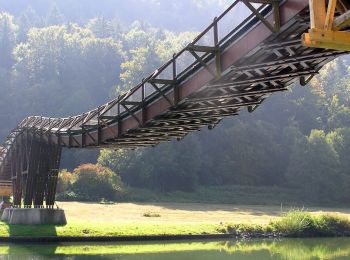
![Tocht Te voet Essing - Rundweg Essing 4 - Photo](https://media.geolcdn.com/t/350/260/f2f32c66-3af0-4280-8b36-366d582e1a70.jpeg&format=jpg&maxdim=2)
![Te voet Te voet](https://static1.geolcdn.com/sitytour/trail-icons/100.png)
Km
Te voet
![](/images/other/stat-length.png)
![](https://static1.geolcdn.com/siteimages/upload/files/1508320355ic_sort_den_pos_24dp.png)
![](https://static1.geolcdn.com/siteimages/upload/files/1508320355ic_sort_den_neg_24dp.png)
![](https://static1.geolcdn.com/siteimages/upload/files/16400158638029165_repeat_loop_refresh_sync_direction_icon.png)
• Trail created by Gemeinde Essing. abgeschlossen (August 2014, by cycling_zno) Symbol: Grüne 4 auf gelbem Pfeil
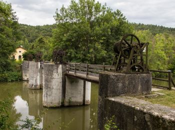
![Tocht Te voet Riedenburg - Rundweg Essing 3 - Photo](https://media.geolcdn.com/t/350/260/3a58a792-a390-45c6-94e3-38879f4a7838.jpeg&format=jpg&maxdim=2)
![Te voet Te voet](https://static1.geolcdn.com/sitytour/trail-icons/100.png)
Km
Te voet
![](/images/other/stat-length.png)
![](https://static1.geolcdn.com/siteimages/upload/files/1508320355ic_sort_den_pos_24dp.png)
![](https://static1.geolcdn.com/siteimages/upload/files/1508320355ic_sort_den_neg_24dp.png)
![](https://static1.geolcdn.com/siteimages/upload/files/16400158638029165_repeat_loop_refresh_sync_direction_icon.png)
• Trail created by Gemeinde Essing. abgeschlossen (August 2014, by cycling_zno) Symbol: Grüne 3 auf gelbem Pfeil
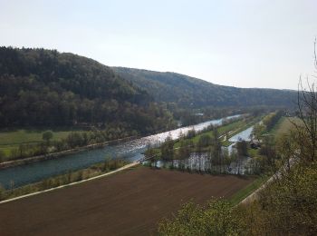
![Tocht Te voet Essing - Rundweg Essing 2 - Photo](https://media.geolcdn.com/t/350/260/4cbce3c3-4063-4504-9f78-aabb5b87919b.jpeg&format=jpg&maxdim=2)
![Te voet Te voet](https://static1.geolcdn.com/sitytour/trail-icons/100.png)
Km
Te voet
![](/images/other/stat-length.png)
![](https://static1.geolcdn.com/siteimages/upload/files/1508320355ic_sort_den_pos_24dp.png)
![](https://static1.geolcdn.com/siteimages/upload/files/1508320355ic_sort_den_neg_24dp.png)
![](https://static1.geolcdn.com/siteimages/upload/files/16400158638029165_repeat_loop_refresh_sync_direction_icon.png)
• Trail created by Gemeinde Essing. abgeschlossen (August 2014, by cycling_zno) Symbol: Grüne 2 auf gelbem Pfeil
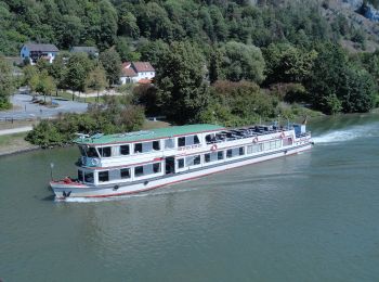
![Tocht Te voet Essing - Rundweg Essing 1 - Photo](https://media.geolcdn.com/t/350/260/1ffbb840-78c9-4b6e-ba20-aa5f75429665.jpeg&format=jpg&maxdim=2)
![Te voet Te voet](https://static1.geolcdn.com/sitytour/trail-icons/100.png)
Km
Te voet
![](/images/other/stat-length.png)
![](https://static1.geolcdn.com/siteimages/upload/files/1508320355ic_sort_den_pos_24dp.png)
![](https://static1.geolcdn.com/siteimages/upload/files/1508320355ic_sort_den_neg_24dp.png)
![](https://static1.geolcdn.com/siteimages/upload/files/16400158638029165_repeat_loop_refresh_sync_direction_icon.png)
• Trail created by Gemeinde Essing. abgeschlossen (August 2014, by cycling_zno) Symbol: Grüne 1 auf gelbem Pfeil
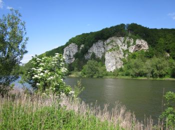
![Tocht Te voet Bad Abbach - S 03 Saal Bf - Bad Abbach Bf (Rotes Rechteck) - Photo](https://media.geolcdn.com/t/350/260/638f45b1-c4af-4aaf-8968-1e05d82aae5e.jpeg&format=jpg&maxdim=2)
![Te voet Te voet](https://static1.geolcdn.com/sitytour/trail-icons/100.png)
Km
Te voet
![](/images/other/stat-length.png)
![](https://static1.geolcdn.com/siteimages/upload/files/1508320355ic_sort_den_pos_24dp.png)
![](https://static1.geolcdn.com/siteimages/upload/files/1508320355ic_sort_den_neg_24dp.png)
![](https://static1.geolcdn.com/siteimages/upload/files/16400158638029165_repeat_loop_refresh_sync_direction_icon.png)
• Trail created by Waldverein Regensburg. Symbol: Rotes Rechteck auf weißem Grund
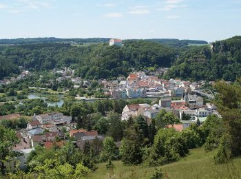
![Tocht Te voet Riedenburg - Rundweg Riedenburg 17 - Photo](https://media.geolcdn.com/t/350/260/35e41579-2452-46ea-9a00-bf9c92343d72.jpeg&format=jpg&maxdim=2)
![Te voet Te voet](https://static1.geolcdn.com/sitytour/trail-icons/100.png)
Km
Te voet
![](/images/other/stat-length.png)
![](https://static1.geolcdn.com/siteimages/upload/files/1508320355ic_sort_den_pos_24dp.png)
![](https://static1.geolcdn.com/siteimages/upload/files/1508320355ic_sort_den_neg_24dp.png)
![](https://static1.geolcdn.com/siteimages/upload/files/16400158638029165_repeat_loop_refresh_sync_direction_icon.png)
• Trail created by Stadt Riedenburg. abgeschlossen (Mai 2104, by cycling_zno) Symbol: Schwarze 17 auf gelbem Grund
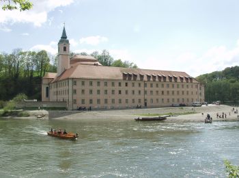
![Tocht Te voet Hienheimer Forst - Rundweg Riedenburg 16 - Photo](https://media.geolcdn.com/t/350/260/a73533ef-377b-4f0b-ba2d-a029a8ac1462.jpeg&format=jpg&maxdim=2)
![Te voet Te voet](https://static1.geolcdn.com/sitytour/trail-icons/100.png)
Km
Te voet
![](/images/other/stat-length.png)
![](https://static1.geolcdn.com/siteimages/upload/files/1508320355ic_sort_den_pos_24dp.png)
![](https://static1.geolcdn.com/siteimages/upload/files/1508320355ic_sort_den_neg_24dp.png)
![](https://static1.geolcdn.com/siteimages/upload/files/16400158638029165_repeat_loop_refresh_sync_direction_icon.png)
• Trail created by Stadt Riedenburg. Wiederspruch tags name-description abgeschlossen (Mai 2104, by cycling_zno) Symb...
![Tocht Te voet Riedenburg - Rundweg Riedenburg 14 - Photo](https://media.geolcdn.com/t/350/260/4eaedbc6-d82e-436b-bcaa-5b95d4fe280a.jpeg&format=jpg&maxdim=2)
![Te voet Te voet](https://static1.geolcdn.com/sitytour/trail-icons/100.png)
Km
Te voet
![](/images/other/stat-length.png)
![](https://static1.geolcdn.com/siteimages/upload/files/1508320355ic_sort_den_pos_24dp.png)
![](https://static1.geolcdn.com/siteimages/upload/files/1508320355ic_sort_den_neg_24dp.png)
![](https://static1.geolcdn.com/siteimages/upload/files/16400158638029165_repeat_loop_refresh_sync_direction_icon.png)
• Trail created by Stadt Riedenburg. abgeschlossen (Mai 2104, by cycling_zno) Symbol: Schwarze 14 auf gelbem Grund
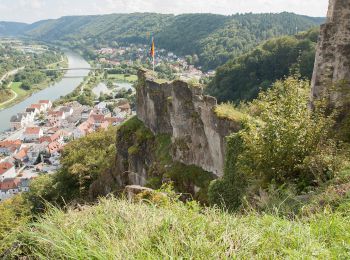
![Tocht Te voet Riedenburg - Rundweg Riedenburg 13 - Photo](https://media.geolcdn.com/t/350/260/ad014142-7c0f-47b0-bbe3-66015a1635b0.jpeg&format=jpg&maxdim=2)
![Te voet Te voet](https://static1.geolcdn.com/sitytour/trail-icons/100.png)
Km
Te voet
![](/images/other/stat-length.png)
![](https://static1.geolcdn.com/siteimages/upload/files/1508320355ic_sort_den_pos_24dp.png)
![](https://static1.geolcdn.com/siteimages/upload/files/1508320355ic_sort_den_neg_24dp.png)
![](https://static1.geolcdn.com/siteimages/upload/files/16400158638029165_repeat_loop_refresh_sync_direction_icon.png)
• Trail created by Stadt Riedenburg. abgeschlossen (Mai 2104, by cycling_zno) Symbol: Schwarze 13 auf gelbem Grund
![Tocht Te voet Riedenburg - Rundweg Riedenburg 11 - Photo](https://media.geolcdn.com/t/350/260/ad014142-7c0f-47b0-bbe3-66015a1635b0.jpeg&format=jpg&maxdim=2)
![Te voet Te voet](https://static1.geolcdn.com/sitytour/trail-icons/100.png)
Km
Te voet
![](/images/other/stat-length.png)
![](https://static1.geolcdn.com/siteimages/upload/files/1508320355ic_sort_den_pos_24dp.png)
![](https://static1.geolcdn.com/siteimages/upload/files/1508320355ic_sort_den_neg_24dp.png)
![](https://static1.geolcdn.com/siteimages/upload/files/16400158638029165_repeat_loop_refresh_sync_direction_icon.png)
• Trail created by Stadt Riedenburg. abgeschlossen (Mai 2104, by cycling_zno) Symbol: Schwarze 11 auf gelbem Grund
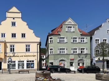
![Tocht Te voet Riedenburg - Rundweg Riedenbeurg 2 - Photo](https://media.geolcdn.com/t/350/260/7802446c-640e-4bf5-b38b-023cbfd1706a.jpeg&format=jpg&maxdim=2)
![Te voet Te voet](https://static1.geolcdn.com/sitytour/trail-icons/100.png)
Km
Te voet
![](/images/other/stat-length.png)
![](https://static1.geolcdn.com/siteimages/upload/files/1508320355ic_sort_den_pos_24dp.png)
![](https://static1.geolcdn.com/siteimages/upload/files/1508320355ic_sort_den_neg_24dp.png)
![](https://static1.geolcdn.com/siteimages/upload/files/16400158638029165_repeat_loop_refresh_sync_direction_icon.png)
• Trail created by Stadt Riedenburg. abgeschlossen (Mai 2104, by cycling_zno) Symbol: Schwarze 2 auf gelbem Grund
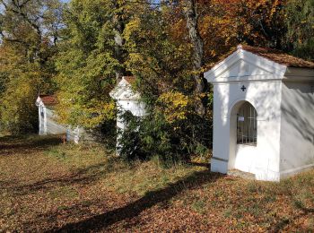
![Tocht Te voet Kelheim - Ortswanderweg Kelheim 4 - Photo](https://media.geolcdn.com/t/350/260/121231fc-5d7a-4b53-94a9-a80b1a82fc5d.jpeg&format=jpg&maxdim=2)
![Te voet Te voet](https://static1.geolcdn.com/sitytour/trail-icons/100.png)
Km
Te voet
![](/images/other/stat-length.png)
![](https://static1.geolcdn.com/siteimages/upload/files/1508320355ic_sort_den_pos_24dp.png)
![](https://static1.geolcdn.com/siteimages/upload/files/1508320355ic_sort_den_neg_24dp.png)
![](https://static1.geolcdn.com/siteimages/upload/files/16400158638029165_repeat_loop_refresh_sync_direction_icon.png)
• Trail created by Stadt Kelheim. abgeschlossen (März 2014, by cycling_zno) Symbol: Grüne 4 auf gelbem Grund
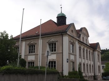
![Tocht Te voet Ihrlerstein - Ortswanderweg Ihrlerstein - Photo](https://media.geolcdn.com/t/350/260/eef7e986-dfc8-4206-99f4-9718967f2d47.jpeg&format=jpg&maxdim=2)
![Te voet Te voet](https://static1.geolcdn.com/sitytour/trail-icons/100.png)
Km
Te voet
![](/images/other/stat-length.png)
![](https://static1.geolcdn.com/siteimages/upload/files/1508320355ic_sort_den_pos_24dp.png)
![](https://static1.geolcdn.com/siteimages/upload/files/1508320355ic_sort_den_neg_24dp.png)
![](https://static1.geolcdn.com/siteimages/upload/files/16400158638029165_repeat_loop_refresh_sync_direction_icon.png)
• Trail created by Gemeinde Ihrlerstein. abgeschlossen (März 2014, by cycling_zno) Symbol: Grüne 1 auf gelbem Grund
![Tocht Te voet Kelheim - W ... Kelheim - Weltenburg (Rotes Dreieck) - Photo](https://media.geolcdn.com/t/350/260/a73533ef-377b-4f0b-ba2d-a029a8ac1462.jpeg&format=jpg&maxdim=2)
![Te voet Te voet](https://static1.geolcdn.com/sitytour/trail-icons/100.png)
Km
Te voet
![](/images/other/stat-length.png)
![](https://static1.geolcdn.com/siteimages/upload/files/1508320355ic_sort_den_pos_24dp.png)
![](https://static1.geolcdn.com/siteimages/upload/files/1508320355ic_sort_den_neg_24dp.png)
![](https://static1.geolcdn.com/siteimages/upload/files/16400158638029165_repeat_loop_refresh_sync_direction_icon.png)
• Trail created by Waldverein Regensburg. Symbol: Rotes Dreieck (Spitze zur Seite) auf weißem Grund
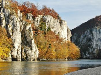
![Tocht Te voet Kelheim - W 59 Kelheim - Weltenburg (Rotes Rechteck) - Photo](https://media.geolcdn.com/t/350/260/4941a7a3-32a5-41bc-9558-f982a7ac4cb7.jpeg&format=jpg&maxdim=2)
![Te voet Te voet](https://static1.geolcdn.com/sitytour/trail-icons/100.png)
Km
Te voet
![](/images/other/stat-length.png)
![](https://static1.geolcdn.com/siteimages/upload/files/1508320355ic_sort_den_pos_24dp.png)
![](https://static1.geolcdn.com/siteimages/upload/files/1508320355ic_sort_den_neg_24dp.png)
![](https://static1.geolcdn.com/siteimages/upload/files/16400158638029165_repeat_loop_refresh_sync_direction_icon.png)
• Trail created by Waldverein Regensburg. Symbol: Rotes Rechteck auf weißem Grund
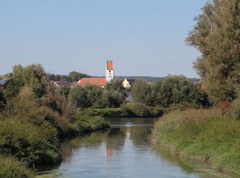
![Tocht Te voet Neustadt an der Donau - Jurasteig Römer-Schlaufe - Photo](https://media.geolcdn.com/t/350/260/780adda3-b2c7-4ed4-87fb-9176cacc1b11.jpeg&format=jpg&maxdim=2)
![Te voet Te voet](https://static1.geolcdn.com/sitytour/trail-icons/100.png)
Km
Te voet
![](/images/other/stat-length.png)
![](https://static1.geolcdn.com/siteimages/upload/files/1508320355ic_sort_den_pos_24dp.png)
![](https://static1.geolcdn.com/siteimages/upload/files/1508320355ic_sort_den_neg_24dp.png)
![](https://static1.geolcdn.com/siteimages/upload/files/16400158638029165_repeat_loop_refresh_sync_direction_icon.png)
• Trail created by Gebietsgemeinschaft Bayerischer Jura. geprüft (April 2014, by cycling_zno) Symbol: Gelbe Schleife ...
20 tochten weergegeven op 31
Gratisgps-wandelapplicatie