![](/images/other/stat-length.png)
Landkreis Neustadt an der Waldnaab, Beieren: Top van de beste wandelroutes, trajecten, tochten en wandelingen
Landkreis Neustadt an der Waldnaab: Ontdek de beste tochten: 64 te voet en 1 met de fiets of mountainbike. Al deze tochten, trajecten, routes en outdoor activiteiten zijn beschikbaar in onze SityTrail-apps voor smartphones en tablets.
De beste trajecten (84)
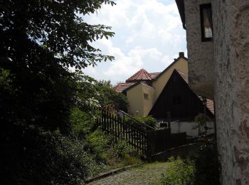
![Tocht Te voet Leuchtenberg - 1 Lerautal - Photo](https://media.geolcdn.com/t/350/260/2ce875d9-c41e-4923-966d-4f0756941b4d.jpeg&format=jpg&maxdim=2)
![Te voet Te voet](https://static1.geolcdn.com/sitytour/trail-icons/100.png)
Km
Te voet
![](/images/other/stat-length.png)
![](https://static1.geolcdn.com/siteimages/upload/files/1508320355ic_sort_den_pos_24dp.png)
![](https://static1.geolcdn.com/siteimages/upload/files/1508320355ic_sort_den_neg_24dp.png)
![](https://static1.geolcdn.com/siteimages/upload/files/16400158638029165_repeat_loop_refresh_sync_direction_icon.png)
• Trail created by OWV Leuchtenberg. Symbol: Rotes Viereck mit Schwarzer 1
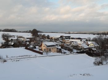
![Tocht Te voet Kohlberg - Wanderweg 1 - Photo](https://media.geolcdn.com/t/350/260/a6946237-faf7-4b86-8549-739426b87601.jpeg&format=jpg&maxdim=2)
![Te voet Te voet](https://static1.geolcdn.com/sitytour/trail-icons/100.png)
Km
Te voet
![](/images/other/stat-length.png)
![](https://static1.geolcdn.com/siteimages/upload/files/1508320355ic_sort_den_pos_24dp.png)
![](https://static1.geolcdn.com/siteimages/upload/files/1508320355ic_sort_den_neg_24dp.png)
![](https://static1.geolcdn.com/siteimages/upload/files/16400158638029165_repeat_loop_refresh_sync_direction_icon.png)
• Trail created by Oberpfälzer Waldverein Kohlberg.
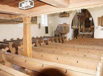
![Tocht Te voet Kohlberg - Wanderweg 2 - Photo](https://media.geolcdn.com/t/350/260/3608d380-8537-427e-a1d3-43ddd9fb5f73.jpeg&format=jpg&maxdim=2)
![Te voet Te voet](https://static1.geolcdn.com/sitytour/trail-icons/100.png)
Km
Te voet
![](/images/other/stat-length.png)
![](https://static1.geolcdn.com/siteimages/upload/files/1508320355ic_sort_den_pos_24dp.png)
![](https://static1.geolcdn.com/siteimages/upload/files/1508320355ic_sort_den_neg_24dp.png)
![](https://static1.geolcdn.com/siteimages/upload/files/16400158638029165_repeat_loop_refresh_sync_direction_icon.png)
• Trail created by Oberpfälzer Waldverein Kohlberg.
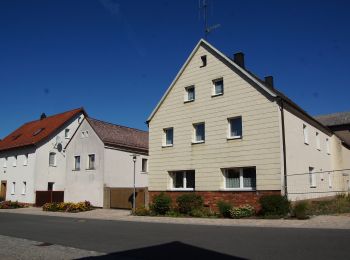
![Tocht Te voet Kohlberg - Wanderweg 5 - Photo](https://media.geolcdn.com/t/350/260/4216dd85-35eb-470d-9a5d-b867aca22c24.jpeg&format=jpg&maxdim=2)
![Te voet Te voet](https://static1.geolcdn.com/sitytour/trail-icons/100.png)
Km
Te voet
![](/images/other/stat-length.png)
![](https://static1.geolcdn.com/siteimages/upload/files/1508320355ic_sort_den_pos_24dp.png)
![](https://static1.geolcdn.com/siteimages/upload/files/1508320355ic_sort_den_neg_24dp.png)
![](https://static1.geolcdn.com/siteimages/upload/files/16400158638029165_repeat_loop_refresh_sync_direction_icon.png)
• Trail created by Oberpfälzer Waldverein Kohlberg.
![Tocht Te voet Kohlberg - Wanderweg 7 - Photo](https://media.geolcdn.com/t/350/260/a6946237-faf7-4b86-8549-739426b87601.jpeg&format=jpg&maxdim=2)
![Te voet Te voet](https://static1.geolcdn.com/sitytour/trail-icons/100.png)
Km
Te voet
![](/images/other/stat-length.png)
![](https://static1.geolcdn.com/siteimages/upload/files/1508320355ic_sort_den_pos_24dp.png)
![](https://static1.geolcdn.com/siteimages/upload/files/1508320355ic_sort_den_neg_24dp.png)
![](https://static1.geolcdn.com/siteimages/upload/files/16400158638029165_repeat_loop_refresh_sync_direction_icon.png)
• Trail created by Oberpfälzer Waldverein Kohlberg.
![Tocht Te voet Kohlberg - Wanderweg 6 - Photo](https://media.geolcdn.com/t/350/260/a6946237-faf7-4b86-8549-739426b87601.jpeg&format=jpg&maxdim=2)
![Te voet Te voet](https://static1.geolcdn.com/sitytour/trail-icons/100.png)
Km
Te voet
![](/images/other/stat-length.png)
![](https://static1.geolcdn.com/siteimages/upload/files/1508320355ic_sort_den_pos_24dp.png)
![](https://static1.geolcdn.com/siteimages/upload/files/1508320355ic_sort_den_neg_24dp.png)
![](https://static1.geolcdn.com/siteimages/upload/files/16400158638029165_repeat_loop_refresh_sync_direction_icon.png)
• Trail created by Oberpfälzer Waldverein Kohlberg.
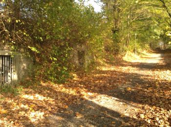
![Tocht Te voet Moosbach - Moosbach - Rundwanderweg 3 - Photo](https://media.geolcdn.com/t/350/260/6f6732bf-bd68-4869-a269-3a67fd8aa48b.jpeg&format=jpg&maxdim=2)
![Te voet Te voet](https://static1.geolcdn.com/sitytour/trail-icons/100.png)
Km
Te voet
![](/images/other/stat-length.png)
![](https://static1.geolcdn.com/siteimages/upload/files/1508320355ic_sort_den_pos_24dp.png)
![](https://static1.geolcdn.com/siteimages/upload/files/1508320355ic_sort_den_neg_24dp.png)
![](https://static1.geolcdn.com/siteimages/upload/files/16400158638029165_repeat_loop_refresh_sync_direction_icon.png)
• Trail created by Oberpfälzer Waldverein. Symbol: blue 3 on white background
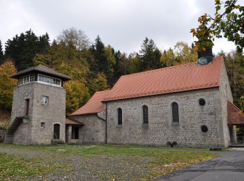
![Tocht Te voet Flossenbürg - Schellenberg - Flossenbürg - Photo](https://media.geolcdn.com/t/350/260/10f949e0-a561-4dc7-b94c-63eb187c72a8.jpeg&format=jpg&maxdim=2)
![Te voet Te voet](https://static1.geolcdn.com/sitytour/trail-icons/100.png)
Km
Te voet
![](/images/other/stat-length.png)
![](https://static1.geolcdn.com/siteimages/upload/files/1508320355ic_sort_den_pos_24dp.png)
![](https://static1.geolcdn.com/siteimages/upload/files/1508320355ic_sort_den_neg_24dp.png)
![](https://static1.geolcdn.com/siteimages/upload/files/16400158638029165_repeat_loop_refresh_sync_direction_icon.png)
• Symbol: Auf weißem, rechteckigen Grund ein blaues zur Seite weisendes Dreieck
![Tocht Te voet Windischeschenbach - Windischeschenbach Rundwanderweg Nr. 8 - Photo](https://media.geolcdn.com/t/350/260/9c770dec-95b0-4717-8529-9e4c0c4504e6.jpeg&format=jpg&maxdim=2)
![Te voet Te voet](https://static1.geolcdn.com/sitytour/trail-icons/100.png)
Km
Te voet
![](/images/other/stat-length.png)
![](https://static1.geolcdn.com/siteimages/upload/files/1508320355ic_sort_den_pos_24dp.png)
![](https://static1.geolcdn.com/siteimages/upload/files/1508320355ic_sort_den_neg_24dp.png)
![](https://static1.geolcdn.com/siteimages/upload/files/16400158638029165_repeat_loop_refresh_sync_direction_icon.png)
• Symbol: Schwarze 8 auf weißem Grund
![Tocht Te voet Waidhaus - RW: Waidhaus – Ulrichsberg – Waidhaus - Photo](https://media.geolcdn.com/t/350/260/6ce2a4a2-b98b-47b9-9d44-2a10fe1ed3c3.jpeg&format=jpg&maxdim=2)
![Te voet Te voet](https://static1.geolcdn.com/sitytour/trail-icons/100.png)
Km
Te voet
![](/images/other/stat-length.png)
![](https://static1.geolcdn.com/siteimages/upload/files/1508320355ic_sort_den_pos_24dp.png)
![](https://static1.geolcdn.com/siteimages/upload/files/1508320355ic_sort_den_neg_24dp.png)
![](https://static1.geolcdn.com/siteimages/upload/files/16400158638029165_repeat_loop_refresh_sync_direction_icon.png)
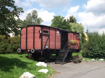
• Trail created by Oberpfälzer Waldverein. Symbol: Rote Raute auf weißem Grund Website: http://owv-waidhaus.de/?page...
![Tocht Te voet Waidhaus - RW: Waidhaus – Frankenreuth – Grenzübergang – Waidhaus - Photo](https://media.geolcdn.com/t/350/260/6ce2a4a2-b98b-47b9-9d44-2a10fe1ed3c3.jpeg&format=jpg&maxdim=2)
![Te voet Te voet](https://static1.geolcdn.com/sitytour/trail-icons/100.png)
Km
Te voet
![](/images/other/stat-length.png)
![](https://static1.geolcdn.com/siteimages/upload/files/1508320355ic_sort_den_pos_24dp.png)
![](https://static1.geolcdn.com/siteimages/upload/files/1508320355ic_sort_den_neg_24dp.png)
![](https://static1.geolcdn.com/siteimages/upload/files/16400158638029165_repeat_loop_refresh_sync_direction_icon.png)
• Trail created by Oberpfälzer Waldverein. Symbol: Rote s Dreieck auf weißem Grund Website: http://owv-waidhaus.de/?...
![Tocht Te voet Windischeschenbach - Windischeschenbach Rundwanderweg Nr. 3 - Photo](https://media.geolcdn.com/t/350/260/e005d0f2-9ecf-446e-972b-6c0133a1f866.jpeg&format=jpg&maxdim=2)
![Te voet Te voet](https://static1.geolcdn.com/sitytour/trail-icons/100.png)
Km
Te voet
![](/images/other/stat-length.png)
![](https://static1.geolcdn.com/siteimages/upload/files/1508320355ic_sort_den_pos_24dp.png)
![](https://static1.geolcdn.com/siteimages/upload/files/1508320355ic_sort_den_neg_24dp.png)
![](https://static1.geolcdn.com/siteimages/upload/files/16400158638029165_repeat_loop_refresh_sync_direction_icon.png)
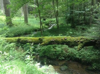
• Symbol: Schwarze 3 auf weißem Grund
![Tocht Te voet Windischeschenbach - Windischeschenbach Rundwanderweg Nr. 2 - Photo](https://media.geolcdn.com/t/350/260/e005d0f2-9ecf-446e-972b-6c0133a1f866.jpeg&format=jpg&maxdim=2)
![Te voet Te voet](https://static1.geolcdn.com/sitytour/trail-icons/100.png)
Km
Te voet
![](/images/other/stat-length.png)
![](https://static1.geolcdn.com/siteimages/upload/files/1508320355ic_sort_den_pos_24dp.png)
![](https://static1.geolcdn.com/siteimages/upload/files/1508320355ic_sort_den_neg_24dp.png)
![](https://static1.geolcdn.com/siteimages/upload/files/16400158638029165_repeat_loop_refresh_sync_direction_icon.png)
• Symbol: Schwarze 2 auf weißem Grund
![Tocht Te voet Schlammersdorf - Holzmühle Rundweg 1 - Photo](https://media.geolcdn.com/t/350/260/6f3556ef-1466-48bd-8b0e-76914fee48a5.jpeg&format=jpg&maxdim=2)
![Te voet Te voet](https://static1.geolcdn.com/sitytour/trail-icons/100.png)
Km
Te voet
![](/images/other/stat-length.png)
![](https://static1.geolcdn.com/siteimages/upload/files/1508320355ic_sort_den_pos_24dp.png)
![](https://static1.geolcdn.com/siteimages/upload/files/1508320355ic_sort_den_neg_24dp.png)
![](https://static1.geolcdn.com/siteimages/upload/files/16400158638029165_repeat_loop_refresh_sync_direction_icon.png)
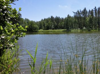
• Symbol: blaue 1 in weißem Kreis
![Tocht Te voet Parkstein - Parkstein Ringweg 7 - Photo](https://media.geolcdn.com/t/350/260/9404fbb6-440a-4041-89e4-8efb06d78360.jpeg&format=jpg&maxdim=2)
![Te voet Te voet](https://static1.geolcdn.com/sitytour/trail-icons/100.png)
Km
Te voet
![](/images/other/stat-length.png)
![](https://static1.geolcdn.com/siteimages/upload/files/1508320355ic_sort_den_pos_24dp.png)
![](https://static1.geolcdn.com/siteimages/upload/files/1508320355ic_sort_den_neg_24dp.png)
![](https://static1.geolcdn.com/siteimages/upload/files/16400158638029165_repeat_loop_refresh_sync_direction_icon.png)
• Trail created by OWV Parkstein.
![Tocht Te voet Parkstein - Parkstein Ringweg 6 - Photo](https://media.geolcdn.com/t/350/260/9404fbb6-440a-4041-89e4-8efb06d78360.jpeg&format=jpg&maxdim=2)
![Te voet Te voet](https://static1.geolcdn.com/sitytour/trail-icons/100.png)
Km
Te voet
![](/images/other/stat-length.png)
![](https://static1.geolcdn.com/siteimages/upload/files/1508320355ic_sort_den_pos_24dp.png)
![](https://static1.geolcdn.com/siteimages/upload/files/1508320355ic_sort_den_neg_24dp.png)
![](https://static1.geolcdn.com/siteimages/upload/files/16400158638029165_repeat_loop_refresh_sync_direction_icon.png)
• Trail created by OWV Parkstein.
![Tocht Te voet Parkstein - Parkstein Ringweg 5 - Photo](https://media.geolcdn.com/t/350/260/9404fbb6-440a-4041-89e4-8efb06d78360.jpeg&format=jpg&maxdim=2)
![Te voet Te voet](https://static1.geolcdn.com/sitytour/trail-icons/100.png)
Km
Te voet
![](/images/other/stat-length.png)
![](https://static1.geolcdn.com/siteimages/upload/files/1508320355ic_sort_den_pos_24dp.png)
![](https://static1.geolcdn.com/siteimages/upload/files/1508320355ic_sort_den_neg_24dp.png)
![](https://static1.geolcdn.com/siteimages/upload/files/16400158638029165_repeat_loop_refresh_sync_direction_icon.png)
• Trail created by OWV Parkstein.
![Tocht Te voet Parkstein - Parkstein Ringweg 4a - Photo](https://media.geolcdn.com/t/350/260/9404fbb6-440a-4041-89e4-8efb06d78360.jpeg&format=jpg&maxdim=2)
![Te voet Te voet](https://static1.geolcdn.com/sitytour/trail-icons/100.png)
Km
Te voet
![](/images/other/stat-length.png)
![](https://static1.geolcdn.com/siteimages/upload/files/1508320355ic_sort_den_pos_24dp.png)
![](https://static1.geolcdn.com/siteimages/upload/files/1508320355ic_sort_den_neg_24dp.png)
![](https://static1.geolcdn.com/siteimages/upload/files/16400158638029165_repeat_loop_refresh_sync_direction_icon.png)
• Trail created by OWV Parkstein.
![Tocht Te voet Parkstein - Parkstein Ringweg 3 - Photo](https://media.geolcdn.com/t/350/260/9404fbb6-440a-4041-89e4-8efb06d78360.jpeg&format=jpg&maxdim=2)
![Te voet Te voet](https://static1.geolcdn.com/sitytour/trail-icons/100.png)
Km
Te voet
![](/images/other/stat-length.png)
![](https://static1.geolcdn.com/siteimages/upload/files/1508320355ic_sort_den_pos_24dp.png)
![](https://static1.geolcdn.com/siteimages/upload/files/1508320355ic_sort_den_neg_24dp.png)
![](https://static1.geolcdn.com/siteimages/upload/files/16400158638029165_repeat_loop_refresh_sync_direction_icon.png)
• Trail created by OWV Parkstein.
![Tocht Te voet Parkstein - Parkstein Ringweg 2 - Photo](https://media.geolcdn.com/t/350/260/9404fbb6-440a-4041-89e4-8efb06d78360.jpeg&format=jpg&maxdim=2)
![Te voet Te voet](https://static1.geolcdn.com/sitytour/trail-icons/100.png)
Km
Te voet
![](/images/other/stat-length.png)
![](https://static1.geolcdn.com/siteimages/upload/files/1508320355ic_sort_den_pos_24dp.png)
![](https://static1.geolcdn.com/siteimages/upload/files/1508320355ic_sort_den_neg_24dp.png)
![](https://static1.geolcdn.com/siteimages/upload/files/16400158638029165_repeat_loop_refresh_sync_direction_icon.png)
• Trail created by OWV Parkstein.
20 tochten weergegeven op 84
Gratisgps-wandelapplicatie