![](/images/other/stat-length.png)
- Tochten
- Outdoor
- Czech Republic
- Zuidwest
- Zuid-Bohemen
Zuid-Bohemen, Zuidwest: Top van de beste wandelroutes, trajecten, tochten en wandelingen
Zuid-Bohemen: Ontdek de beste tochten: 167 te voet en 2 met de fiets of mountainbike. Al deze tochten, trajecten, routes en outdoor activiteiten zijn beschikbaar in onze SityTrail-apps voor smartphones en tablets.
De beste trajecten (170)
![Tocht Te voet Polná na Šumavě - NS Olšina - Photo](https://media.geolcdn.com/t/350/260/d4dd5415-e6fc-4961-98ea-93ee979025e5.jpeg&format=jpg&maxdim=2)
![Te voet Te voet](https://static1.geolcdn.com/sitytour/trail-icons/100.png)
Km
Te voet
![](/images/other/stat-length.png)
![](https://static1.geolcdn.com/siteimages/upload/files/1508320355ic_sort_den_pos_24dp.png)
![](https://static1.geolcdn.com/siteimages/upload/files/1508320355ic_sort_den_neg_24dp.png)
![](https://static1.geolcdn.com/siteimages/upload/files/16400158638029165_repeat_loop_refresh_sync_direction_icon.png)
• VLS ČR, s.p. je státní společnost s více než 80. letou tradicí, s kořeny v první republice. Website: https://www.vls...
![Tocht Te voet Prachatice - Goldsteig Verbindungsweg Černý Kříž - Prachatice - Photo](https://media.geolcdn.com/t/350/260/c3c91cea-0a90-4fdc-abb9-2afc1597ecb3.jpeg&format=jpg&maxdim=2)
![Te voet Te voet](https://static1.geolcdn.com/sitytour/trail-icons/100.png)
Km
Te voet
![](/images/other/stat-length.png)
![](https://static1.geolcdn.com/siteimages/upload/files/1508320355ic_sort_den_pos_24dp.png)
![](https://static1.geolcdn.com/siteimages/upload/files/1508320355ic_sort_den_neg_24dp.png)
![](https://static1.geolcdn.com/siteimages/upload/files/16400158638029165_repeat_loop_refresh_sync_direction_icon.png)
• Symbool: blauer, stilisierter s-förmiger Weg auf weißem, rechteckigen Grund Website: https://zlatoustezkou.cz/route...
![Tocht Te voet Mažice - Mažická naučná stezka - Photo](https://media.geolcdn.com/t/350/260/16fef0e7-7257-4b99-8729-a923498d289a.jpeg&format=jpg&maxdim=2)
![Te voet Te voet](https://static1.geolcdn.com/sitytour/trail-icons/100.png)
Km
Te voet
![](/images/other/stat-length.png)
![](https://static1.geolcdn.com/siteimages/upload/files/1508320355ic_sort_den_pos_24dp.png)
![](https://static1.geolcdn.com/siteimages/upload/files/1508320355ic_sort_den_neg_24dp.png)
![](https://static1.geolcdn.com/siteimages/upload/files/16400158638029165_repeat_loop_refresh_sync_direction_icon.png)
• Tocht aangemaakt door KČT.
![Tocht Te voet Albrechtice nad Vltavou - Historická stezka Albrechtickem - Photo](https://media.geolcdn.com/t/350/260/4ec0b7ff-0c97-4fba-b42c-637cce5f02aa.jpeg&format=jpg&maxdim=2)
![Te voet Te voet](https://static1.geolcdn.com/sitytour/trail-icons/100.png)
Km
Te voet
![](/images/other/stat-length.png)
![](https://static1.geolcdn.com/siteimages/upload/files/1508320355ic_sort_den_pos_24dp.png)
![](https://static1.geolcdn.com/siteimages/upload/files/1508320355ic_sort_den_neg_24dp.png)
![](https://static1.geolcdn.com/siteimages/upload/files/16400158638029165_repeat_loop_refresh_sync_direction_icon.png)
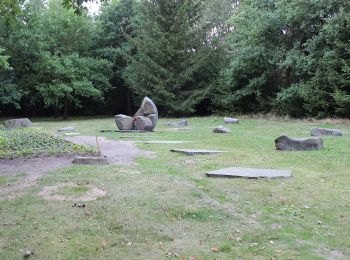
• Tocht aangemaakt door obec Albrechtice n. Vlt.. chybi zastaveni 8 v Albrechticich
![Tocht Te voet Písek - [Č] Písek - Velká Brašna - Photo](https://media.geolcdn.com/t/350/260/bfca88cd-0504-44c2-9a66-8e406f087387.jpeg&format=jpg&maxdim=2)
![Te voet Te voet](https://static1.geolcdn.com/sitytour/trail-icons/100.png)
Km
Te voet
![](/images/other/stat-length.png)
![](https://static1.geolcdn.com/siteimages/upload/files/1508320355ic_sort_den_pos_24dp.png)
![](https://static1.geolcdn.com/siteimages/upload/files/1508320355ic_sort_den_neg_24dp.png)
![](https://static1.geolcdn.com/siteimages/upload/files/16400158638029165_repeat_loop_refresh_sync_direction_icon.png)
• Tocht aangemaakt door cz:KČT.
![Tocht Te voet Nová Ves - Vidov - Hůrka - Photo](https://media.geolcdn.com/t/350/260/a002da0c-6900-4fa2-8565-48e5dba76a10.jpeg&format=jpg&maxdim=2)
![Te voet Te voet](https://static1.geolcdn.com/sitytour/trail-icons/100.png)
Km
Te voet
![](/images/other/stat-length.png)
![](https://static1.geolcdn.com/siteimages/upload/files/1508320355ic_sort_den_pos_24dp.png)
![](https://static1.geolcdn.com/siteimages/upload/files/1508320355ic_sort_den_neg_24dp.png)
![](https://static1.geolcdn.com/siteimages/upload/files/16400158638029165_repeat_loop_refresh_sync_direction_icon.png)
• Tocht aangemaakt door cz:KČT. Symbool: white yellow white
![Tocht Te voet Týn nad Vltavou - [Ž] Nad Překvapením - Semenec (rozhl.) - Photo](https://media.geolcdn.com/t/350/260/5b43c739-7905-4a0c-8a8b-63468991b1a9.jpeg&format=jpg&maxdim=2)
![Te voet Te voet](https://static1.geolcdn.com/sitytour/trail-icons/100.png)
Km
Te voet
![](/images/other/stat-length.png)
![](https://static1.geolcdn.com/siteimages/upload/files/1508320355ic_sort_den_pos_24dp.png)
![](https://static1.geolcdn.com/siteimages/upload/files/1508320355ic_sort_den_neg_24dp.png)
![](https://static1.geolcdn.com/siteimages/upload/files/16400158638029165_repeat_loop_refresh_sync_direction_icon.png)
• Tocht aangemaakt door cz:KČT.
![Tocht Te voet Všemyslice - naučná stezka Za Neznašovským kohoutem - Photo](https://media.geolcdn.com/t/350/260/d0ca1351-ea77-4047-a33d-45b3a503a3ef.jpeg&format=jpg&maxdim=2)
![Te voet Te voet](https://static1.geolcdn.com/sitytour/trail-icons/100.png)
Km
Te voet
![](/images/other/stat-length.png)
![](https://static1.geolcdn.com/siteimages/upload/files/1508320355ic_sort_den_pos_24dp.png)
![](https://static1.geolcdn.com/siteimages/upload/files/1508320355ic_sort_den_neg_24dp.png)
![](https://static1.geolcdn.com/siteimages/upload/files/16400158638029165_repeat_loop_refresh_sync_direction_icon.png)
• Tocht aangemaakt door cz:KČT.
![Tocht Te voet Milevsko - [Č] Milevsko - Jetětice - Photo](https://media.geolcdn.com/t/350/260/19b73443-10f3-4ee2-b906-2593e9794aea.jpeg&format=jpg&maxdim=2)
![Te voet Te voet](https://static1.geolcdn.com/sitytour/trail-icons/100.png)
Km
Te voet
![](/images/other/stat-length.png)
![](https://static1.geolcdn.com/siteimages/upload/files/1508320355ic_sort_den_pos_24dp.png)
![](https://static1.geolcdn.com/siteimages/upload/files/1508320355ic_sort_den_neg_24dp.png)
![](https://static1.geolcdn.com/siteimages/upload/files/16400158638029165_repeat_loop_refresh_sync_direction_icon.png)
• Tocht aangemaakt door cz:KČT.
![Tocht Te voet Vimperk - NS Údolím vimperských památek - část okolí města - Photo](https://media.geolcdn.com/t/350/260/0c3278c4-22c6-443a-9272-3a8fb3625d46.jpeg&format=jpg&maxdim=2)
![Te voet Te voet](https://static1.geolcdn.com/sitytour/trail-icons/100.png)
Km
Te voet
![](/images/other/stat-length.png)
![](https://static1.geolcdn.com/siteimages/upload/files/1508320355ic_sort_den_pos_24dp.png)
![](https://static1.geolcdn.com/siteimages/upload/files/1508320355ic_sort_den_neg_24dp.png)
![](https://static1.geolcdn.com/siteimages/upload/files/16400158638029165_repeat_loop_refresh_sync_direction_icon.png)
• Tocht aangemaakt door cz:KČT.
![Tocht Te voet Písek - NS Od Ptáčkovny k Živci - Photo](https://media.geolcdn.com/t/350/260/cb7dd3a0-b882-4d93-a910-805045955afa.jpeg&format=jpg&maxdim=2)
![Te voet Te voet](https://static1.geolcdn.com/sitytour/trail-icons/100.png)
Km
Te voet
![](/images/other/stat-length.png)
![](https://static1.geolcdn.com/siteimages/upload/files/1508320355ic_sort_den_pos_24dp.png)
![](https://static1.geolcdn.com/siteimages/upload/files/1508320355ic_sort_den_neg_24dp.png)
![](https://static1.geolcdn.com/siteimages/upload/files/16400158638029165_repeat_loop_refresh_sync_direction_icon.png)
• Tocht aangemaakt door cz:KČT.
![Tocht Te voet Milevsko - [Ž] Budák rybník - Karlov - Photo](https://media.geolcdn.com/t/350/260/6a7dbc34-5b93-44a1-bcc9-52d789012a05.jpeg&format=jpg&maxdim=2)
![Te voet Te voet](https://static1.geolcdn.com/sitytour/trail-icons/100.png)
Km
Te voet
![](/images/other/stat-length.png)
![](https://static1.geolcdn.com/siteimages/upload/files/1508320355ic_sort_den_pos_24dp.png)
![](https://static1.geolcdn.com/siteimages/upload/files/1508320355ic_sort_den_neg_24dp.png)
![](https://static1.geolcdn.com/siteimages/upload/files/16400158638029165_repeat_loop_refresh_sync_direction_icon.png)
• Tocht aangemaakt door cz:KČT.
![Tocht Te voet Vlkov - [Z] Veselí nad Lužnicí - Vlkov - Photo](https://media.geolcdn.com/t/350/260/5f369528-2855-4942-97de-c16c1e2154da.jpeg&format=jpg&maxdim=2)
![Te voet Te voet](https://static1.geolcdn.com/sitytour/trail-icons/100.png)
Km
Te voet
![](/images/other/stat-length.png)
![](https://static1.geolcdn.com/siteimages/upload/files/1508320355ic_sort_den_pos_24dp.png)
![](https://static1.geolcdn.com/siteimages/upload/files/1508320355ic_sort_den_neg_24dp.png)
![](https://static1.geolcdn.com/siteimages/upload/files/16400158638029165_repeat_loop_refresh_sync_direction_icon.png)
• Tocht aangemaakt door cz:KČT.
![Tocht Te voet Lety - NS Lety - Photo](https://media.geolcdn.com/t/350/260/d835afd1-38cc-4ff7-be4f-069fcf082a0b.jpeg&format=jpg&maxdim=2)
![Te voet Te voet](https://static1.geolcdn.com/sitytour/trail-icons/100.png)
Km
Te voet
![](/images/other/stat-length.png)
![](https://static1.geolcdn.com/siteimages/upload/files/1508320355ic_sort_den_pos_24dp.png)
![](https://static1.geolcdn.com/siteimages/upload/files/1508320355ic_sort_den_neg_24dp.png)
![](https://static1.geolcdn.com/siteimages/upload/files/16400158638029165_repeat_loop_refresh_sync_direction_icon.png)
• Tocht aangemaakt door cz:KČT.
![Tocht Te voet Písek - NS Školní polesí - Hůrka - Photo](https://media.geolcdn.com/t/350/260/7133faff-b21d-41b6-9f51-c54858ab31a0.jpeg&format=jpg&maxdim=2)
![Te voet Te voet](https://static1.geolcdn.com/sitytour/trail-icons/100.png)
Km
Te voet
![](/images/other/stat-length.png)
![](https://static1.geolcdn.com/siteimages/upload/files/1508320355ic_sort_den_pos_24dp.png)
![](https://static1.geolcdn.com/siteimages/upload/files/1508320355ic_sort_den_neg_24dp.png)
![](https://static1.geolcdn.com/siteimages/upload/files/16400158638029165_repeat_loop_refresh_sync_direction_icon.png)
• Tocht aangemaakt door cz:KČT.
![Tocht Te voet Nadějkov - Naučná stezka Nadějkovsko - Photo](https://media.geolcdn.com/t/350/260/b70d83df-174f-4a46-bba5-47ca798e43f1.jpeg&format=jpg&maxdim=2)
![Te voet Te voet](https://static1.geolcdn.com/sitytour/trail-icons/100.png)
Km
Te voet
![](/images/other/stat-length.png)
![](https://static1.geolcdn.com/siteimages/upload/files/1508320355ic_sort_den_pos_24dp.png)
![](https://static1.geolcdn.com/siteimages/upload/files/1508320355ic_sort_den_neg_24dp.png)
![](https://static1.geolcdn.com/siteimages/upload/files/16400158638029165_repeat_loop_refresh_sync_direction_icon.png)
• Tocht aangemaakt door cz:KČT.
![Tocht Te voet Borotín - Naučná stezka J. E. Kypty - Photo](https://media.geolcdn.com/t/350/260/82f316cb-c6b2-41c5-858e-333ff491b3af.jpeg&format=jpg&maxdim=2)
![Te voet Te voet](https://static1.geolcdn.com/sitytour/trail-icons/100.png)
Km
Te voet
![](/images/other/stat-length.png)
![](https://static1.geolcdn.com/siteimages/upload/files/1508320355ic_sort_den_pos_24dp.png)
![](https://static1.geolcdn.com/siteimages/upload/files/1508320355ic_sort_den_neg_24dp.png)
![](https://static1.geolcdn.com/siteimages/upload/files/16400158638029165_repeat_loop_refresh_sync_direction_icon.png)
• Tocht aangemaakt door cz:KČT.
![Tocht Te voet Běleč - NS Kolem hradu Šelmberk - Photo](https://media.geolcdn.com/t/350/260/433e6df1-235e-4119-853d-9b1923407fbb.jpeg&format=jpg&maxdim=2)
![Te voet Te voet](https://static1.geolcdn.com/sitytour/trail-icons/100.png)
Km
Te voet
![](/images/other/stat-length.png)
![](https://static1.geolcdn.com/siteimages/upload/files/1508320355ic_sort_den_pos_24dp.png)
![](https://static1.geolcdn.com/siteimages/upload/files/1508320355ic_sort_den_neg_24dp.png)
![](https://static1.geolcdn.com/siteimages/upload/files/16400158638029165_repeat_loop_refresh_sync_direction_icon.png)
• Tocht aangemaakt door cz:KČT.
![Tocht Te voet Volenice - NS Boží kámen - Photo](https://media.geolcdn.com/t/350/260/4623a922-1d9c-4365-b7ea-a8b7563717d1.jpeg&format=jpg&maxdim=2)
![Te voet Te voet](https://static1.geolcdn.com/sitytour/trail-icons/100.png)
Km
Te voet
![](/images/other/stat-length.png)
![](https://static1.geolcdn.com/siteimages/upload/files/1508320355ic_sort_den_pos_24dp.png)
![](https://static1.geolcdn.com/siteimages/upload/files/1508320355ic_sort_den_neg_24dp.png)
![](https://static1.geolcdn.com/siteimages/upload/files/16400158638029165_repeat_loop_refresh_sync_direction_icon.png)
• Tocht aangemaakt door cz:KČT.
![Tocht Te voet Vodňany - Turisticko NS Vodňanská - Photo](https://media.geolcdn.com/t/350/260/f0c5e510-1596-458a-ba5f-018c597cf067.jpeg&format=jpg&maxdim=2)
![Te voet Te voet](https://static1.geolcdn.com/sitytour/trail-icons/100.png)
Km
Te voet
![](/images/other/stat-length.png)
![](https://static1.geolcdn.com/siteimages/upload/files/1508320355ic_sort_den_pos_24dp.png)
![](https://static1.geolcdn.com/siteimages/upload/files/1508320355ic_sort_den_neg_24dp.png)
![](https://static1.geolcdn.com/siteimages/upload/files/16400158638029165_repeat_loop_refresh_sync_direction_icon.png)
• Tocht aangemaakt door cz:KČT.
20 tochten weergegeven op 170
Gratisgps-wandelapplicatie
Activiteiten
Nabije regio's
- Albrechtice nad Vltavou
- Běleč
- Blažejov
- Borkovice
- Borotín
- Borová Lada
- Borovany
- Bošice
- Branice
- Brloh
- Černá v Pošumaví
- České Budějovice
- Český Krumlov
- Český Rudolec
- Chlum u Třeboně
- Chotoviny
- Chvalšiny
- Číčenice
- Čížová
- Čkyně
- Dačice
- Dolní Dvořiště
- Dolní Třebonín
- Dub
- Dubné
- Frymburk
- Hatín
- Heřmaneč
- Hluboká nad Vltavou
- Holubov
- Hořice na Šumavě
- Horní Dvořiště
- Horní Planá
- Horní Stropnice
- Horní Vltavice
- Husinec
- Jílovice
- Jindřichův Hradec
- Jistebnice
- Kamenná
- Kamenný Újezd
- Kostelní Radouň
- Kovářov
- Křemže
- Ktiš
- Kunžak
- Kvilda
- Lety
- Libín
- Libníč
- Lipno nad Vltavou
- Lišov
- Litvínovice
- Lomnice nad Lužnicí
- Loučovice
- Malonty
- Malšice
- Mažice
- Milevsko
- Mirotice
- Mirovice
- Nadějkov
- Nasavrky
- Nová Bystřice
- Nová Pec
- Nová Ves
- Nové Hrady
- Novosedly nad Nežárkou
- Omlenice
- Orlík nad Vltavou
- Oslov
- Písečné
- Písek
- Planá nad Lužnicí
- Plav
- Polná na Šumavě
- Prachatice
- Přední Výtoň
- Protivín
- Putim
- Radhostice
- Ratibořské Hory
- Ražice
- Rodvínov
- Rudolfov
- Sedlice
- Ševětín
- Sezimovo Ústí
- Slavonice
- Srnín
- Stachy
- Staré Hobzí
- Staré Město pod Landštejnem
- Štěkeň
- Stožec
- Stožice
- Strakonice
- Stráž nad Nežárkou
- Strážný
- Studená
- Tábor
- Třeboň
- Trhové Sviny
- Týn nad Vltavou
- Varvažov
- Vidov
- Vimperk
- Vitín
- Vlachovo Březí
- Vlkov
- Vodňany
- Vojníkov
- Volary
- Volenice
- Volyně
- Vrábče
- Vráž
- Vrcovice
- Všemyslice
- Vyšší Brod
- Záblatí
- Želnava
- Zvíkovské Podhradí