![](/images/other/stat-length.png)
- Tochten
- Outdoor
- Switzerland
- Luzern
- Onbekend
- Nottwil
Nottwil, Onbekend: Top van de beste wandelroutes, trajecten, tochten en wandelingen
Nottwil: Ontdek de beste tochten: 4 te voet. Al deze tochten, trajecten, routes en outdoor activiteiten zijn beschikbaar in onze SityTrail-apps voor smartphones en tablets.
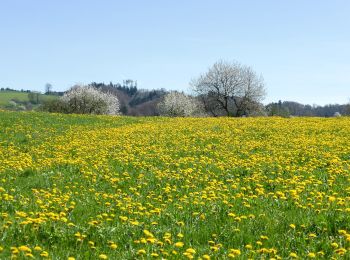
De beste trajecten (4)
![Tocht Te voet Nottwil - Sempachersee-Moosweg - Photo](https://media.geolcdn.com/t/350/260/5b43a39d-2789-497e-af40-998ef39b5ba7.jpeg&format=jpg&maxdim=2)
![Te voet Te voet](https://static1.geolcdn.com/sitytour/trail-icons/100.png)
Km
Te voet
![](/images/other/stat-length.png)
![](https://static1.geolcdn.com/siteimages/upload/files/1508320355ic_sort_den_pos_24dp.png)
![](https://static1.geolcdn.com/siteimages/upload/files/1508320355ic_sort_den_neg_24dp.png)
![](https://static1.geolcdn.com/siteimages/upload/files/16400158638029165_repeat_loop_refresh_sync_direction_icon.png)
• Trail created by Luzerner Wanderwege. Symbol: weisser Pfeil
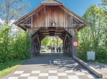
![Tocht Te voet Nottwil - Nottwil - Sempach (Vogelwarte) - Photo](https://media.geolcdn.com/t/350/260/06c2aee0-d9ed-4bae-a21f-a68a34b0e075.jpeg&format=jpg&maxdim=2)
![Te voet Te voet](https://static1.geolcdn.com/sitytour/trail-icons/100.png)
Km
Te voet
![](/images/other/stat-length.png)
![](https://static1.geolcdn.com/siteimages/upload/files/1508320355ic_sort_den_pos_24dp.png)
![](https://static1.geolcdn.com/siteimages/upload/files/1508320355ic_sort_den_neg_24dp.png)
![](https://static1.geolcdn.com/siteimages/upload/files/16400158638029165_repeat_loop_refresh_sync_direction_icon.png)
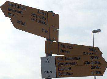
• Trail created by Luzerner Wanderwege. Nottwil - Sempach (Vogelwarte) Symbol: gelber Rhombus
![Tocht Te voet Nottwil - Buttisholz-Luternau-Bühl - Photo](https://media.geolcdn.com/t/350/260/46f53176-6c87-4bb3-9cc8-30ad4d04a457.jpeg&format=jpg&maxdim=2)
![Te voet Te voet](https://static1.geolcdn.com/sitytour/trail-icons/100.png)
Km
Te voet
![](/images/other/stat-length.png)
![](https://static1.geolcdn.com/siteimages/upload/files/1508320355ic_sort_den_pos_24dp.png)
![](https://static1.geolcdn.com/siteimages/upload/files/1508320355ic_sort_den_neg_24dp.png)
![](https://static1.geolcdn.com/siteimages/upload/files/16400158638029165_repeat_loop_refresh_sync_direction_icon.png)
• Trail created by Luzerner Wanderwege. Buttisholz-Luternau-Bühl Symbol: gelber Diamant
![Tocht Te voet Nottwil - Hinter Tannenfels - Buttisholz - Photo](https://media.geolcdn.com/t/350/260/ext.jpg?maxdim=2&url=https%3A%2F%2Fstatic1.geolcdn.com%2Fsiteimages%2Fupload%2Ffiles%2F1545311037marcheuse_200dpi.jpg)
![Te voet Te voet](https://static1.geolcdn.com/sitytour/trail-icons/100.png)
Km
Te voet
![](/images/other/stat-length.png)
![](https://static1.geolcdn.com/siteimages/upload/files/1508320355ic_sort_den_pos_24dp.png)
![](https://static1.geolcdn.com/siteimages/upload/files/1508320355ic_sort_den_neg_24dp.png)
![](https://static1.geolcdn.com/siteimages/upload/files/16400158638029165_repeat_loop_refresh_sync_direction_icon.png)
• Trail created by Luzerner Wanderwege. Hinter Tannenfels - Buttisholz Symbol: gelber Diamant
4 tochten weergegeven op 4
Gratisgps-wandelapplicatie